Cita
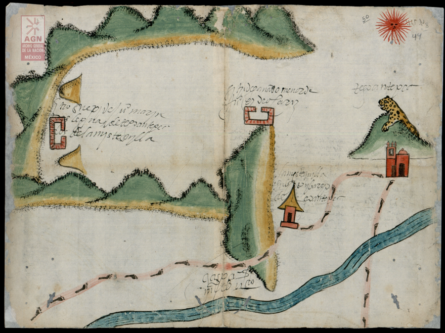
Mystequilla y Tegoantepec. Oaxaca, 1573. AGN, Tierras, vol. 3343, exp. 4, ff. 43v. y 44 http://bdmx.mx/documento/galeria/mapas-indigenas-novohispanos-agn/fo_06
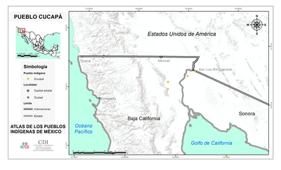
PUEBLO CUCAPA
Mapa 2020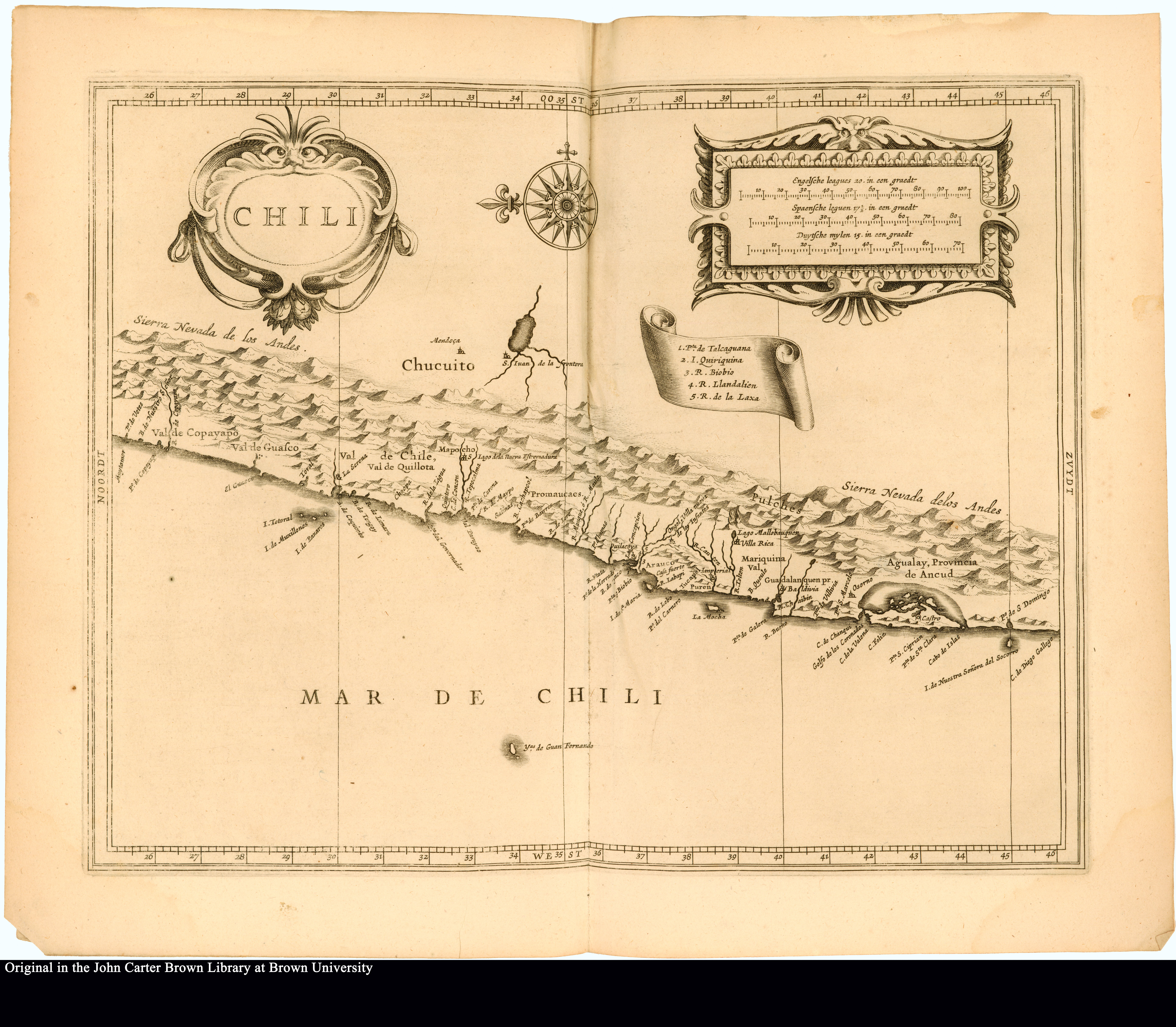
Chili
Mapa 1625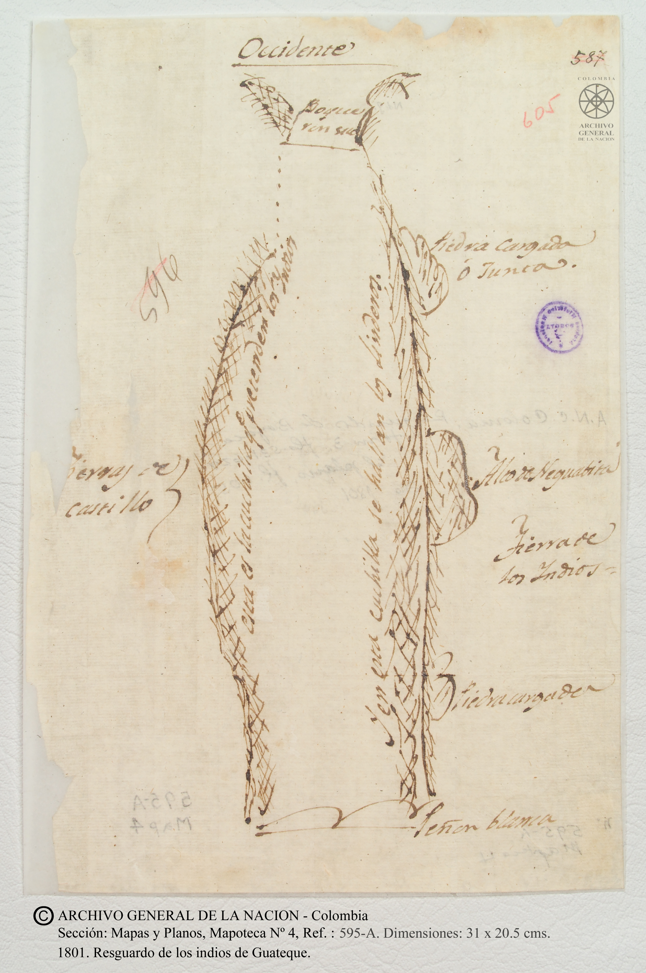
Resguardo de los indios de Guateque. Plano en trazo simple de la cuchilla que pretenden los indios. Corresponde al expediente seguido por los indios con Francisco Javier del Castillo, por deslinde de tierras
Mapa 1801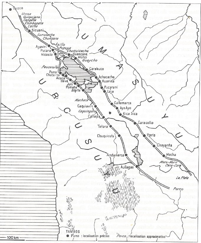
INCA ROADS AND TAMBOS in the 16th CENTURY
Mapa 1530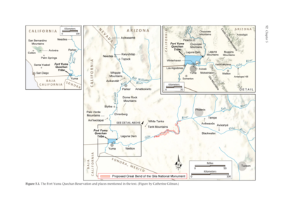
The Fort Yuma Reservation and Places Mentioned in the Text
Mapa 2016
Property Ownership in 1900, Verapaz Guatemala
Mapa 1900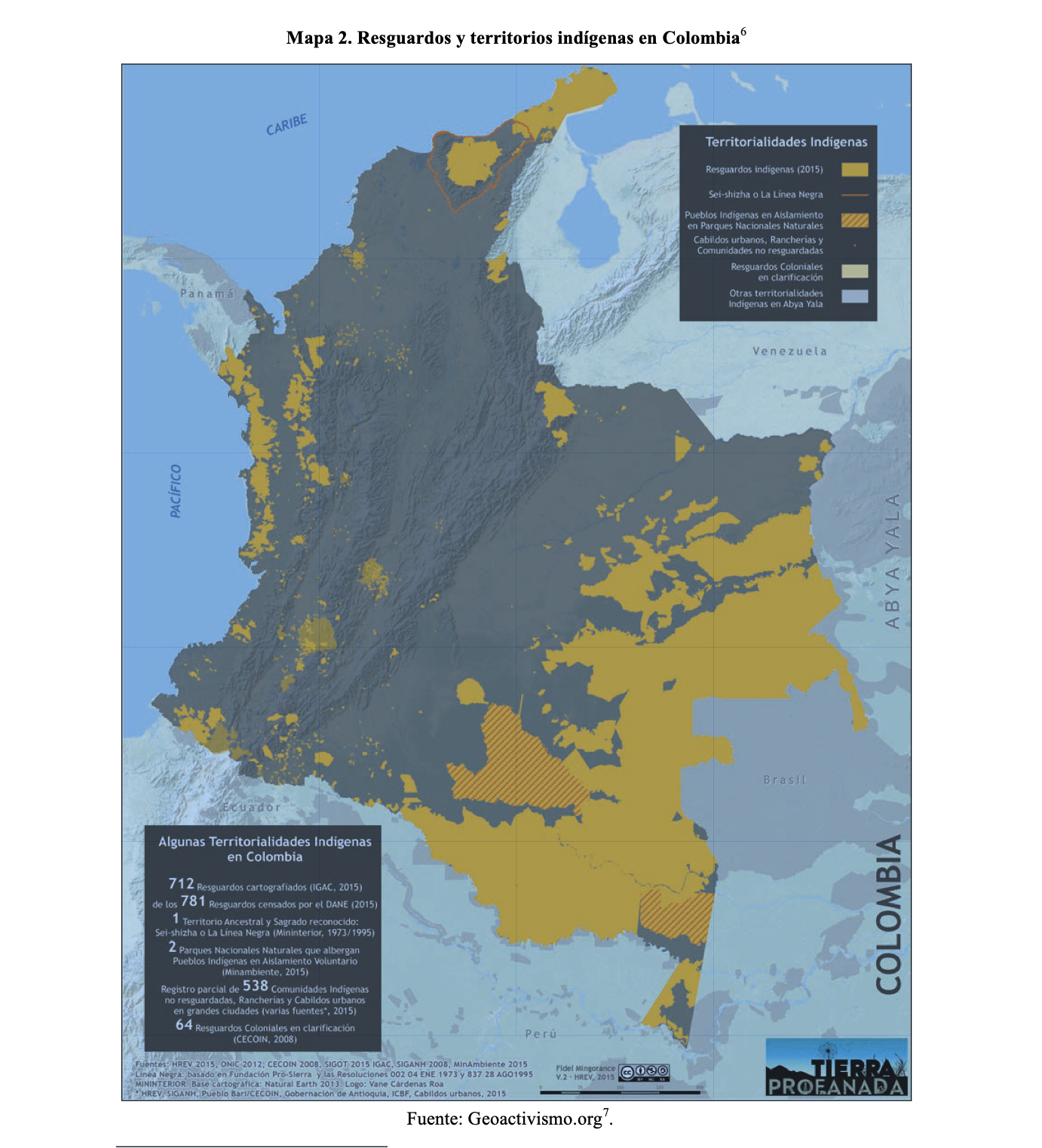
RESGUARDOS Y TERRITORIOS INDIGENAS EN COLOMBIA
Mapa 2015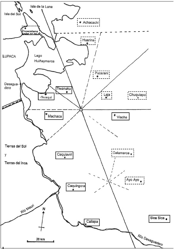
INDIGENOUS DRAFT LABOR (MITA) FOR MINES OF POTOSI UNDER SPANISH COLONIAL RULE – THE CASE OF THE PAKAXA AYMARA POLITY IN THE LATE 16TH CENTURY
Mapa 1570 - 1650