Dispossesions in the Americas

Dispossesions in the Americas

  • Inicio
  • Explorar
  • Autores
  • Sobre
  • Arte
  • Cuerpos
  • Planes de Estudio
  • Herencia Cultural
  • Mapas
  • Territorios
Volver a Explorar

Leyendo en Inglés

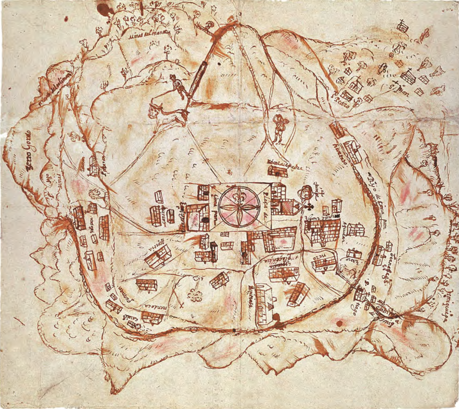
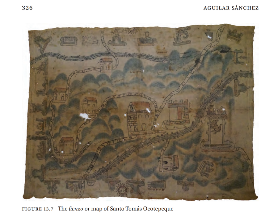
Mapa 1580

LIENZO OF SANTO TOMÁS OCOTEPEQUE

    Publicado: 1580

    • Descargar Imágen
    • Descargar Imágen
    Mapa 1580

    LIENZO OF SANTO TOMÁS OCOTEPEQUE

      Publicado: 1580

      • Descargar Imágen

      Pueblos

      • MIXTEC

      Citas

      Aguilar Sánchez, Omar. "Re-interpreting Ñuu Savi Pictorial Manuscripts from a Mixtec Perspective: Linking Past and Present." In Re-interpreting Ñuu Savi Pictorial Manuscripts from a Mixtec Perspective: Linking Past and Present, edited by Maarten Jansen, Virginia M. Lladó-Buisán, and Ludo Snijders, 313-40. Vol. 8. Leiden: Brill, 2019.
      • Descargar Imágen

      Artículos Relacionados

      Paraguay;ó prov. de Rio de la Plata cum regionibus adiacentibus Tucuman et Sta. Cruz de la Sierra

      Paraguay;ó prov. de Rio de la Plata cum regionibus adiacentibus Tucuman et Sta. Cruz de la Sierra

      Mapa 1600 - 1699
      PUEBLO TRIQUI

      PUEBLO TRIQUI

      Mapa 2020
      A Sequel of the Seat of War in the West Indies containing… Sub-map title: A large & accurate MAP of part of the Isthmus of Panama, taken from a Spanish drought exhibiting the Country adjacent to that City and Puerto Bello, with the Roads and Course of the River CHAGRE, by which the Treasure of the South Sea is conveyed a cross the Isthmus

      A Sequel of the Seat of War in the West Indies containing… Sub-map title: A large & accurate MAP of part of the Isthmus of Panama, taken from a Spanish drought exhibiting the Country adjacent to that City and Puerto Bello, with the Roads and Course of the River CHAGRE, by which the Treasure of the South Sea is conveyed a cross the Isthmus

      Mapa 1740
      Indian Languages, Late 16th Century, (According to Ponce and Viana).

      Indian Languages, Late 16th Century, (According to Ponce and Viana).

      Mapa 1500
      Geographical Distribution of the Cuicatec

      Geographical Distribution of the Cuicatec

      Mapa 1969
      REGIÓN CHONTAL DE TABASCO

      REGIÓN CHONTAL DE TABASCO

      Mapa 2000
      Carte geographique, statistique et historique de la Guyane.

      Carte geographique, statistique et historique de la Guyane.

      Mapa 1800 - 1899
      CARTE DE LA DEPENDANCE DU YAPOK JUSQU'A la Riviere des Amazones

      CARTE DE LA DEPENDANCE DU YAPOK JUSQU'A la Riviere des Amazones

      Mapa 1737

      Despojos en las Américas

      Un Proyecto de

      University of Pennsylvania

      Copyright 2024

      Con el apoyo de

      Mellon Foundation

      Diseño y Desarrollo del Sitio

      Element 84

      Créditos Artísticos

      Aguilar Sánchez, Omar. “Re-interpreting Ñuu Savi Pictorial Manuscripts from a Mixtec Perspective: Linking Past and Present.” In Re-interpreting Ñuu Savi Pictorial Manuscripts from a Mixtec Perspective: Linking Past and Present, edited by Maarten Jansen, Virginia M. Lladó-Buisán, and Ludo Snijders, 313-40. Vol. 8. Leiden: Brill, 2019.
      Páginas del Sitio

      • Inicio
      • Explorar
      • Autores
      • Sobre
      • Arte
      • Cuerpos
      • Planes de Estudio
      • Herencia Cultural
      • Mapas
      • Territorios