
Cita
Comisión Nacional para el Desarrollo de los Pueblos Indígenas. Regiones indígenas de México. Publication no. 330.972. 2006. https://www.gob.mx/cms/uploads/attachment/file/35735/cdi-regiones-indigenas-mexico.pdf.
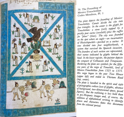
The Founding of Tenochtitlan-Mexico Codex Mendoza, Pl 1
Mapa 1541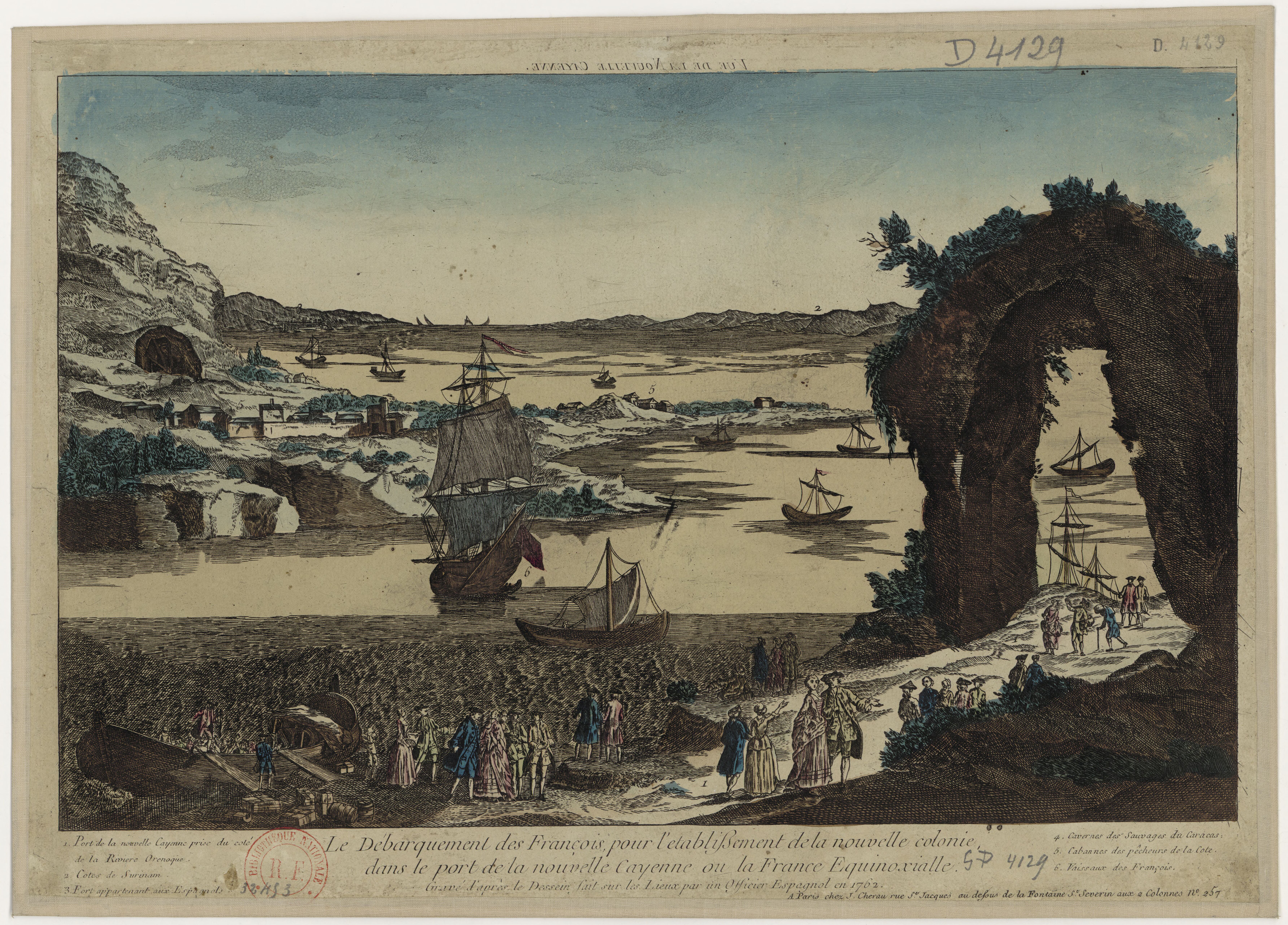
Vue de la Nouvelle Cayenne. Le Débarquement des Français, pour l'établissement de la nouvelle colonie, dans le port de la Nouvelle-Cayenne, ou la France équinoxiale, gravé d'après le dessin fait sur les lieux par un officier espagnol en 1762.
Mapa 1762
The modern departments of Ahuachapán, La Libertad, Santa Ana, and Sonsonate (highlighted in red) now contain the highest concentration of Indigenous communities in El Salvador.
Mapa 2010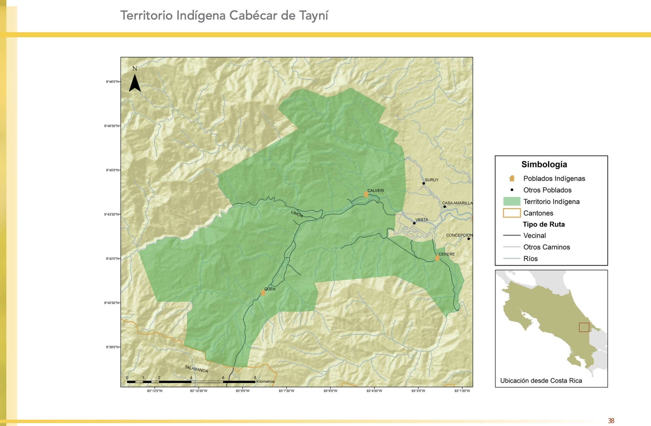
"Territorio Indígena Cabécar de Tayní"
Mapa 2010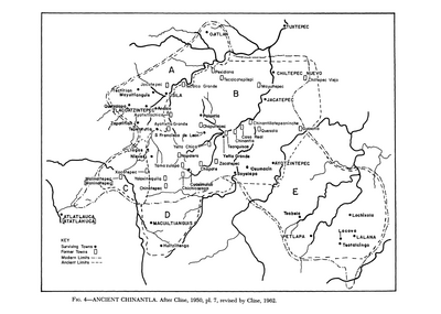
Ancient Chinantla
Mapa 1962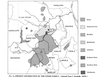
Present Distribution of the Otomi Family
Mapa 1969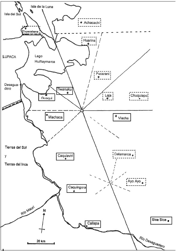
INDIGENOUS DRAFT LABOR (MITA) FOR MINES OF POTOSI UNDER SPANISH COLONIAL RULE – THE CASE OF THE PAKAXA AYMARA POLITY IN THE LATE 16TH CENTURY
Mapa 1570 - 1650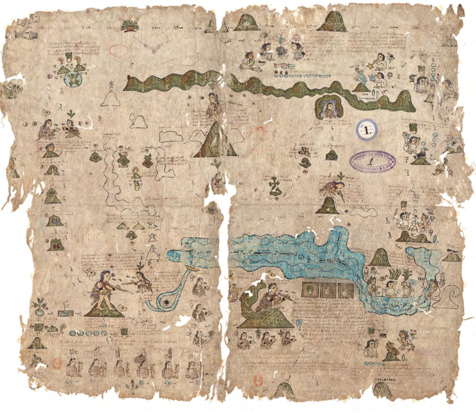
CÓDICE XOLOTL
Mapa 1100 - 1499