
Cita
Comisión Nacional para el Desarrollo de los Pueblos Indígenas. Regiones indígenas de México. Publication no. 330.972. 2006. https://www.gob.mx/cms/uploads/attachment/file/35735/cdi-regiones-indigenas-mexico.pdf.
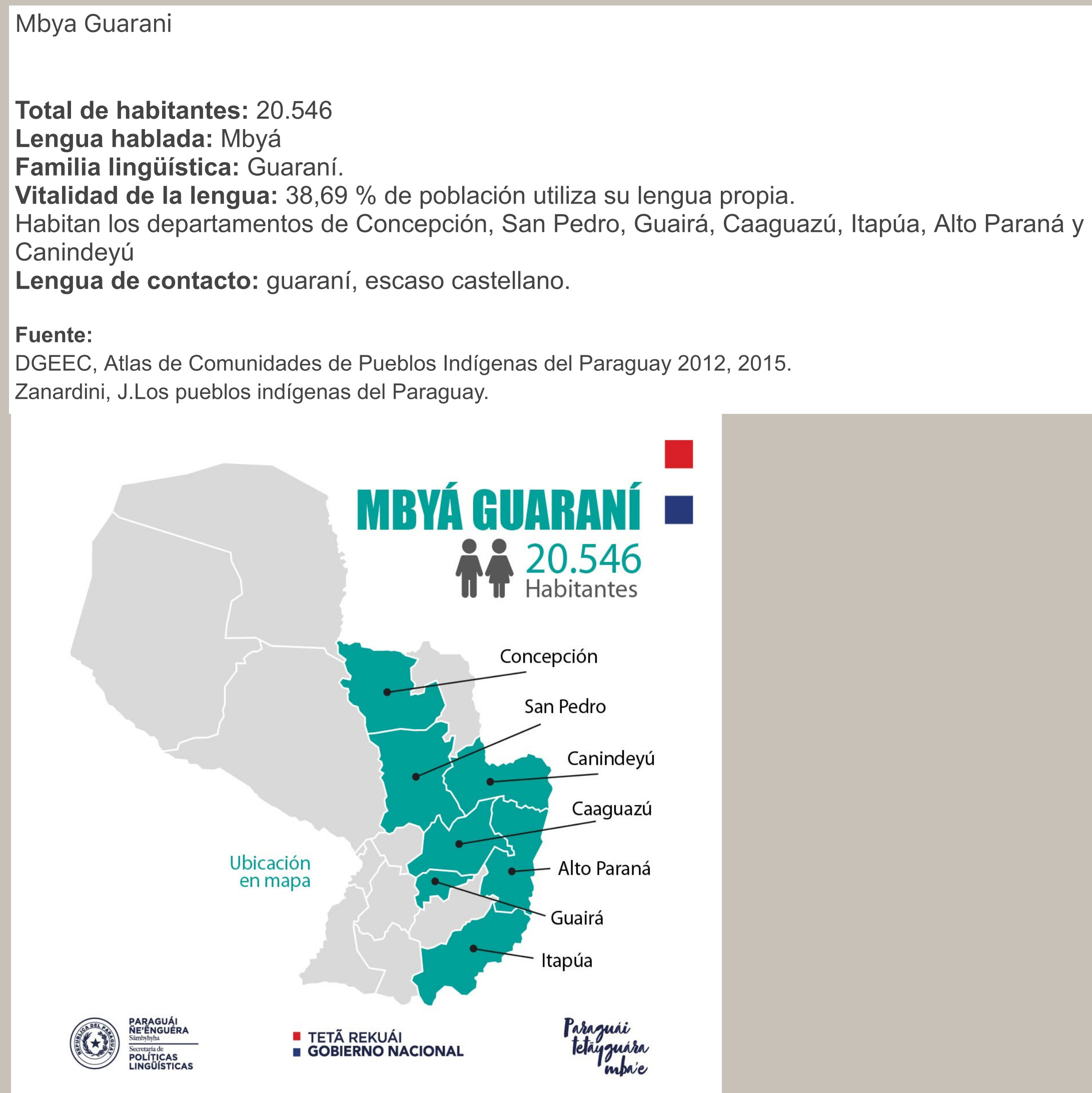
MBYÁ GUARANÍ
Mapa 2015
Carte d'une partie de la Riviere de Marony qui separe la Guïanne Françoise des Hollandois Levée depuis son embouchure, Jusqu'au premier Sault.
Mapa 1700 - 1799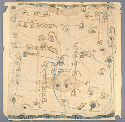
MAPA DE COATLINCHAN/ MAP OF COALINCHAN
Mapa 1500 - 1599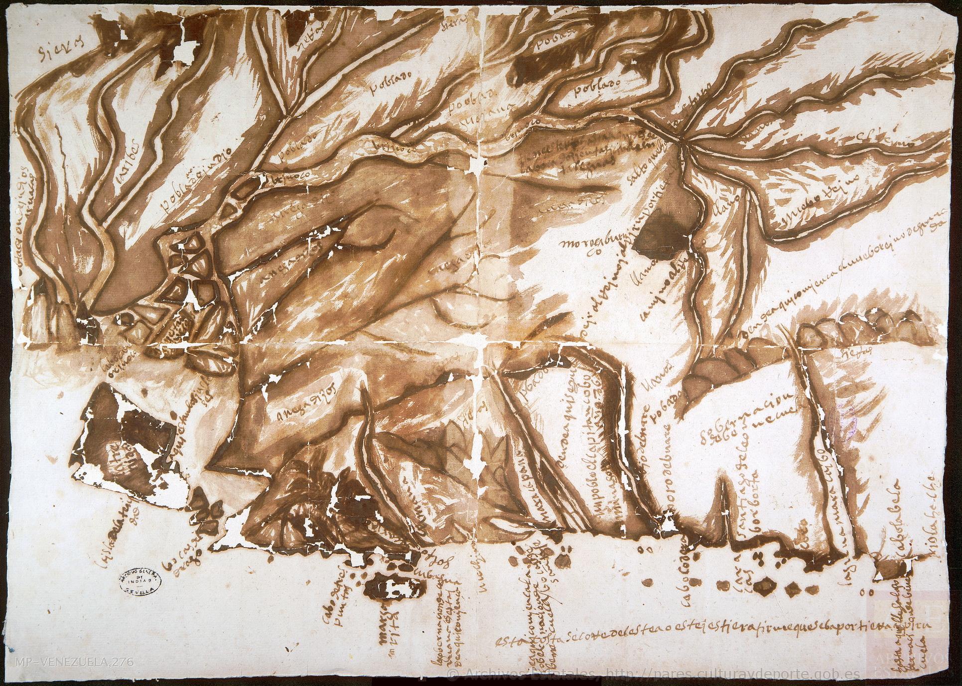
No Title
Mapa 1590
PUEBLO MATLATZINCA
Mapa 2020
COLUMBIA;ECUADOR;VENEZUELA;BRITISH DUTCH AND FRENCH GUIANA
Mapa 1900 - 1999
MAPPA CHOROGRAPHICA da Provincia DE STA CATHARINA, PARTE DA PA. DE S. PAULO E DA PA. DE RIO GRANDE DO SUL E PARTE DA REPUBLICA DO PARAGUAY
Mapa 1774 - 1842
Ulises, cuerpo gaseoso
Obra de Arte