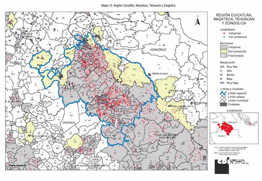
Pueblos
- MAZATEC
Cita
Comisión Nacional para el Desarrollo de los Pueblos Indígenas. Regiones indígenas de México. Publication no. 330.972. 2006. https://www.gob.mx/cms/uploads/attachment/file/35735/cdi-regiones-indigenas-mexico.pdf.
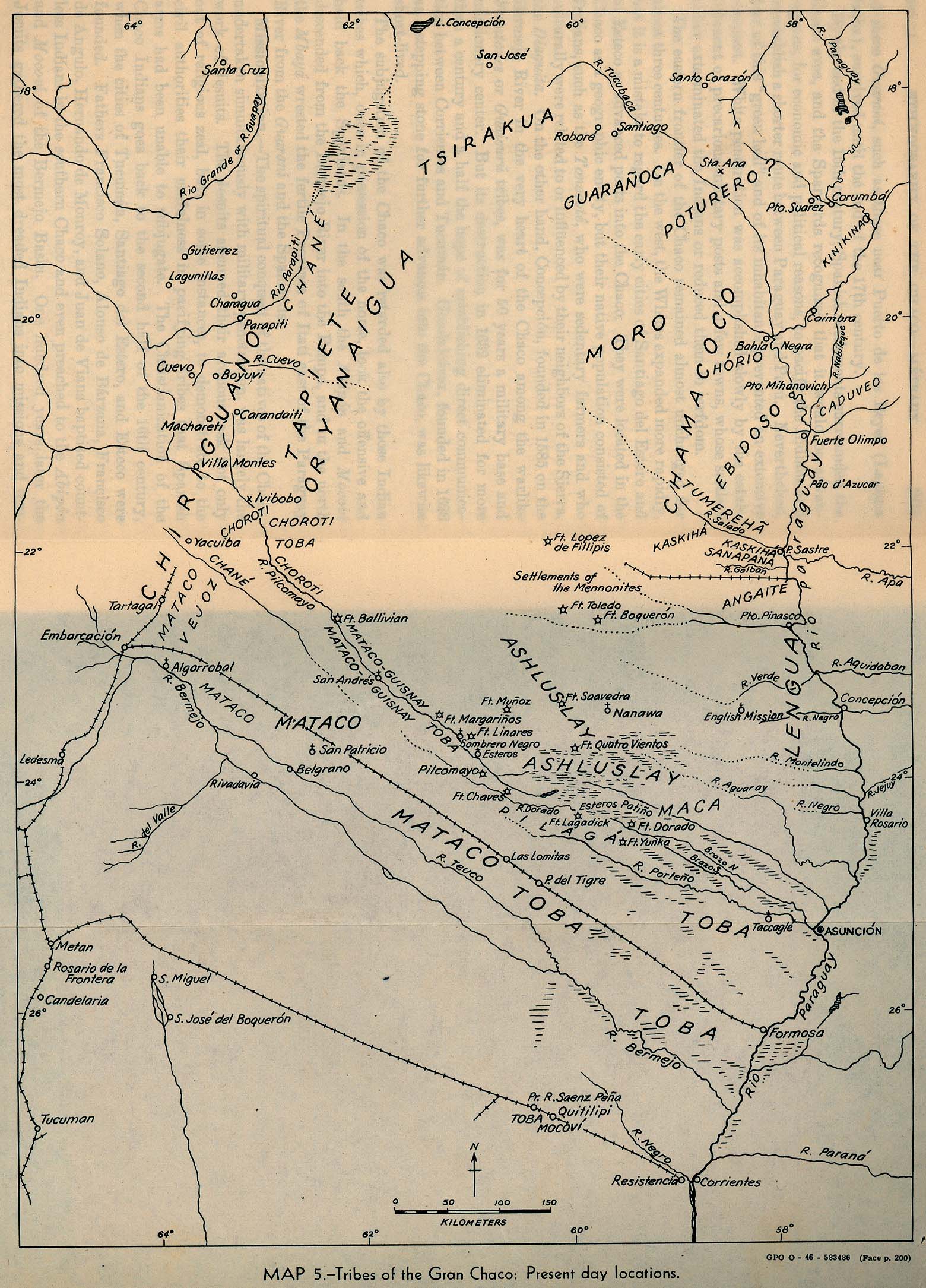
Tribes of the Gran Chaco: Present day locations
Mapa 1946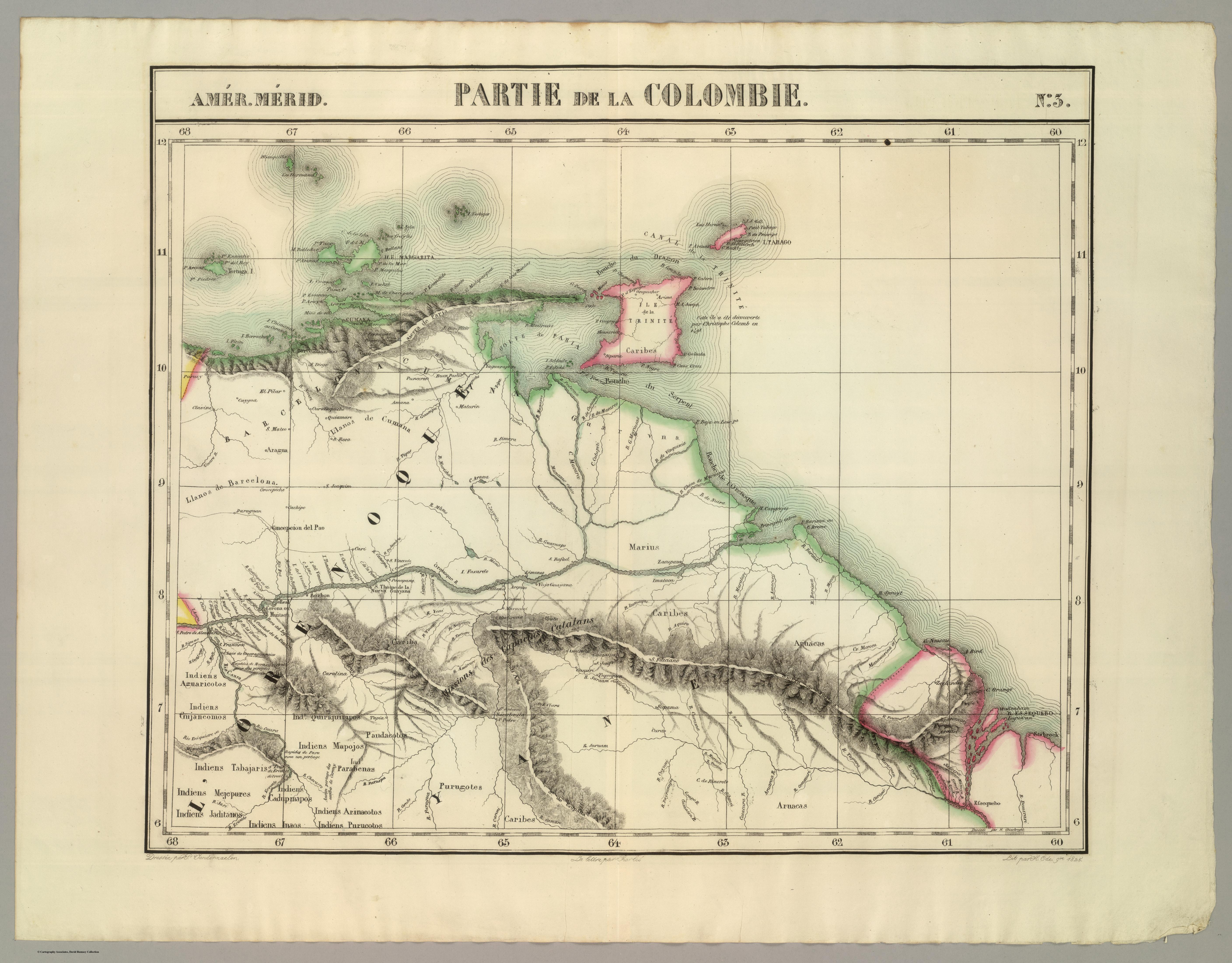
PARTIE DE LA COLOMBIE
Mapa 1825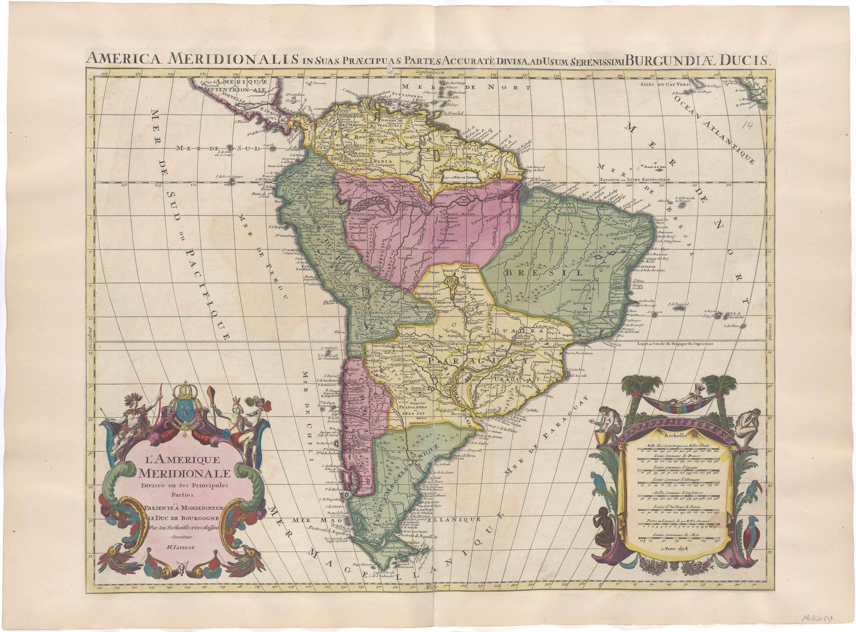
L'Amerique Meridionale Divisée en ses Principales Parties. Presenté à Monseigneur le Duc de Bourgogne
Mapa 1694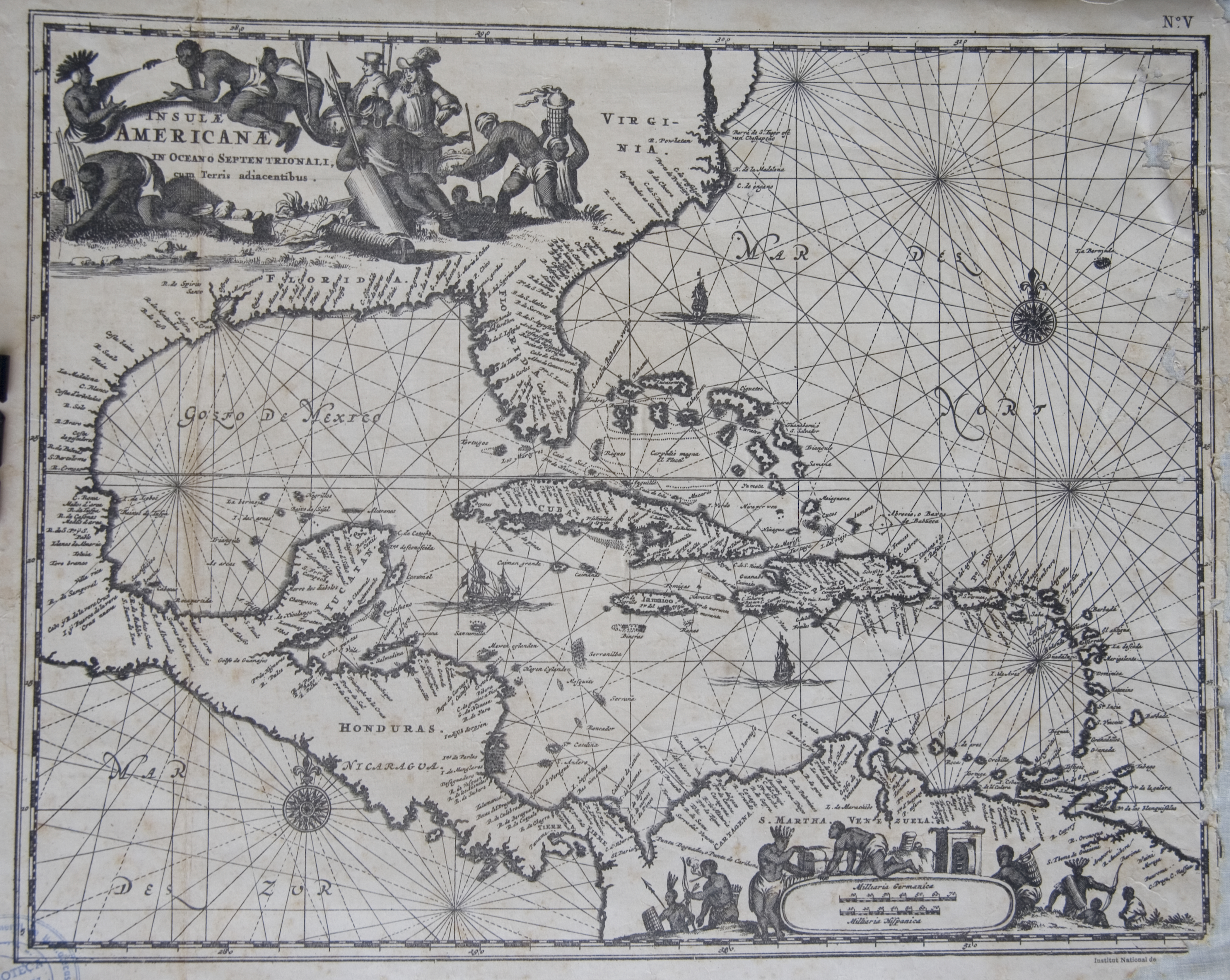
Islas Antillas y costas de tierra firme.
Mapa 1500 - 1599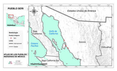
PUEBLO SERI
Mapa 2020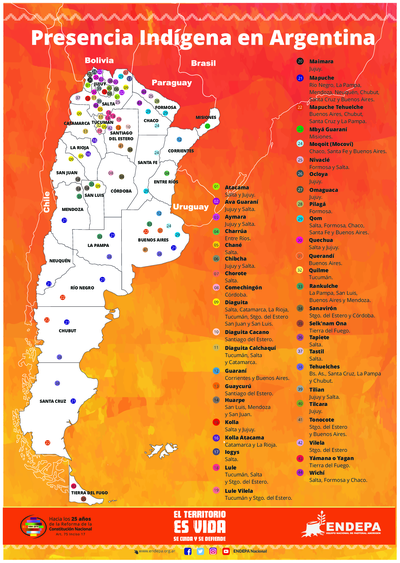
Presencia indígena en Argentina
Mapa 2015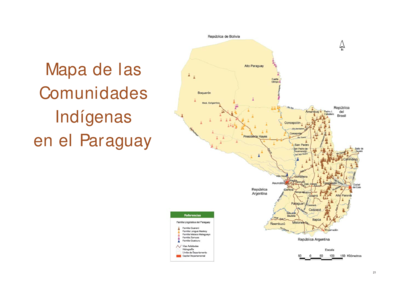
Mapa de las Comunidades Indígenas en el Paraguay
Mapa 2004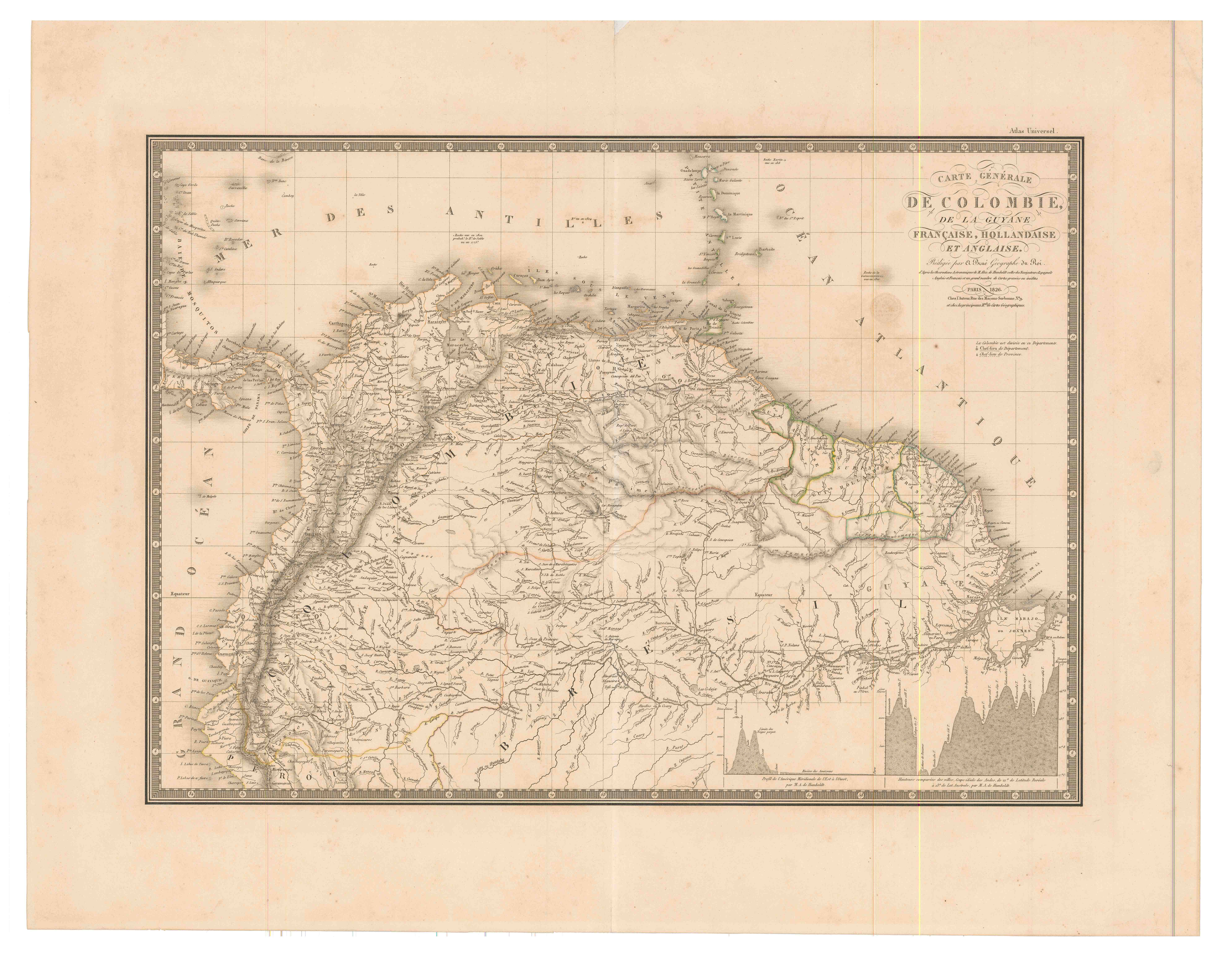
Carte générale de Colombie, de la Guyane Française, Hollandaise et Anglaise.
Mapa 1800 - 1899