Cita
Hidalgo, Alex. Trail of Footprints: A History of Indigenous Maps from Viceregal Mexico. Austin: University of Texas Press, 2019. https://www.jstor.org/stable/10.7560/317518.6.
![Ombre des Amazonies [Sombra de las Amazonías]](https://dnet8ble6lm7w.cloudfront.net/art/APER055.JPG)
Ombre des Amazonies [Sombra de las Amazonías]
Obra de Arte
Carte 5: Le pays Wayãpi: Région méridionale
Mapa 1760 - 1790
Los amarillos
Obra de Arte!["Mapa de lo principal de la Provincia de Nicaragua;su Laguna;y desagüe de ella;por el Río de San Juan;Poblasones [sic] de los enemigos Zambos e yngleses en Puntagorda y Mosquitos;y las costas y parajes;adonde hazen daños y prezas".](https://dnet8ble6lm7w.cloudfront.net/maps/NIC/NIC0009.jpg)
"Mapa de lo principal de la Provincia de Nicaragua;su Laguna;y desagüe de ella;por el Río de San Juan;Poblasones [sic] de los enemigos Zambos e yngleses en Puntagorda y Mosquitos;y las costas y parajes;adonde hazen daños y prezas".
Mapa 1700 - 1716
Plano del pueblo de Nuestra Señora de Altagracia y del reparto de tierras a los indios, con vista de Cumaná y de la fortaleza de Araya.
Mapa 1704
Carte particulière de la Coste de Cayenne depuis le Cap Nord jusques au Païs des Saimakotes
Mapa 1600 - 1699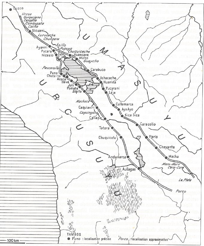
INCA ROADS AND TAMBOS in the 16th CENTURY
Mapa 1530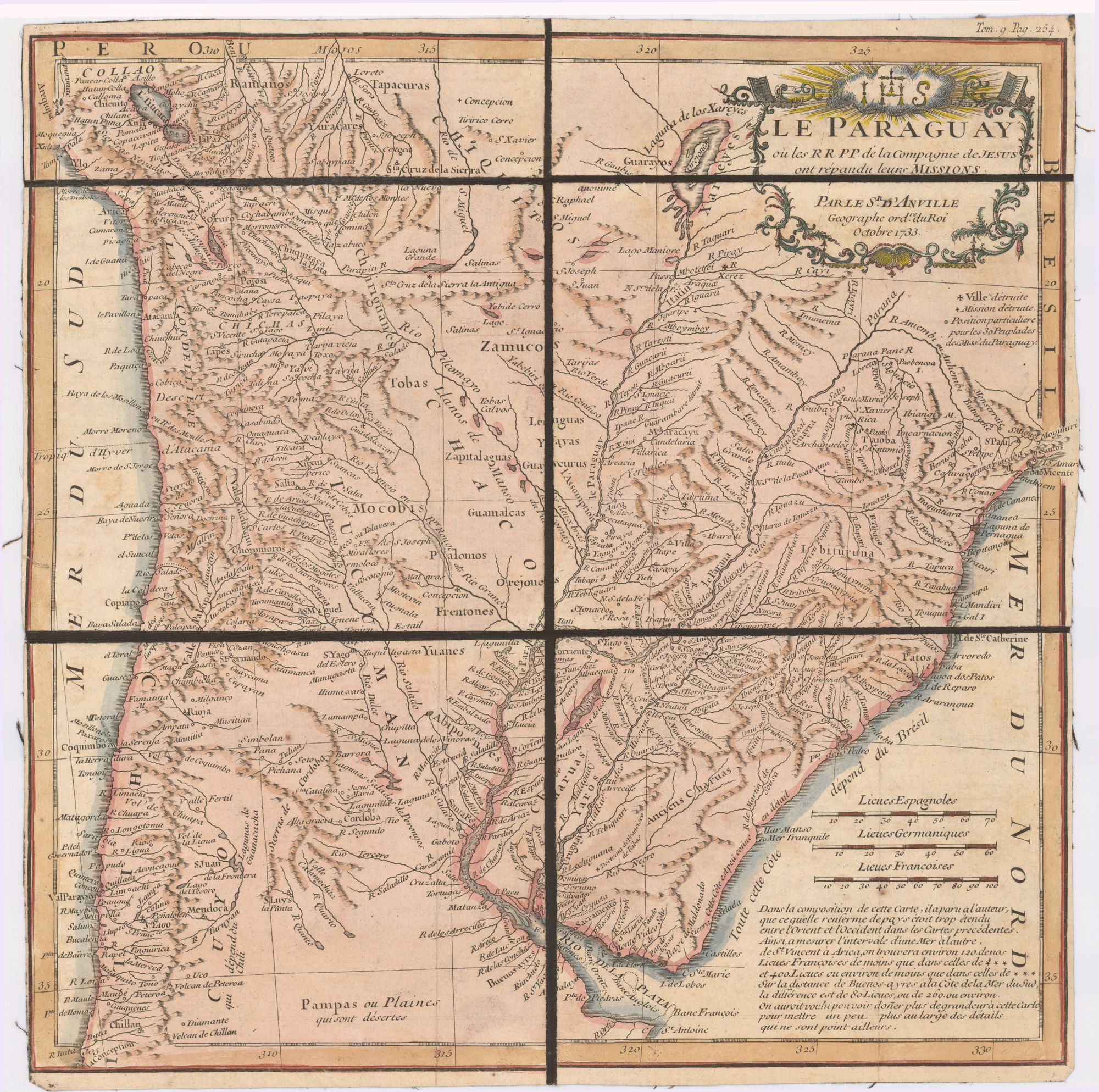
Le Paraguay;où les R.R.P.P. de la Compagnie de Jesus ont répandu leurs missions par le Sr. d'Anville;geographe ordre. du Roi;Octobre 1733
Mapa 1733