Pueblos
- TEPEHUANO DEL SUR
Cita
Instituto Nacional de los Pueblos Indígenas. "Distribución por Entidad Federativa." Atlas de los pueblos indígenas de México. http://atlas.inpi.gob.mx/distribucion-por-entidad-federativa/.

Serie Fatherland / Padre Patria
Obra de Arte
Map of the RIVER AQUIRY (an Affluent of the Purûs)
Mapa 1800 - 1850
Carte du Paraguay;du Chili;du Detroit de Magellan &c. Dressée sur les descriptions des PP. Alfonse d'Ovalle;et Nicolas Techo;et sur les relations et memoires de Brouwer;Narbouroug;Mr. de Beauchesne &c.
Mapa 1703
‘INDIAN ROYAL TOWNS’ (REDUCCIONES) AND PROVINCES (CORREGIMIENTOS) UNDER SPANISH COLONIAL RULE IN THE LATE 16TH CENTURY
Mapa 1570 - 1650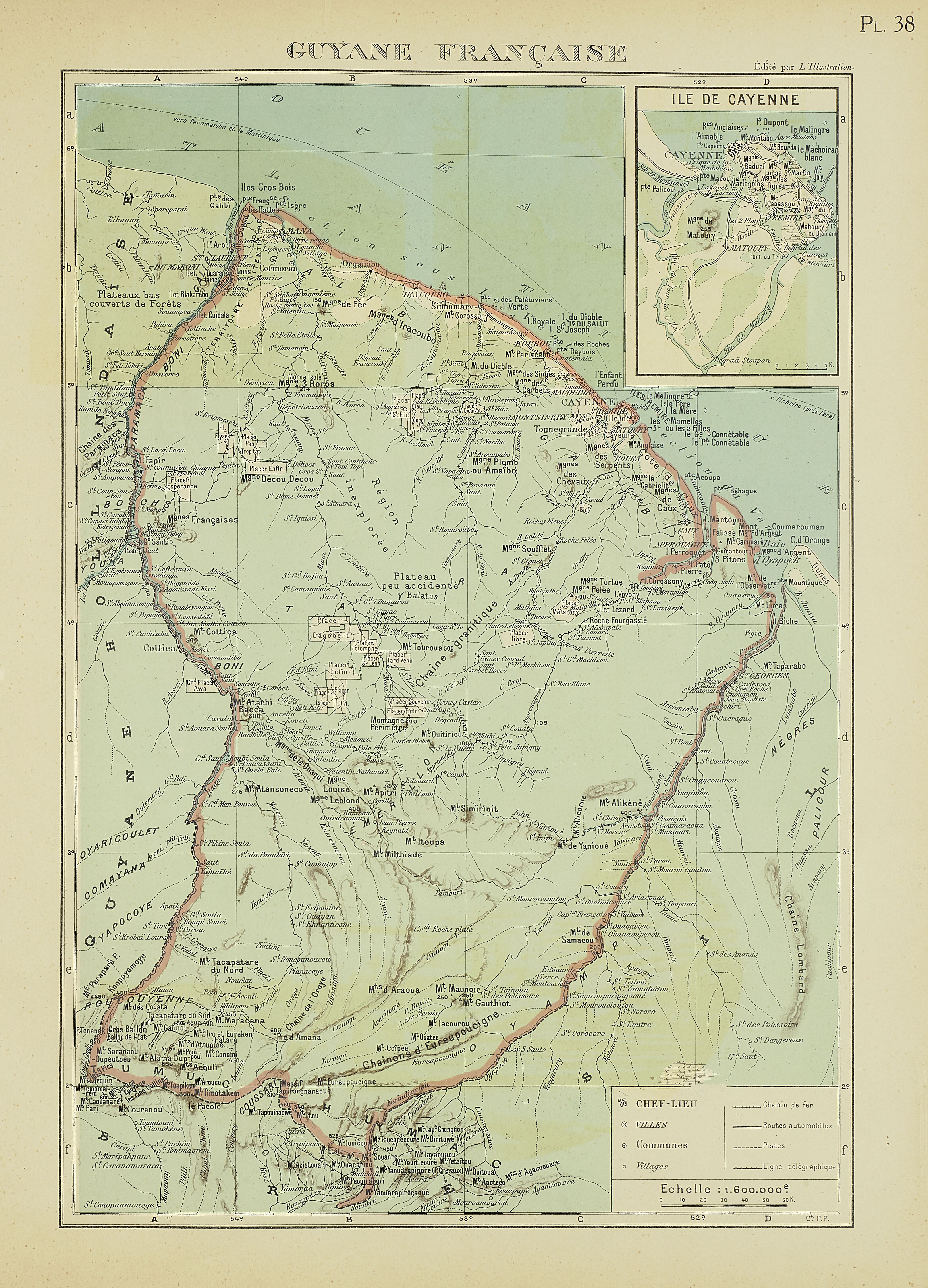
PL 38: Guyane française.
Mapa 1929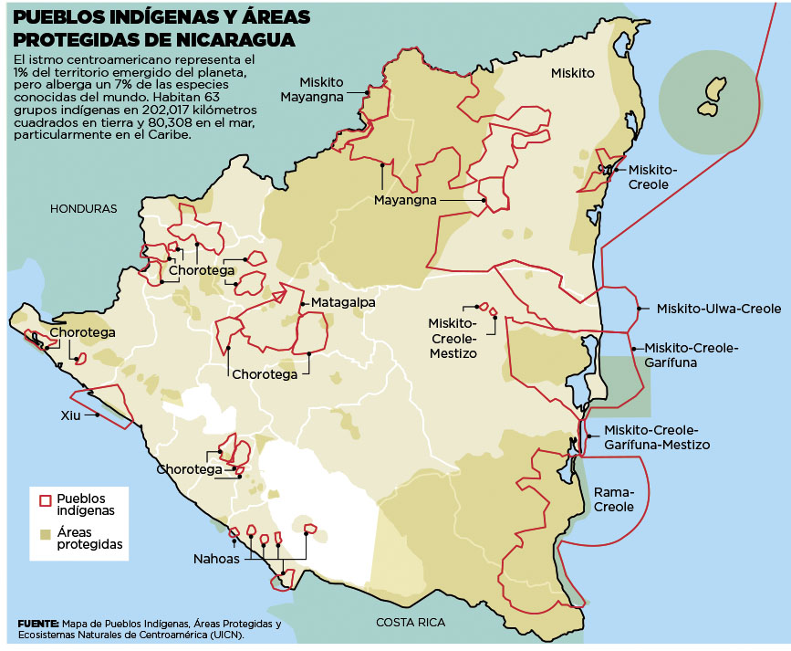
Pueblos Indígenas;Áreas Protegidas de Nicaragua
Mapa 2000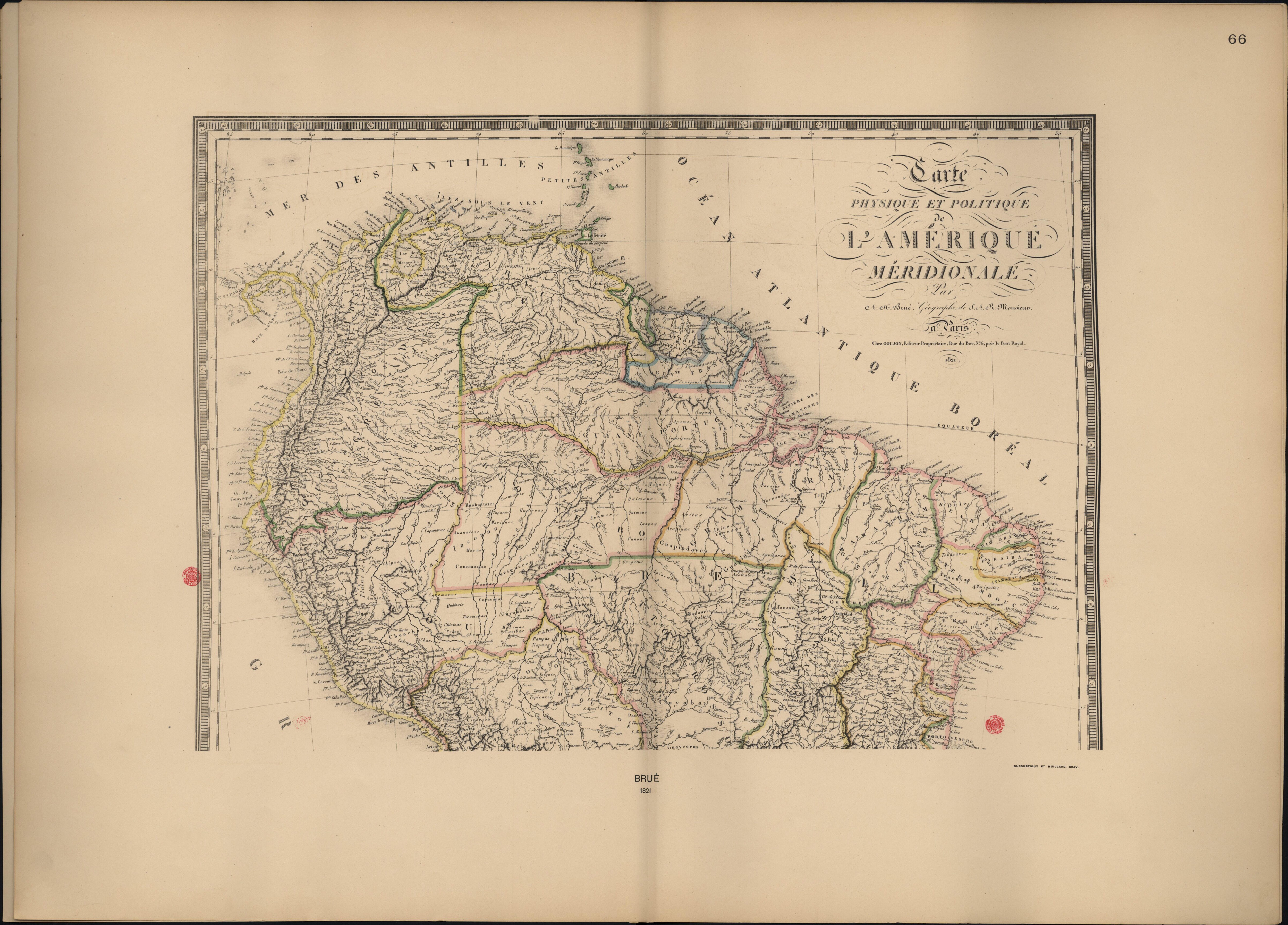
Carte Physique et Politique de l'Amérique Méridionale.
Mapa 1800 - 1899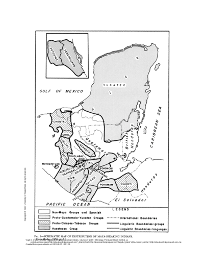
SCHEMATIC MAP OF DISTRIBUTION OF MAYA-SPEAKING INDIANS (From Morley, 1956, pl.7)
Mapa