
Pueblos
- CHICHIMECA JONAZ
- OTOMI
Cita
Instituto Nacional de los Pueblos Indígenas. "Distribución por Entidad Federativa." Atlas de los pueblos indígenas de México. http://atlas.inpi.gob.mx/distribucion-por-entidad-federativa/.
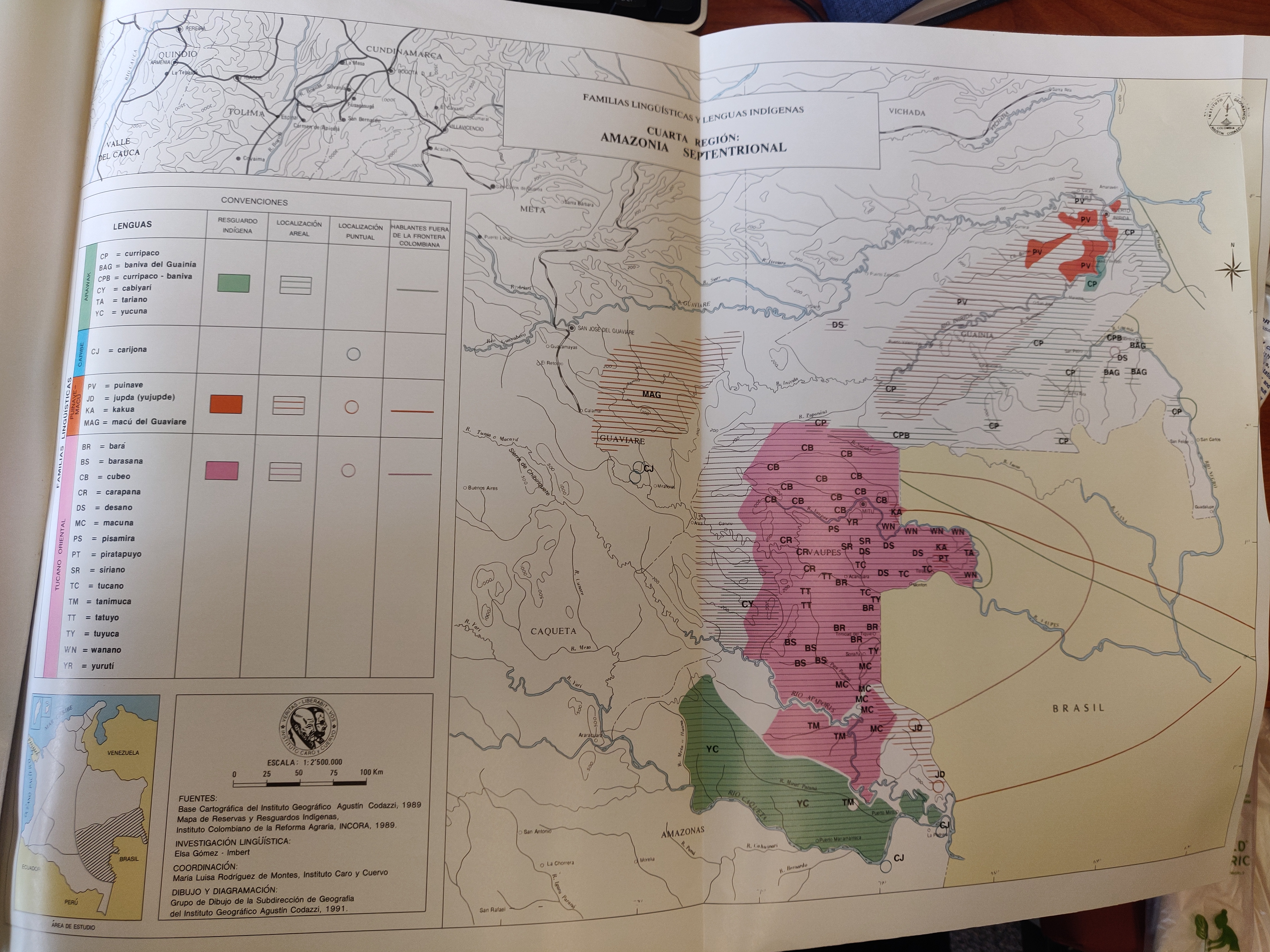
FAMILIAS LINGUÍSTICAS Y LENGUAS INDÍGENAS. CUARTA REGIÓN: AMAZONIA SEPTENTRIONAL
Mapa 1989
4. Ubicación de las comunidades indígenas y composición étnica de la región del Vaupés.
Mapa 2013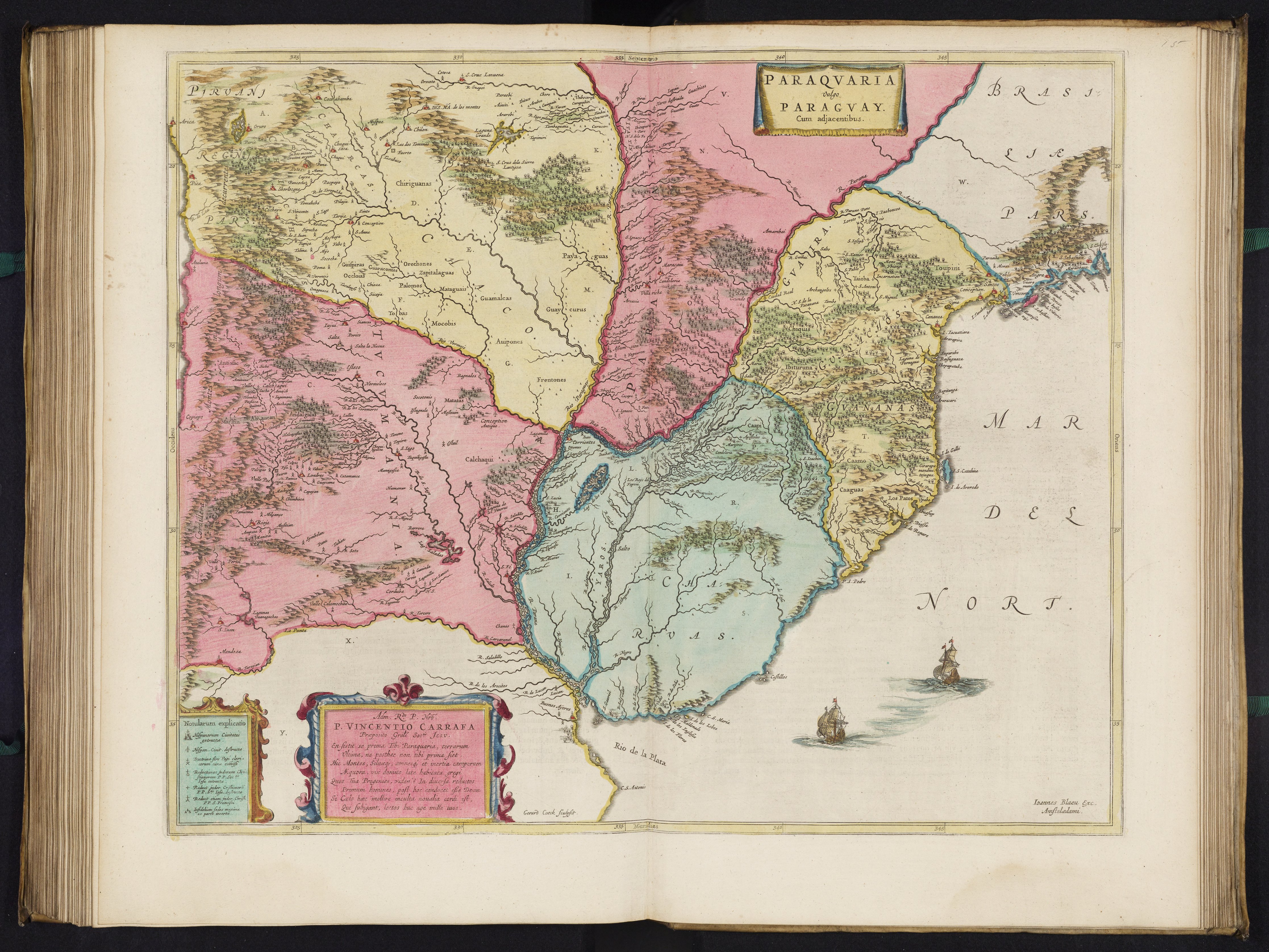
PARAQVARIA vulgo PARAGVAY.
Mapa 1600 - 1699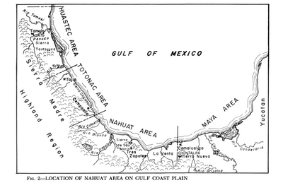
Location of Nahuat Area on Gulf Coast Plain
Mapa 1969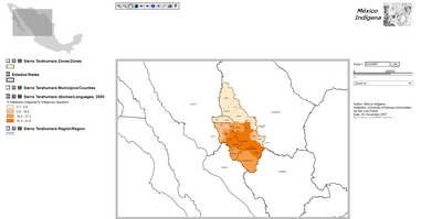
Sierra Tarahumara Study Area - Online GIS
Mapa 2005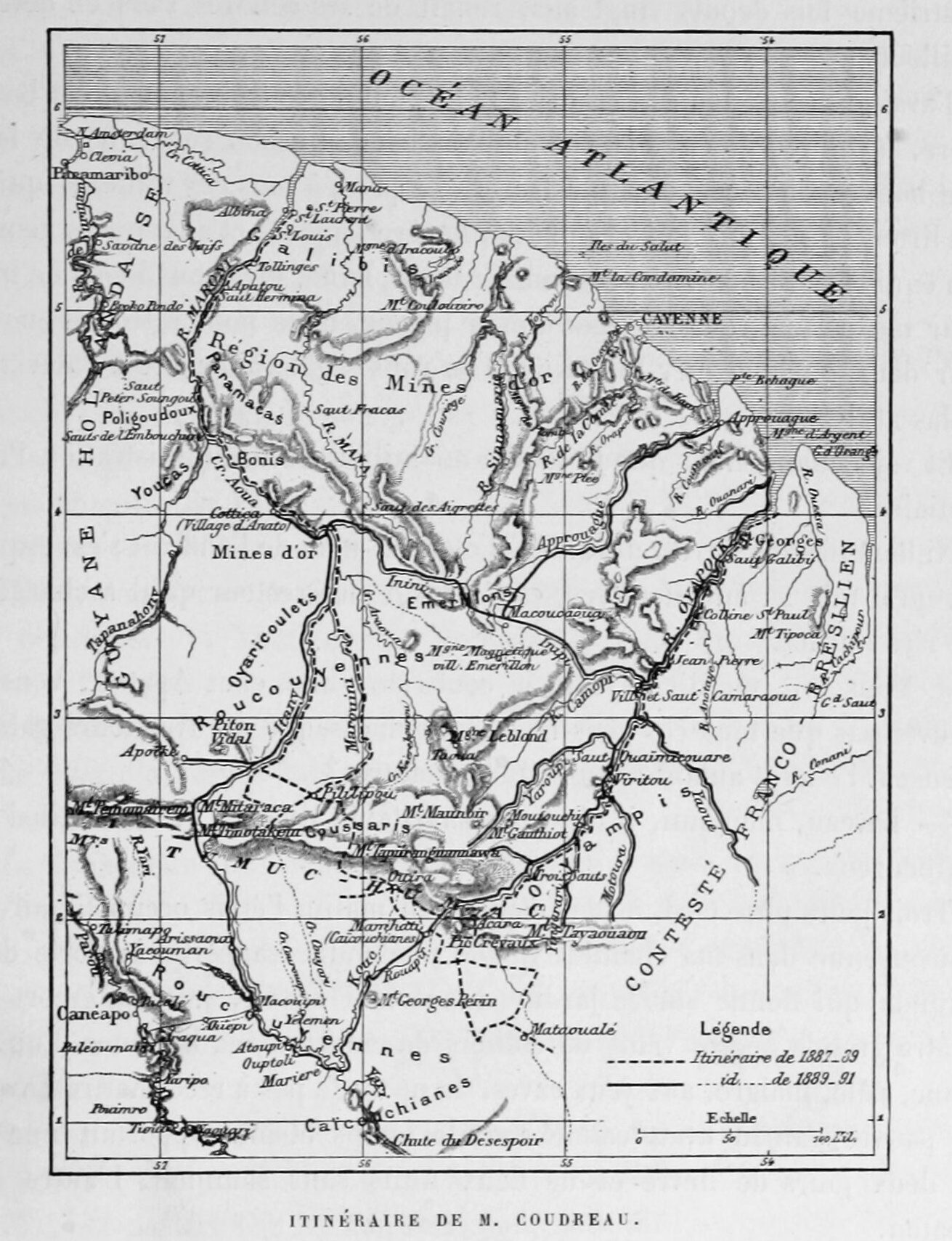
Itinéraire de M. Coudreau
Mapa 1893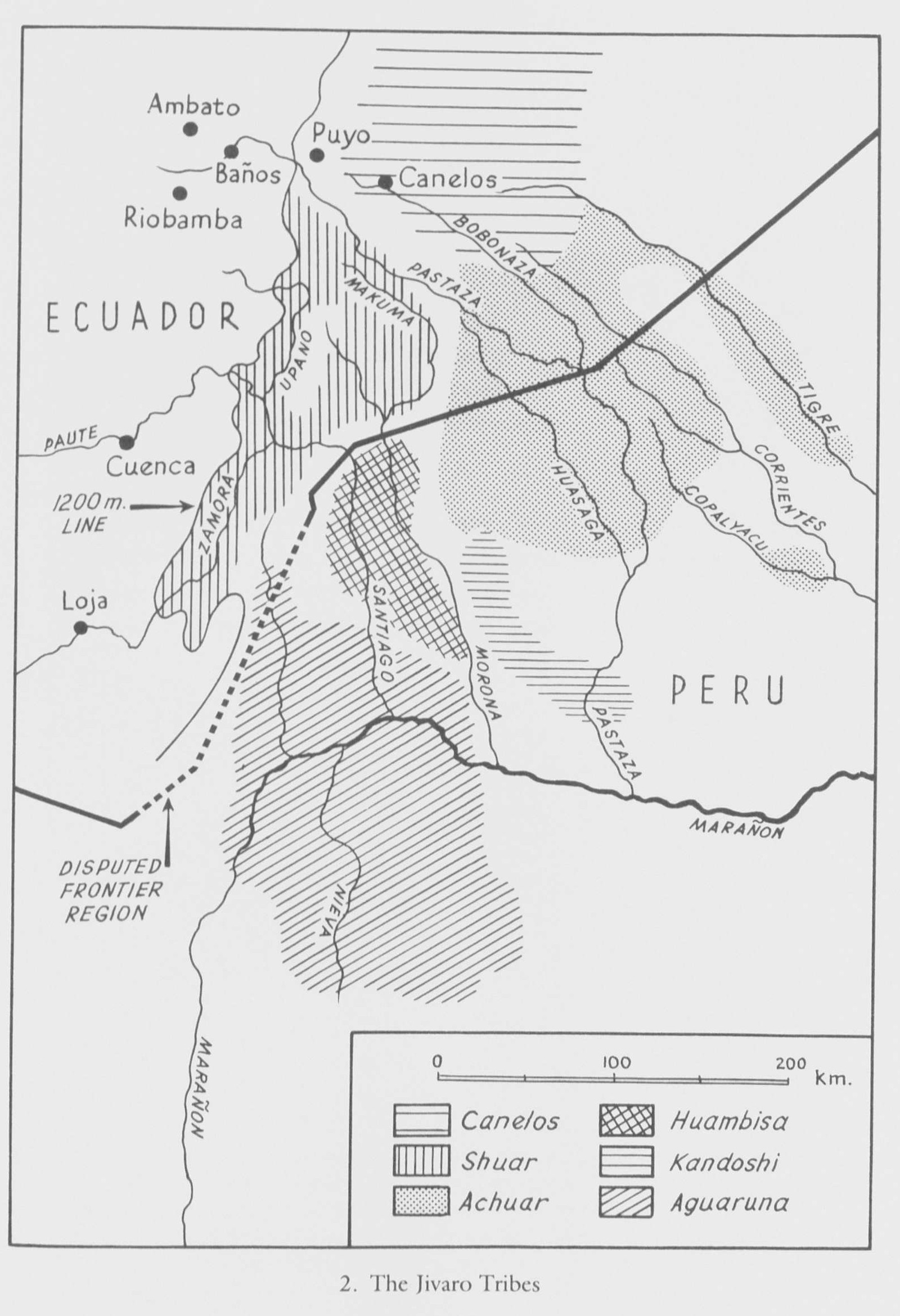
Jivaro country in Sad America
Mapa 1976 - 1978![Pescaria [Pescando]](https://dnet8ble6lm7w.cloudfront.net/art/ABRA017.jpeg)
Pescaria [Pescando]
Obra de Arte