Cita
Tanck de Estrada, Dorothy. Atlas Ilustrado de los Pueblos de Indios: Nueva España, 1800. México: El Colegio de México, 2005. N/A - NO DIGITAL ACCESS
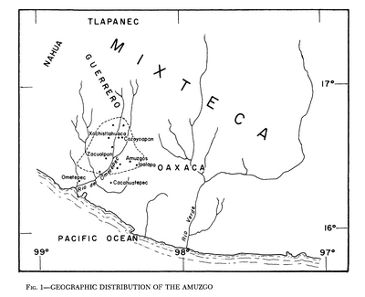
Geographic Distribution of the Amuzgo
Mapa 1969
Fig. 1 Map of the Guianas with schematic locations of the indigenous groups relevant to our study, based on the linguistic map of South America (http://www.muturzikin.com/cartesamerique/ 7.htm). Carib-speaking groups are indicated in yellow, Arawak-speaking groups in blue, Tupi-speaking Wayãpi in pink and the Warao-speaking group in green
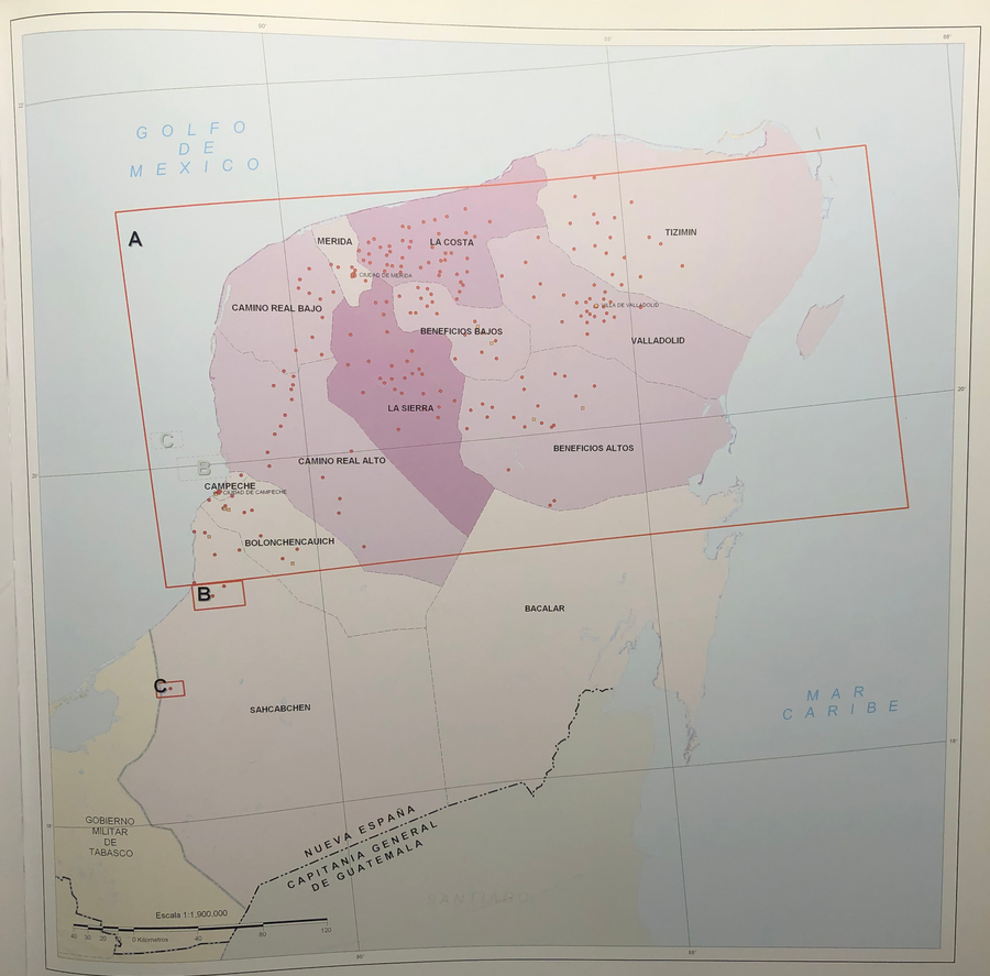
Mapa 2000 - 2024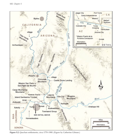
Quechan settlements, circa 1770-1900
Mapa 1770 - 1900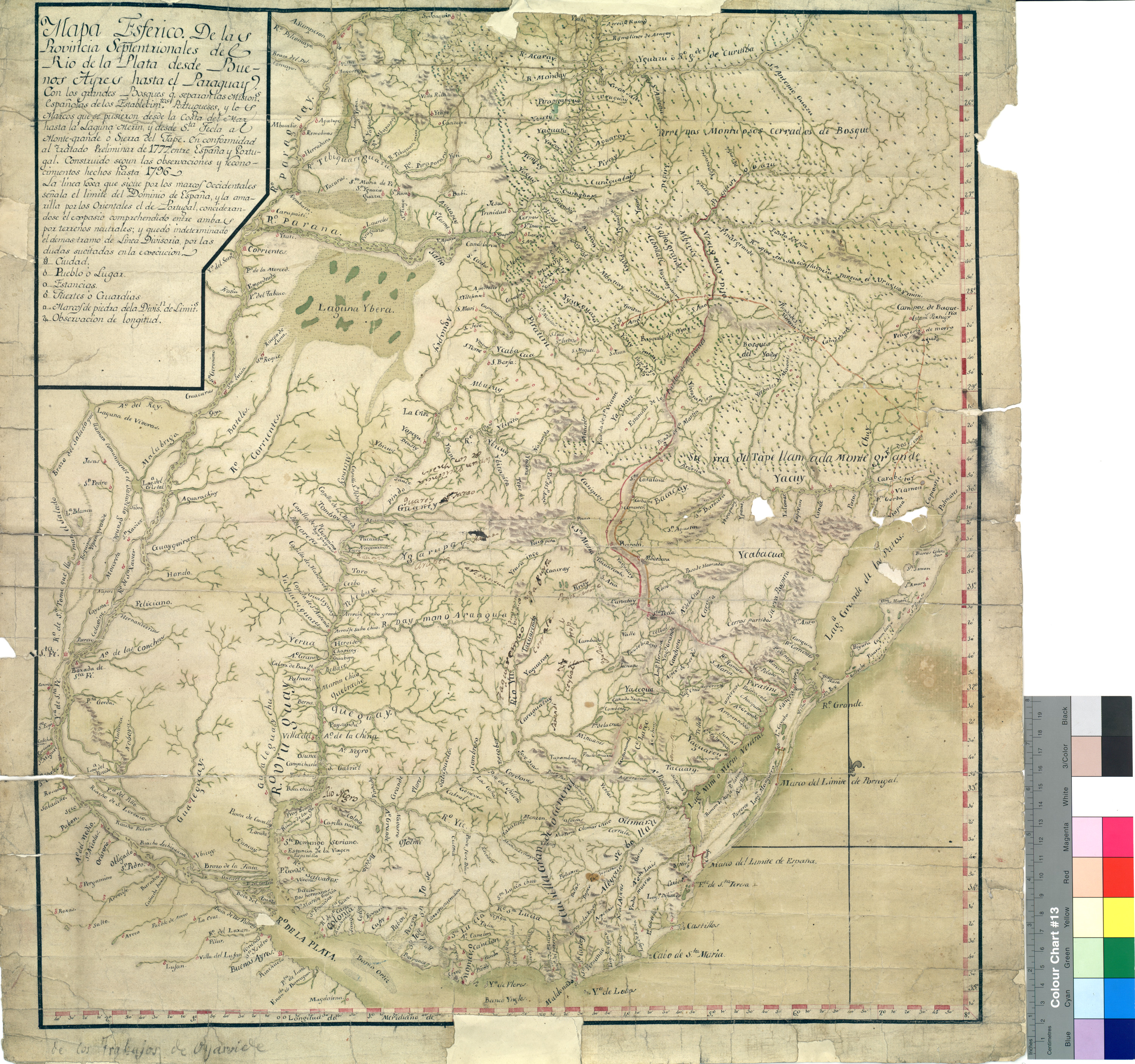
Mapa Esférico De las Provincias Septentrionales del Río de la Plata
Mapa 1796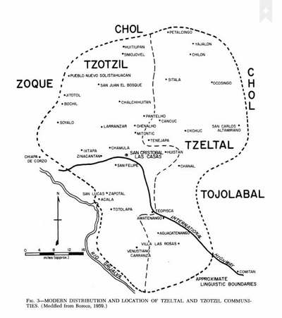
Modern Distribution and Location of Tzetzal and Tzotzil Communities
Mapa 1959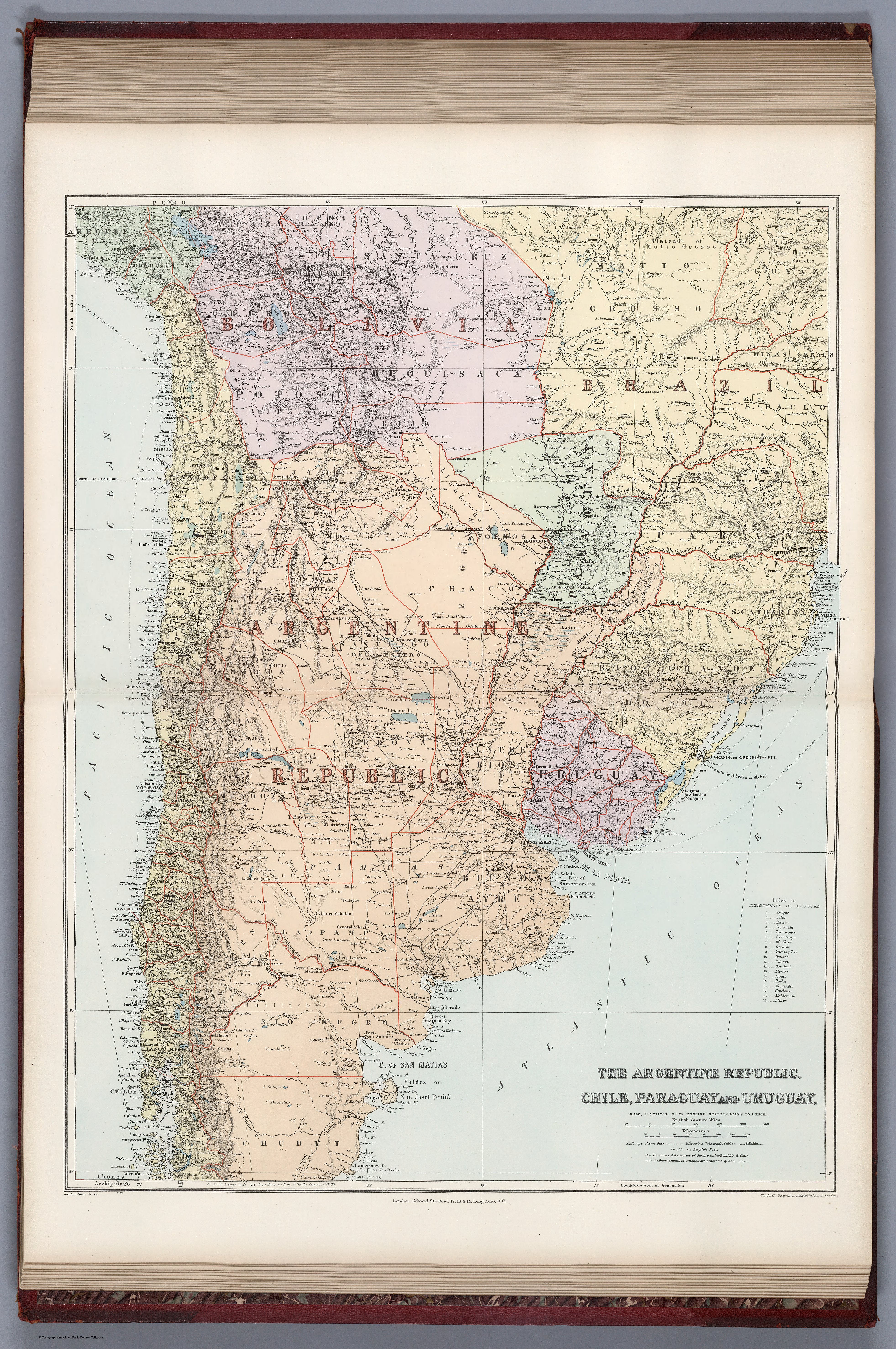
THE ARGENTINE REPUBLIC;CHILE;PARAGUAY AND URUGUAY
Mapa 1887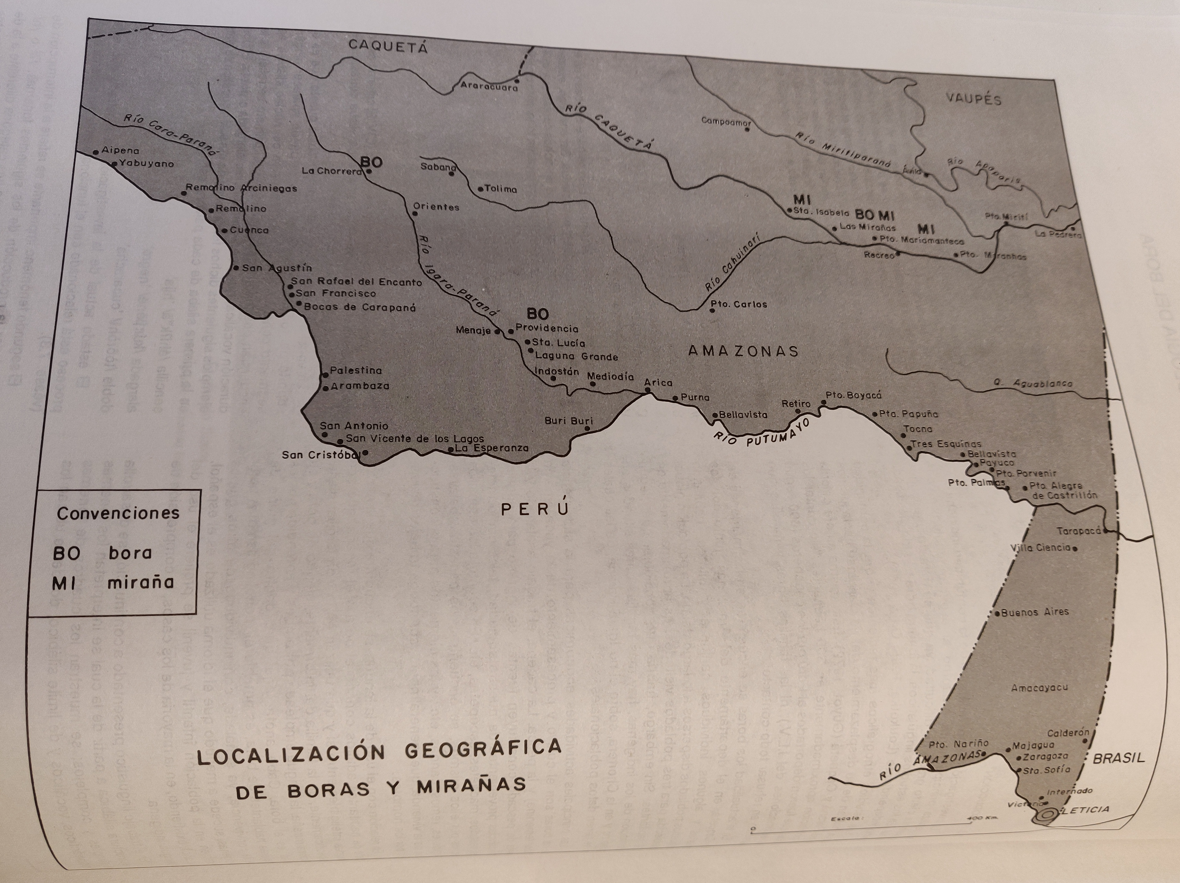
LOCALIZACIÓN GEOGRÁFICA DE BORAS Y MIRAÑAS
Mapa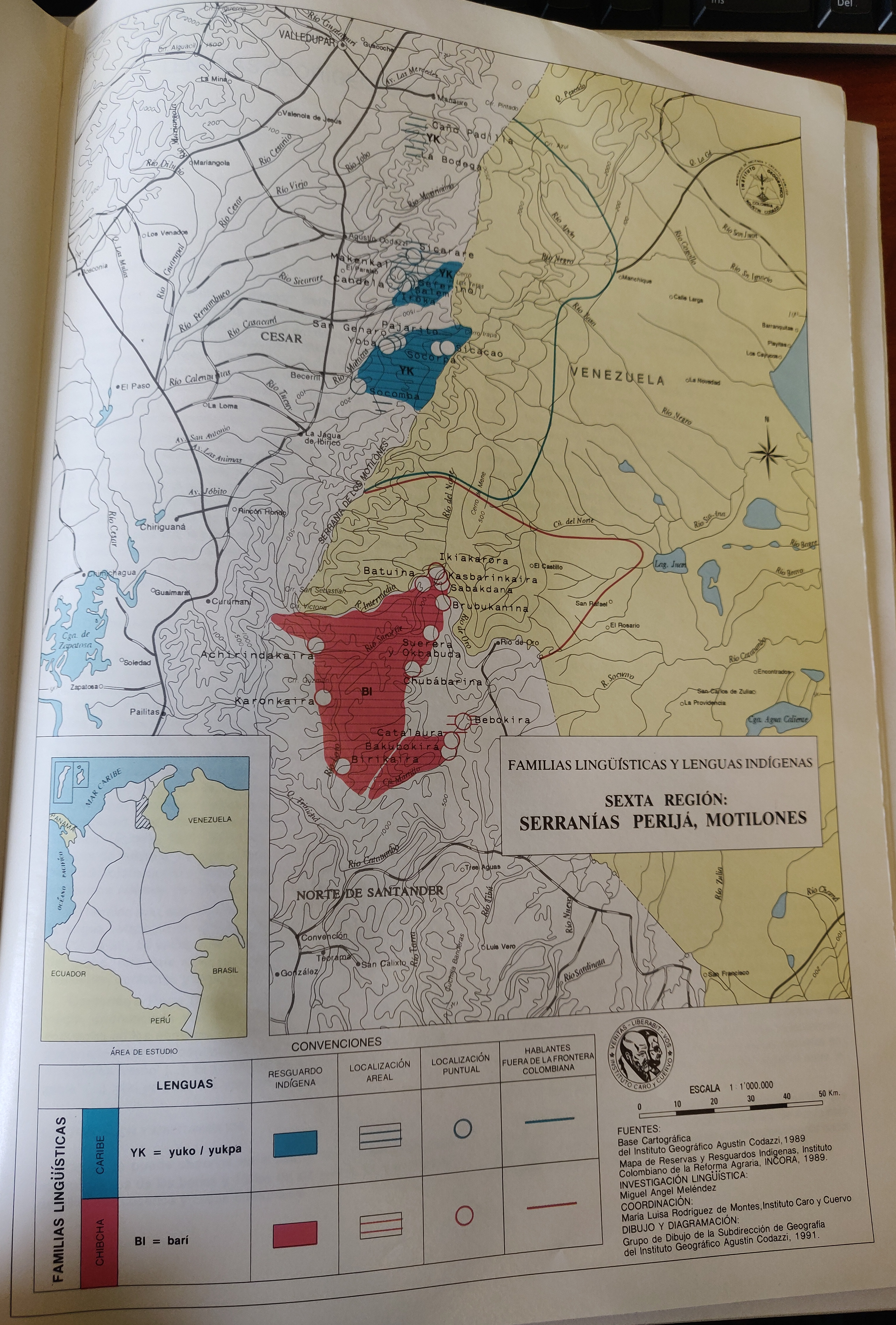
FAMILIAS LINGUÍSTICAS Y LENGUAS INDÍGENAS. SEXTA REGION: SERRANÍAS PERIJA, MOTILONES
Mapa 1989