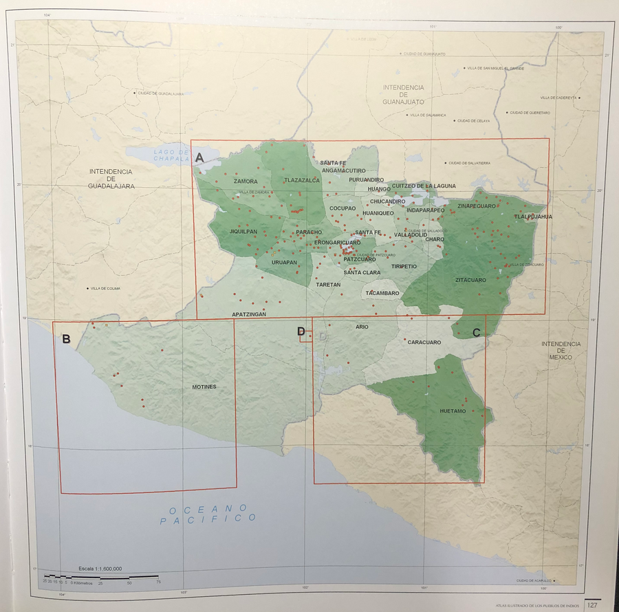
Cita
Tanck de Estrada, Dorothy. Atlas Ilustrado de los Pueblos de Indios: Nueva España, 1800. México: El Colegio de México, 2005. N/A - NO DIGITAL ACCESS
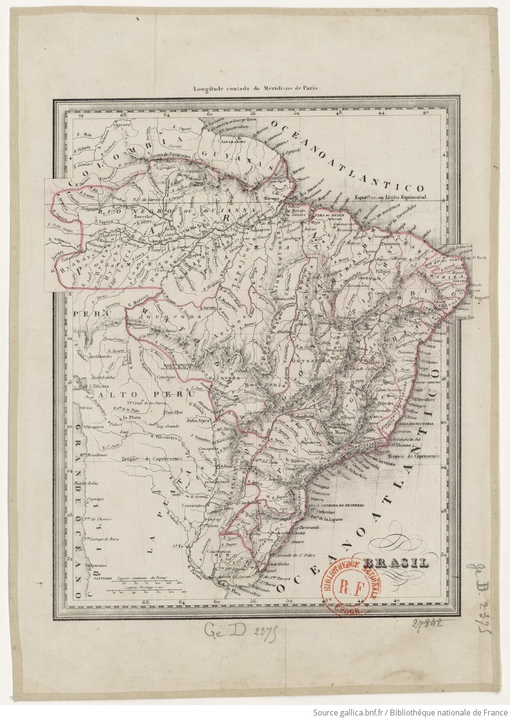
BRASIL
Mapa 1835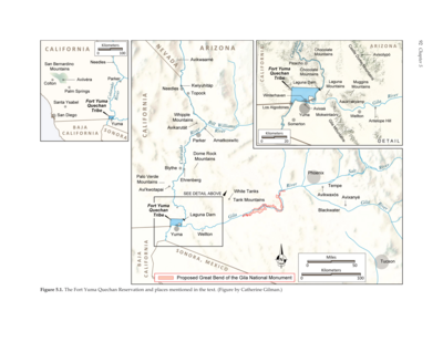
The Fort Yuma Reservation and Places Mentioned in the Text
Mapa 2016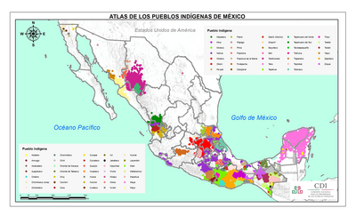
ATLAS DE LOS PUEBLOS INDÍGENAS DE MEXICO
Mapa 2015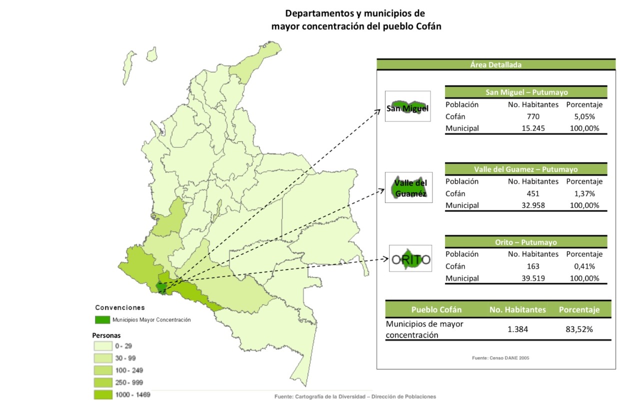
Departamentos y municipios de mayor concentración del pueblo Cofán
Mapa 2005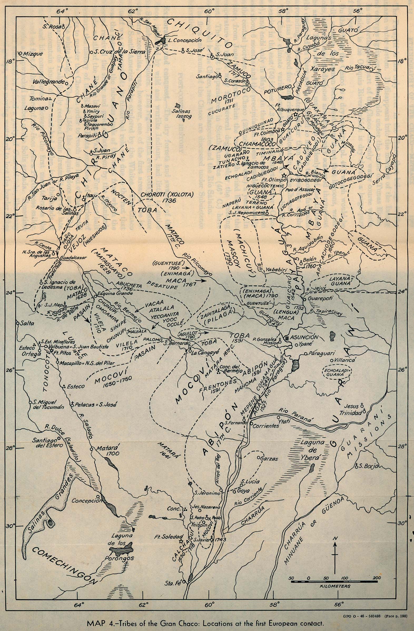
Tribes of the Gran Chaco: Locations at the first European contact
Mapa 1524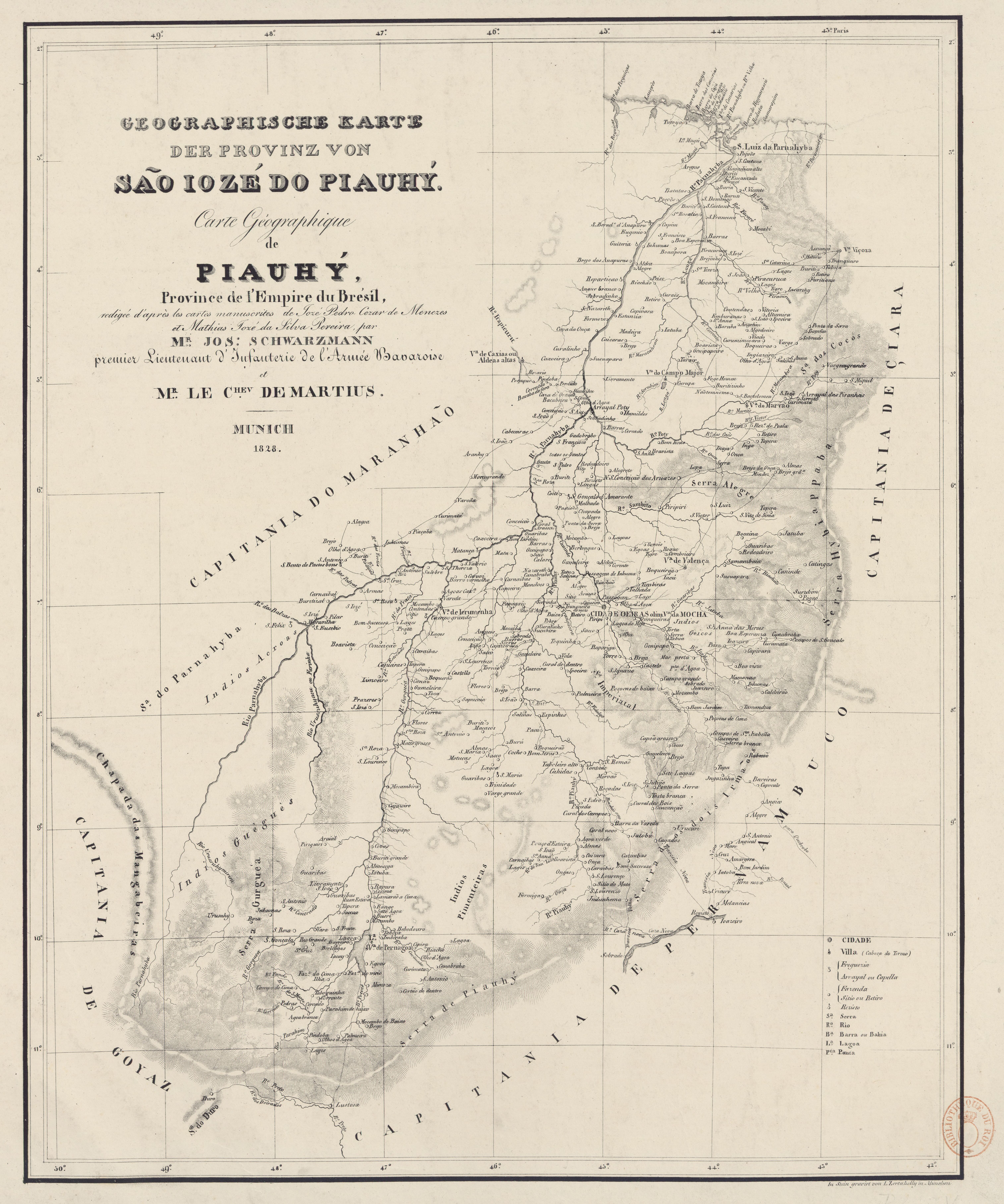
GEOGRAPHISCHE KARTE DER PROVINZ VON SÃO JOZÉ DO PIAUHY. Carte Géographique de PIAUHY, Province de l'Empire du Brésil
Mapa 1828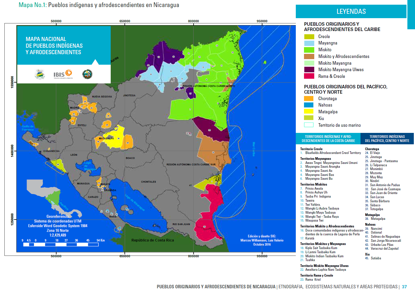
Mapa Nacional de Pueblos Indígenas y Afrodescendientes
Mapa 2016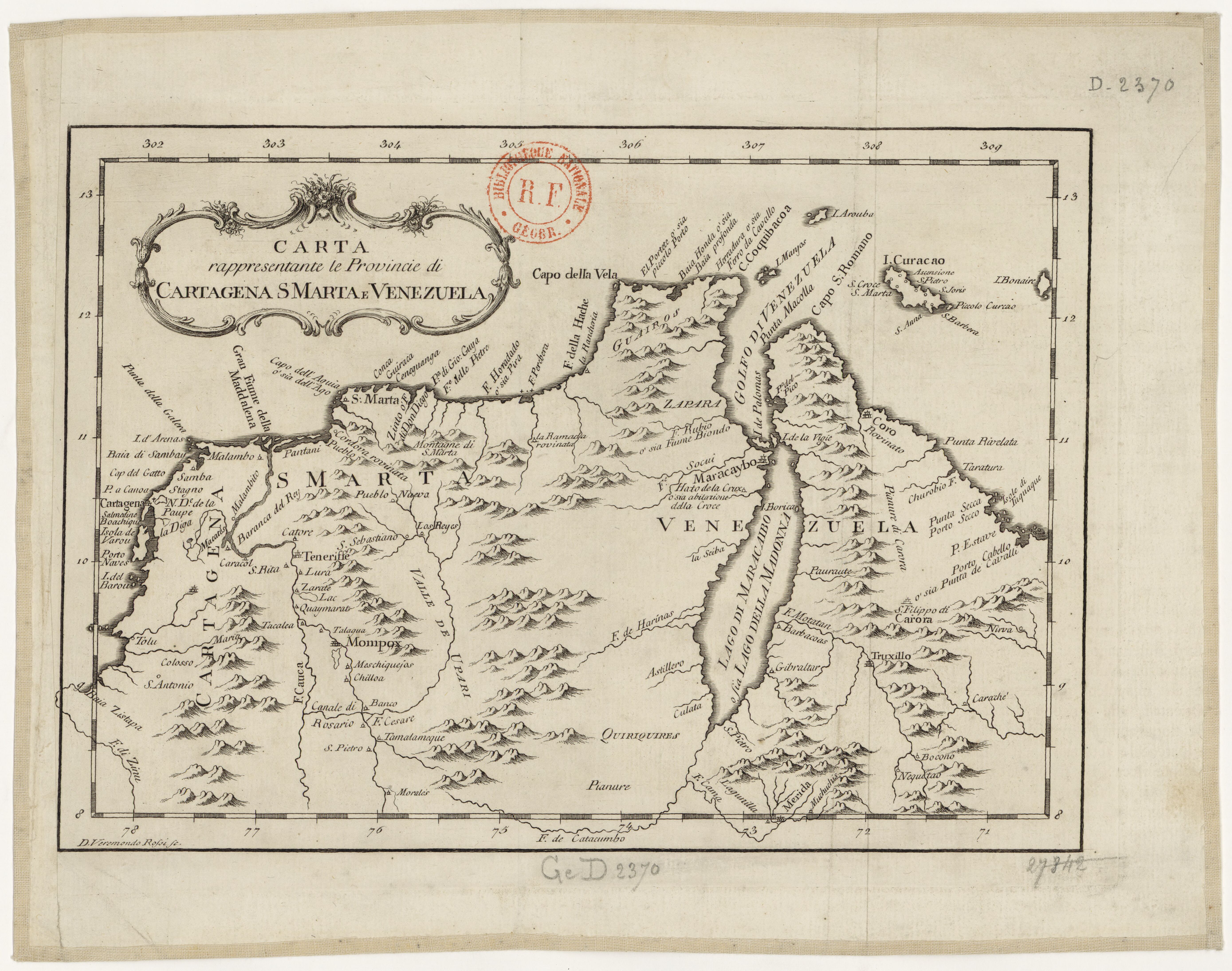
Carta rappresentante le Provincie di Cartagena;S Marta e Venezuela
Mapa 1754