
Citas
Tanck de Estrada, Dorothy. Atlas Ilustrado de los Pueblos de Indios: Nueva España, 1800. México: El Colegio de México, 2005. N/A - NO DIGITAL ACCESS
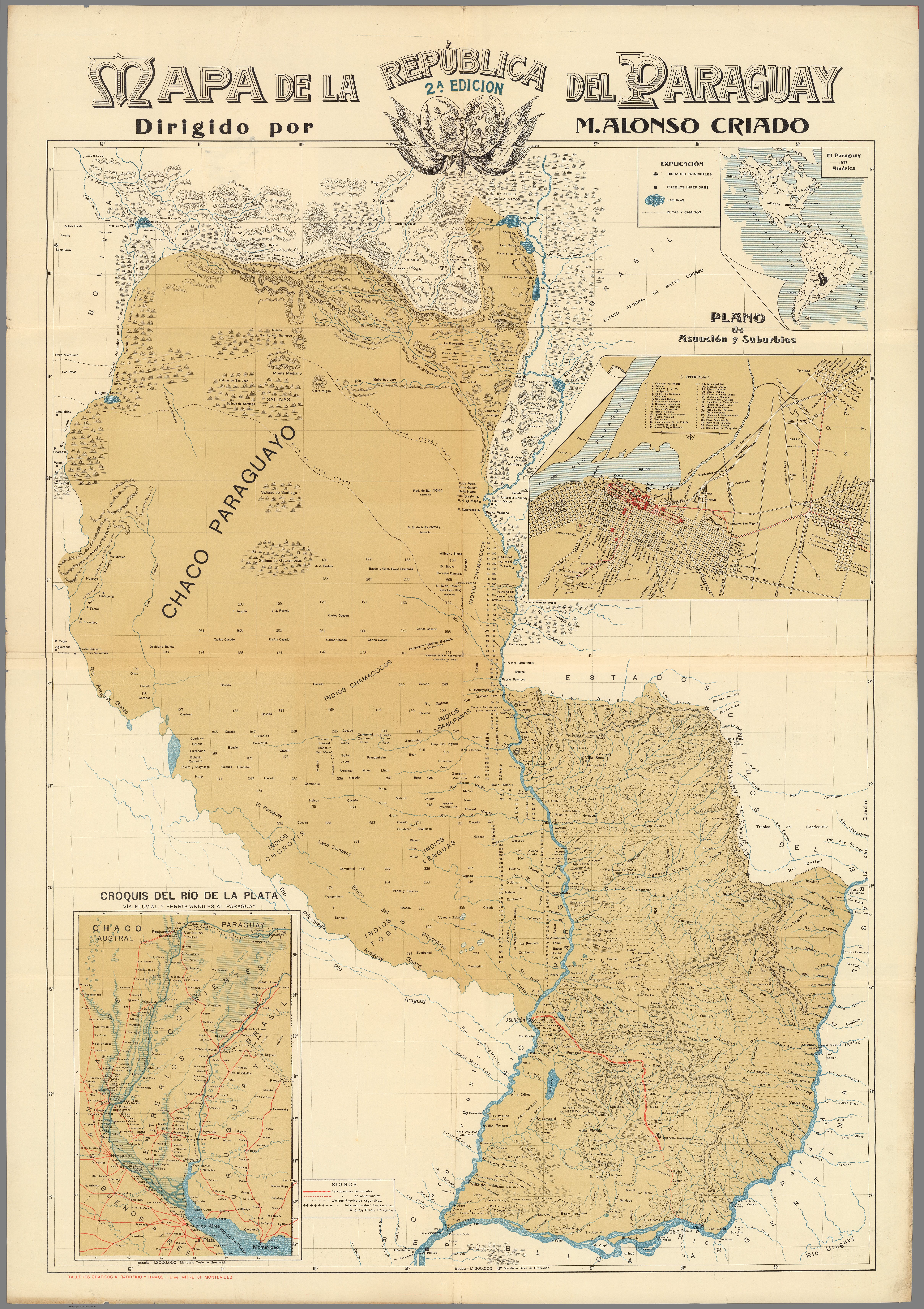
MAPA DE LA REPÚBLICA DEL PARAGUAY
Mapa 1908
Railroad Map of British Honduras Transportation Department of the United States Department of Commerce. Library of Congress Geography and Map Division. https://hdl.loc.gov/loc.wdl/wdl.11329
Mapa 1900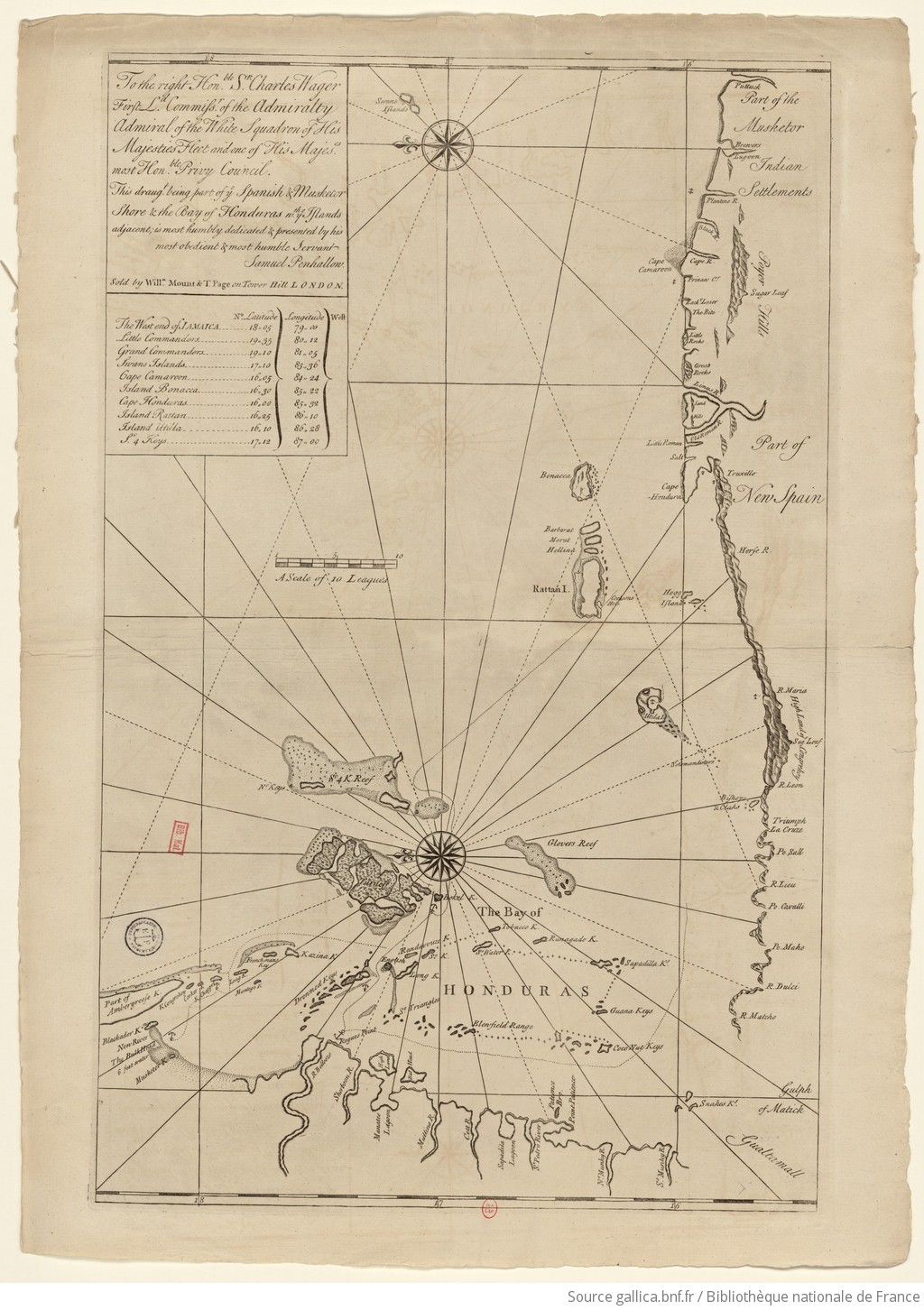
The Spanish and Musketor shore and the bay of Honduras and the islands adjacent
Mapa 1735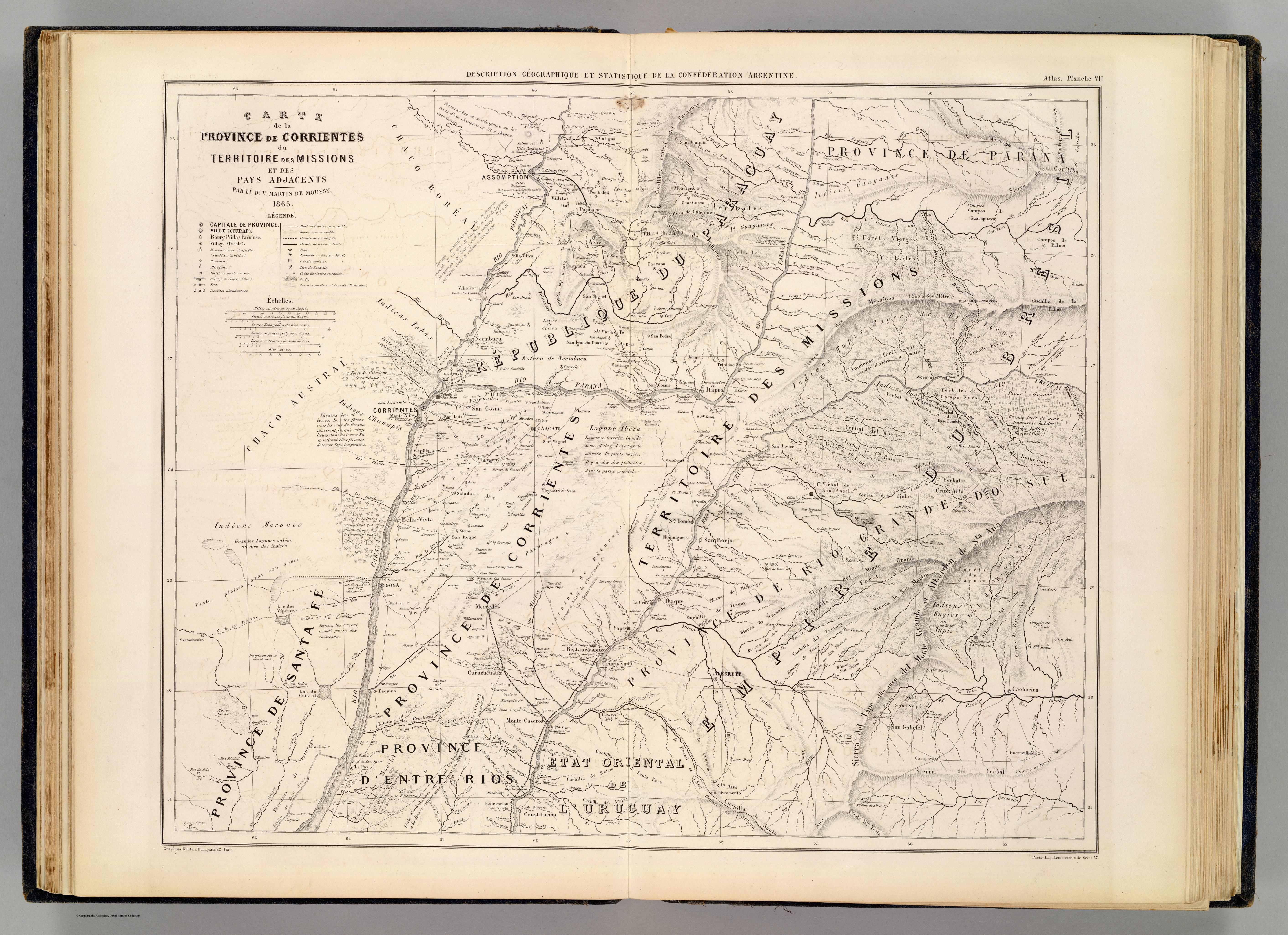
CARTE de la PROVINCE de CORRIENTES du TERRITOIRE des MISSIONS et des PAYS ADJACENTS
Mapa 1865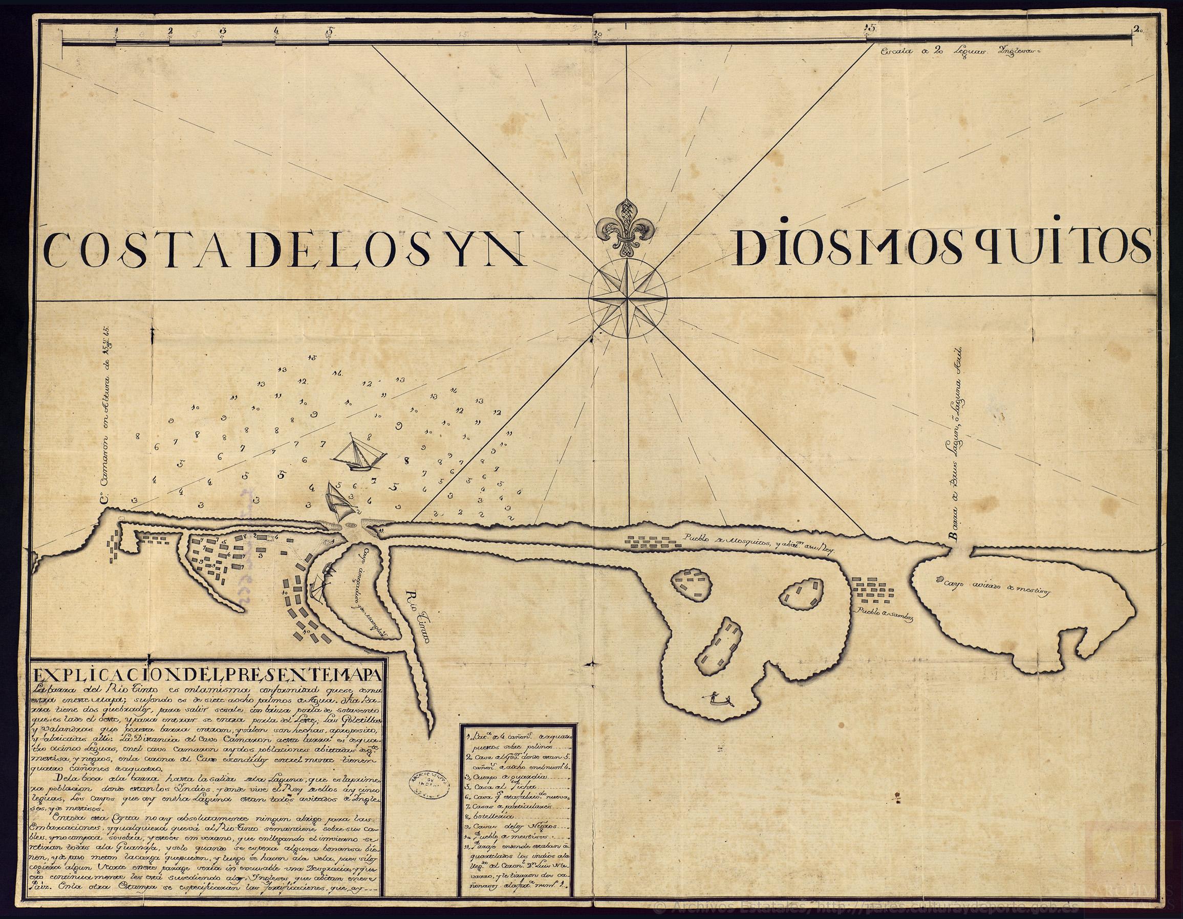
Costa de los Yndios Mosquitos:Plano de la Costa de Mosquitos, desde el Cabo Camarón hasta la Laguna de Brus
Mapa 1700
Foodtopia: después de todo territorio
Obra de Arte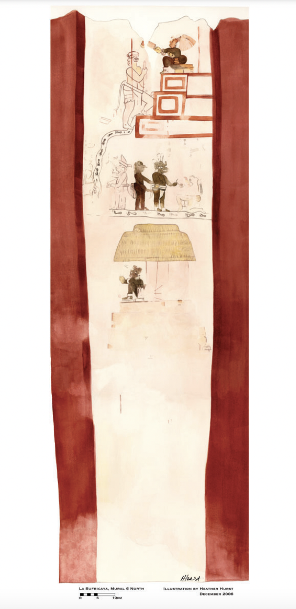
Reproduction of a 4th century mural painted on the wall of a royal residence at La Sufricaya in the Peten region of Guatemala. Mural 6 North.
Mapa 300 - 400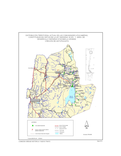
Distribucion Territorial Actual de las Comunidades Atacamenas
Mapa 1993