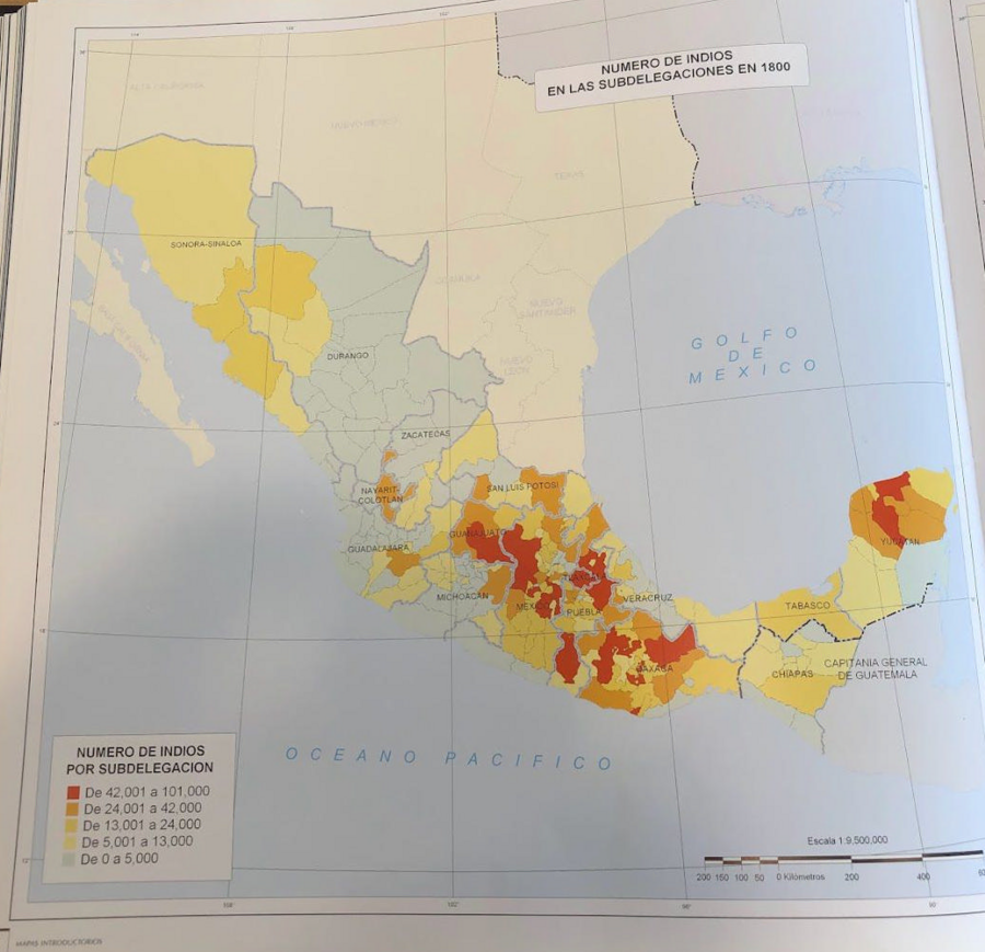
Cita
Tanck de Estrada, Dorothy. Atlas Ilustrado de los Pueblos de Indios: Nueva España, 1800. México: El Colegio de México, 2005. N/A - NO DIGITAL ACCESS
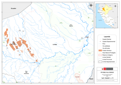
PUEBLO KANDOZI
Mapa 2021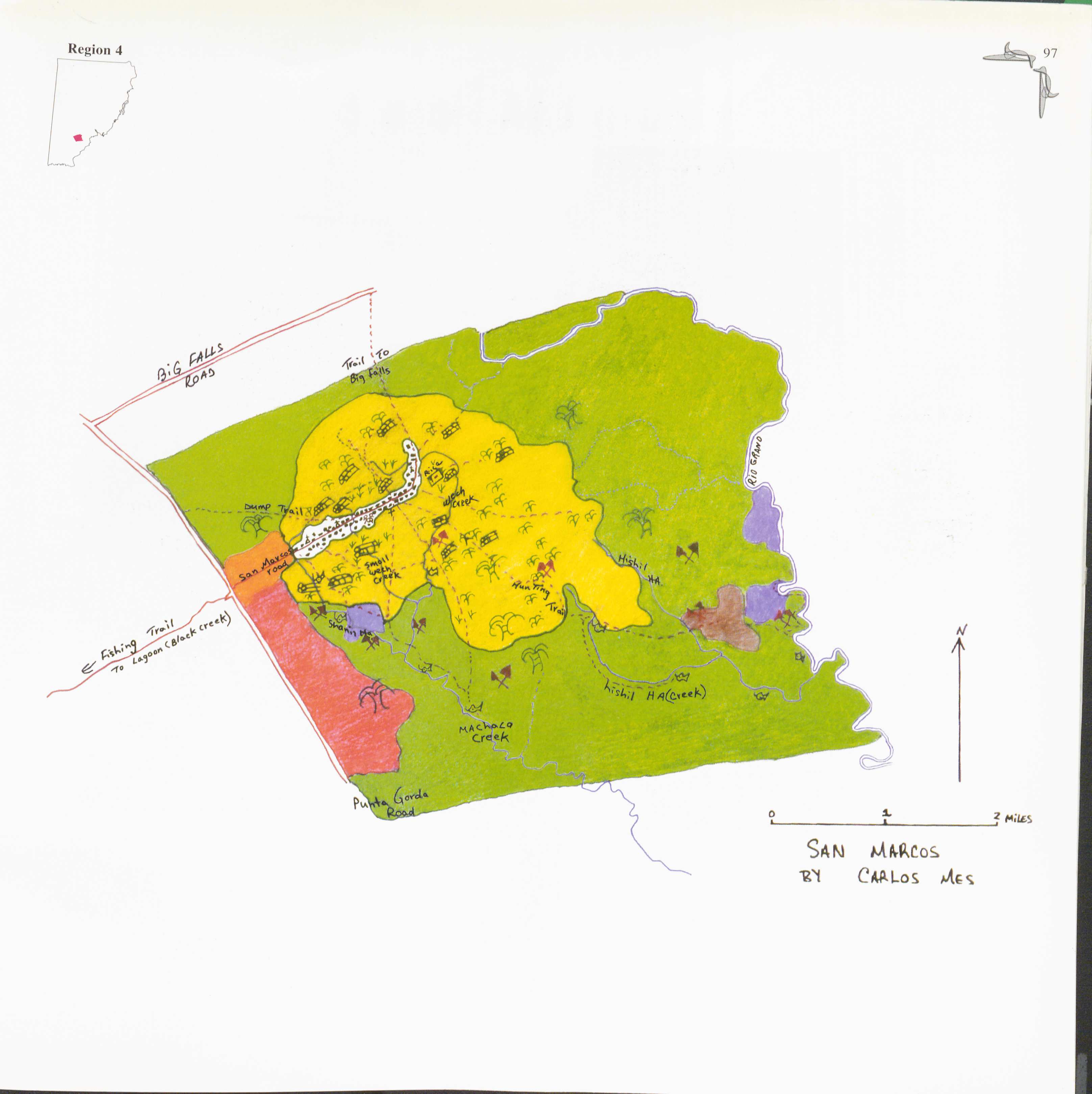
San Marcos
Mapa 1997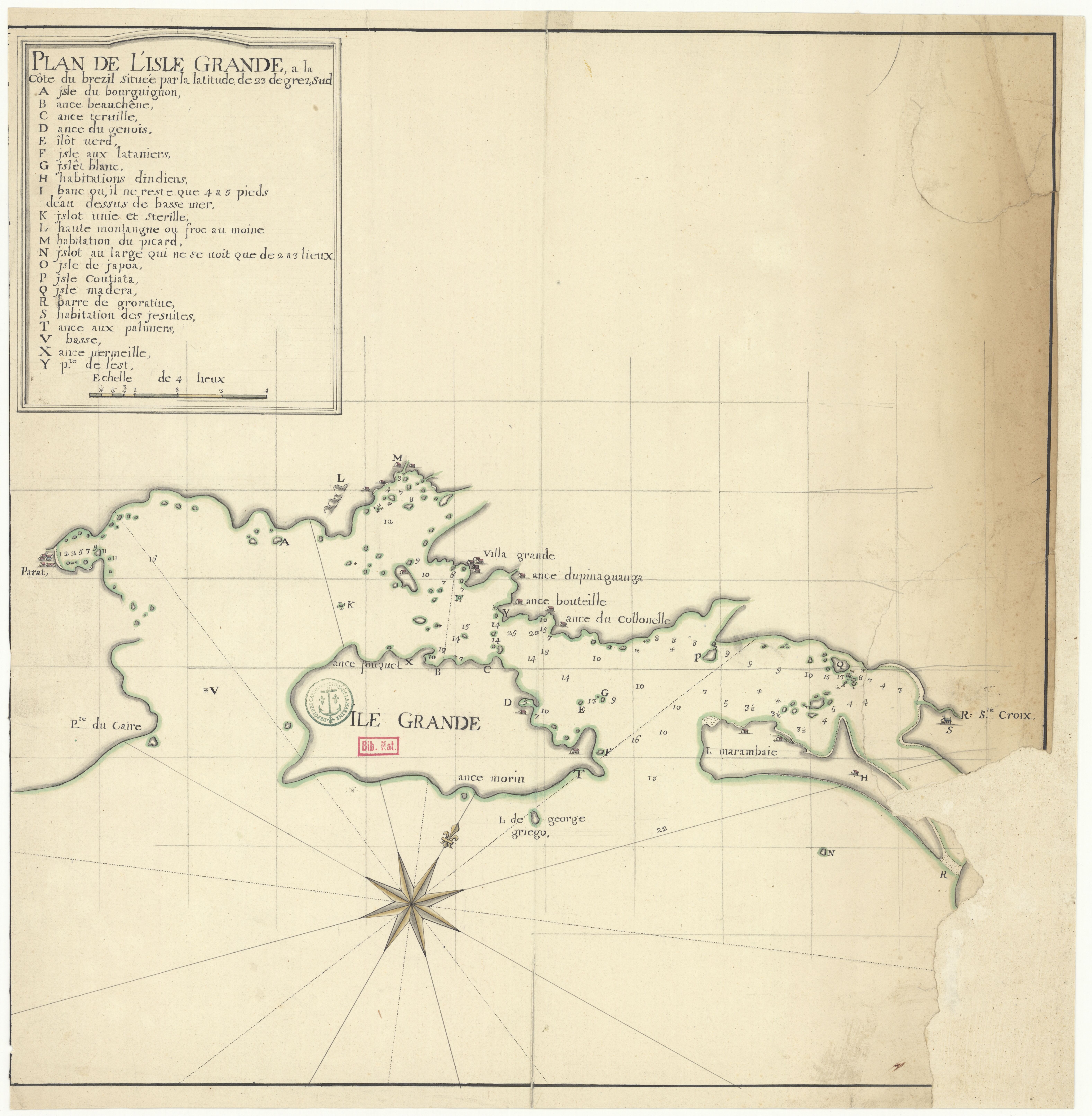
PLAN DE L'ISLE GRANDE, à la côte du Brezil
Mapa 1700 - 1750
AMERIQUE MERIDIONALE: BRESIL AUX PORTUGAIS: CAPITAINERIE DE RIO-IANEIRO
Mapa 1757
Mayan Access to Biomass Resources (Guatemala 2018).
Mapa 2000
Map of Honduras and San Salvador, Central America, Showing the line of the proposed Honduras Interoceanic Railway
Mapa 1854
Serie Fatherland / Padre Patria
Obra de Arte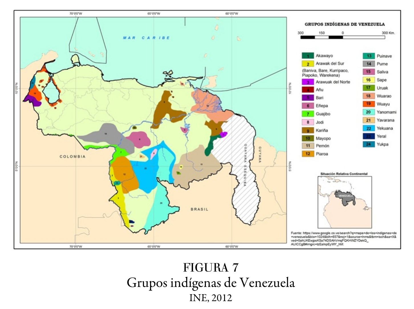
Grupos indígenas de Venezuela
Mapa 2012