
Cita
Vásquez Vásquez, Elena. Distribución Geográfica y Organización De Las Órdenes Religiosas En La Nueva España Siglo XVI. México DF: Universidad Autónoma de México, 1965.

TAJO
Obra de Arte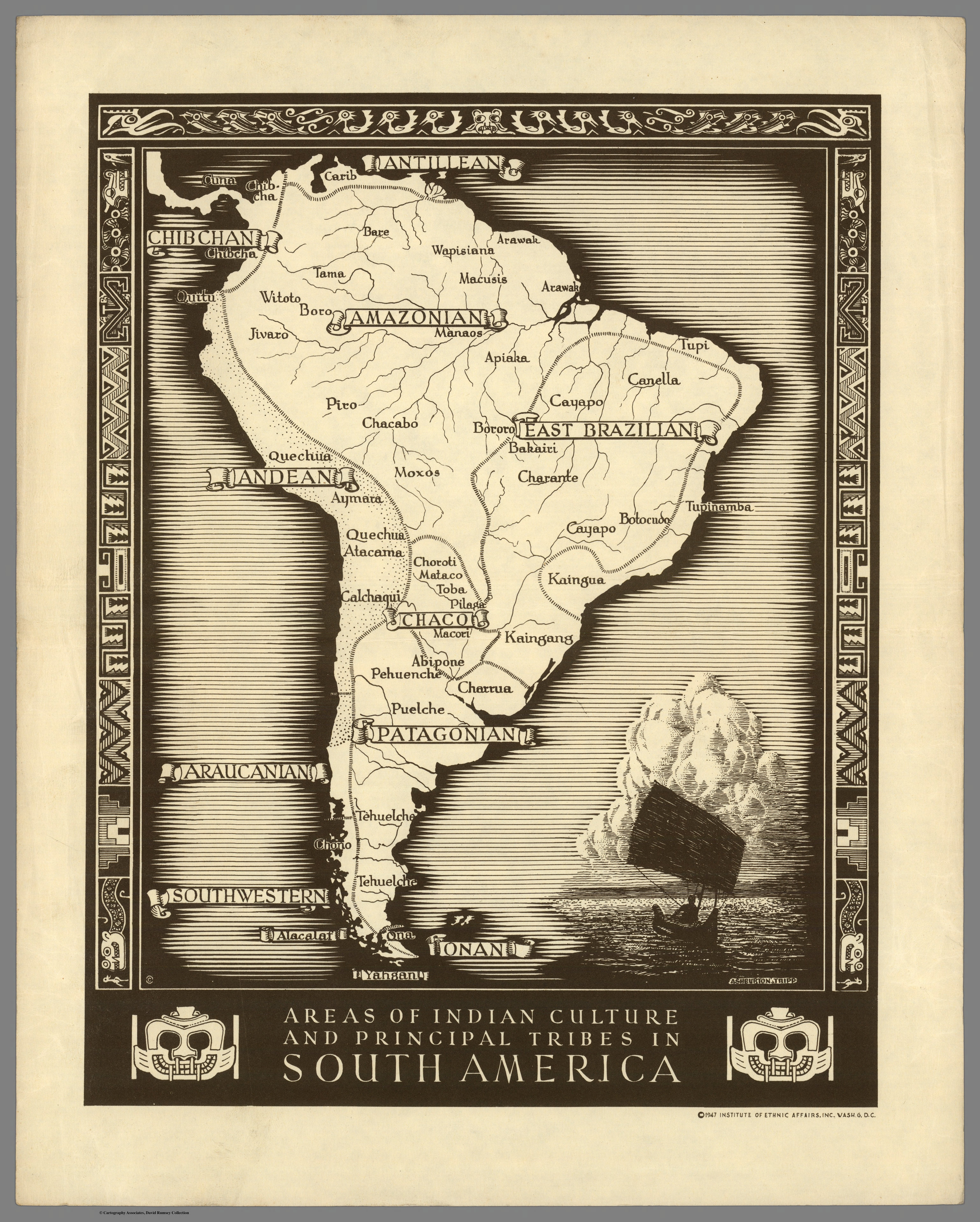
Areas of Indian Culture and Principal Tribes in South America
Mapa 1500 - 1900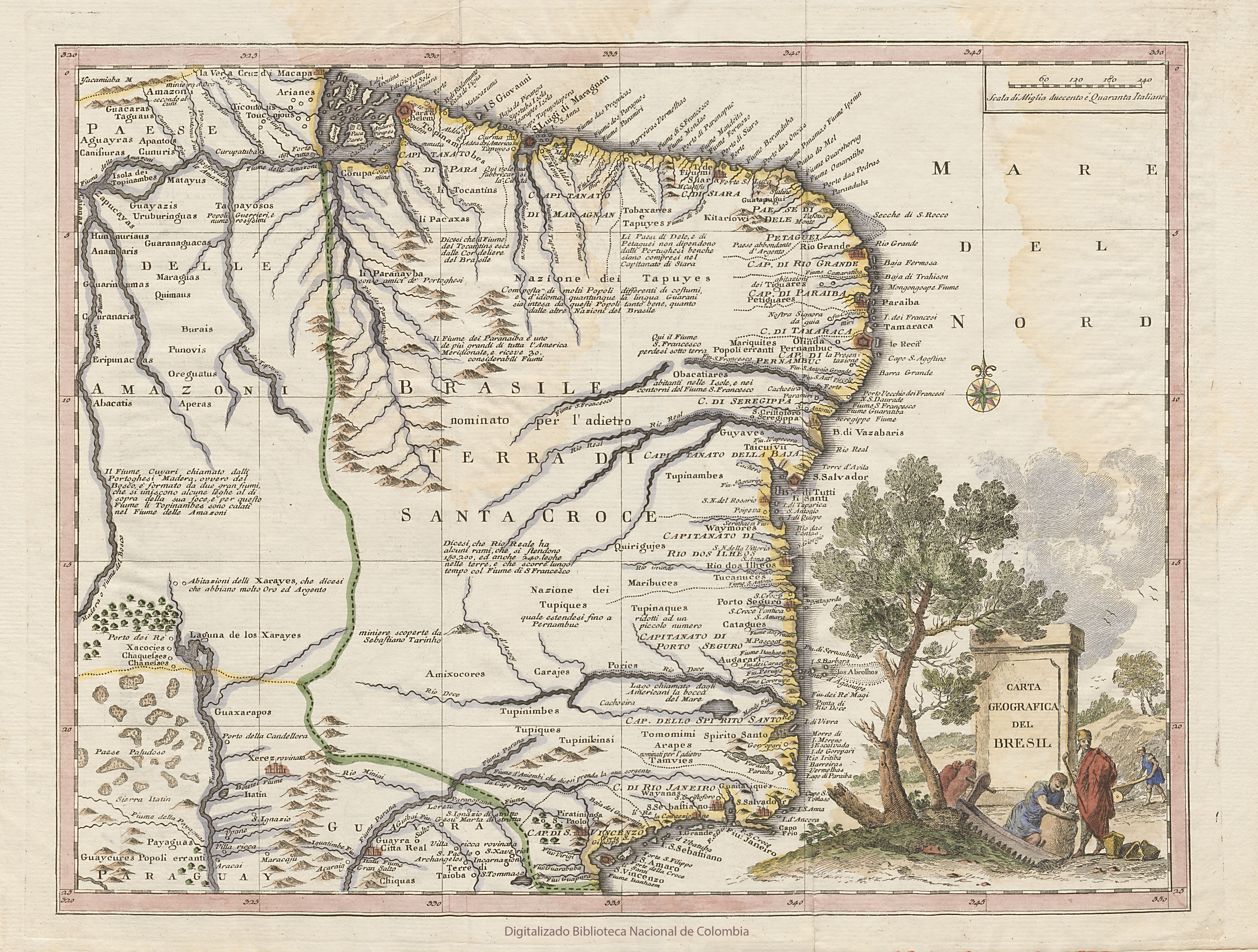
CARTA GEOGRAFICA DEL BRESIL
Mapa 1740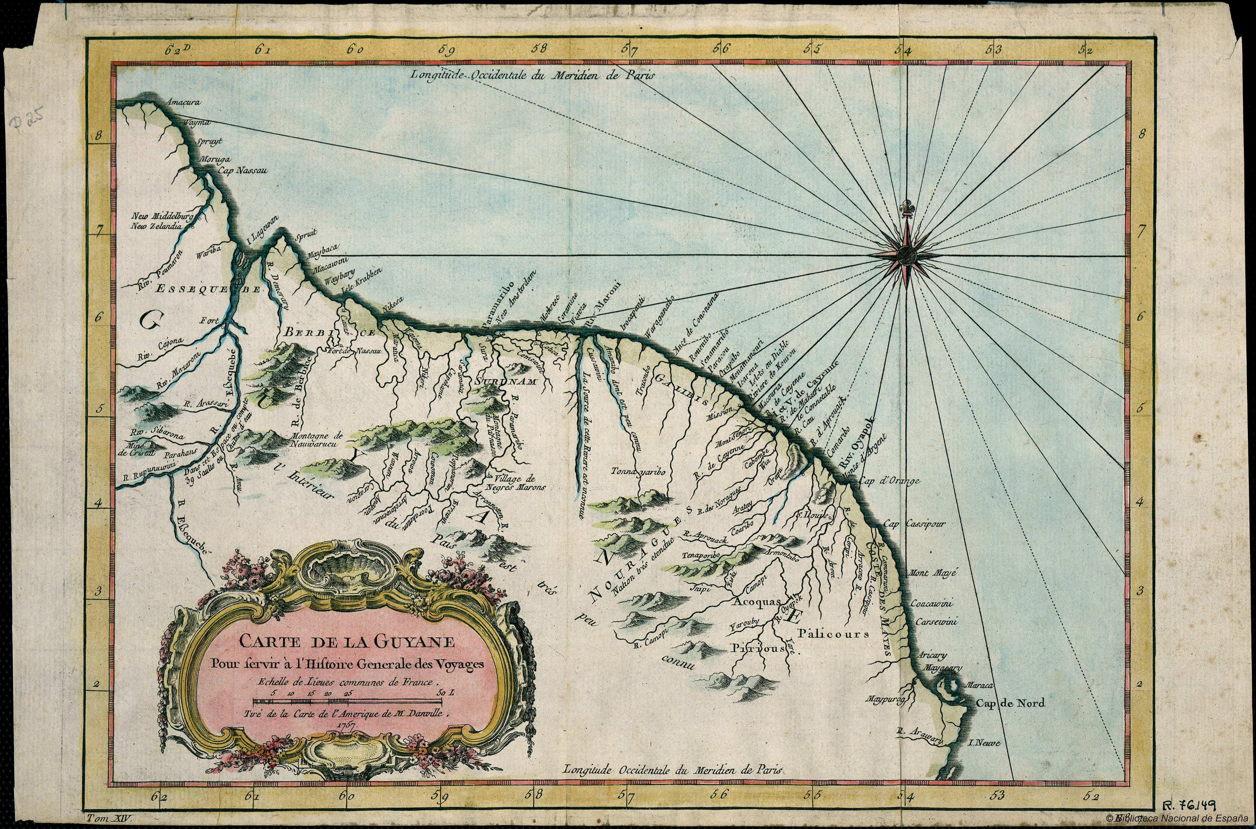
Carte de la Guyana pour servir à l'Histoire Generale des Voyages.
Mapa 1757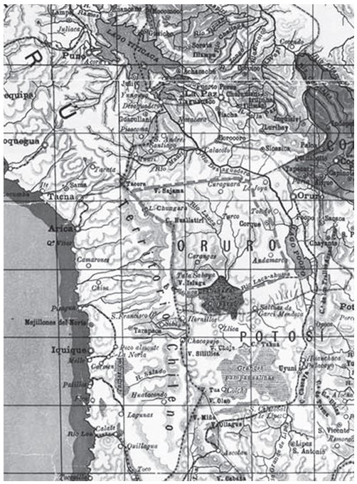
APPROXIMATE BORDERS OF TERRITORY OF THE AYMARA POLITY KARANQAS (OR CARANGAS) IN THE 19TH CENTURY
Mapa 1894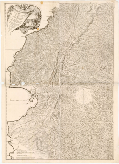
Carta de la provincia de quito y de sus
Mapa 1700 - 1750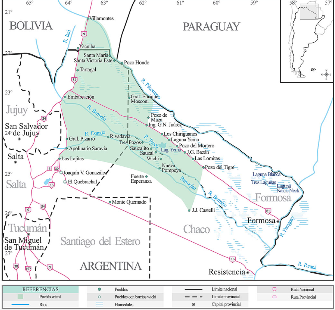
Lengua wichí. Dónde se habla
Mapa 2009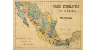
CARTA ETNOGRÁFICA DE MEXICO
Mapa 1864