Pueblos
- COCHIMI
- GUAYCURA
- PERICU
Cita
Crosby, Henry W. Antigua California: Mission and Colony on the Peninsular Frontier, 1697-1768. Albuquerque: University of New Mexico Press, 1994. https://hdl.handle.net/2027/mdp.39015032491873.
Distribución actual de las culturas indígenas.
Mapa 2007
MAYAN SPIRITUAL SITES
Mapa -2500 - 1520
NOVA ET EXACTA DELINEATIO AMERICA
Mapa 1534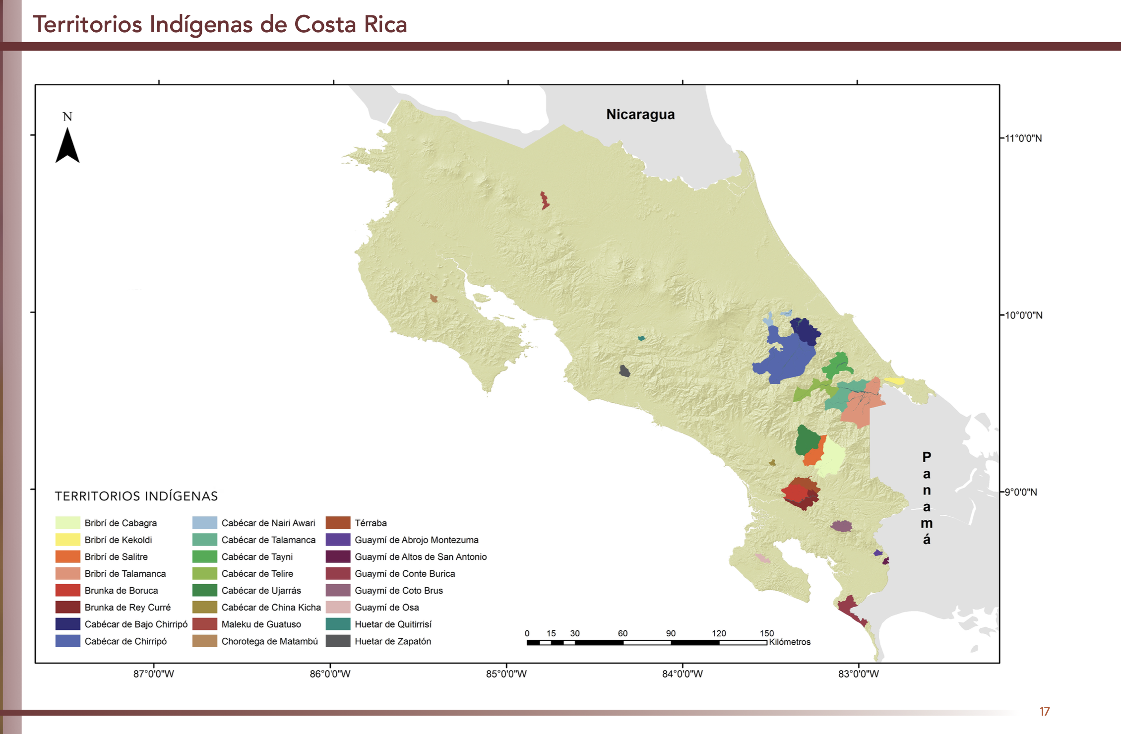
"Territorios Indígenas de Costa Rica"
Mapa 2010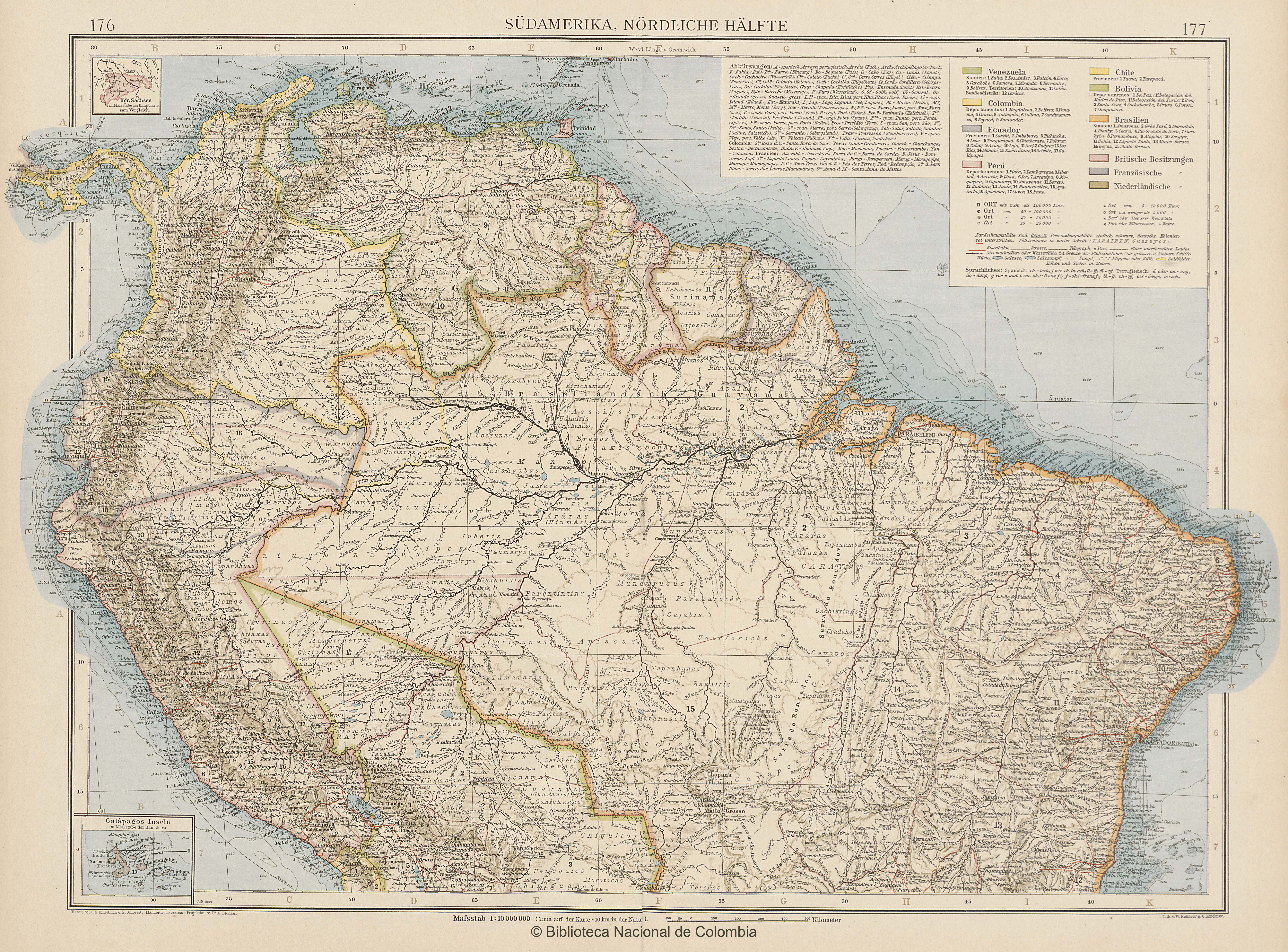
SÜDAMERIKA, NÖRDLICHE HÄLFTE
Mapa 1902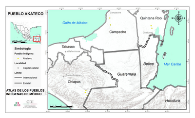
PUEBLO AKATECO
Mapa 2020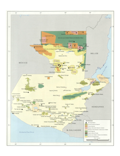
Sistema guatemalteco de áreas protegidas (SIGAP) y sitios arqueológicos en 2000.
Mapa 2000![Tawahka homeland, 1916: Showing Río Wampú (Wanpo), Río Patuca (Butuk), Cerro Quigungun (Wangkibila Volc [anol]), and the first cartographical rendering of Krautara (Moravian Archives, Bethlehem, Pennsylvania, Heath 1916)](https://dnet8ble6lm7w.cloudfront.net/maps_sm/HON/HON0014.png)
Tawahka homeland, 1916: Showing Río Wampú (Wanpo), Río Patuca (Butuk), Cerro Quigungun (Wangkibila Volc [anol]), and the first cartographical rendering of Krautara (Moravian Archives, Bethlehem, Pennsylvania, Heath 1916)
Mapa 1916