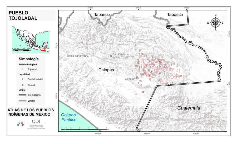
Pueblos
- TOJOLABAL
Cita
Instituto Nacional de los Pueblos Indígenas. "Tojolabales – Ubicación." Atlas de los Pueblos Indígenas de México. http://atlas.inpi.gob.mx/tojolabales-ubicacion/.
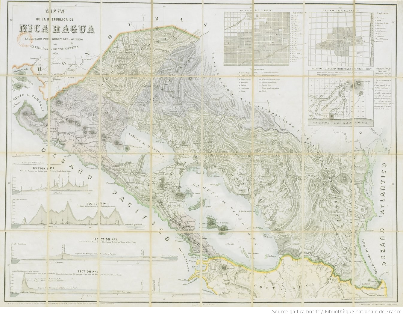
Mapa de la Republica de Nicaragua leventado por orden del gobierno por Maxmilian v Sonnenstern.
Mapa 1839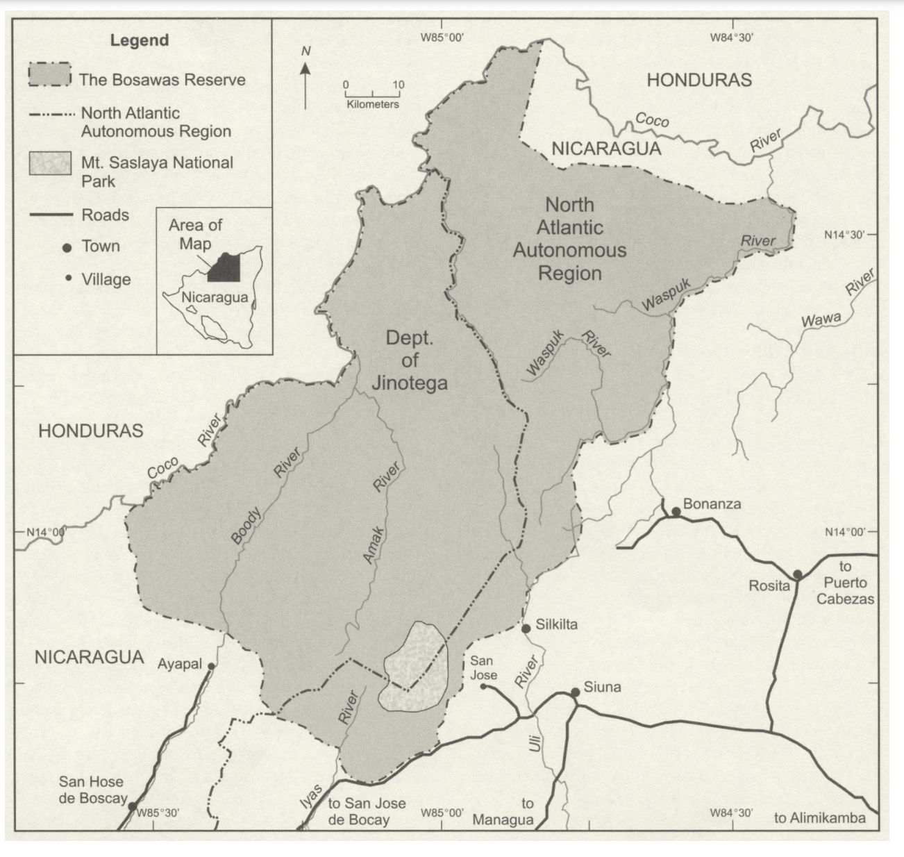
The Bosawas Reserve;North-Central Nicaragua
Mapa 2000 - 2003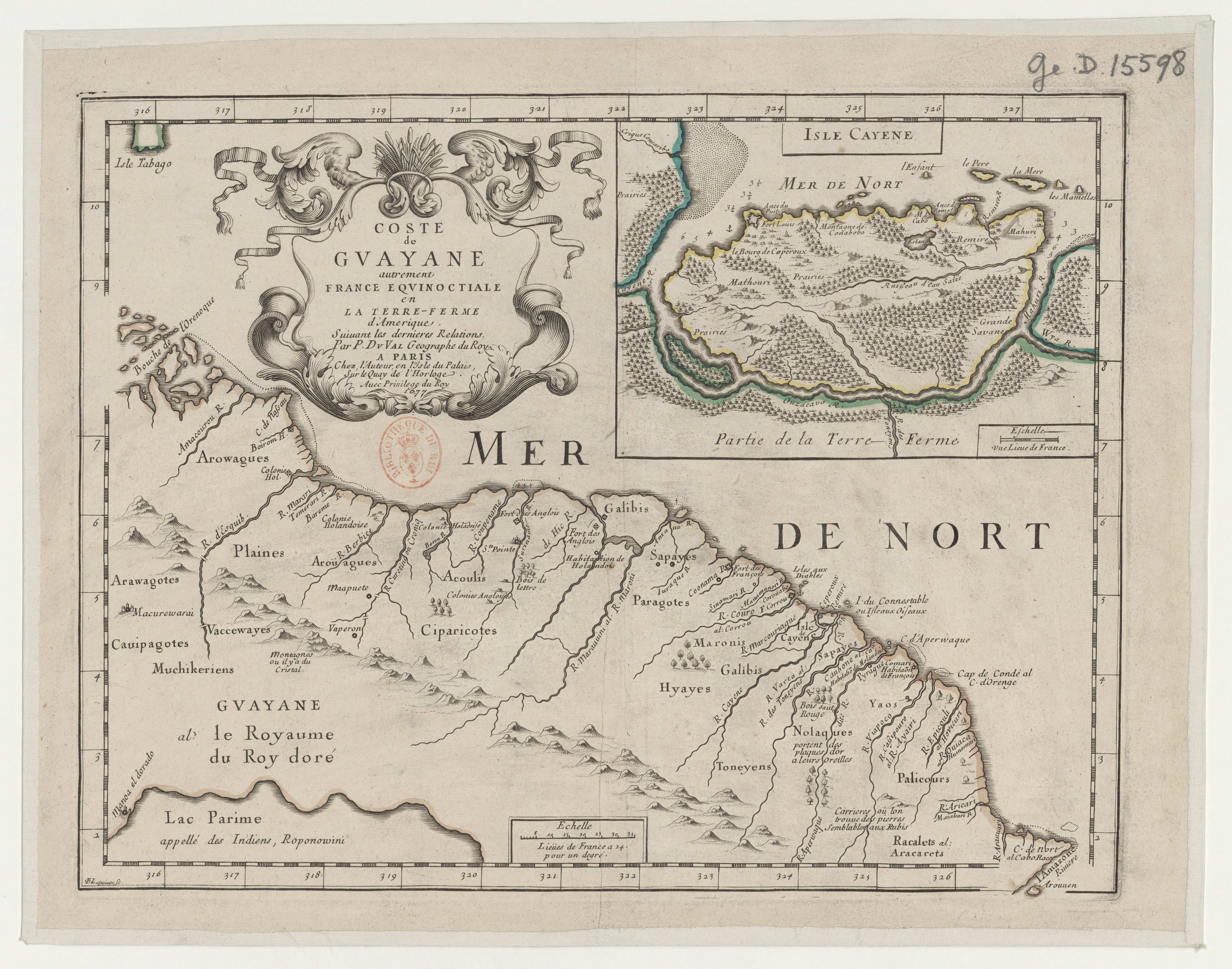
Coste de Guayane autrement France equinoctiale en la Terre Ferme d'Amérique.
Mapa 1677
Comunidad Aborigen Misión Federico Pérez - Pueblo Wichí
Mapa 2020
INTENDENCIA DE OAXACA
Mapa 1800
Carte particulière de la colonie de Cayenne. Levée et présentée à Monseigneur le Comte de Pontchartrain, Ministre et secrétaire d'Etat ;Par son très humble serviteur et très obéissant serviteur De Créanton officier de la marine
Mapa 1701![Carte de la Guyane française (2ème édition). Service géographique des colonies. [Feuille 1]](https://dnet8ble6lm7w.cloudfront.net/maps_sm/FGU/FGU0011-0.png)
Carte de la Guyane française (2ème édition). Service géographique des colonies. [Feuille 1]
Mapa 1926
Modelo para armar y desarmar una fuente de agua
Obra de Arte