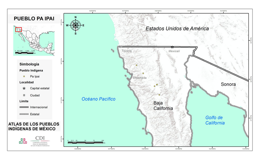
Pueblos
- PAIPAI
Cita
Instituto Nacional de los Pueblos Indígenas. "Pa ipais – Ubicación." Atlas de los Pueblos Indígenas de México. Accessed August 12, 2021. http://atlas.inpi.gob.mx/pa-ipais-ubicacion/.
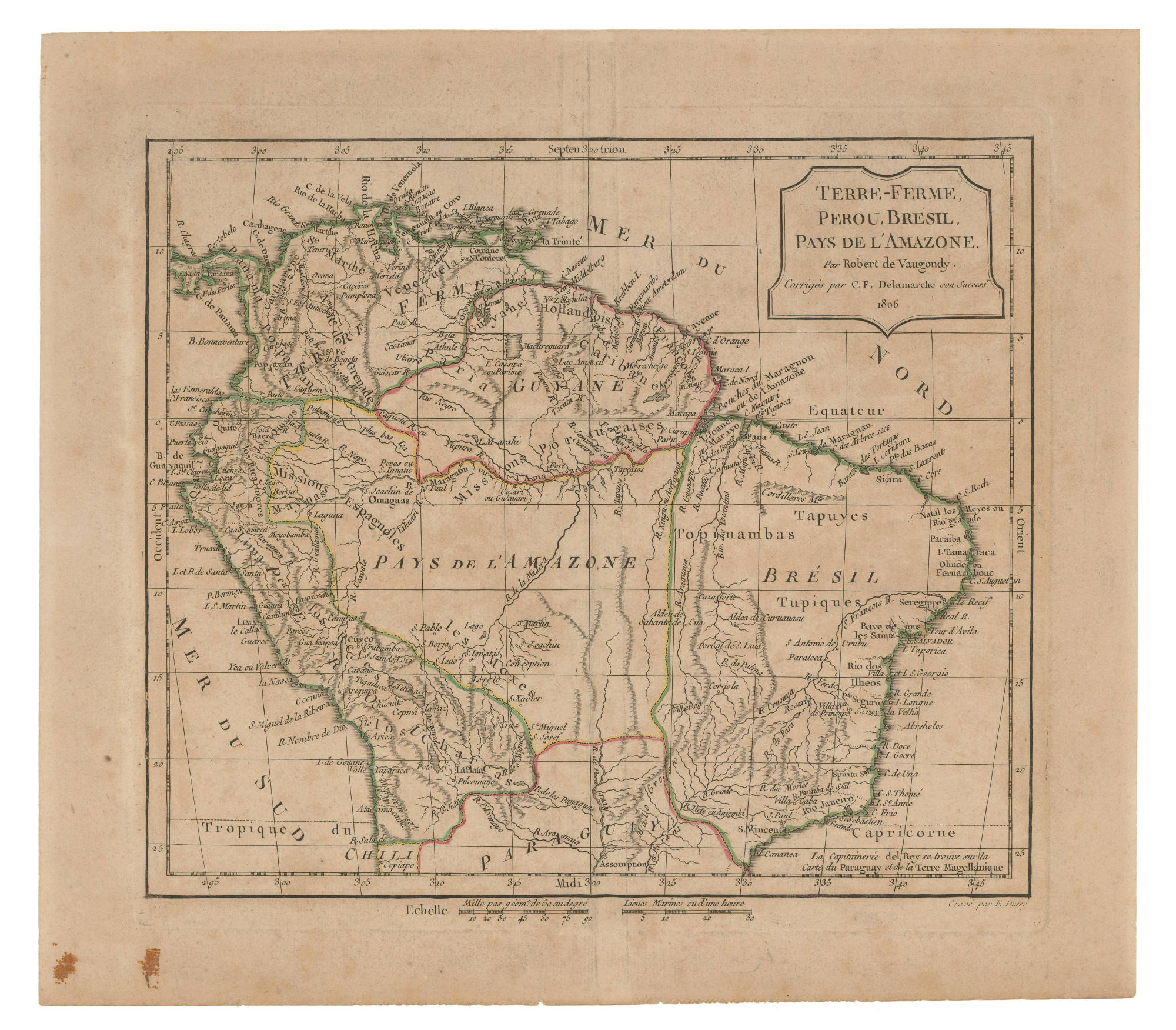
TERRE-FERME, PEROU, BRESIL, PAYS DE L'AMAZONE
Mapa 1806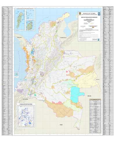
Mapa de resguardos indígenas
Mapa 2012![Pátria, sangue e nada mais [Patria, sangre y nada más]](https://dnet8ble6lm7w.cloudfront.net/art_sm/ABRA010.png)
Pátria, sangue e nada mais [Patria, sangre y nada más]
Obra de Arte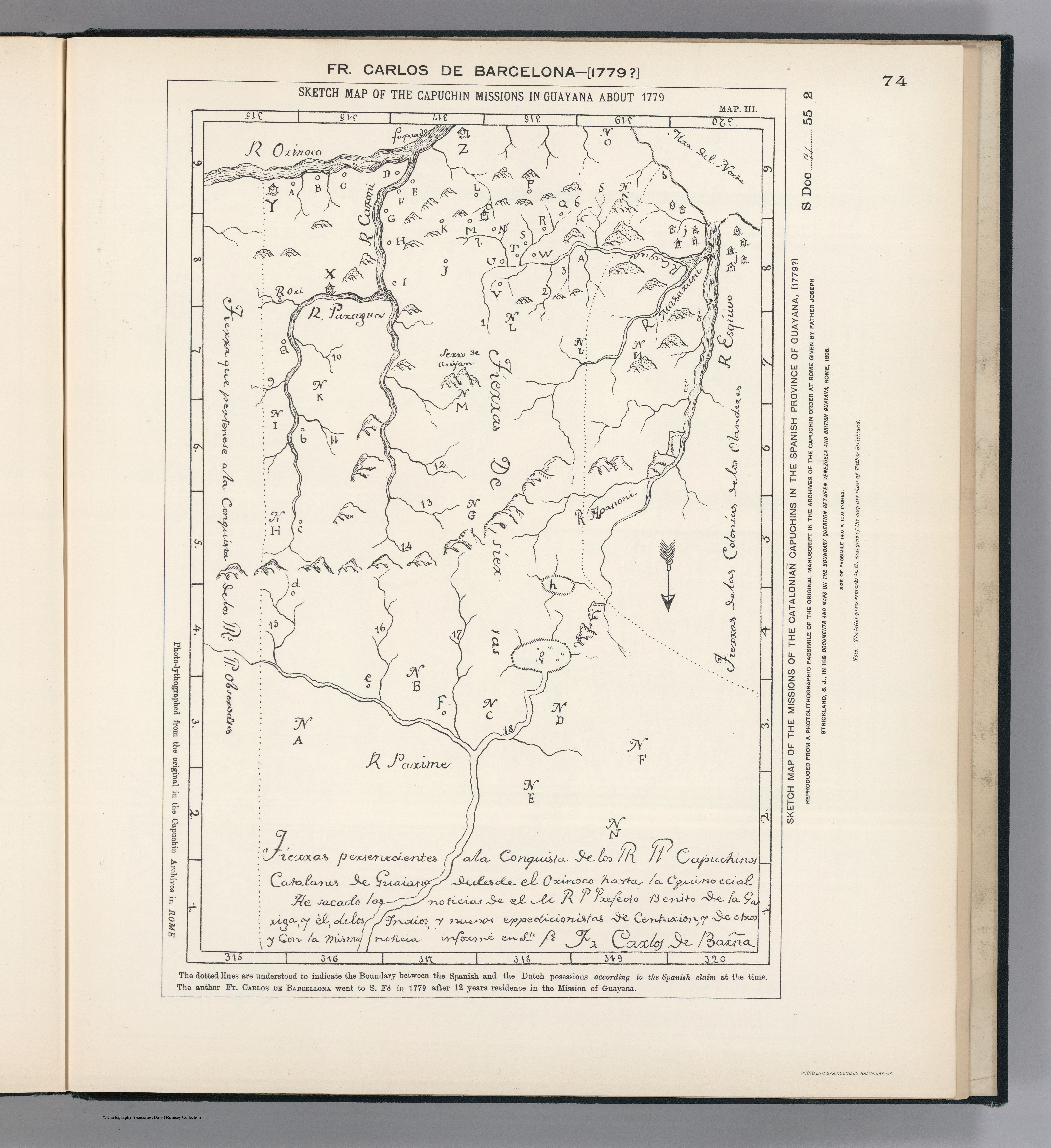
SKETCH MAP OF THE CAPUCHIN MISSIONS IN GUAYANA ABOUT 1779
Mapa 1779
Venezuela;cum parte Australi Novae Andalusiae
Mapa 1630
Sketch of the country from reduction to Buenos Ayres, shewing the movements of B. Genl. Beresford, when he captured that place June 1806. Drawn from memorandums furnished by Capt: Donnelly
Mapa 1806
Carte du Gouvernement de Cayenne dans l'Amérique Méridionale
Mapa 1763
Railroad Map of British Honduras Transportation Department of the United States Department of Commerce. Library of Congress Geography and Map Division. https://hdl.loc.gov/loc.wdl/wdl.11329
Mapa 1900