Pueblos
- MIXTECO
Cita
Instituto Nacional de los Pueblos Indígenas. "Mixtecos – Ubicación." Atlas de los Pueblos Indígenas de México. Accessed July 7, 2021. http://atlas.inpi.gob.mx/mixtecos-ubicacion/.
Mexico at the Time of the Conquest
Mapa 1519
La región andina central ecuatoriana
Mapa -500 - 1550
A New Chart of the Coast of Brazil from the Banks of St. Roque, to the Island of St. Sebastian;with the Islands and Soundings in the Offing
Mapa 1794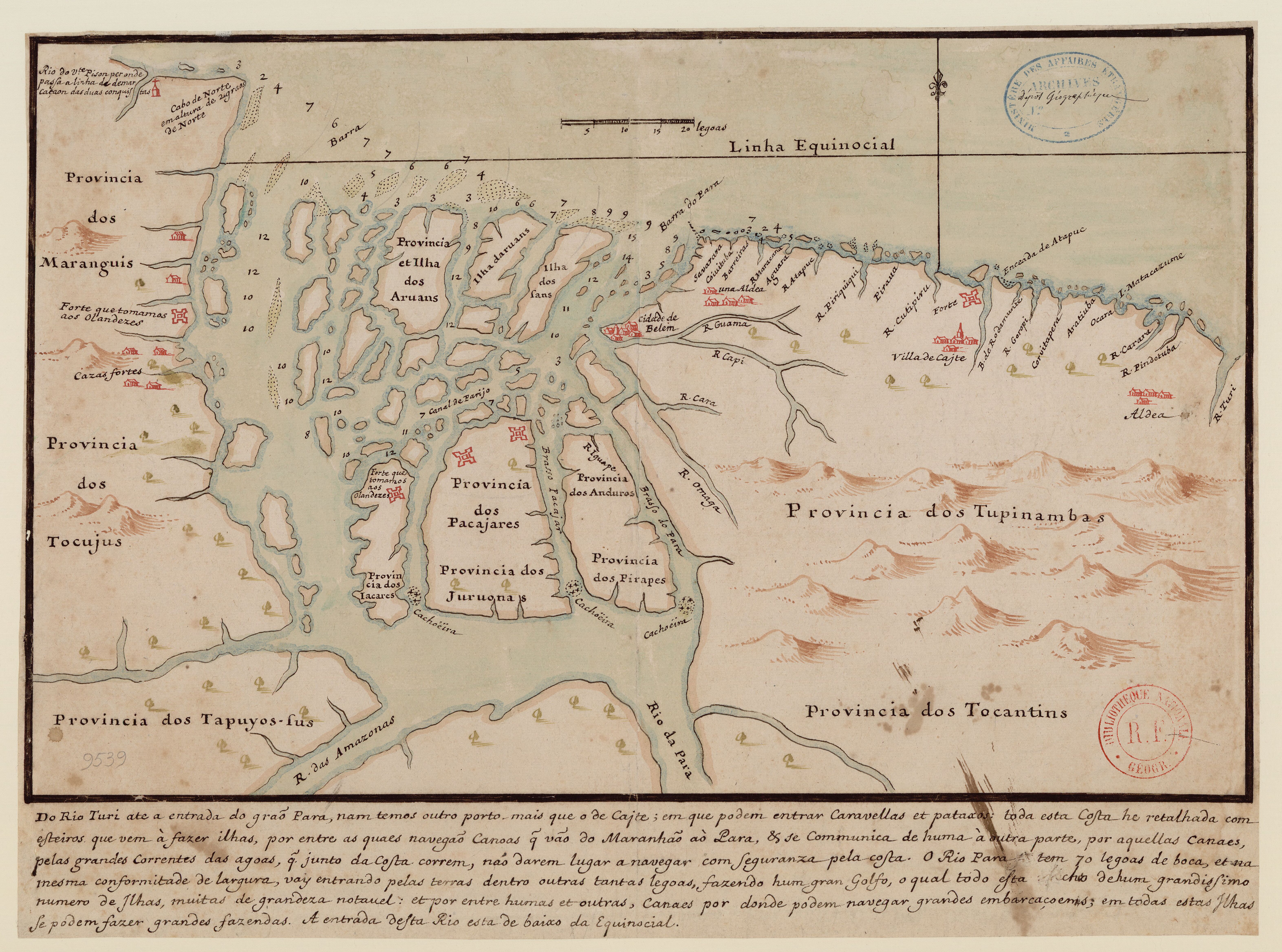
Do Rio Turi ate a entrada do Grao Para
Mapa 1600 - 1640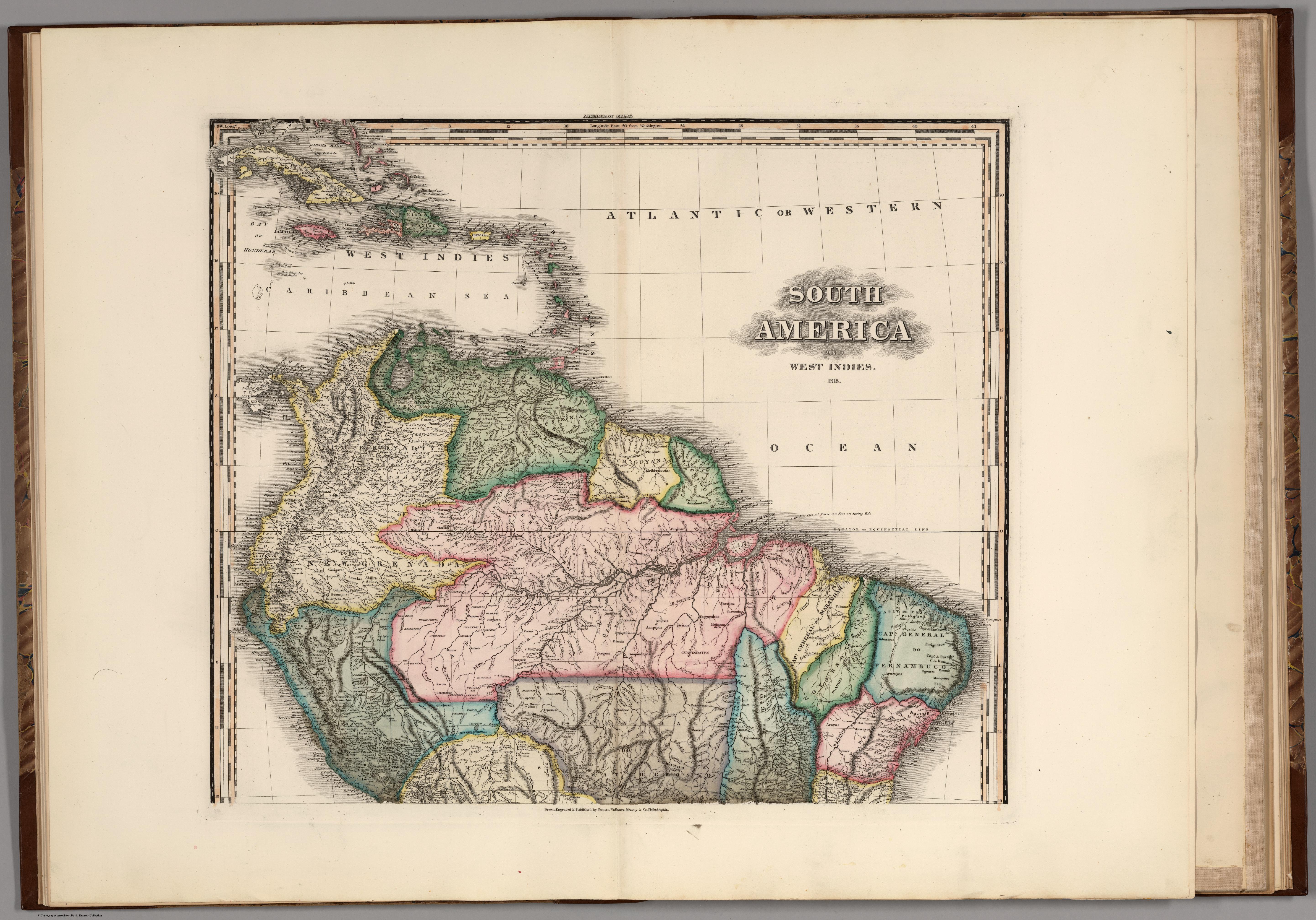
South America and West Indies. 1818
Mapa 1818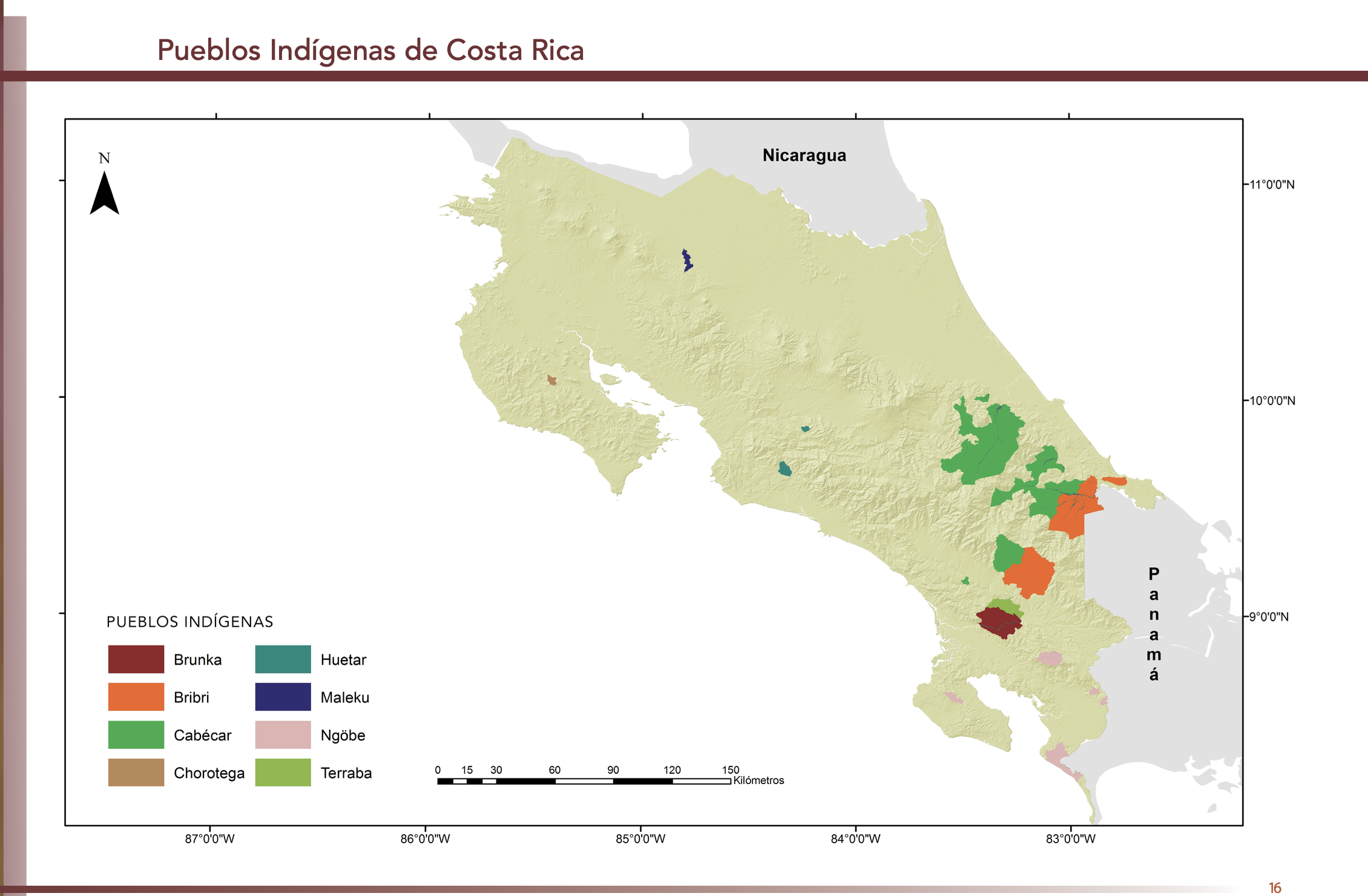
"Pueblos Indígenas de Costa Rica"
Mapa 2010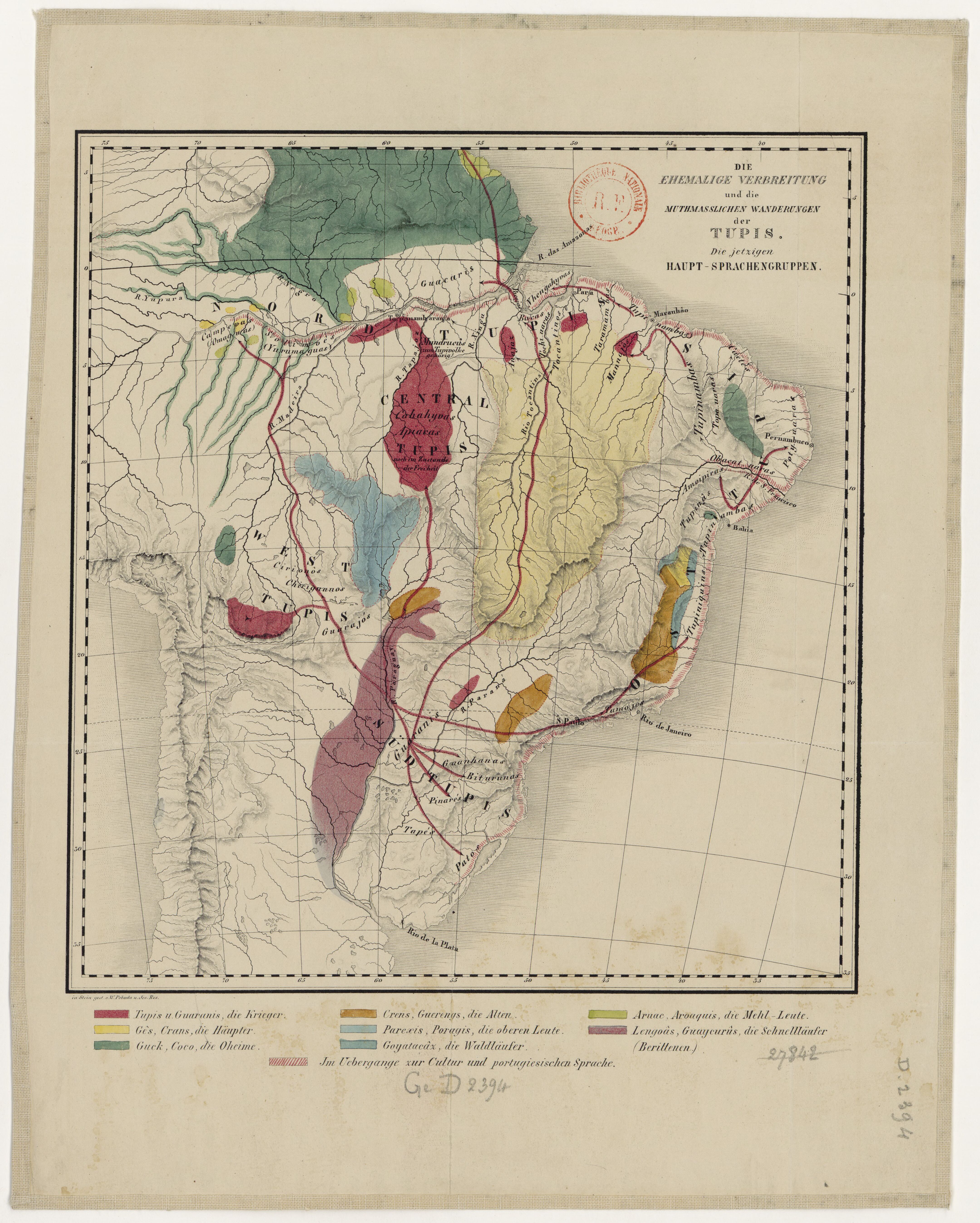
DIE EHEMALIGE VERBREITUNG und die MUTHMASSLICHEN WANDERUNGEN der TUPIS. Die jetzigen HAUPT-SPRACHENGRUPPEN.
Mapa 1875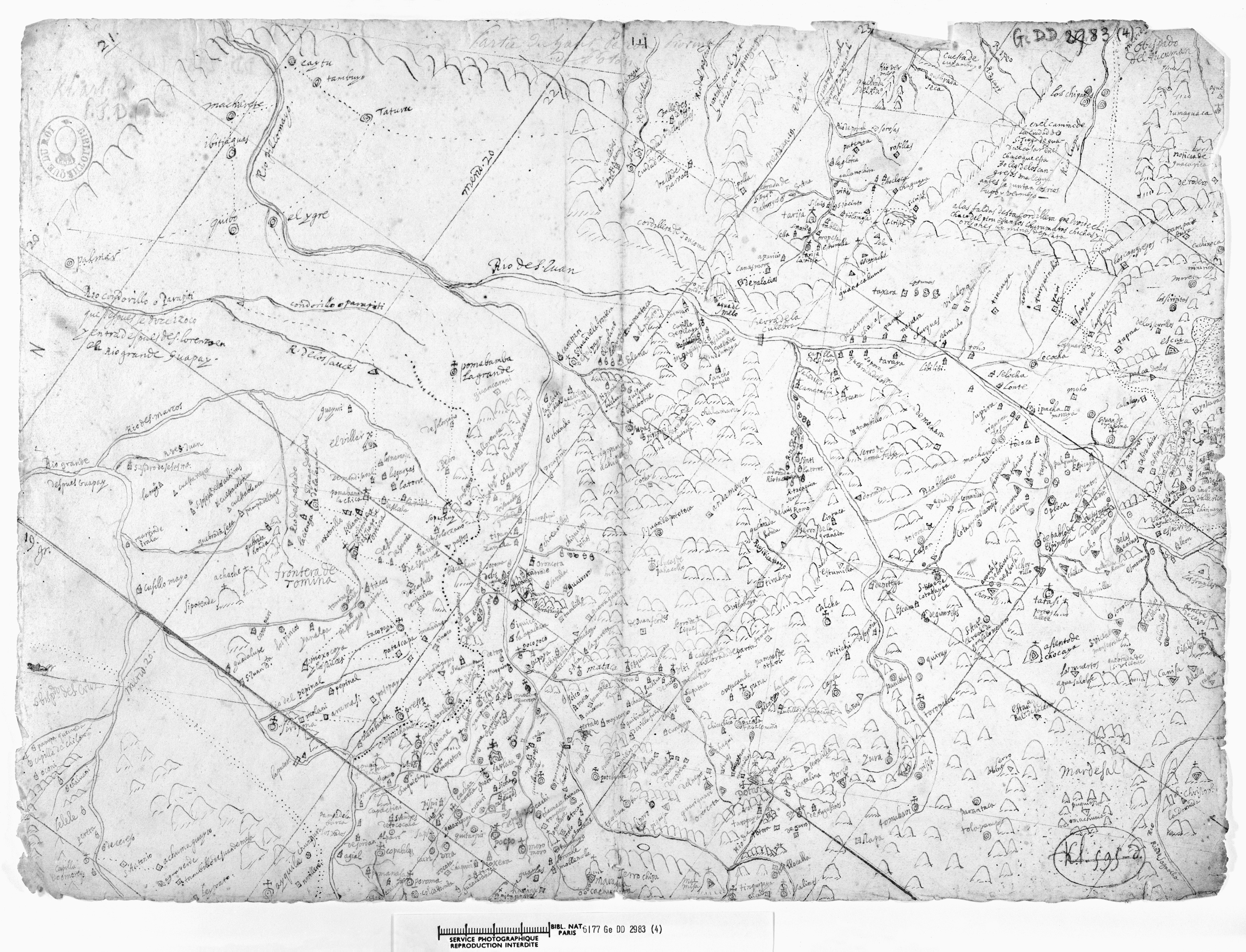
LA PROVINCIA DE POTOSÍ EN EL ALTO PERÚ EN EL SIGLO XVII
Mapa 1600 - 1699