
Pueblos
- LACANDON
Cita
Instituto Nacional de los Pueblos Indígenas. "Lacandones – Ubicación." Atlas de los Pueblos Indígenas de México. http://atlas.inpi.gob.mx/lacandones-ubicacion/.
PUEBLO PIMA
Mapa 2020
MAPPA DO BRAZIL baseado no mappa da America do Sul de Stieler
Mapa 1900 - 1999
Coste de Guiane depuis le cap de nord jusqu'à Cayenne, par François Duvillard, sergent, traiteur, voyageur, en la susdite cote de Guiane.
Mapa 1727
MAPA CORO-GRÁFICO DE LA NUEVA ANDALUCIA
Mapa 1778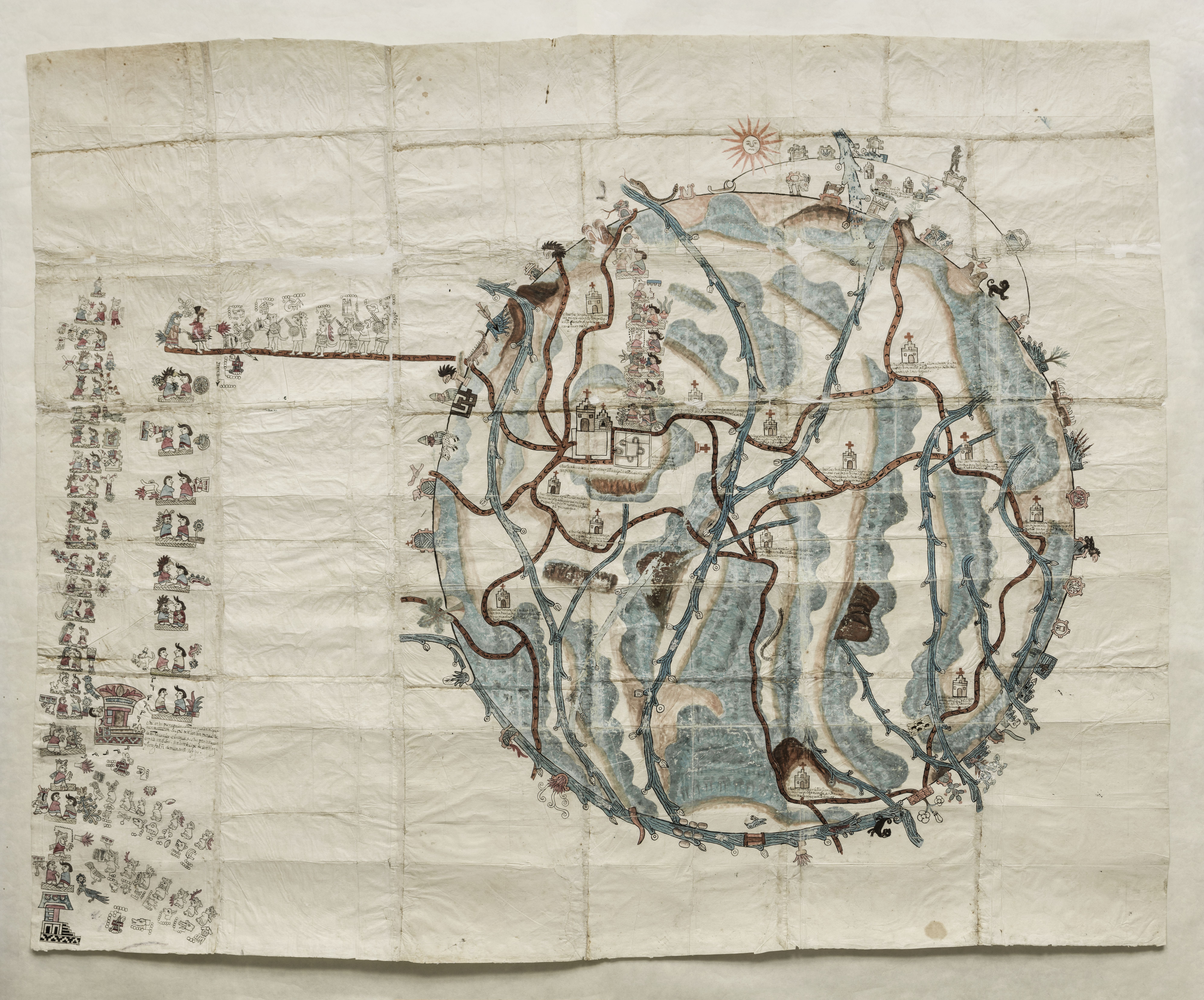
PINTURA DE TEOZACOALCO
Mapa 1500 - 1599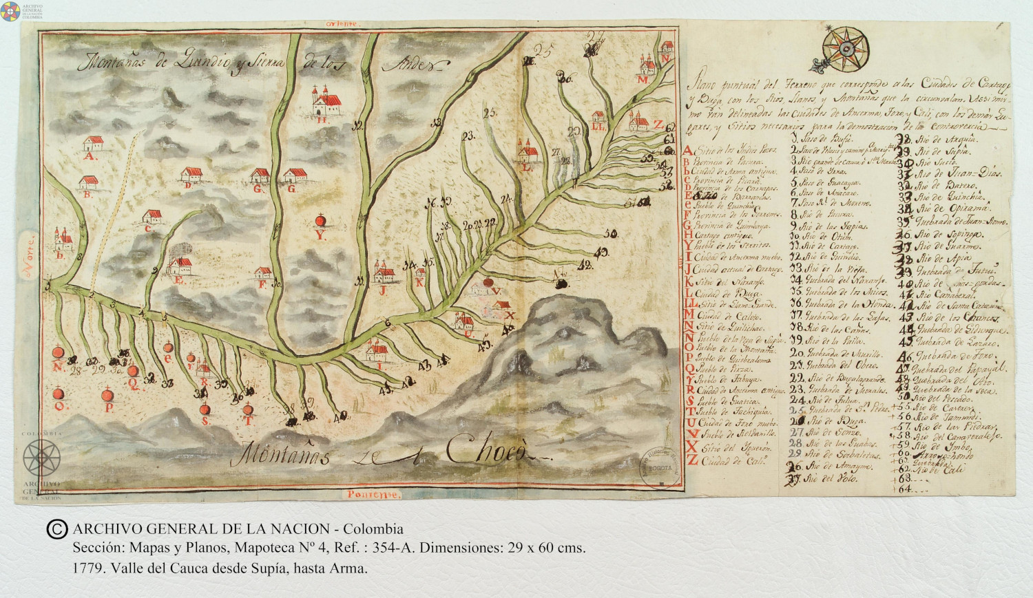
Plano puntual del terreno que corresponde a las ciudades de Cartago y Buga con los rios, llanos, y montañas que las circunvalan.
Mapa 1779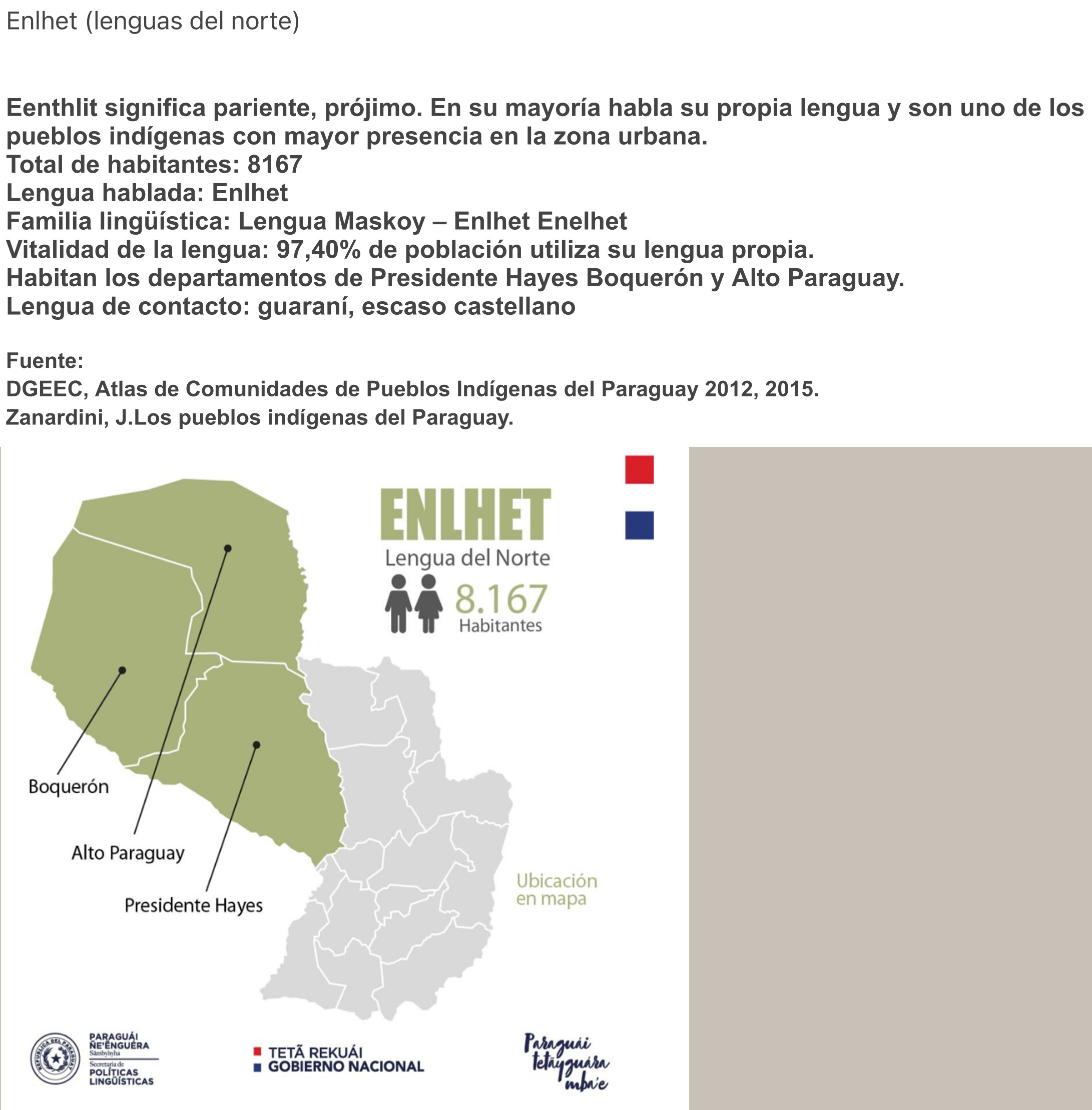
ENLHET Lengua del Norte
Mapa 2015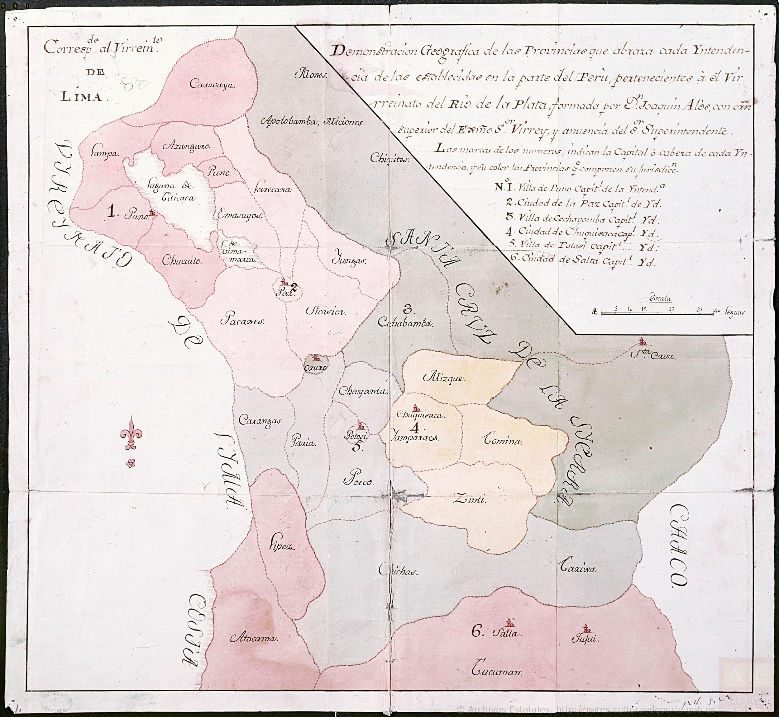
Demonstración Geográfica de las Provincias que abraza cada Yntendencia de las establecidas en la parte del Perú desde Salta, pertenecientes a el Virreynato del Río de la Plata
Mapa 1783