
Pueblos
- CHUJ
Cita
Instituto Nacional de los Pueblos Indígenas. "Chujes – Ubicación." Atlas de los Pueblos Indígenas de México. Accessed April 30, 2021. http://atlas.inpi.gob.mx/chuj-ubicacion/.
El mapa de los pueblos originarios
Mapa 2017
A Map of part of Yucatan or of that Part of the Eastern Shore Within the Bay of Honduras Alloted to Great Britain for the Cutting of Logwood, in consequence of the Convention Signed with Spain on the 14th July 1786.
Mapa 1700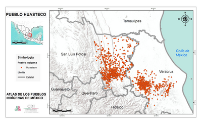
PUEBLO HUASTECO
Mapa 2020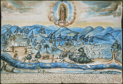
VISTA DE LA NUEVA POBLACION DE SAN FERNANDO DE GUADALUPE EN EL SALTO DE AGUA DEL RIO TULIJA, QUE LLEVA SU CORRIENTE A LAS LAGUNAS DE CHICHICASTE Y DE TÉRMINOS
Mapa 1795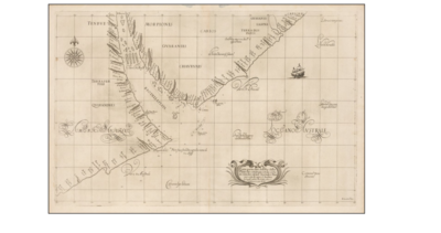
Carta particolare dell'Rio della Plata che comincia con la costa in Gradi 31 di latine Australe, è Finisce con il capo S. Andrea.
Mapa 1594 - 1596
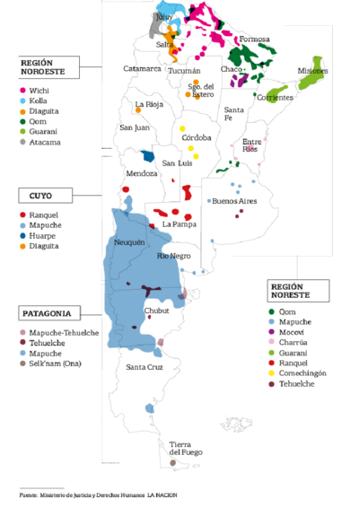
MAPA LINGÜÍSTICO DEL PAIS
Mapa 2009 - 2010
Partie de la coste de la Guyane depuis la Rivière de Mahury jusqu'à celle de Macouria ou se trouve comprise la Rade de Cayenne
Mapa 1765
SKETCH MAP OF BRITISH GUIANA
Mapa 1835 - 1839