
Pueblos
- COCHIMI
Cita
Instituto Nacional de los Pueblos Indígenas. "Cochimíes – Ubicación." Atlas de los Pueblos Indígenas de México. Accessed August 10, 2021. http://atlas.inpi.gob.mx/cochimies-ubicacion/.
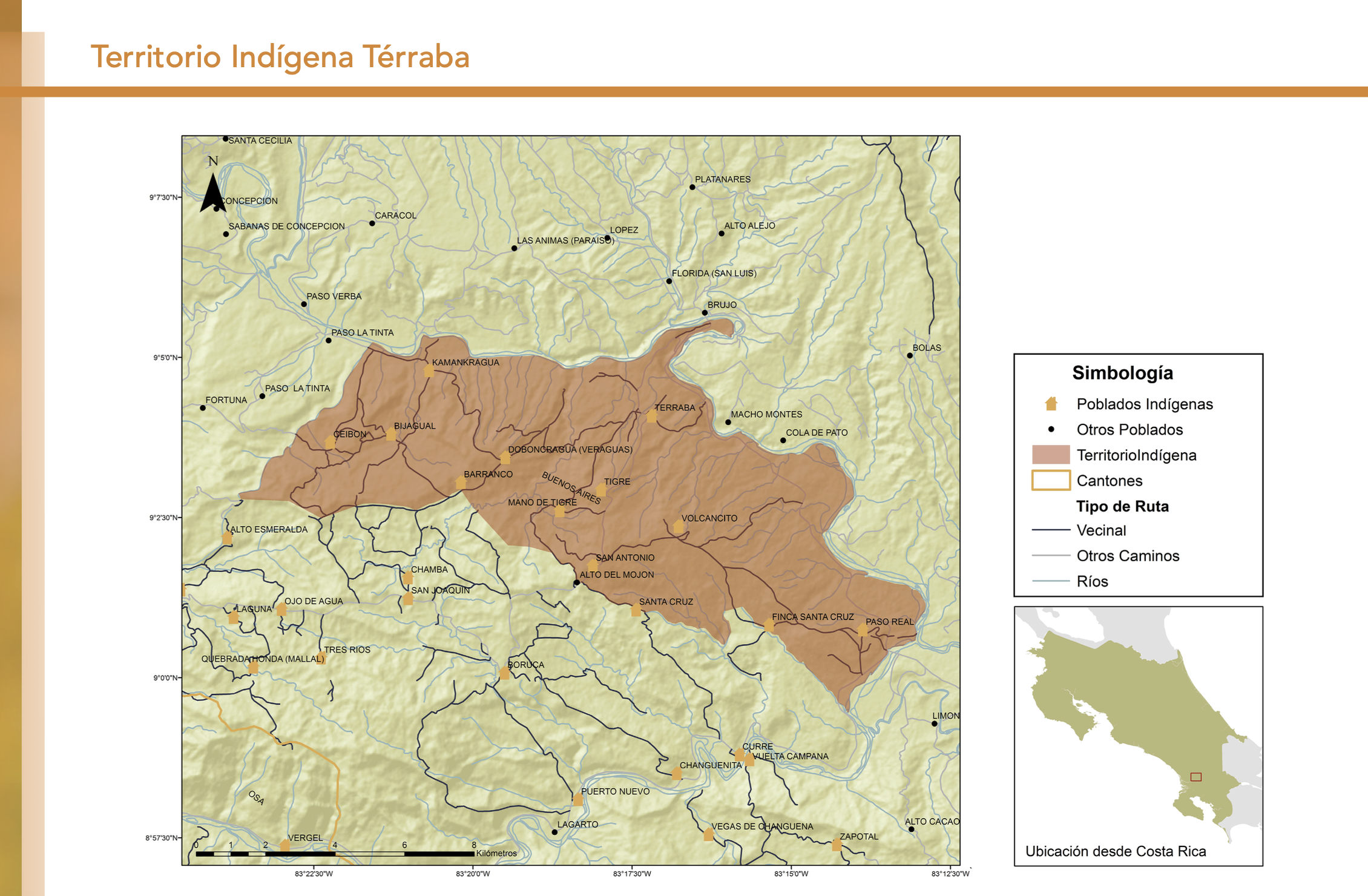
"Territorio Indígena Cabécar de Ujarrás"
Mapa 2010![Pata Ewa’n – o coração do mundo [Pata Ewa’n – El corazón del mundo]](https://dnet8ble6lm7w.cloudfront.net/art_sm/ABRA022.png)
Pata Ewa’n – o coração do mundo [Pata Ewa’n – El corazón del mundo]
Obra de Arte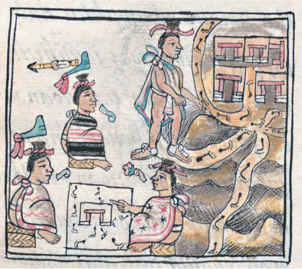
FLORENTINE CODEX, BOOK 3, CHAPTER 17, F 33V
Mapa 1500 - 1599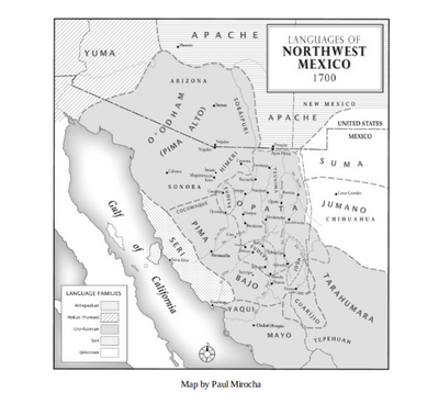
Languages of Northwest Mexico
Mapa 1700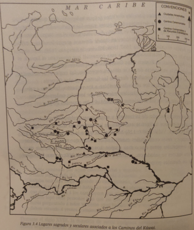
Lugares sagrados y seculares asociados a los caminos del Kuwai
Mapa 1399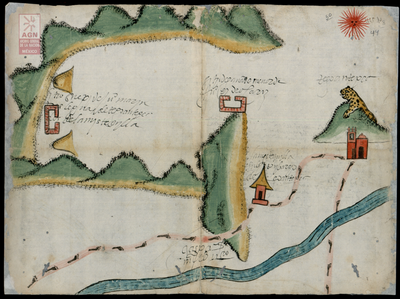
Mystequilla y Tegoantepec. Oaxaca, 1573
Mapa 1573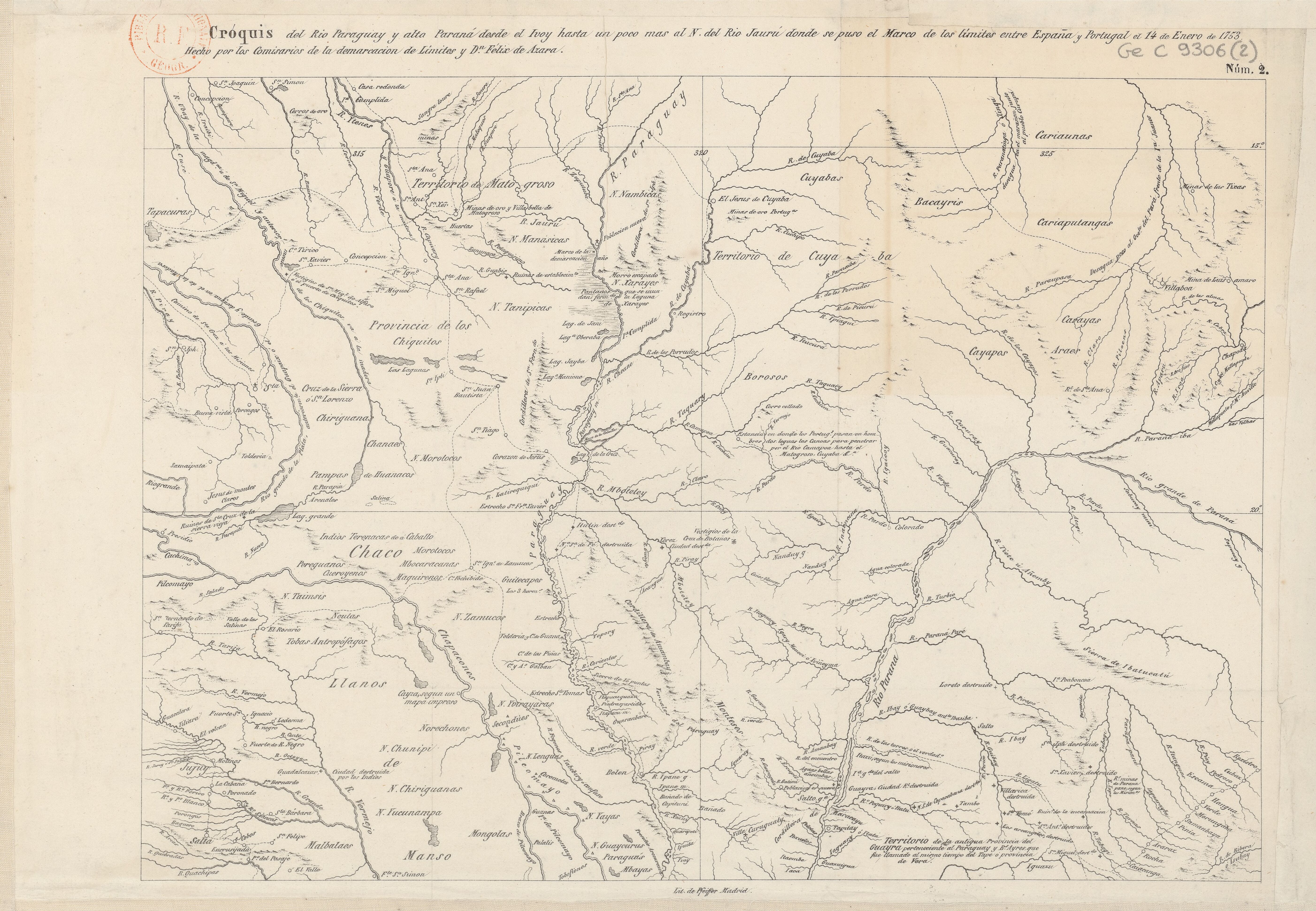
Cróquis del Rio Paraguay y alta Paraná desde el Ivoy hasta un poco más al N. del Rio Jaurú donde se puso el Marco de los límites entre España y Portugal el 14 de Enero de 1753.
Mapa 1750 - 1850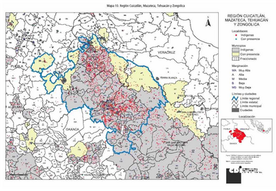
REGIÓN CUICATÁN, MAZATECA. TEHUACÁN Y ZONGOLICA
Mapa 2000