
Pueblos
- PIMAS ALTOS
- OPATAS
- SERIS
- PIMAS BAJOS
- YAQUIS
- MAYOS
Cita
Trejo Contreras, Zulema. "Indigenous People and Nation-State Building, 1840-1870." Frontera Norte 26, no. 51 2014: 5-24. http://www.scielo.org.mx/pdf/fn/v26n51/v26n51a1.pdf.
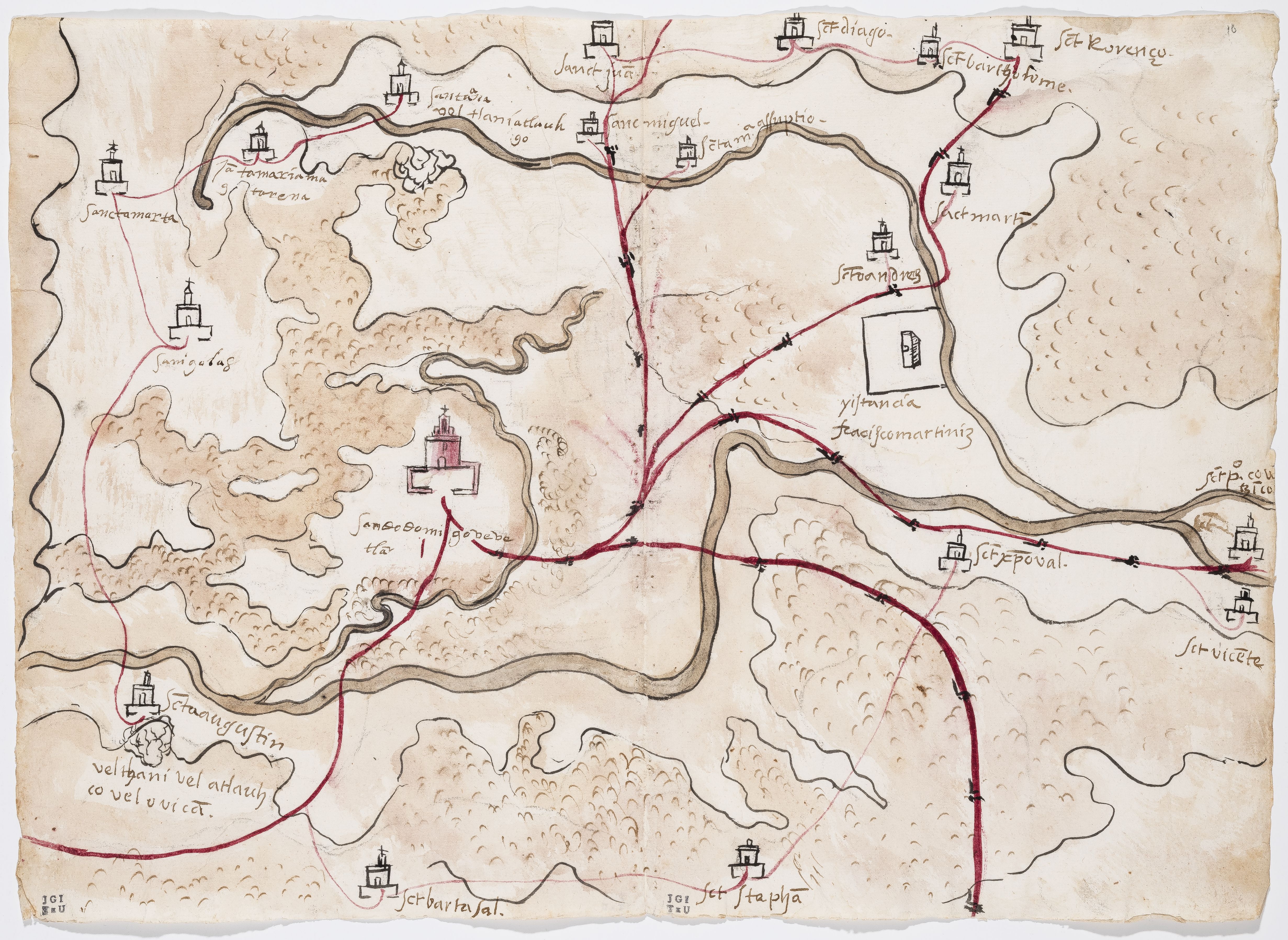
PINTURA DE GUEGUETLAN
Mapa 1500 - 1599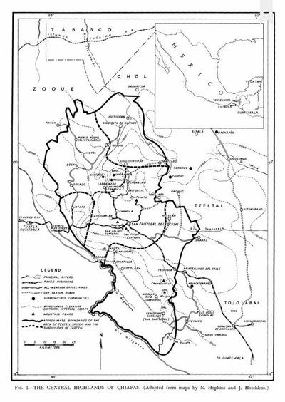
The Central Highlands of Chiapas
Mapa 1969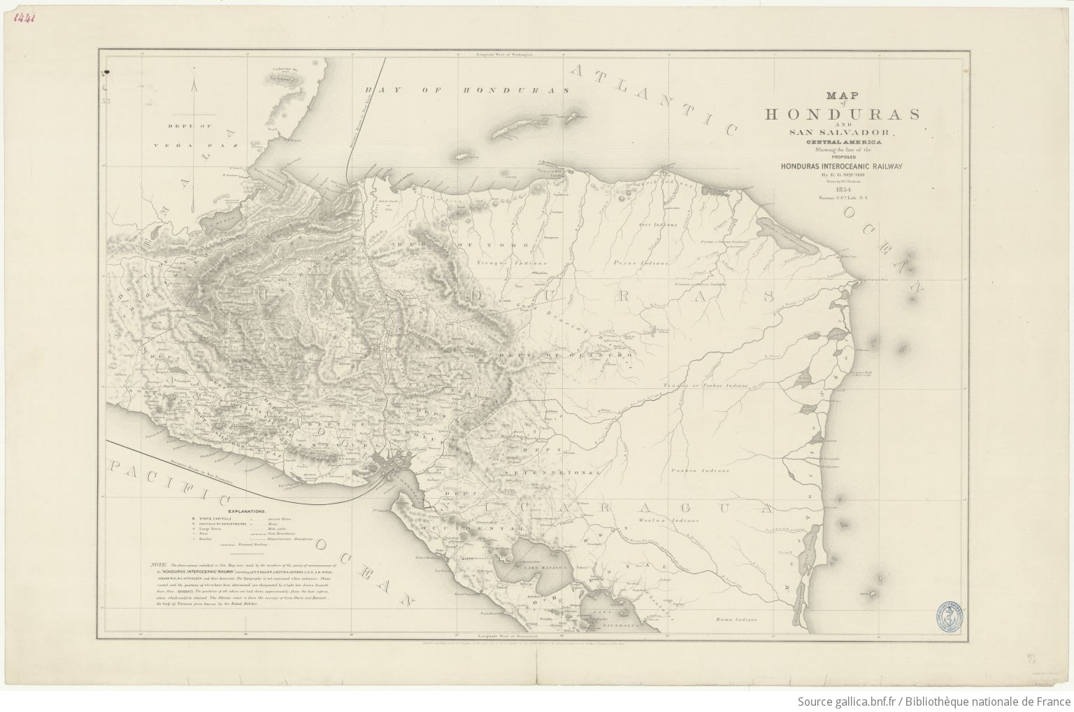
Map of Honduras and San Salvador, Central America, Showing the line of the proposed Honduras Interoceanic Railway
Mapa 1854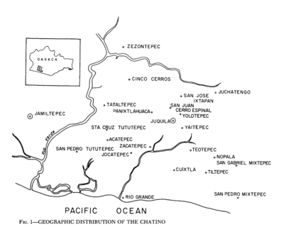
Geographic Distribution of the Chatino
Mapa 1969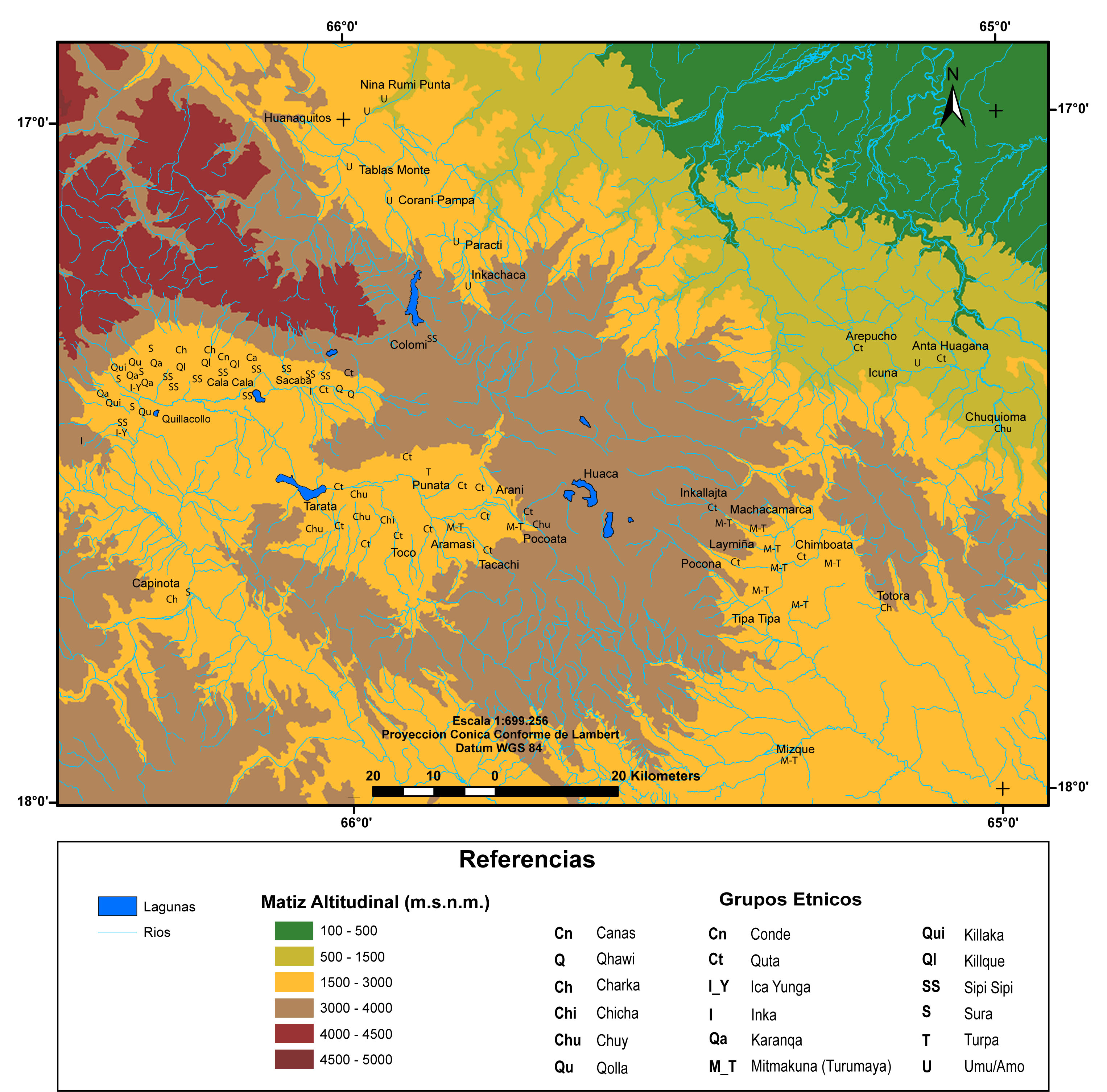
MULTI-ETHNIC TERRITORY under INCA DIRECT RULE: THE CENTRAL AND UPPER VALLEYS OF COCHABAMBA in the 1530s
Mapa 1520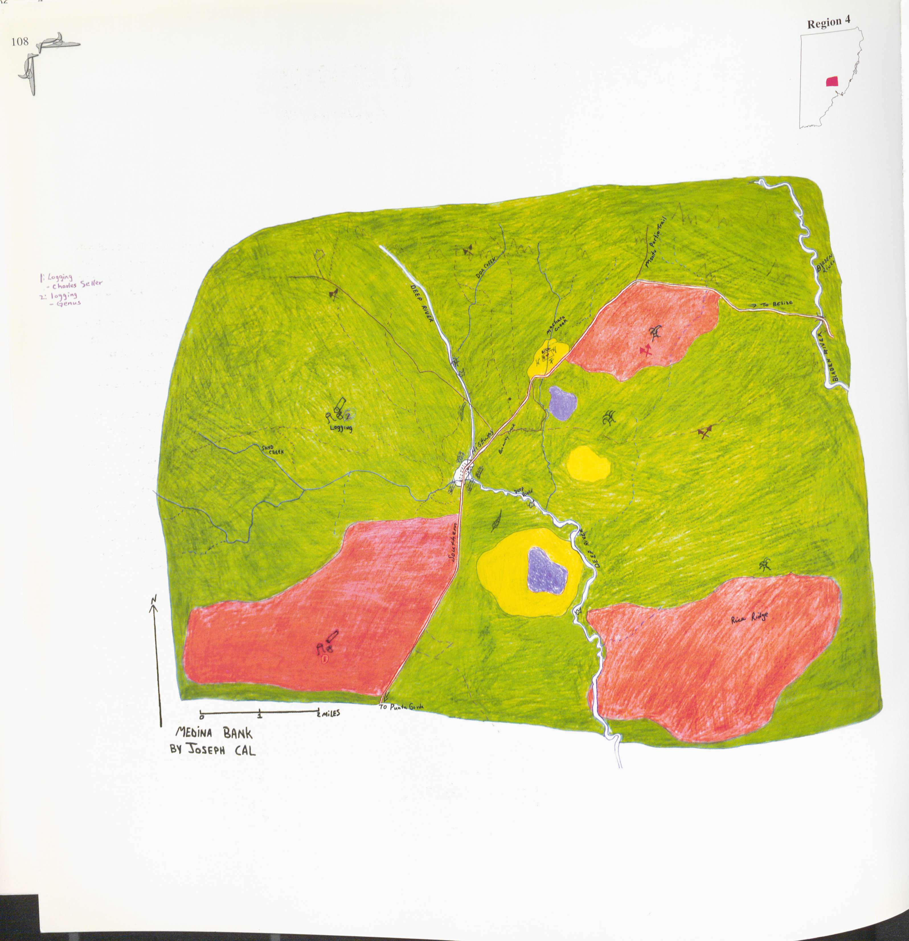
Medina Bank
Mapa 1997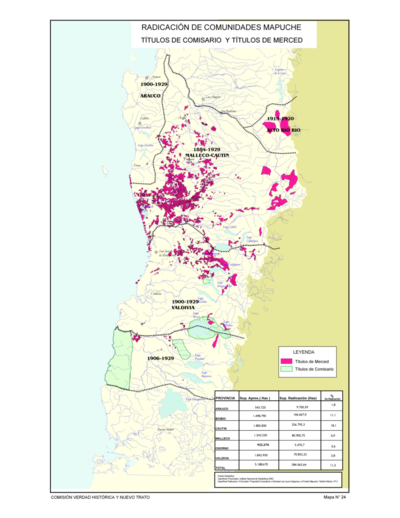
Radicación de Comunidades Mapuche. Titulos de Comisario y Titulos de Merced
Mapa 1884 - 1929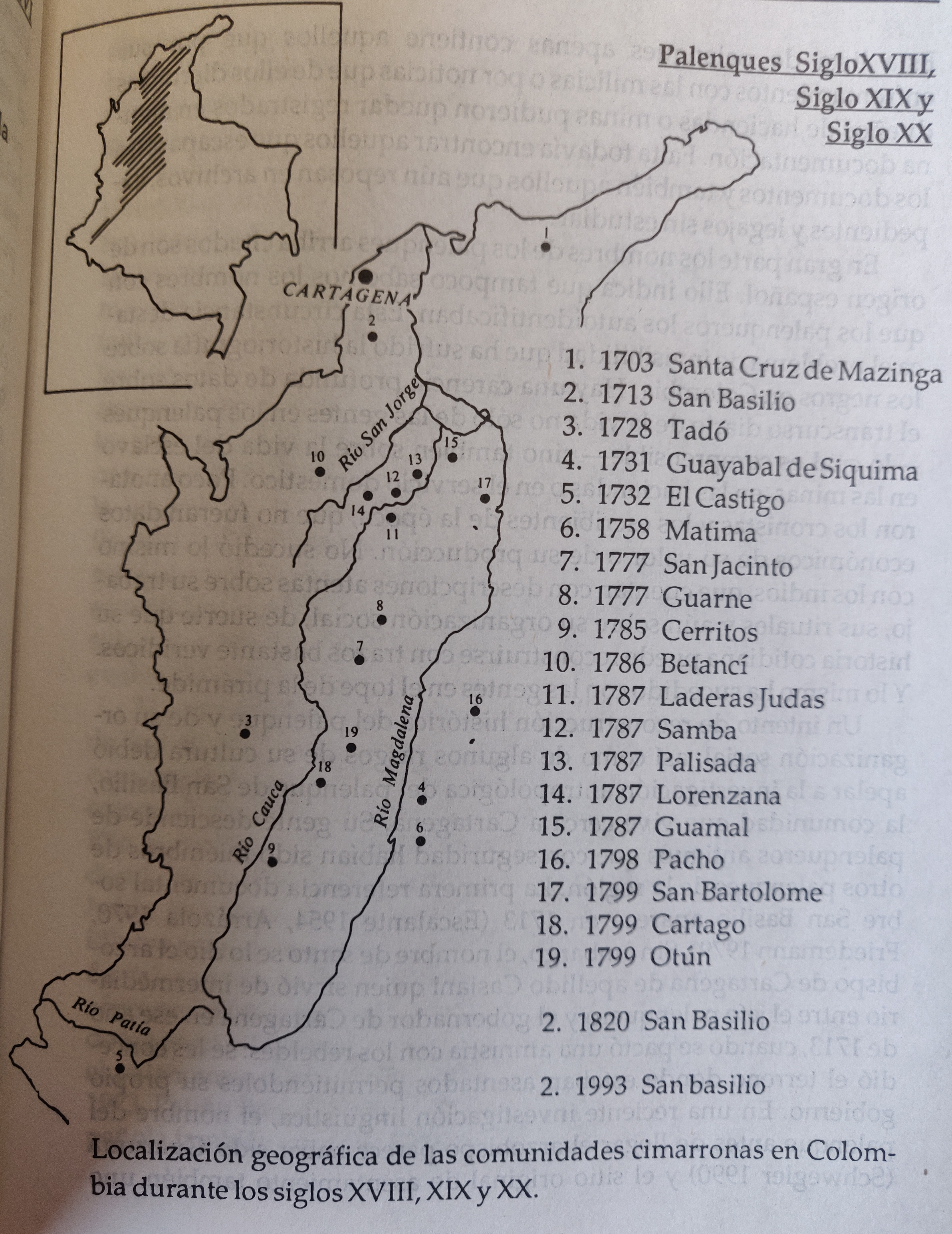
LOCALIZACION GEOGRAFICA DE LAS COMUNIDADES CIMARRONAS EN COLOMBIA DURANTE LOS SIGLOS XVIII, XIX Y XX
Mapa 1700 - 1999