Pueblos
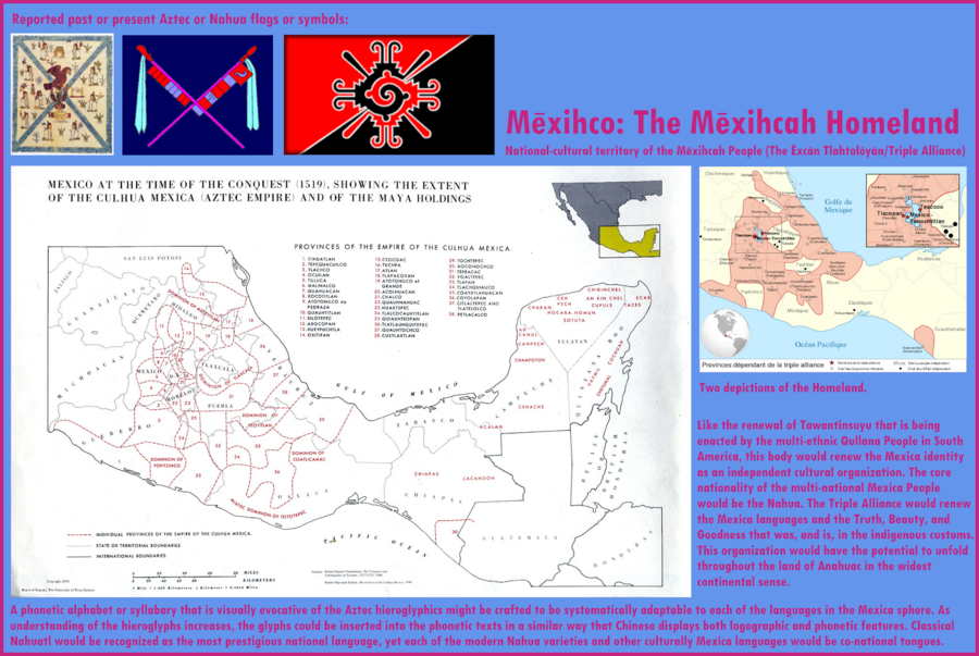
- TRIPLE ALLIANCE
- MAYA
Cita
"Mexihco: The Mexihca Homeland." Infographic. Accessed May 4, 2021. https://lh3.googleusercontent.com/-CQEKE0h1Ntw/Tanbw5gY_PI/AAAAAAAAZdE/oji_KP6SFEc/s2048-Ic42/Mexica%252520Homeland.png.
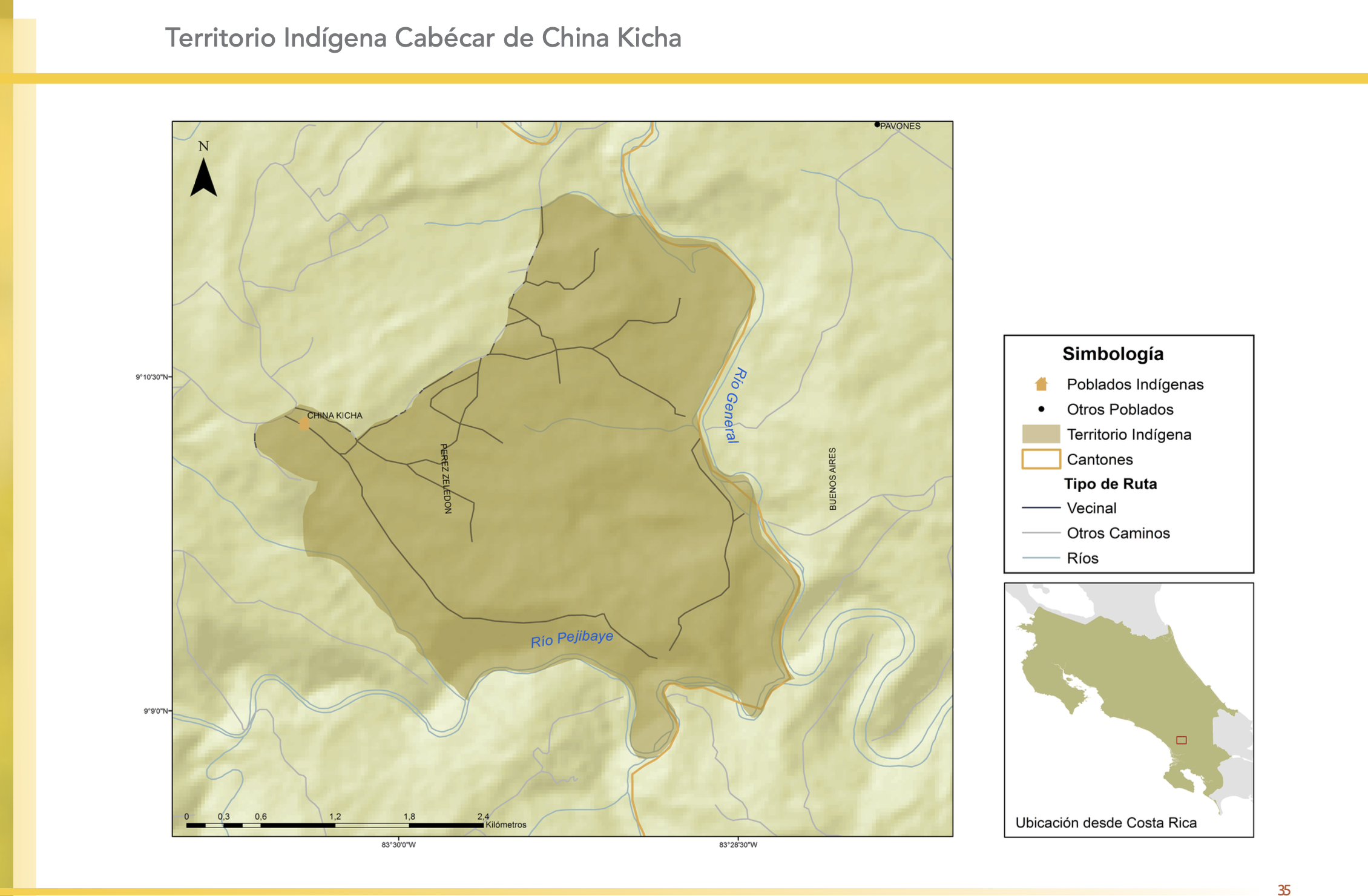
"Territorio Indígena Cabécar de China Kicha"
Mapa 2010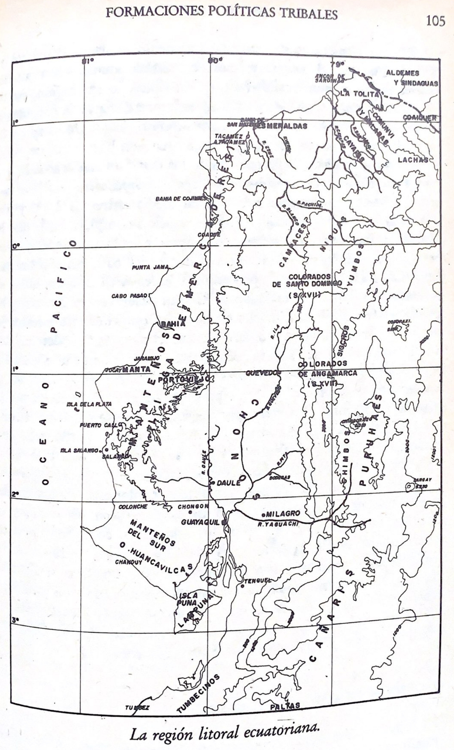
La región litoral ecuatoriana
Mapa -500 - 1551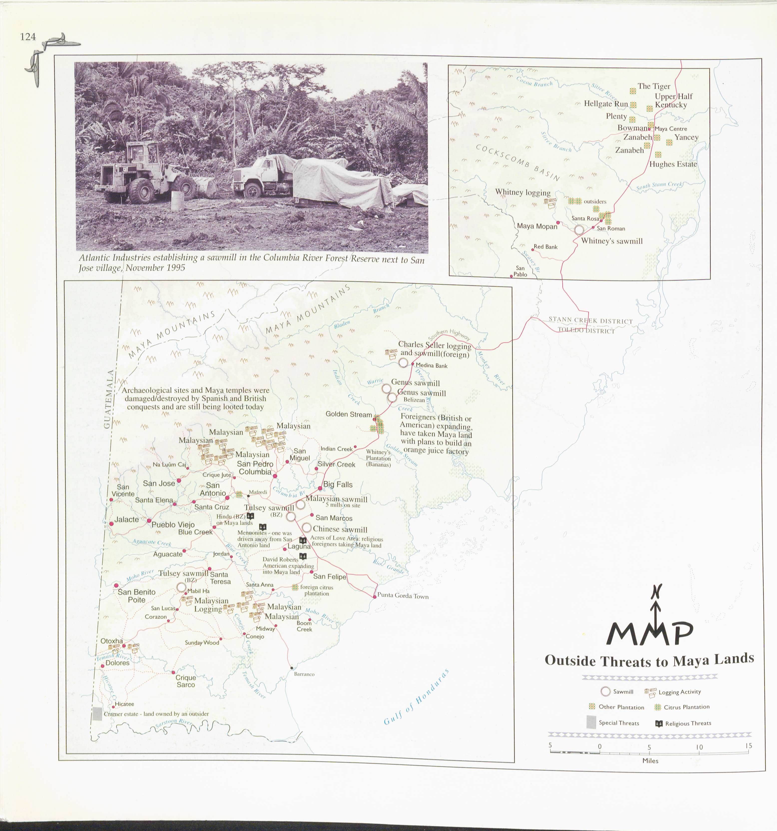
Outside Threats to Maya Lands
Mapa 1997
Mapa de las Comunidades Indígenas en el Paraguay
Mapa 2004
Sistema guatemalteco de áreas protegidas (SIGAP) y sitios arqueológicos en 2000.
Mapa 2000
An exact draught of the Gulf of Darien & the coast to Porto Bello with Panama in the South sea & the Scotch settlement in Calledonia
Mapa 1700 - 1799
PUEBLO MATLATZINCA
Mapa 2020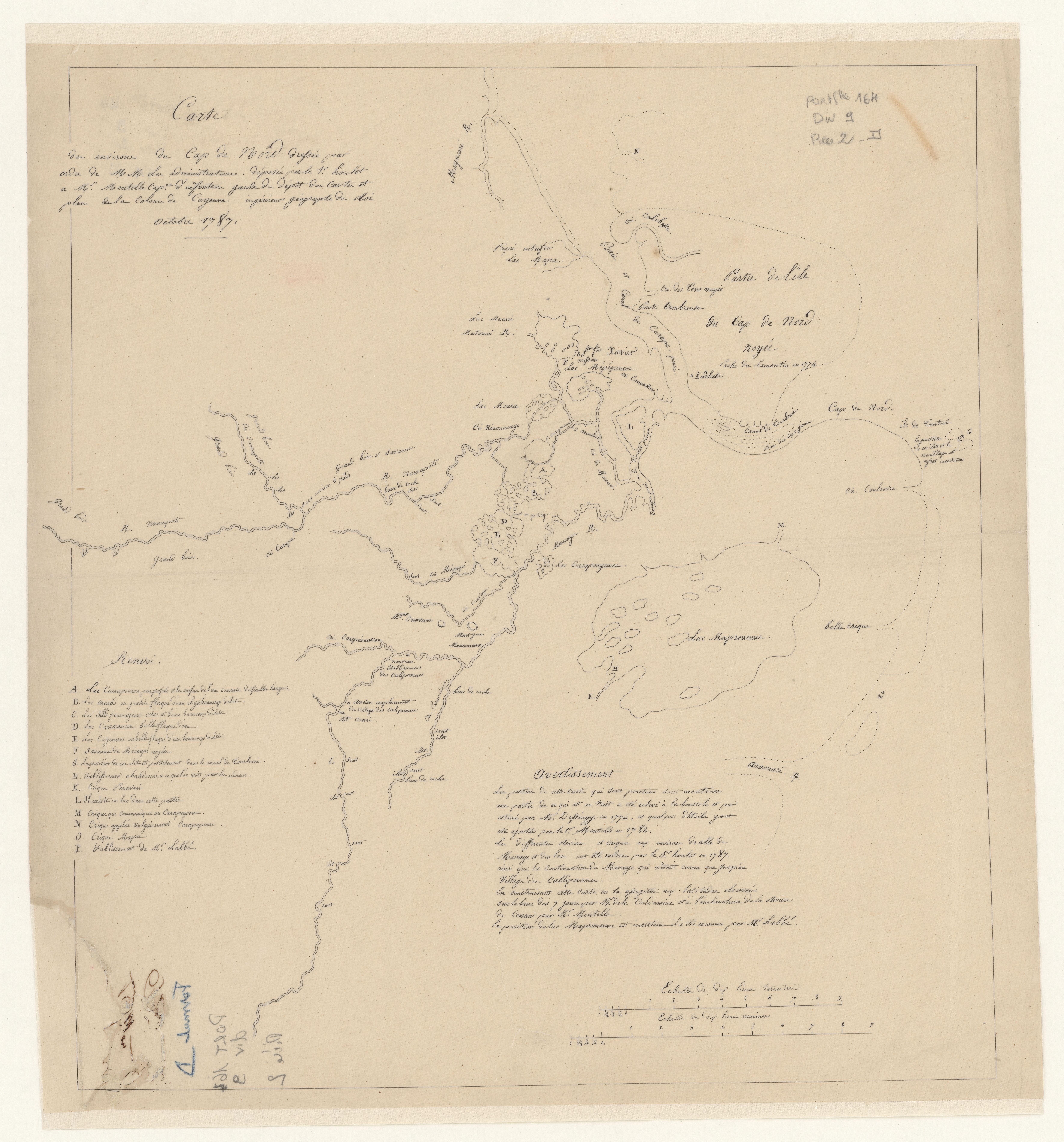
Carte des environs de Cap de Nord
Mapa 1774