
Pueblos
- TAWAHKA
Cita
Davidson, William V. Ethnic Geography of Honduras, 2001: Tables and Maps based on the National Census. Memphis, TN, 2011. PDF. http://williamvdavidson.com/pdf/Ethnic-Geography-of-Honduras-2001-Davidson.pdf
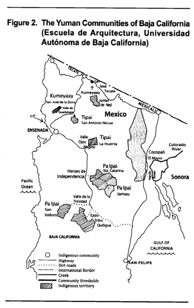
The Yuman Communities of Baja California
Mapa 2016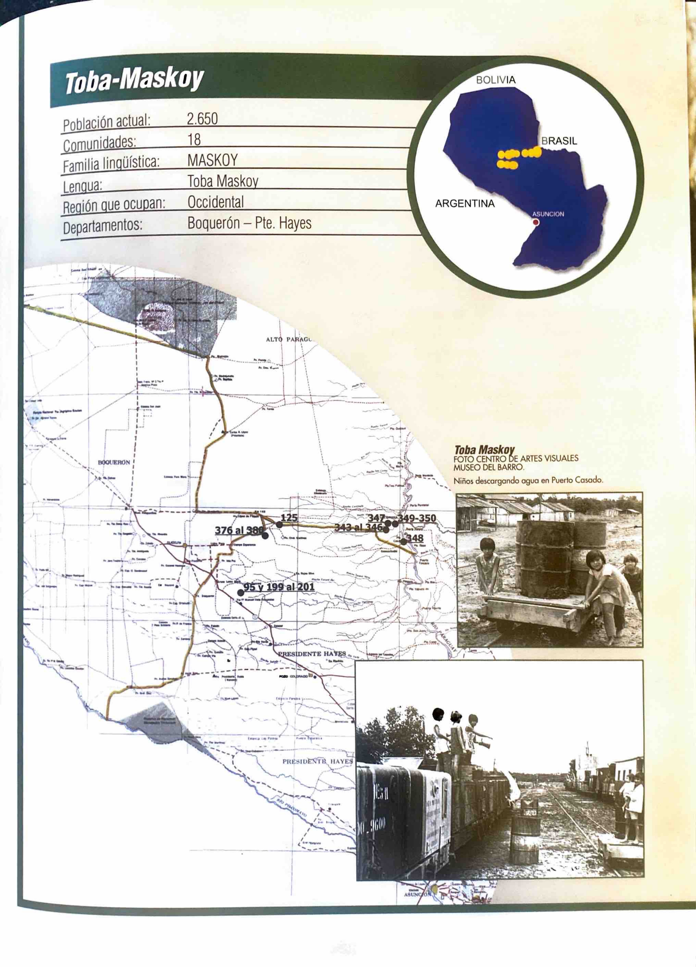
Toba-Maskoy
Mapa 2001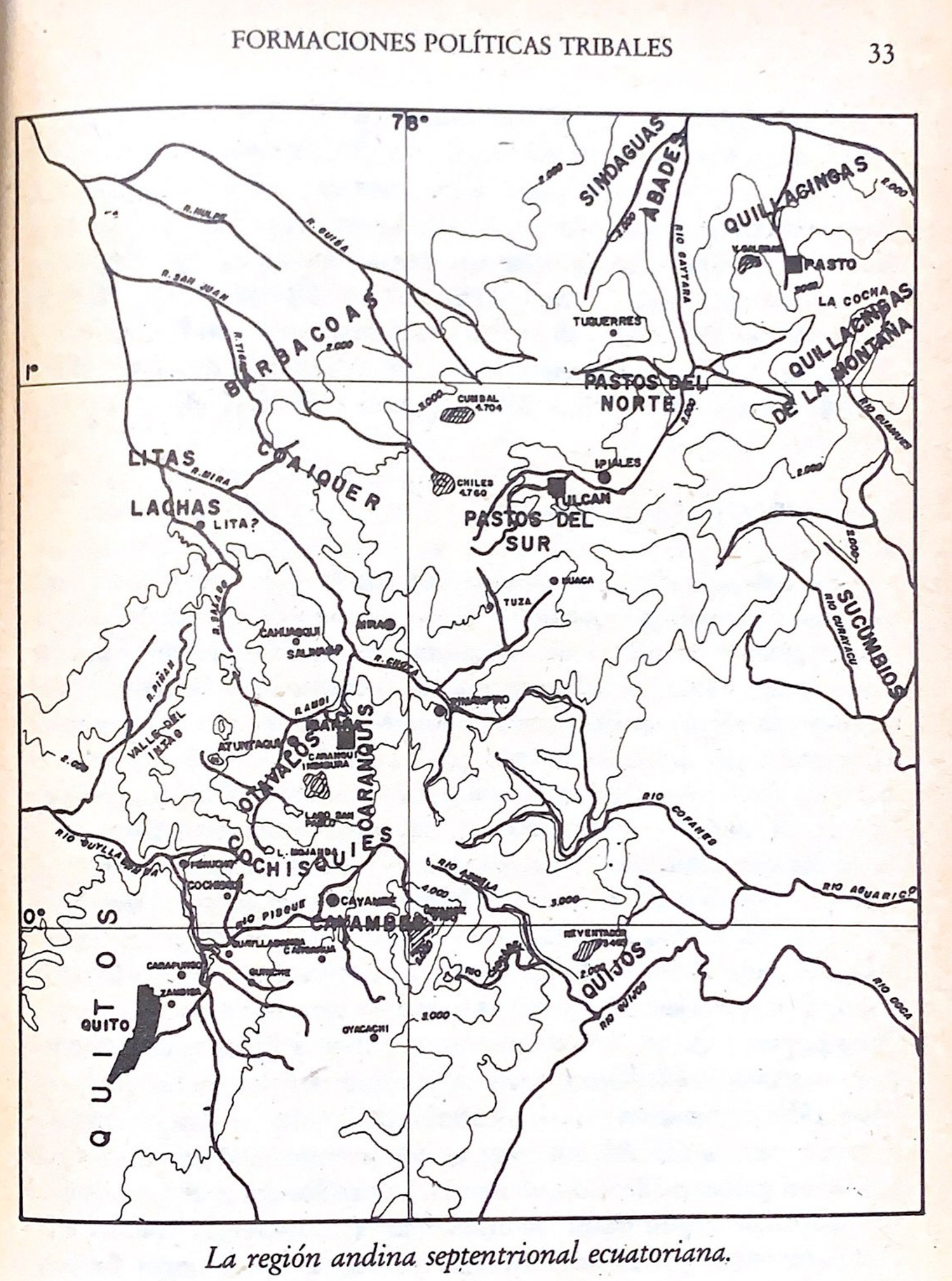
La región andina septentrional ecuatoriana
Mapa -500 - 1550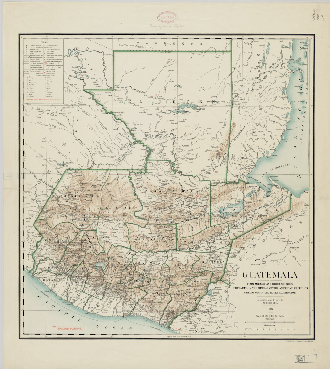
Guatemala: From Official and Other Sources
Mapa 1900 - 1902
Explorations de la Guyane par Henri Coudreau, 1887-89, 1889-91.
Mapa 1887 - 1891
CHOL REGION AND THE LACANDON FOREST
Mapa 1998
PLANO DEL HATO DEL TAMBO;ADJUNTO A LA ESCRITURA DE DONACIÓN QUE OTORGA PABLO CHIRIBOGA A FAVOR DE LOS INDÍGENAS DE PAPALLACTA
Mapa 1903
CARTE GÉOGRAPHIQUE, STATISTIQUE, HISTORIQUE ET POLITIQUE DU BRÉSIL
Mapa 1826