
Pueblos
- TAWAHKA
Cita
Davidson, William V. Ethnic Geography of Honduras, 2001: Tables and Maps based on the National Census. Memphis, TN, 2011. PDF. http://williamvdavidson.com/pdf/Ethnic-Geography-of-Honduras-2001-Davidson.pdf
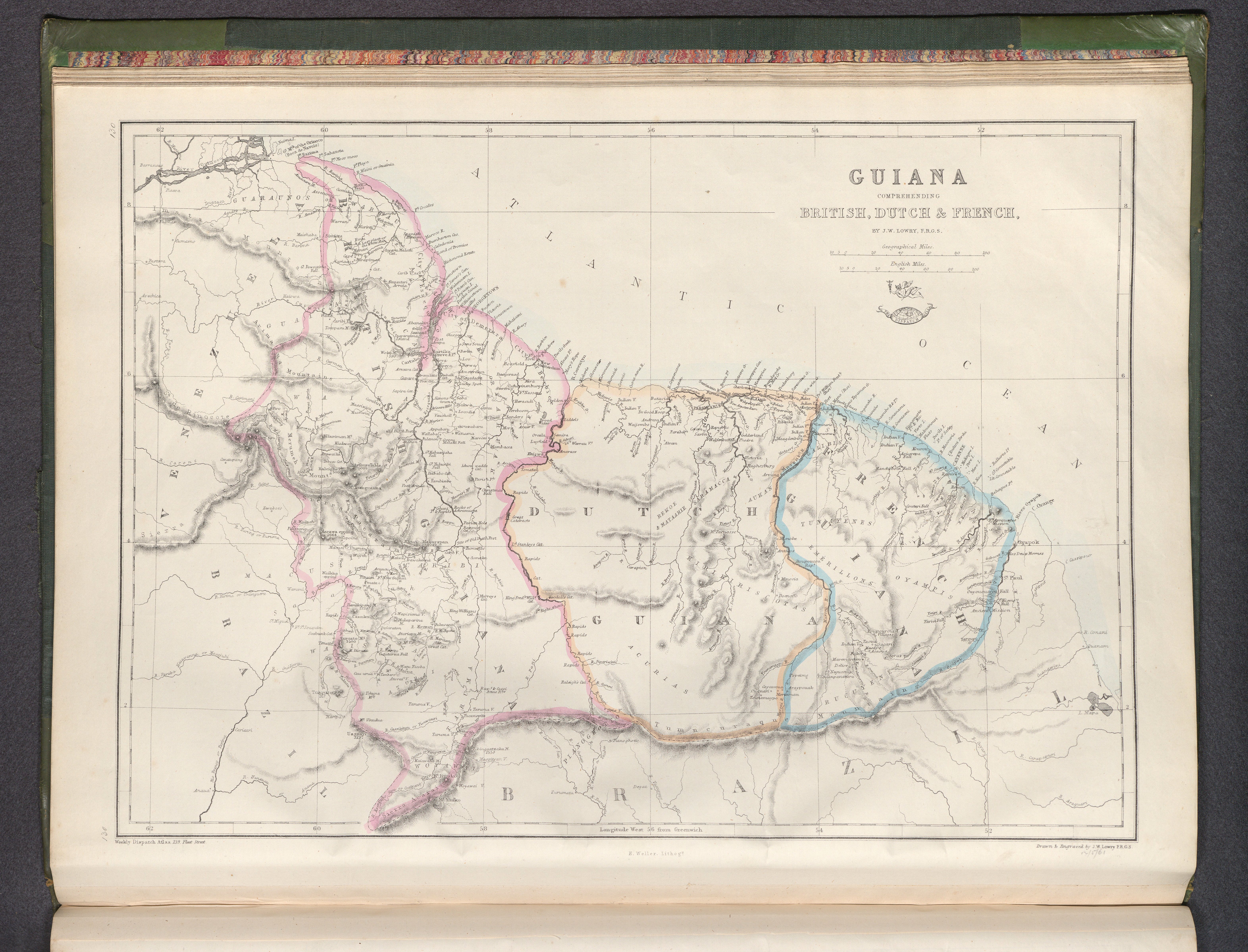
Guiana, comprehending British, Dutch & French
Mapa 1800 - 1899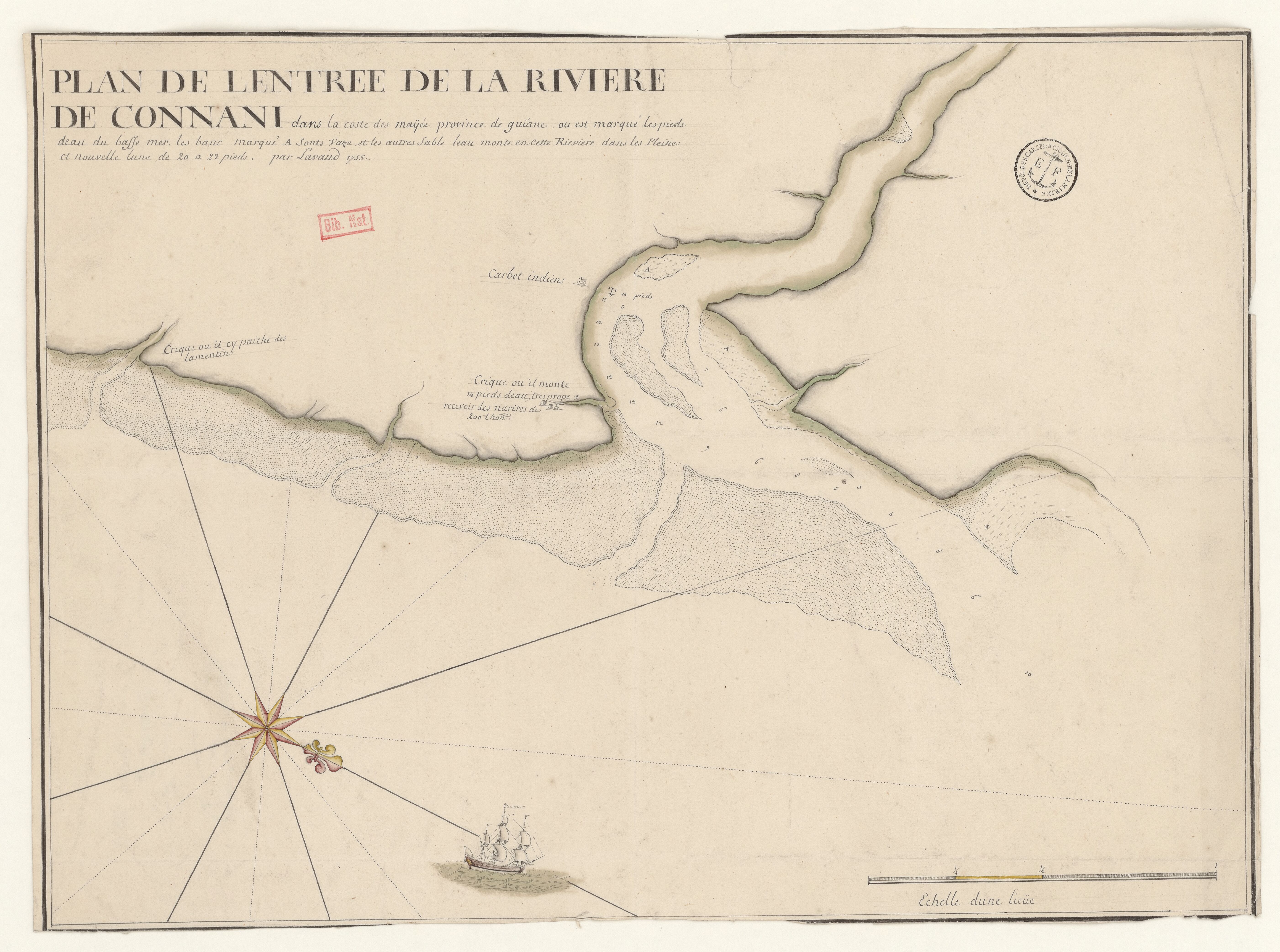
PLAN DE L'ENTREE DE LA RIVIERE DE CONNANI dans la coste des maÿée province de guiàne
Mapa 1755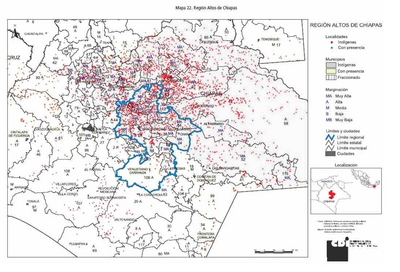
REGIÓN ALTOS DE CHIAPAS
Mapa 2000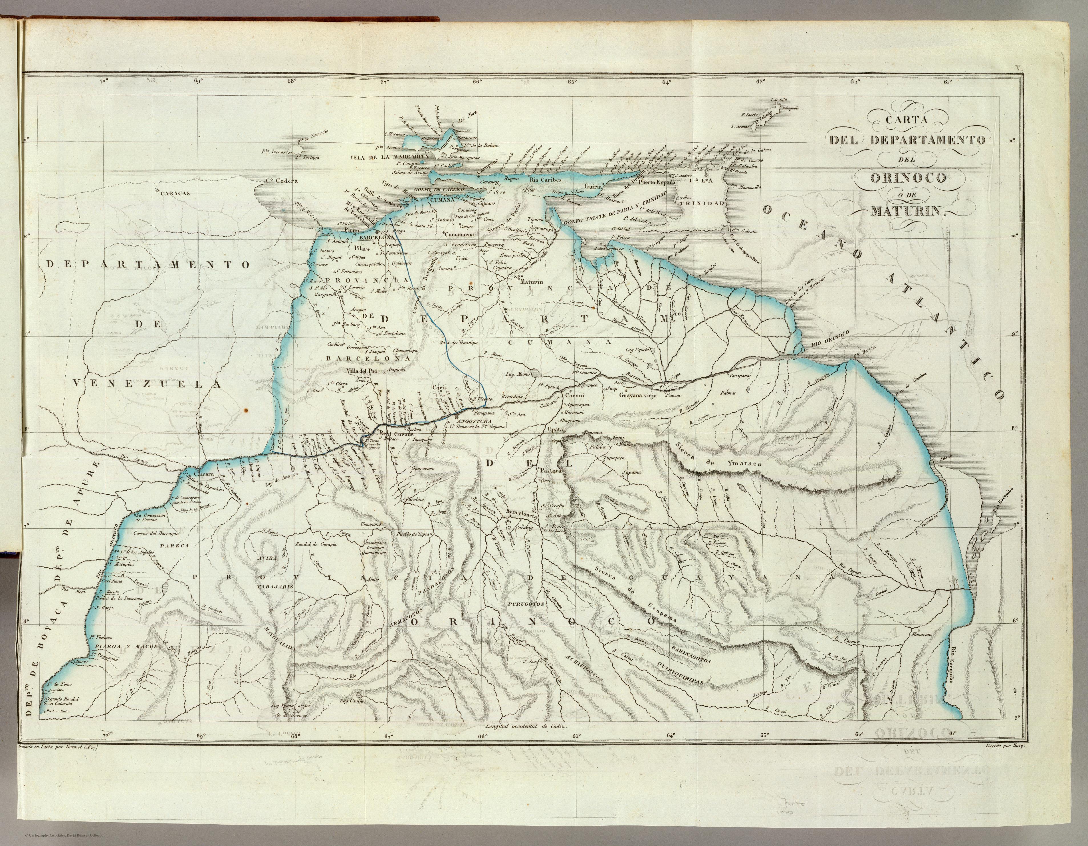
CARTA DEL DEPARTAMENTO DEL ORINOCO O DE MATURIN
Mapa 1827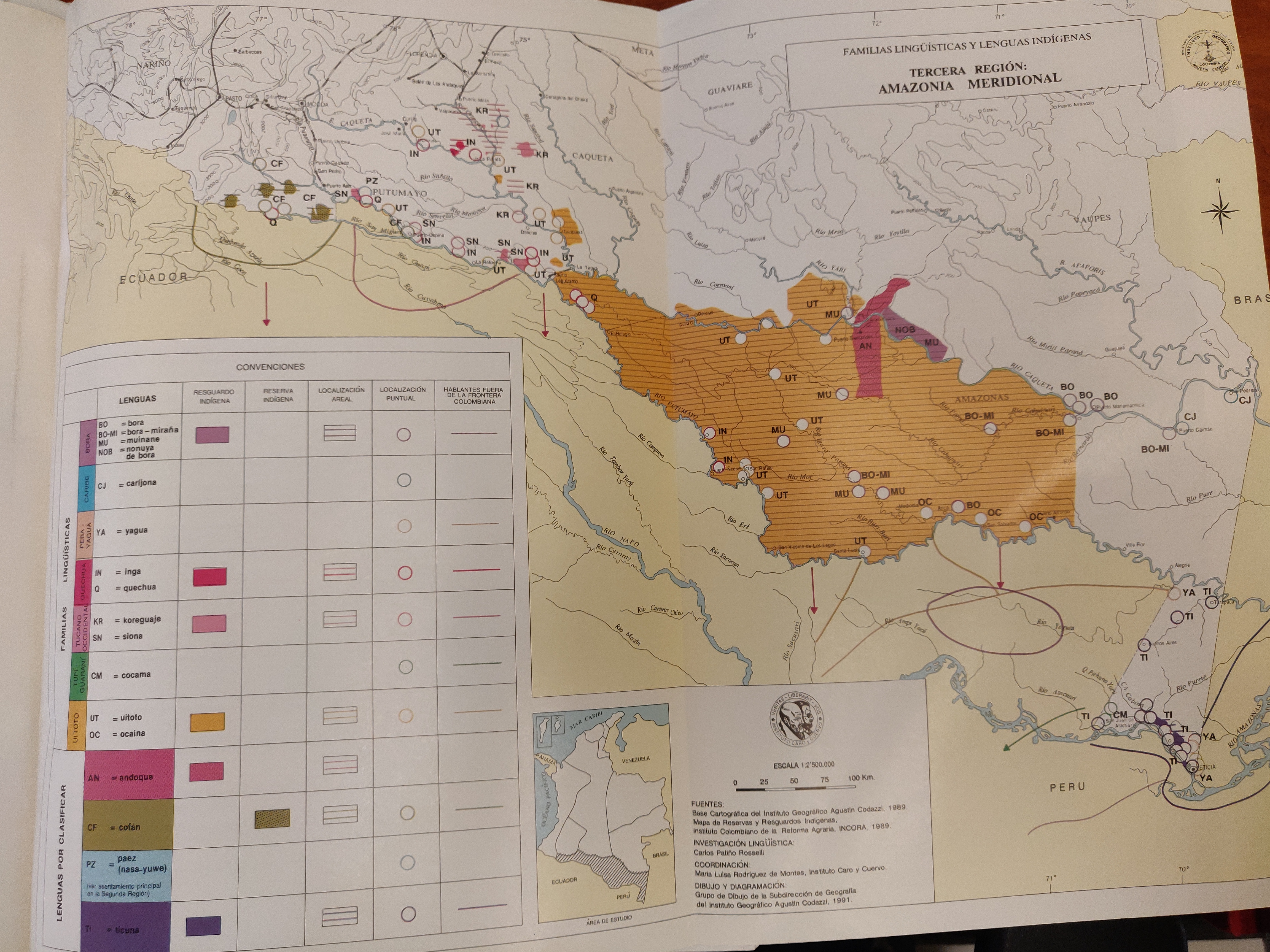
FAMILIAS LINGUISTICAS Y LENGUAS INDIGENAS - TERCERA REGION: AMAZONIA MERIDIONAL
Mapa 1989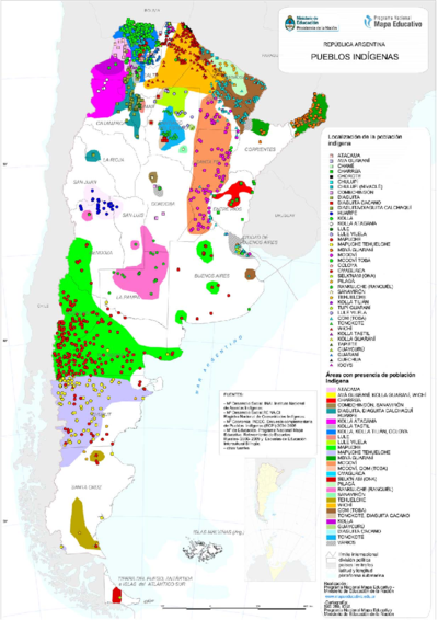
PUEBLOS INDIGENAS
Mapa 2021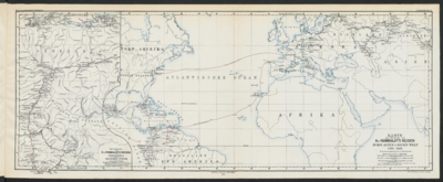
Specialkarte von A. v. HUMBOLDT’S REISEN in VENEZUELA und am ORINOKO-STROM
Mapa 1799 - 1800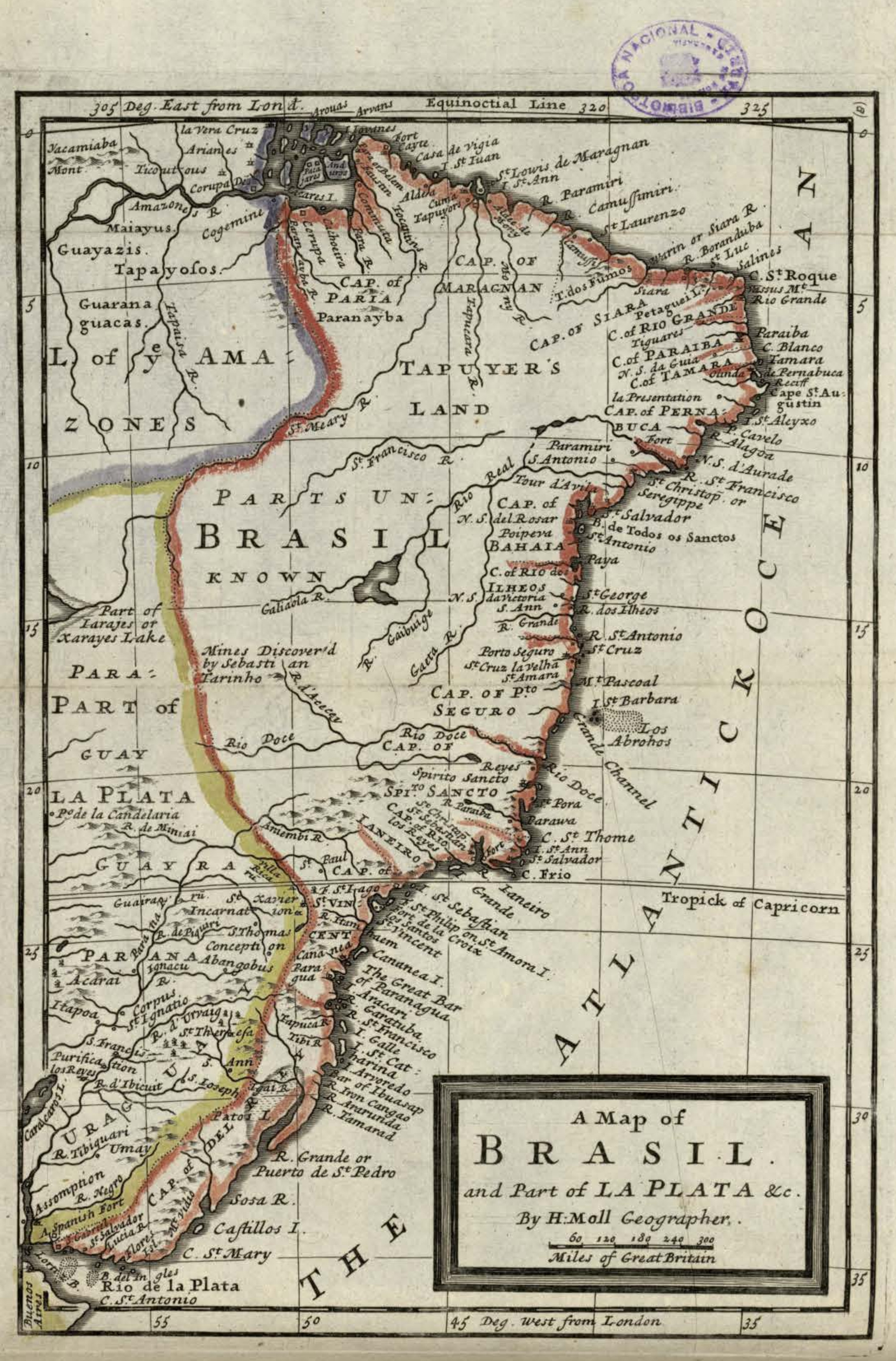
A Map of BRASIL and Part of LA PLATA
Mapa 1717