Cita
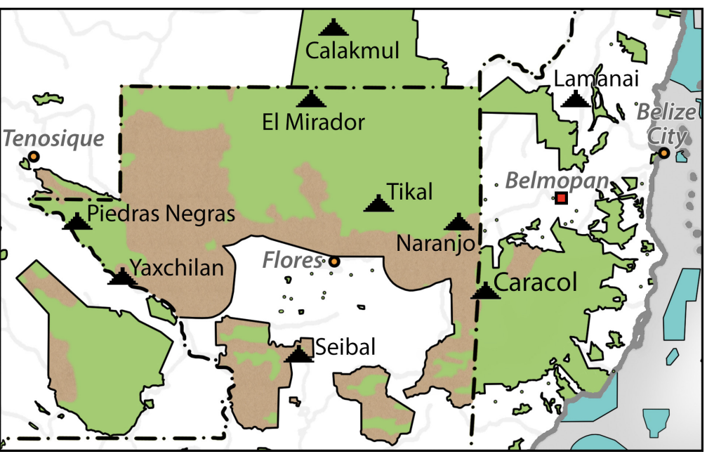
"Map of deforestation within protected areas in Guatemala and adjoining areas."by Harri Kettunen 2020. In Kettunen, Harri, and Antonio Cuxil. “Indigenous People, National Parks, and Biodiversity in The Maya Region.” In Bridging Cultural Concepts of Nature: Indigenous People and Protected Spaces of Nature, edited by Rani-Henrik Andersson, Boyd Cothran, and Saara Kekki, 139–68. Helsinki University Press, 2021. http://www.jstor.org/stable/j.ctv26qjj3b.11.