Cita
"Population of Tontonicapan 1778" IN Historical Atlas of Central America by Carolyn Hall and Héctor Pérez Brignoli. PG. 89. University of Oklhoma Press, 2005.
Mapa del area lingüística de la lengua Xinka
Mapa 2015
Mapa de las comunidades y asentamientos garífunas
Mapa
A NEW MAP OF BRAZIL, COMPILED FROM THE LATEST Government & other Authentic Surveys.
Mapa 1866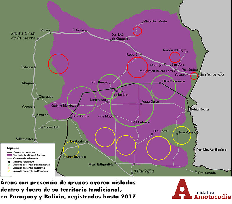
Áreas con presencia de grupos ayoreo aislados dentro y fuera de su territorio traditional, en Paraguay y Bolivia, registrados hasta 2017
Mapa 2017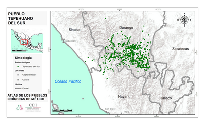
PUEBLO TEPEHUANO DEL SUR
Mapa 2020
Cours du Sinnamary
Mapa 1777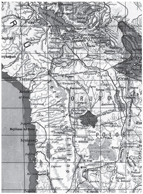
APPROXIMATE BORDERS OF TERRITORY OF THE AYMARA POLITY KARANQAS (OR CARANGAS) IN THE 19TH CENTURY
Mapa 1894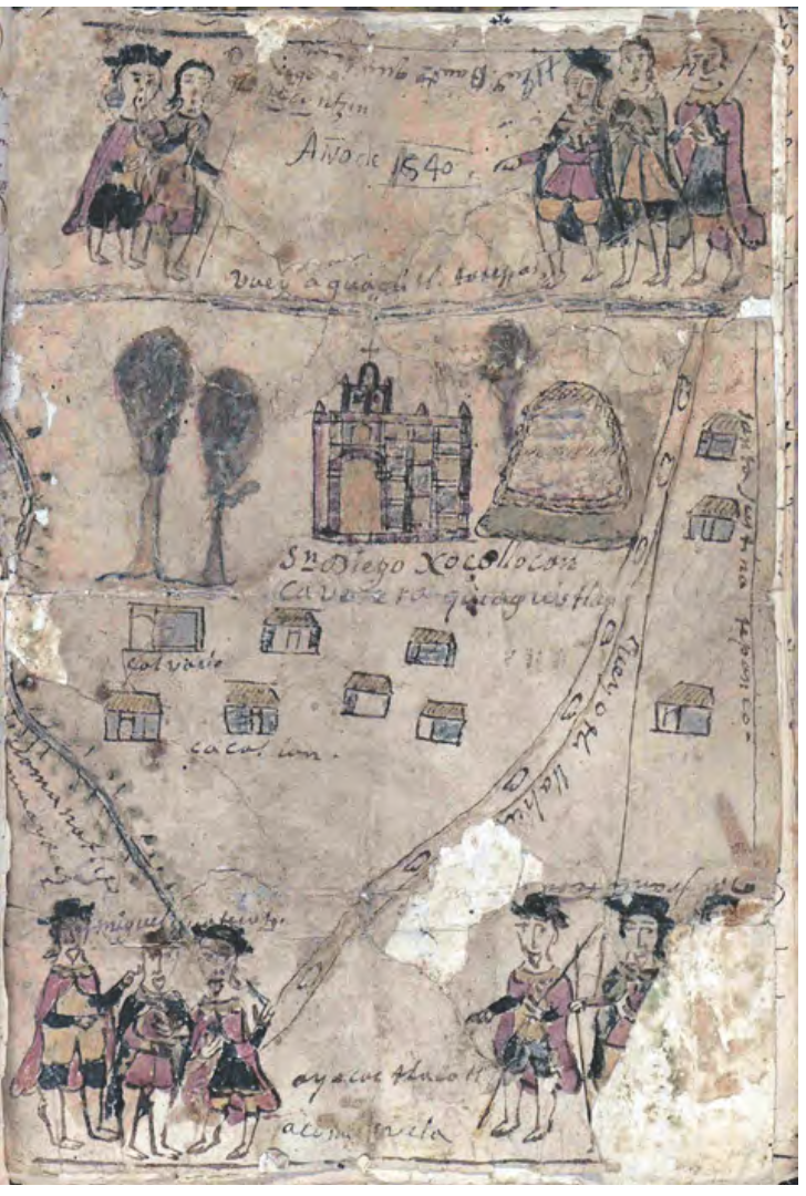
MAPA DE SAN DIEGO XOCOYUCAN
Mapa 1500 - 1599