
Cita
"Property Ownership in 1900, Verapaz Guatemala" IN Historical Atlas of Central America by Carolyn Hall and Héctor Pérez Brignoli. PG. 197. University of Oklhoma Press, 2005.
Islas Antillas y costas de tierra firme.
Mapa 1500 - 1599
The Island and Colony of Cayenne subject to the French, on the Continent of South America.
Mapa 1760
CARTE DU COURS DE L'AMAZONE DEPUIS L'OCÉAN JUSQU'À MANAOS ET DE LA GUYANE BRÉSILIENNE
Mapa 1892 - 1906
XI RONDA PETROLERA Y TERRITORIOS INDIGENAS
Mapa 2011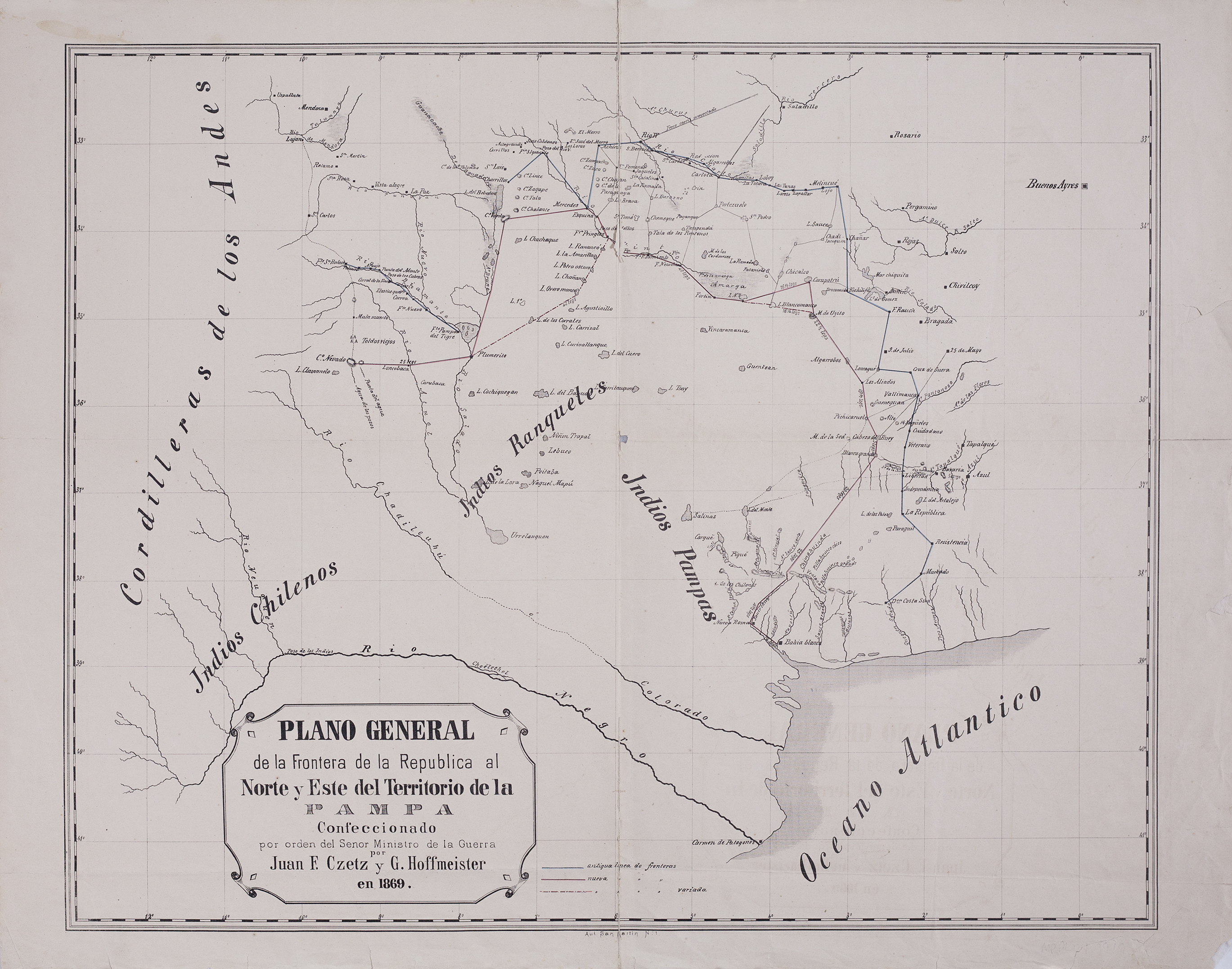
Plano general de la frontera de la República al norte y este del territorio de la Pampa.
Mapa 1869
Río Corrientes
Obra de Arte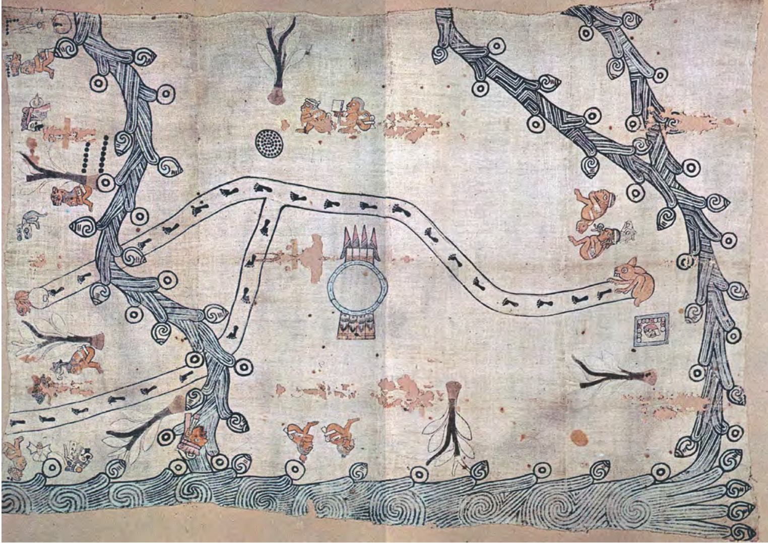
MAPA LOCAL DE TOCHPAN
Mapa 1400 - 1499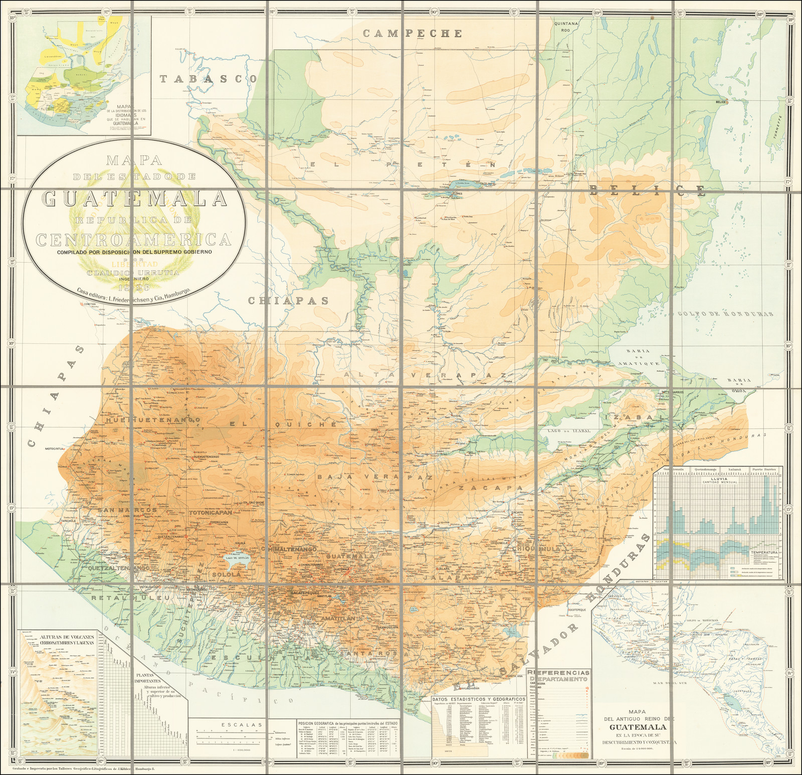
MAPA DEL ANTIGUO REINO DE GUATEMALA EN LA EPOCA DE SU DESCUBRIMIENTO Y CONQUISTA
Mapa 1900 - 1999