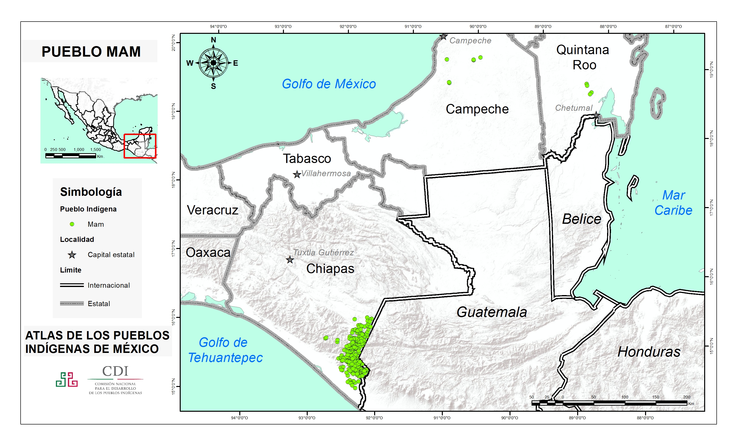
Pueblos
- MAM
Cita
Instituto Nacional de los Pueblos Indígenas. "Mames – Ubicación." Atlas de los Pueblos Indígenas de México. Accessed April 29, 2021. http://atlas.inpi.gob.mx/mames-ubicacion/.
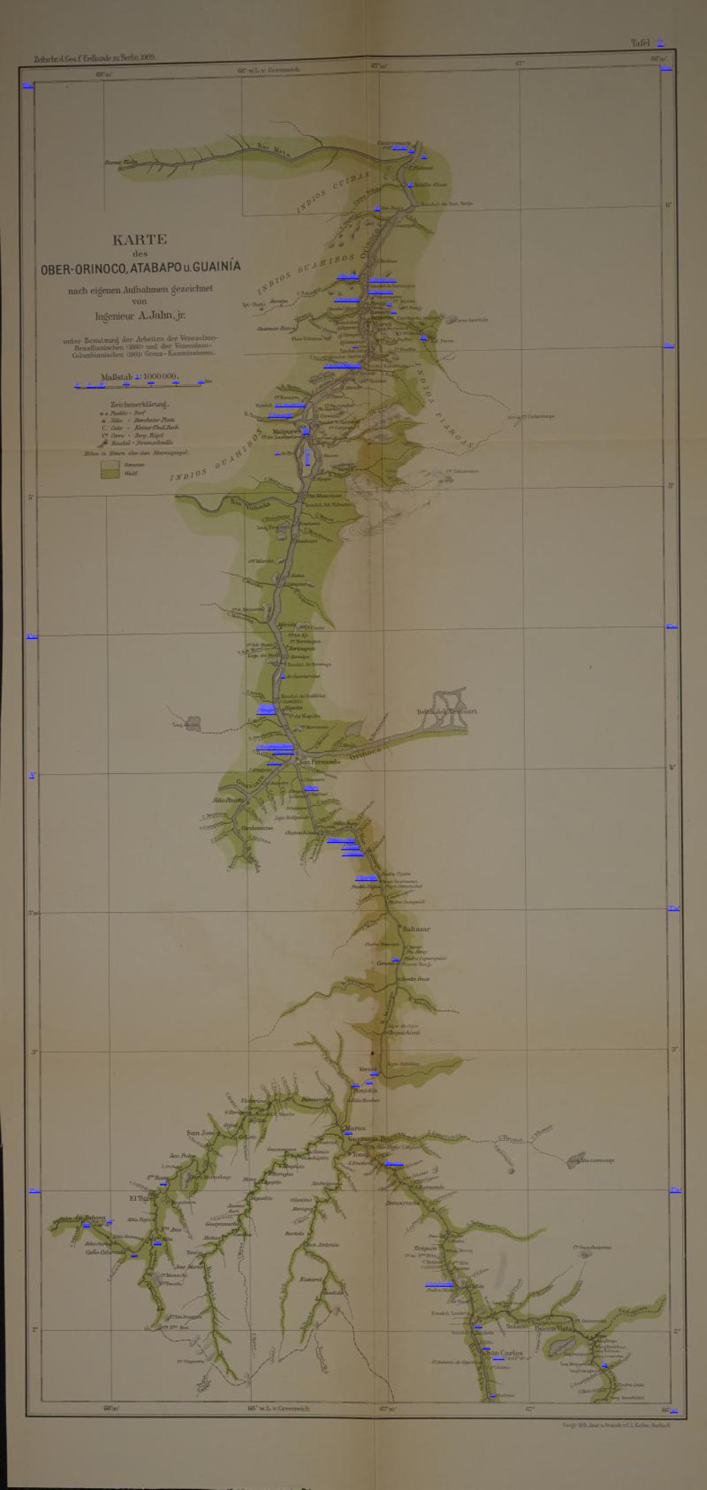
KARTE des OBER-ORINOCO;ATABAPO U GUAINÍA
Mapa 1909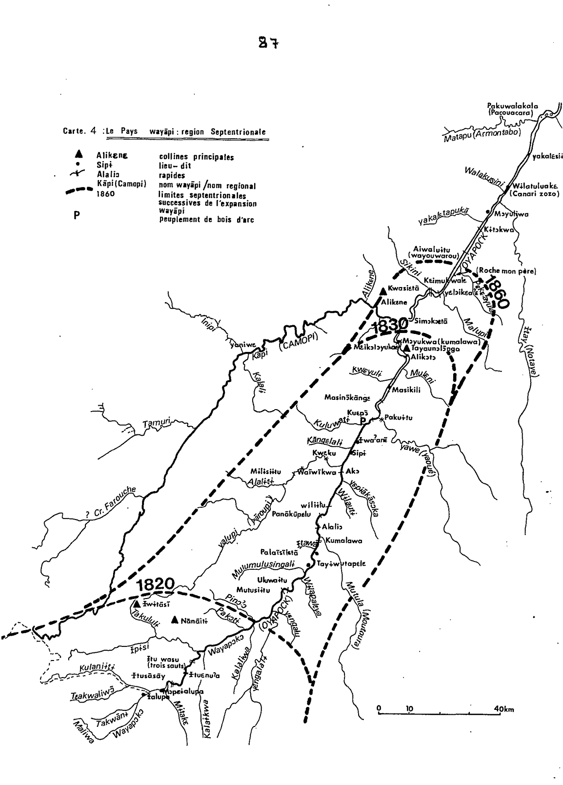
Carte 4: Le Pays Wayãpi : region Septentrionale
Mapa 1820 - 1860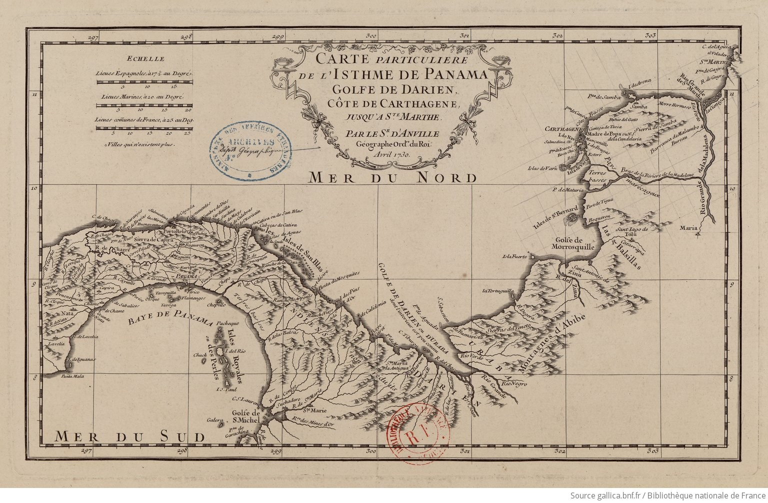
Carte particulière de l'isthme de Panama golfe de Darien, côte de Carthagene, jusqu'à Ste Marthe / par le Sr d'Anville,…
Mapa 1730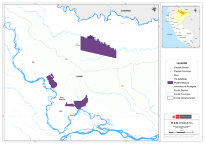
PUEBLO MAIJUNA
Mapa 2021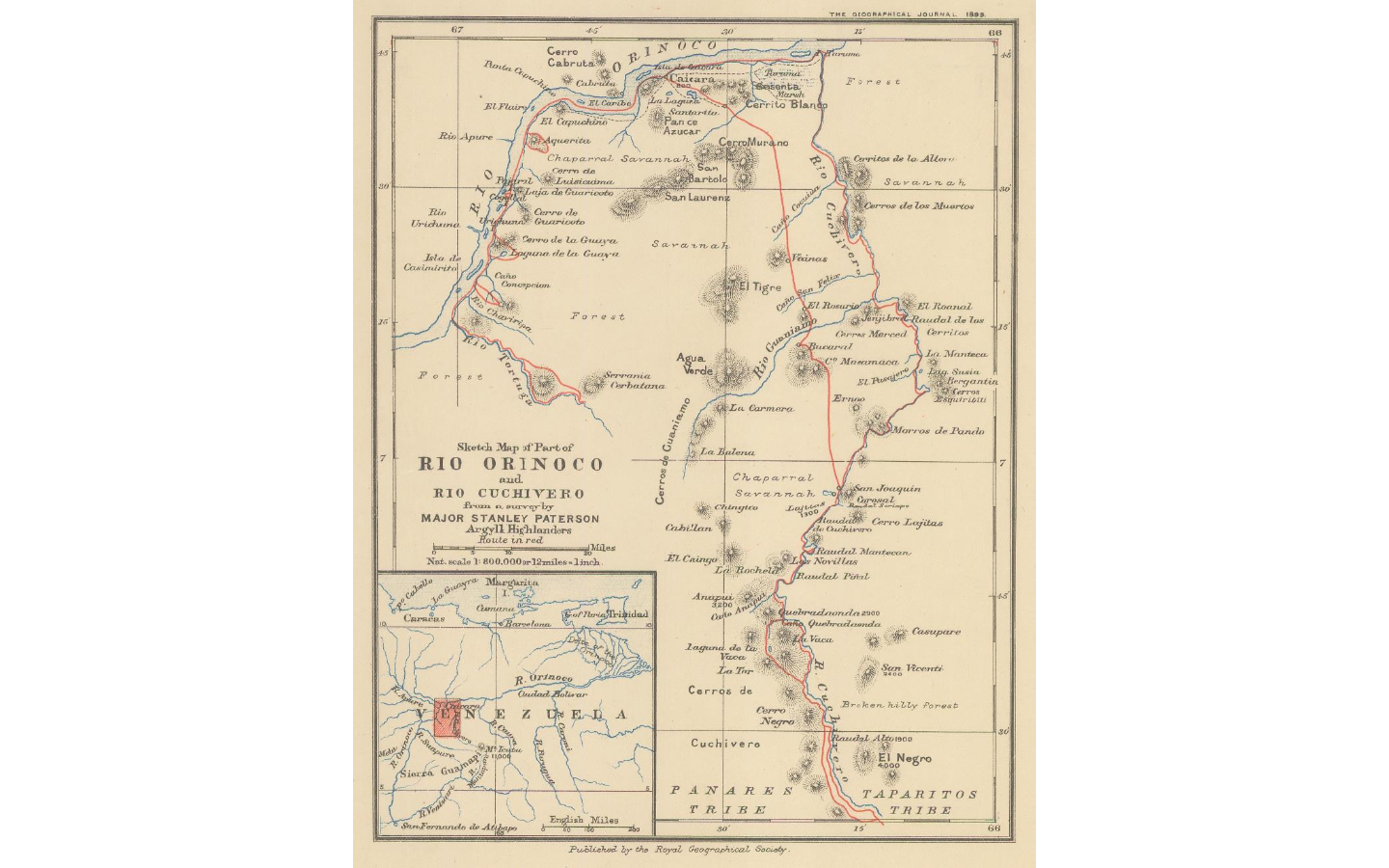
Sketch map of part of RÍO ORINOCO and RIO CUCHIVERO from a survey by MAJOR STANLEY PATERSON
Mapa 1896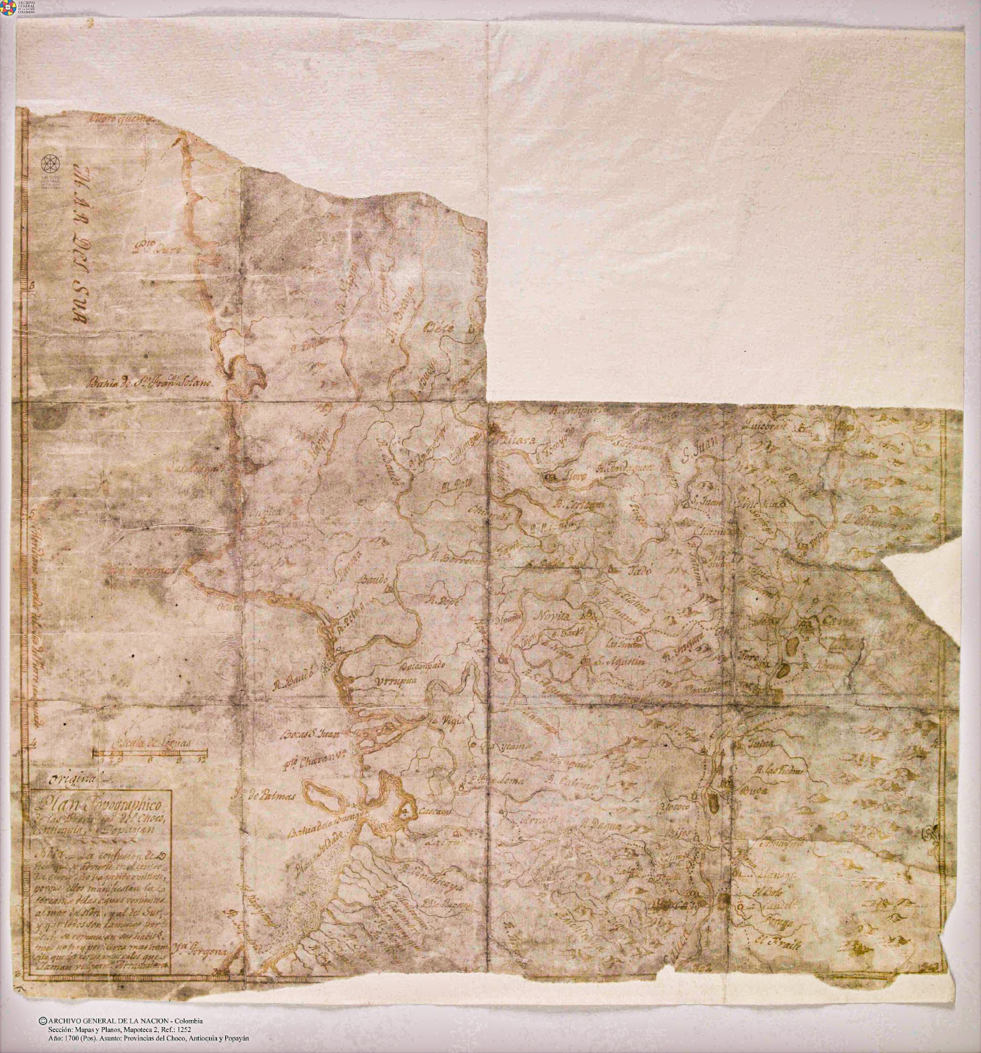
Plan topográfico de las Provincias de Chocó, Antioquia y Popayán
Mapa 1700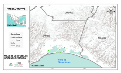
PUEBLO HUAVE
Mapa 2020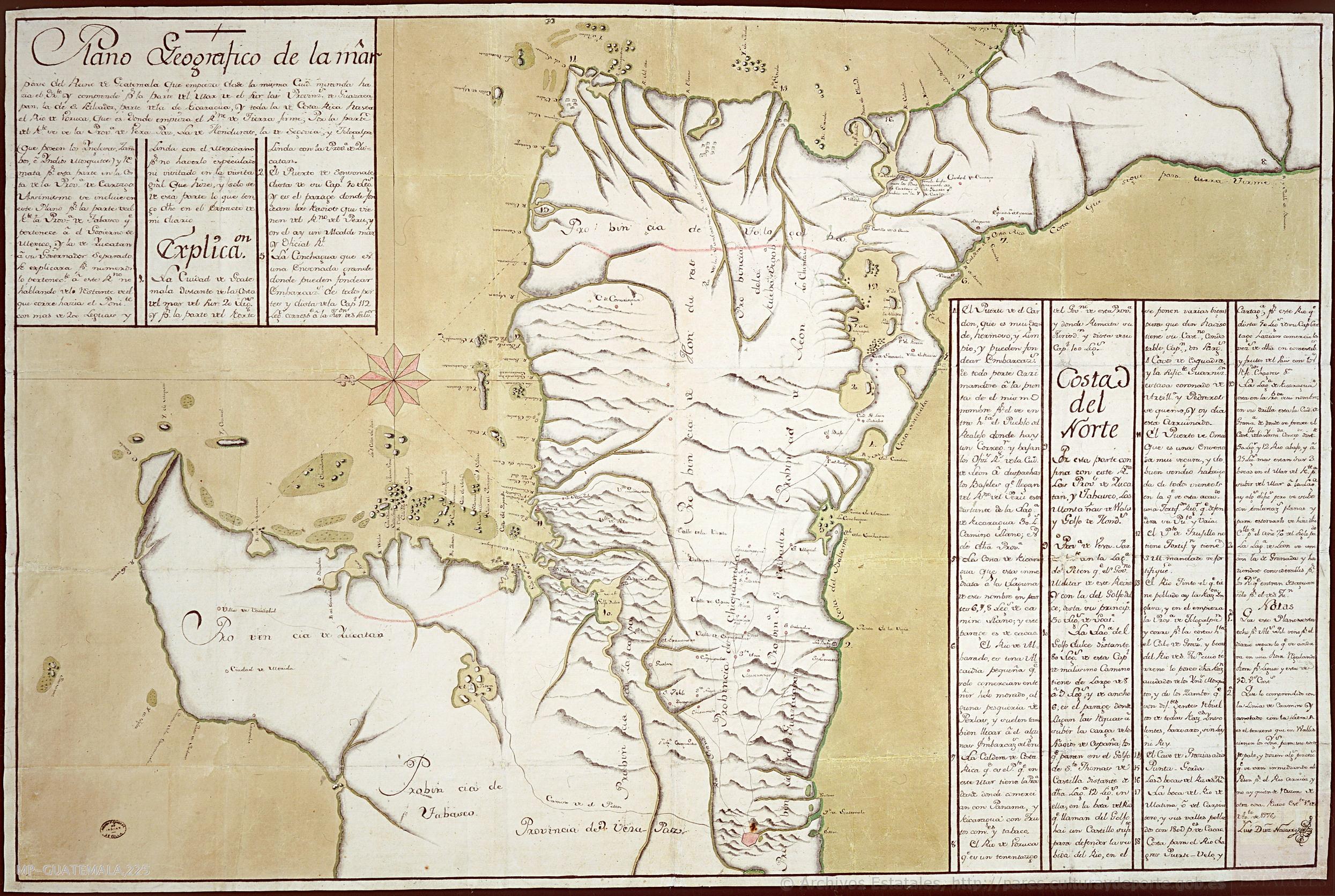
Plano Geográfico de la maior parte del Reino de Guatemala que empieza desde la misma Ciudad mirando hacia el Oriente y comprende por la parte del Mar de el Sur las Provincias de Guazacapan;la de San Salvador;y parte de la de Nicaragua y toda la de Costa Rica hasta el Rio de Voruca;que es donde empieza el Reino de Tierra firme: Por la parte del Norte se vé la Provincia de Vera Paz;la de Honduras;la de Segovia y Tologalpa (que poseen los Ingleses;Zambos é Indios Mosquitos) y remata por esta parte en la costa de la Provincia de Cartago ;etc
Mapa 1776