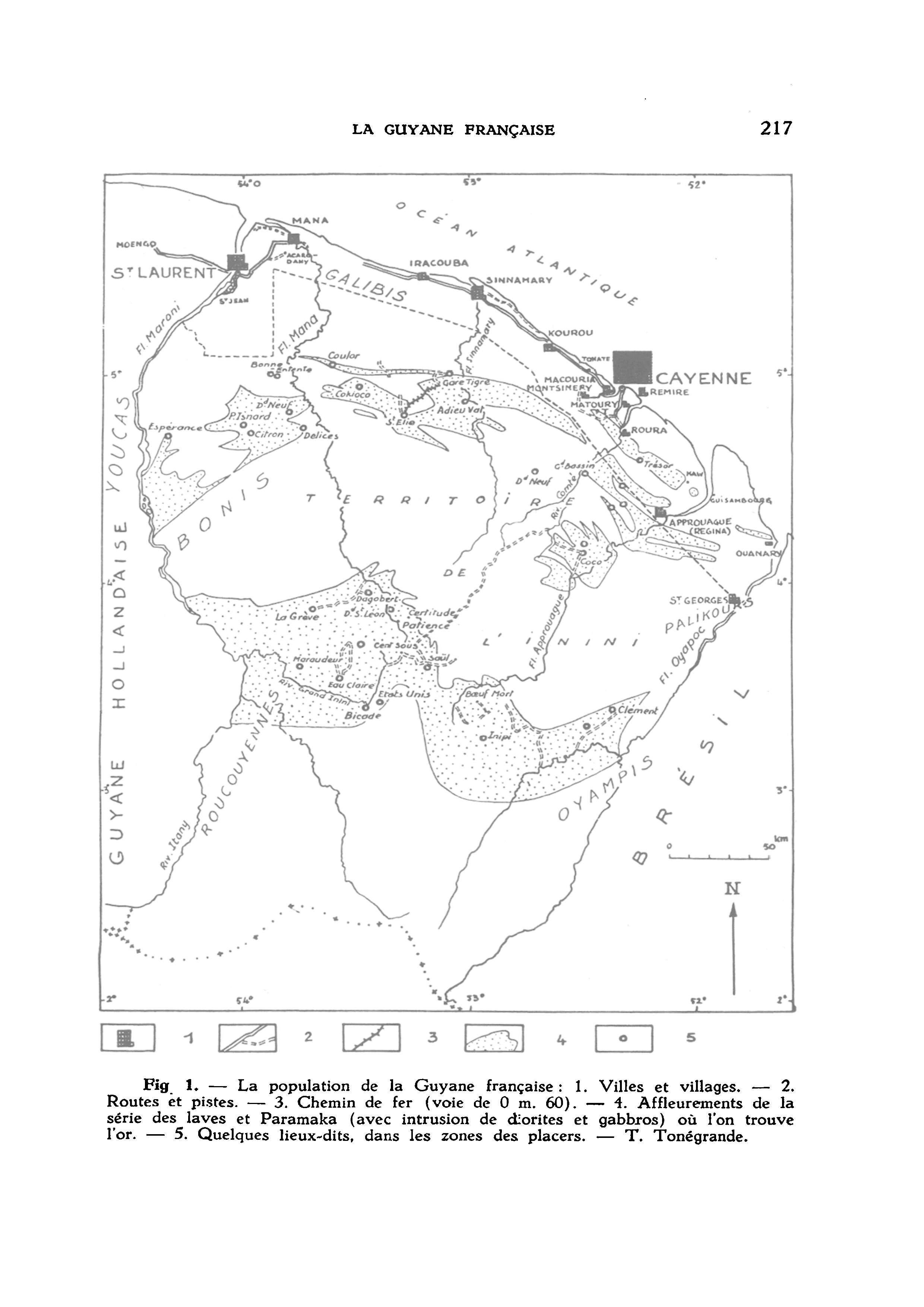
Pueblos
- BONIS
- GALIBIS
- OYAMPIS
- PALIKOURS
- ROUCOUYENNES
- YOUCAS
Cita
Louis, Papy. "La Guyane française. Premier article." Cahiers d'outre-mer, 31 (1955): 209-232 https://doi.org/10.3406/caoum.1955.1967
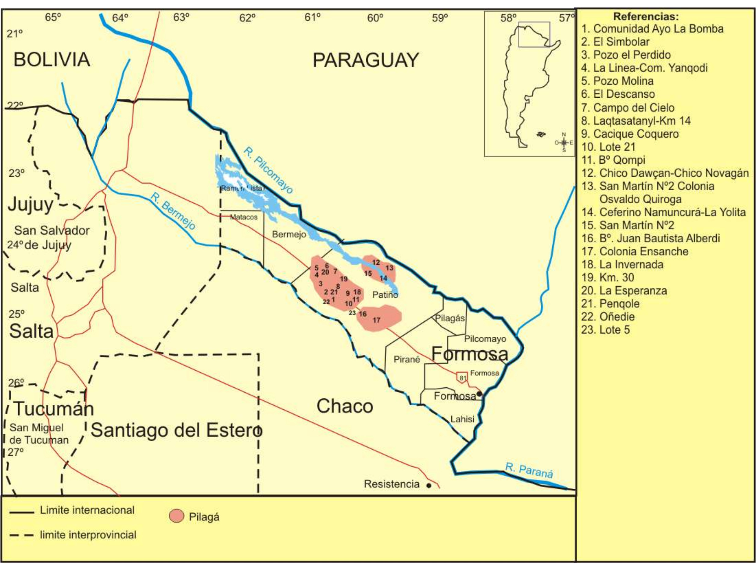
Lengua Pilagá - Ubicación geográfica
Mapa 2021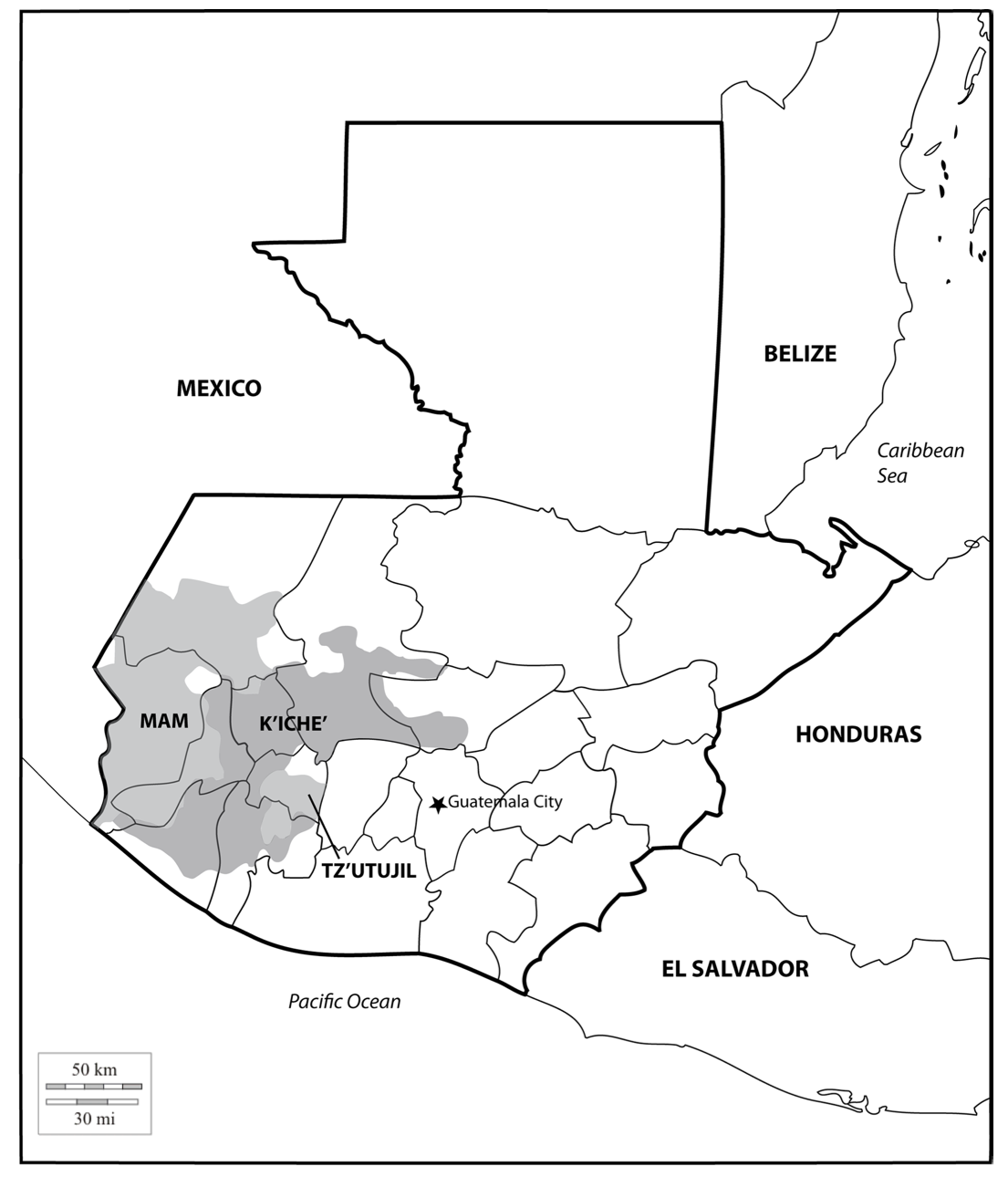
Location of three ethno-linguistic groups in the highlands of Guatemala in which joint InHerit-Riecken community-participant mapping took place. Adapted from http://d-maps. com/carte.php?num_car=1717&lang=en)
Mapa 2000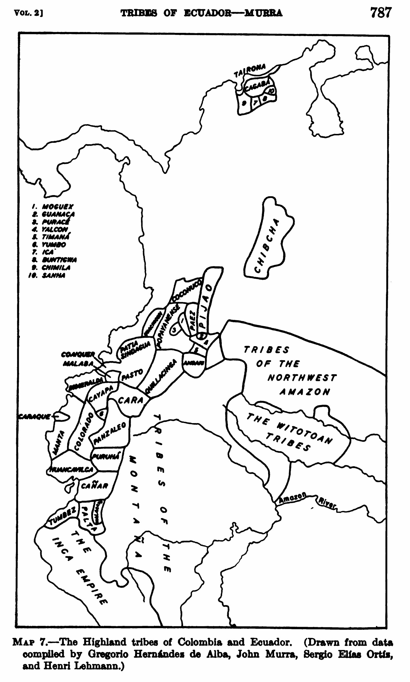
MAP 7.—The Highland tribes of Colombia and Ecuador. (Drawn from data compiled by Gregorio Hernández de Alba;John Murra;Sergio Elías Ortíz;and Henri Lehmann.)
Mapa 1400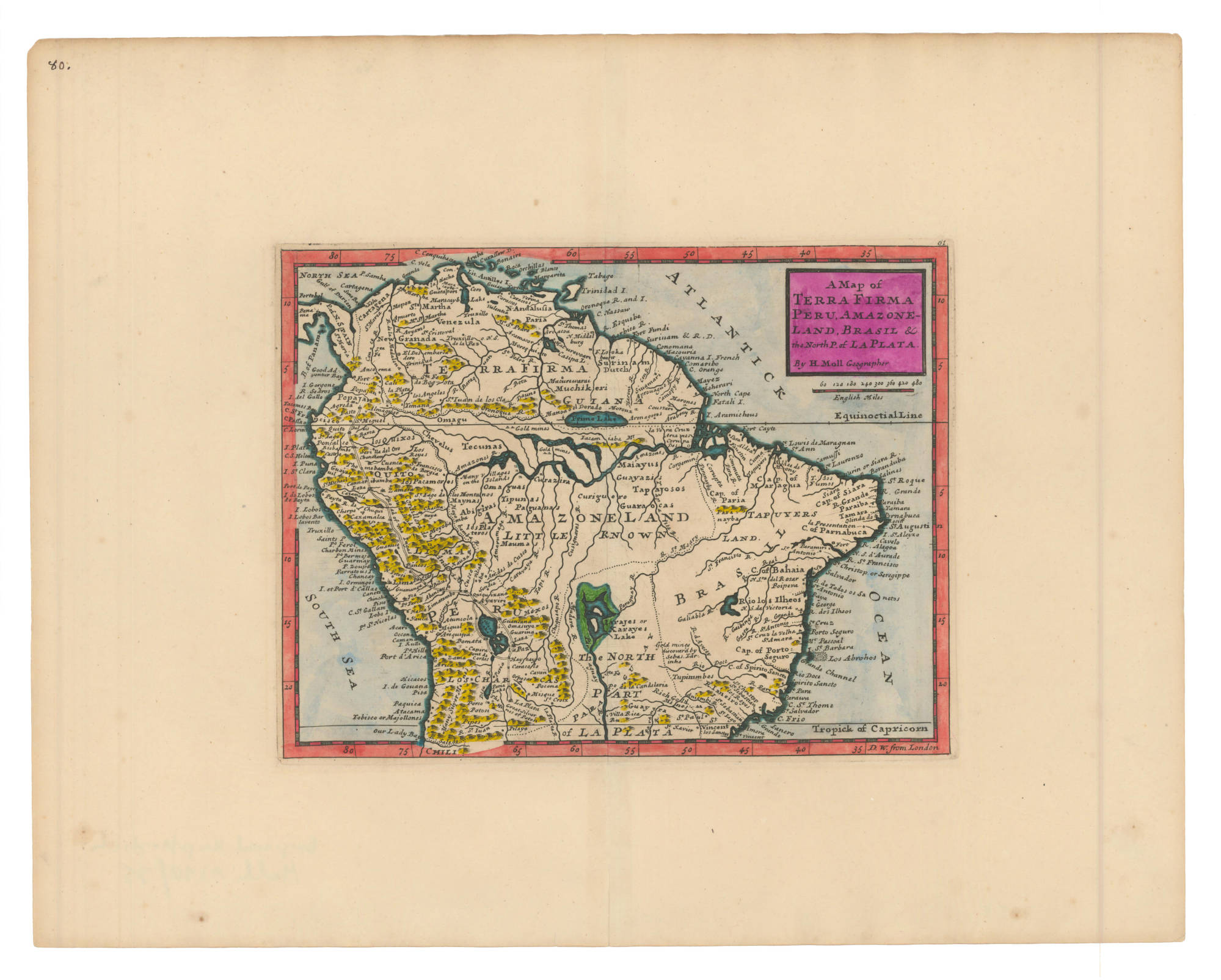
A Map of TERRA FIRMA PERU, AMAZONELAND, BRASIL and the North P. of LA PLATA
Mapa 1700 - 1799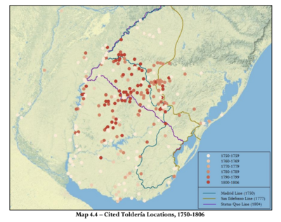
Cited Toldería Locations, 1750-1806
Mapa 1750 - 1806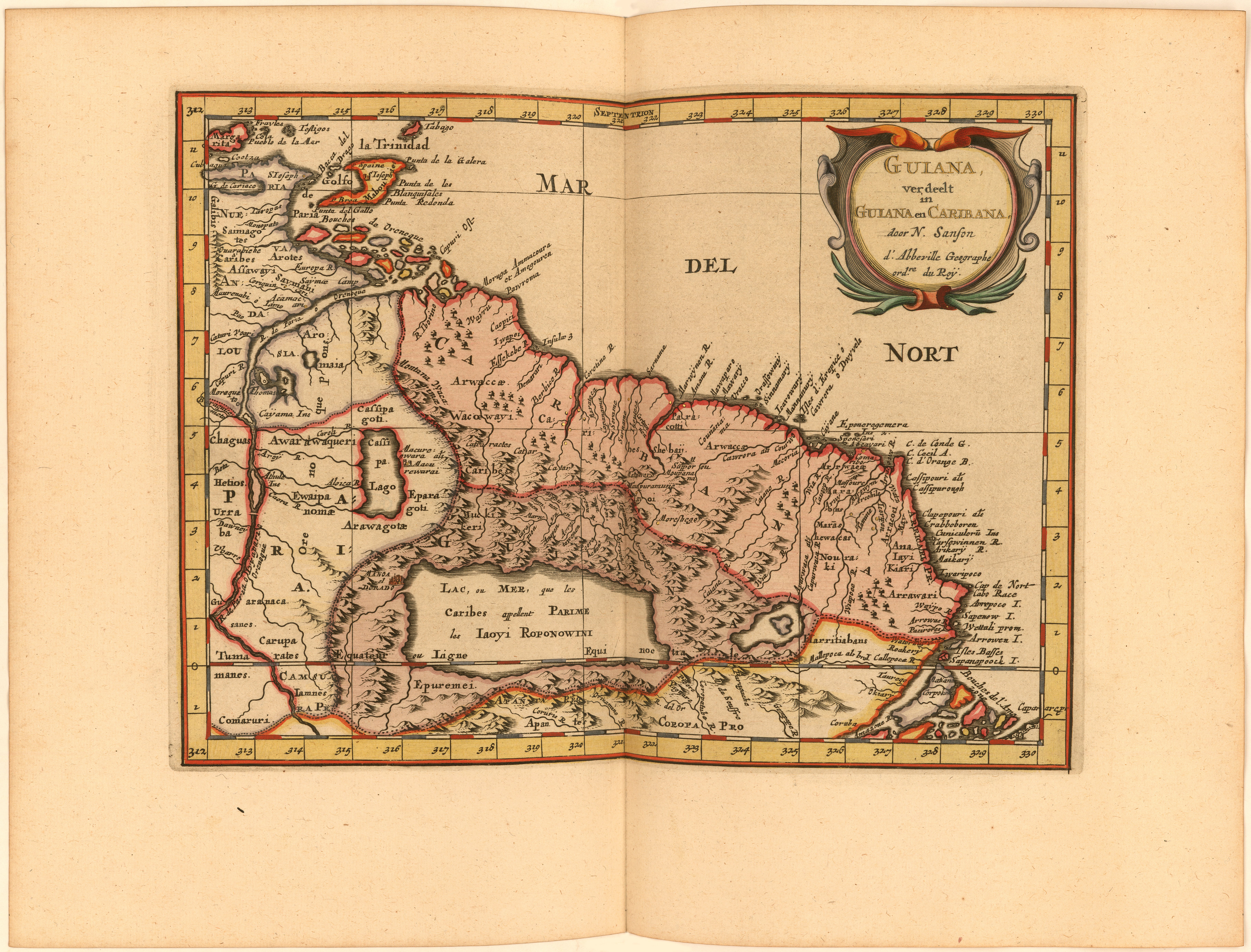
Guiana verdeelt in Guiana en Caribana. door N. Sanson d.'Abbeville, Geogr ordre. du Roÿ
Mapa 1600 - 1699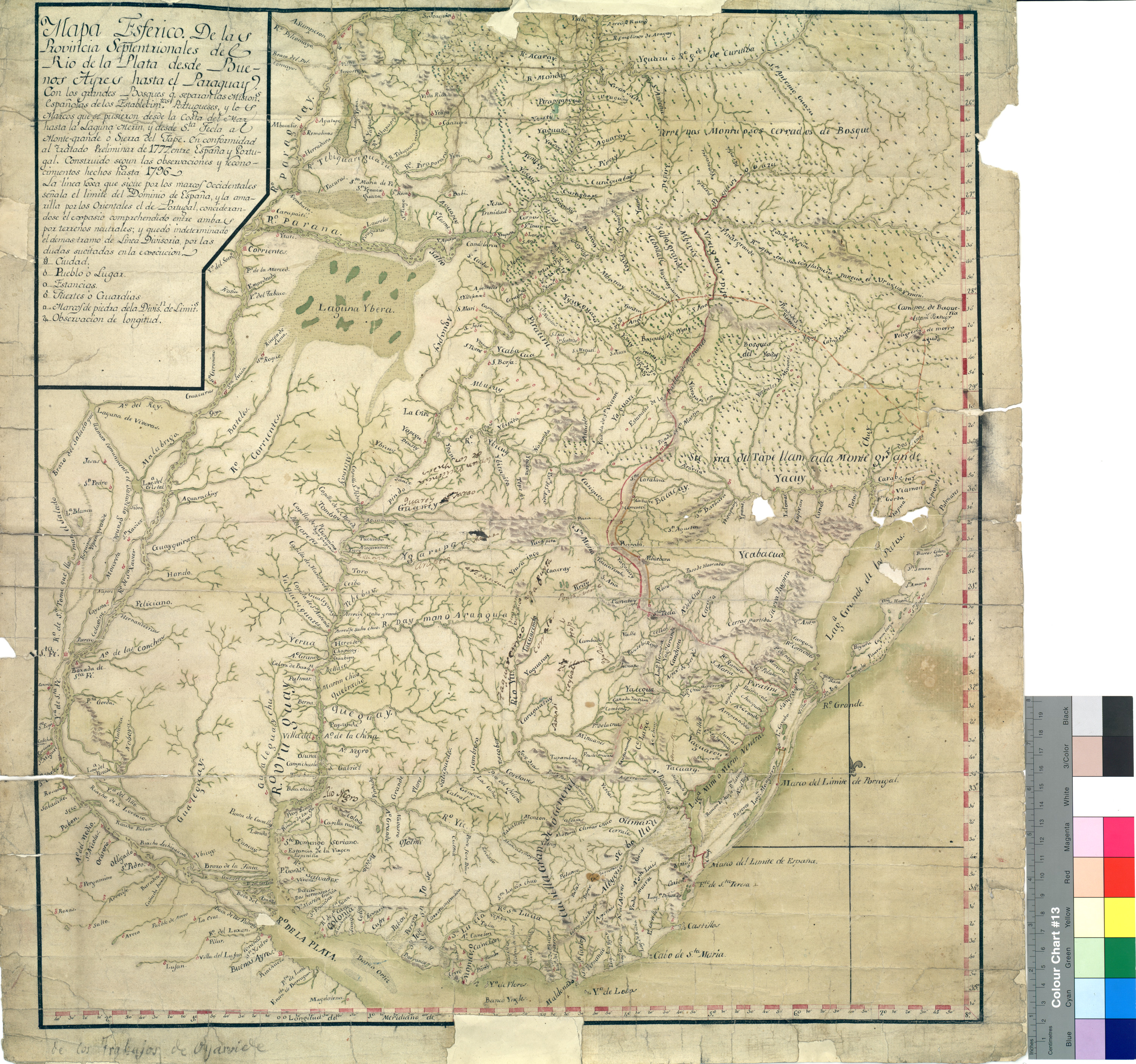
Mapa Esférico De las Provincias Septentrionales del Río de la Plata
Mapa 1796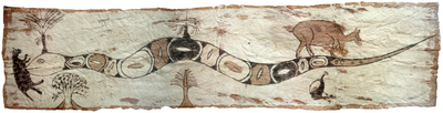
Sachamama
Obra de Arte