Pueblos
- HABITATIONS D'INDIENS
Cita
Carte particulière de l'Isle de Cayenne avec les sondes. Gallica. Last modified: September 28, 2015. Accessed, August 1, 2023. https://gallica.bnf.fr/ark:/12148/btv1b53103453f
Carte générale de Colombie, de la Guyane Française, Hollandaise et Anglaise.
Mapa 1800 - 1899
Aldeia Tekoha Mara’E Ey
Mapa 1989 - 2001
A Sequel of the Seat of War in the West Indies containing… Sub-map title: A large & accurate MAP of part of the Isthmus of Panama, taken from a Spanish drought exhibiting the Country adjacent to that City and Puerto Bello, with the Roads and Course of the River CHAGRE, by which the Treasure of the South Sea is conveyed a cross the Isthmus
Mapa 1740
Map of Tenango (Valley of Mexico), 1587, Archivo General de la Nación, no. 1822
Mapa 1587![[Ecuador & Peru Coastlines] Carta particolare del'Peru che comincia con il capo di Guanapo e finisce con il C. S:](https://dnet8ble6lm7w.cloudfront.net/maps/PER/PER0087.jpg)
[Ecuador & Peru Coastlines] Carta particolare del'Peru che comincia con il capo di Guanapo e finisce con il C. S:
Mapa 1646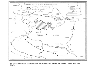
Preconquest and Modern Boundaries of Tarascan Speech
Mapa 1550 - 1999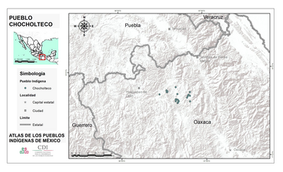
PUEBLO CHOCHOLTECO
Mapa 2020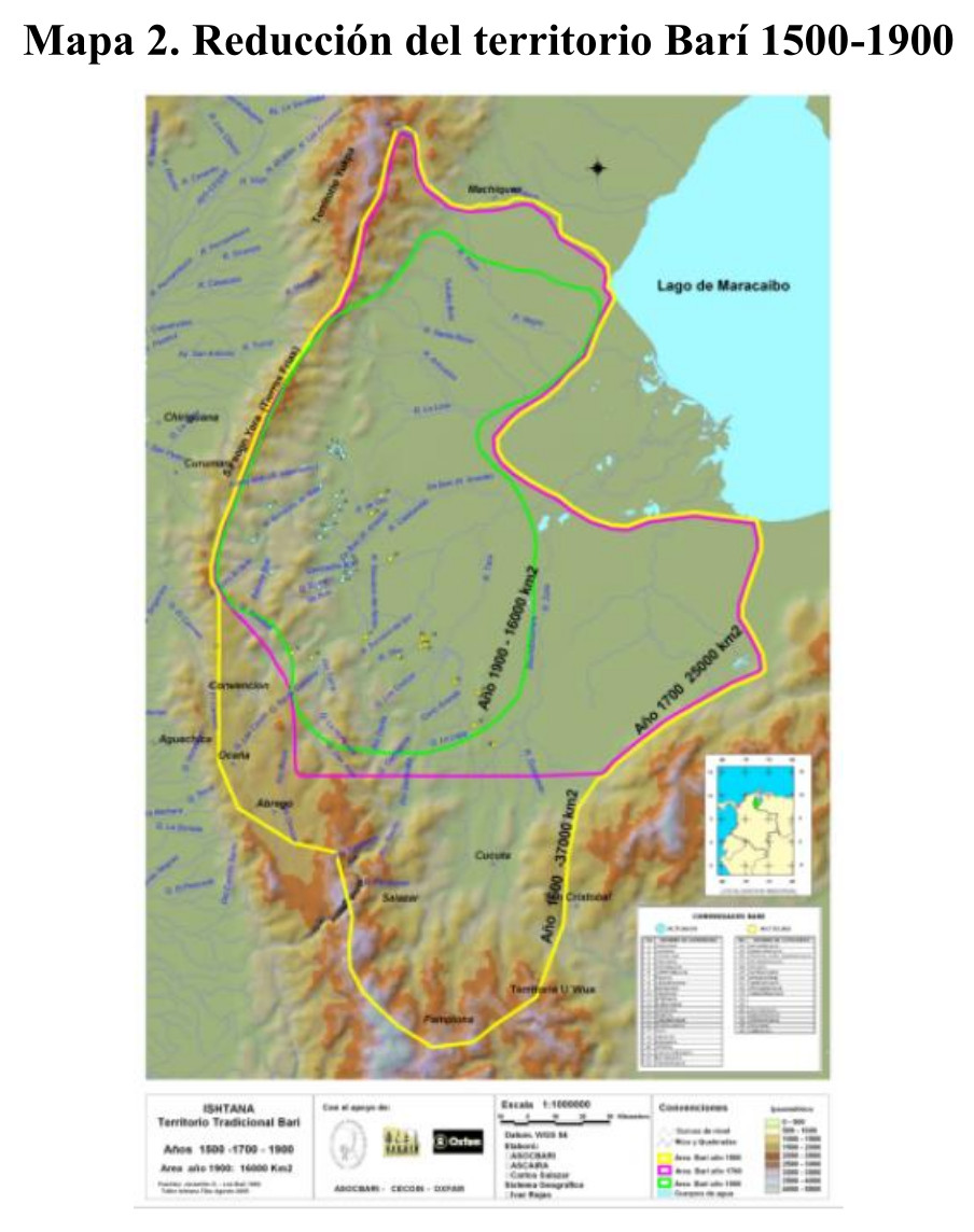
Reducción del territorio Barí 1500-1900
Mapa 1500 - 1900