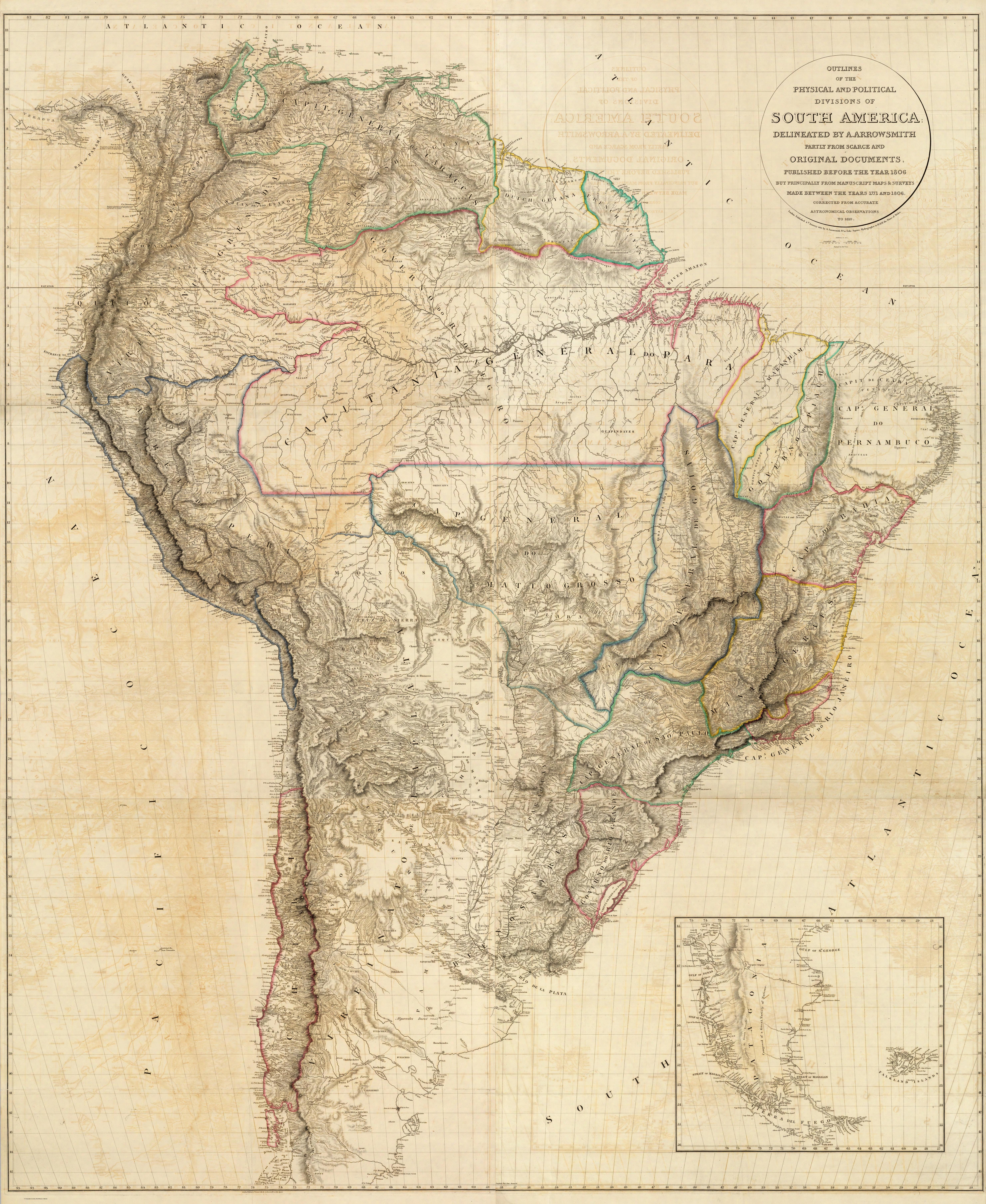
Dispossesions in the Americas

Dispossesions in the Americas

  • Inicio
  • Explorar
  • Autores
  • Sobre
  • Arte
  • Cuerpos
  • Planes de Estudio
  • Herencia Cultural
  • Mapas
  • Territorios
Volver a Explorar

Leyendo en Inglés

Mapa 1717

Cayenne représentée exactement dans toutes ses rivières, criques et habitations et ses dehors

  • FRANCE, DÉPÔT DES FORTIFICATIONS DES COLONIES.

Publicado: 1717

  • Descargar Imágen
  • Descargar Imágen
Mapa 1717

Cayenne représentée exactement dans toutes ses rivières, criques et habitations et ses dehors

  • FRANCE, DÉPÔT DES FORTIFICATIONS DES COLONIES.

Publicado: 1717

  • Descargar Imágen

Pueblos

  • AROUAS
  • GALIBIS
  • NORAGUES

Cita

Dépôt des Fortifications des Colonies. Guyane. Cayenne représentée exactement dans toutes ses rivières, criques et habitations et ses dehors. Gallica. Last modified: January 8, 2023. Accessed, July 8, 2023. https://gallica.bnf.fr/ark:/12148/btv1b10112356t

  • Descargar Imágen

Leyendo en Portugués

Mapa 1717

Cayenne représentée exactement dans toutes ses rivières, criques et habitations et ses dehors

  • FRANCE, DÉPÔT DES FORTIFICATIONS DES COLONIES.

Publicado: 1717

  • Descargar Imágen

Pueblos

  • AROUAS
  • GALIBIS
  • NORAGUES

Cita

Dépôt des Fortifications des Colonies. Guyane. Cayenne représentée exactement dans toutes ses rivières, criques et habitations et ses dehors. Gallica. Last modified: January 8, 2023. Accessed, July 8, 2023. https://gallica.bnf.fr/ark:/12148/btv1b10112356t

  • Descargar Imágen

Artículos Relacionados

Angaité

Angaité

Mapa 2001
QUERÉTARO

QUERÉTARO

Mapa 2015
NIVACLÉ

NIVACLÉ

Mapa 2015
SOUTH AMERICA

SOUTH AMERICA

Mapa 1771 - 1806
Carte d'une partie de la Guyanne extraite des observations faites en 1762, 1763 et 1764.

Carte d'une partie de la Guyanne extraite des observations faites en 1762, 1763 et 1764.

Mapa 1762 - 1764
Chili

Chili

Mapa 1663
Location of the main settlements on the Lenca-Chortí-Nahua-Pipil frontier, 1530-1539. (Taken from Lara-Pinto 2009 with modifications.)

Location of the main settlements on the Lenca-Chortí-Nahua-Pipil frontier, 1530-1539. (Taken from Lara-Pinto 2009 with modifications.)

Mapa 1530 - 1539
Planta do TERRITORIO PARAGUAYO

Planta do TERRITORIO PARAGUAYO

Mapa 1865 - 1868

Despojos en las Américas

Un Proyecto de

University of Pennsylvania

Copyright 2024

Con el apoyo de

Mellon Foundation

Diseño y Desarrollo del Sitio

Element 84

Créditos Artísticos

Dépôt des Fortifications des Colonies. Guyane. Cayenne représentée exactement dans toutes ses rivières, criques et habitations et ses dehors. Gallica. Last modified: January 8, 2023. Accessed, July 8, 2023. https://gallica.bnf.fr/ark:/12148/btv1b10112356t

Páginas del Sitio

  • Inicio
  • Explorar
  • Autores
  • Sobre
  • Arte
  • Cuerpos
  • Planes de Estudio
  • Herencia Cultural
  • Mapas
  • Territorios