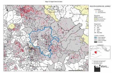
Pueblos
- YUMBOS
- BARBACOA
Cita
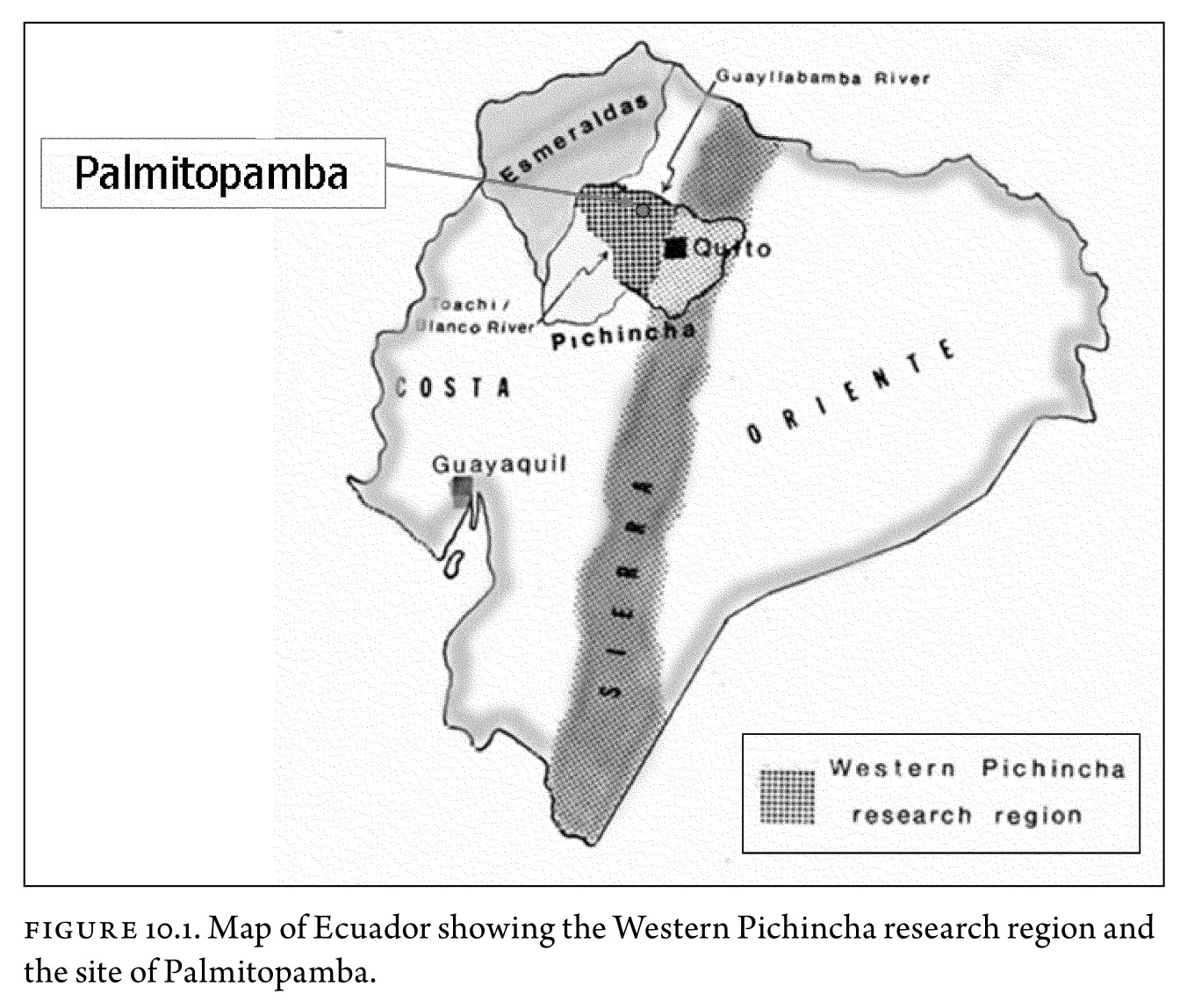
Malpass;M. A.;& Alconini;S. (Eds.). (2010). Distant provinces in the inka empire : Toward a deeper understanding of inka imperialism. University of Iowa Press.Created from upenn-ebooks on 2022-09-02 16:11:14. https://upenn.alma.exlibrisgroup.com/discovery/openurl?institution=01UPENN_INST&vid=01UPENN_INST:Services&%3Fctx_ver=Z39.88-2004&ctx_enc=info:ofi%2Fenc:UTF-8&rfr_id=info:sid%2Fsummon.serialssolutions.com&rft_val_fmt=info:ofi%2Ffmt:kev:mtx:book&rft.genre=book&rft.title=Distant%20provinces%20in%20the%20inka%20empire:%20Toward%20a%20Deeper%20Understanding%20of%20Inka%20Imperialism&rft.au=Malpass%20Prof;%20Michael%20A.&rft.au=Alconini;%20Sonia&rft.date=2010-01-01&rft.isbn=9781587298691&rft.externalDBID=n%2Fa&rft.externalDocID=255354928

![[Carta particolare della costa di Guiana]](https://dnet8ble6lm7w.cloudfront.net/maps/CNT/CNT0213.jpg)