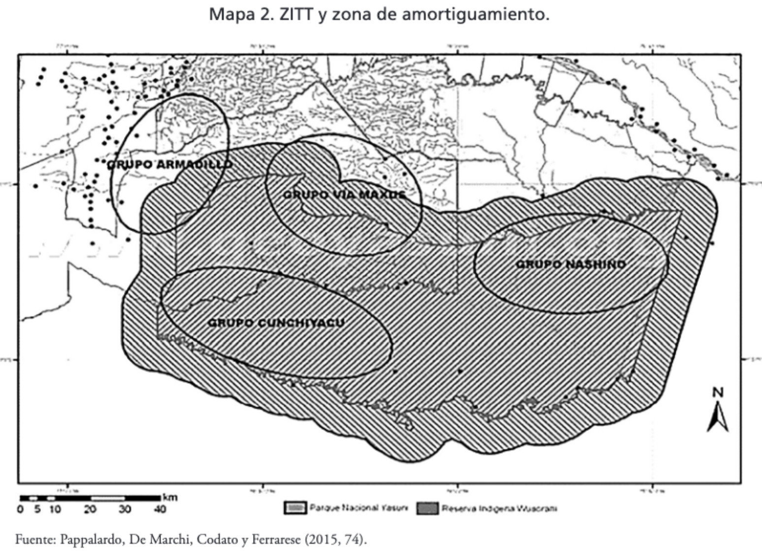
Dispossesions in the Americas

Dispossesions in the Americas

  • Inicio
  • Explorar
  • Autores
  • Sobre
  • Arte
  • Cuerpos
  • Planes de Estudio
  • Herencia Cultural
  • Mapas
  • Territorios
Volver a Explorar

Leyendo en Inglés

Mapa 2015

MAPA 2. ZITT Y ZONA DE AMORTIGUAMIENTO.

  • PAPPALARDO;DE MARCHI;CODATO Y FERRARESE

Publicado: 2017

  • Descargar Imágen
  • Descargar Imágen
Mapa 2015

MAPA 2. ZITT Y ZONA DE AMORTIGUAMIENTO.

  • PAPPALARDO;DE MARCHI;CODATO Y FERRARESE

Publicado: 2017

  • Descargar Imágen

Pueblos

  • WAORANI
  • TAGAERI
  • TAROMENANE

Cita

Narváez Quiñónez;Iván Tarcicio. “Amazonía: Cambio de La Comprensión de La Territorialidad Al Interior Del Territorio Waorani (Los Derechos Indígenas)/ Amazon: Change of the Understanding of the Territoriality to the Interior of the Waorani Territory (indigenous Rights).” Eutopía.;no. 12 (2017). https://revistas.flacsoandes.edu.ec/eutopia/article/view/2906/2052

  • Descargar Imágen

Leyendo en Portugués

Mapa 2015

MAPA 2. ZITT Y ZONA DE AMORTIGUAMIENTO.

  • PAPPALARDO;DE MARCHI;CODATO Y FERRARESE

Publicado: 2017

  • Descargar Imágen

Pueblos

  • WAORANI
  • TAGAERI
  • TAROMENANE

Cita

Narváez Quiñónez;Iván Tarcicio. “Amazonía: Cambio de La Comprensión de La Territorialidad Al Interior Del Territorio Waorani (Los Derechos Indígenas)/ Amazon: Change of the Understanding of the Territoriality to the Interior of the Waorani Territory (indigenous Rights).” Eutopía.;no. 12 (2017). https://revistas.flacsoandes.edu.ec/eutopia/article/view/2906/2052

  • Descargar Imágen

Artículos Relacionados

PUEBLO MAM

PUEBLO MAM

Mapa 2020
Dolores

Dolores

Mapa 1997
PUEBLO TEKO

PUEBLO TEKO

Mapa 2020
Pueblos Indios del Norte Chico y Zona Central de Chile en el Siglo XVI y XVII

Pueblos Indios del Norte Chico y Zona Central de Chile en el Siglo XVI y XVII

Mapa 1500 - 1600
Detail from the 1770 copy of Francisco Álvarez Barreiro’s 1728 map of northern New Spain illustrating Spanish mapping of Indian domains in southern Texas and along the Gulf Coast, especially through the repetition of labels: “tierra de los Pampopas,” “tierra de los Carrizos,” “tierra de los Cujanes,” etc.

Detail from the 1770 copy of Francisco Álvarez Barreiro’s 1728 map of northern New Spain illustrating Spanish mapping of Indian domains in southern Texas and along the Gulf Coast, especially through the repetition of labels: “tierra de los Pampopas,” “tierra de los Carrizos,” “tierra de los Cujanes,” etc.

Mapa 1728
Plano de las tierras del Convento de Predicadores del Valle del Santo Ecce Homo, parroquia del Cocuy.

Plano de las tierras del Convento de Predicadores del Valle del Santo Ecce Homo, parroquia del Cocuy.

Mapa 1822
Matrimonios Duitama

Matrimonios Duitama

Mapa 1500 - 1600
GUERRERO

GUERRERO

Mapa 2015

Despojos en las Américas

Un Proyecto de

University of Pennsylvania

Copyright 2024

Con el apoyo de

Mellon Foundation

Diseño y Desarrollo del Sitio

Element 84

Créditos Artísticos

Narváez Quiñónez;Iván Tarcicio. “Amazonía: Cambio de La Comprensión de La Territorialidad Al Interior Del Territorio Waorani (Los Derechos Indígenas)/ Amazon: Change of the Understanding of the Territoriality to the Interior of the Waorani Territory (indigenous Rights).” Eutopía.;no. 12 (2017). https://revistas.flacsoandes.edu.ec/eutopia/article/view/2906/2052

Páginas del Sitio

  • Inicio
  • Explorar
  • Autores
  • Sobre
  • Arte
  • Cuerpos
  • Planes de Estudio
  • Herencia Cultural
  • Mapas
  • Territorios