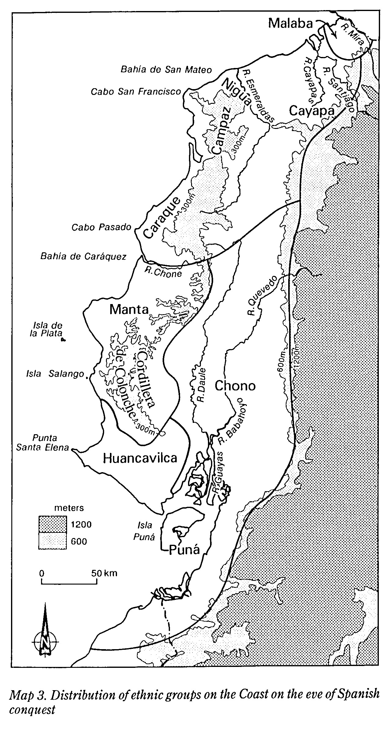
Pueblos
- MALABA
- CAYAPA
- NIGUA
- CAMPAZ
- CARANQUI
- MANTENO
- MILAGRO-QUEVEDO
- PUNA
Cita
Newson;Linda A. Life and Death In Early Colonial Ecuador. Norman: University of Oklahoma Press;1995. https://franklin.library.upenn.edu/catalog/FRANKLIN_9918959033503681
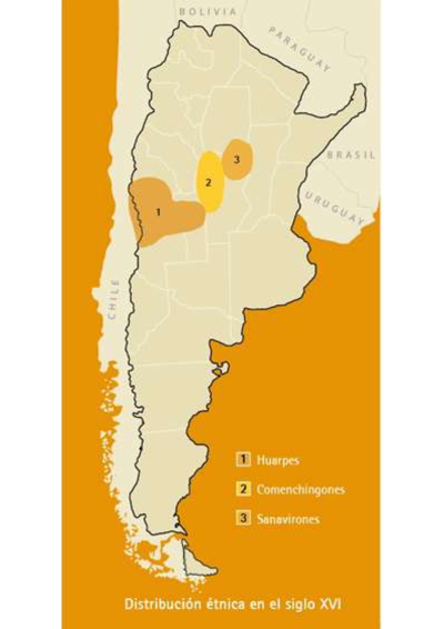
Distribución étnica en el siglo XVI
Mapa 1500 - 1599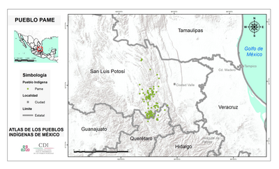
PUEBLO PAME
Mapa 2020![“O beijo” [El beso]](https://dnet8ble6lm7w.cloudfront.net/art/ABRA026.jpg)
“O beijo” [El beso]
Obra de Arte
Map representing the linguistic diversity that existed in Central America and the Gulf of Fonseca at the time of contact with the Spanish
Mapa 1522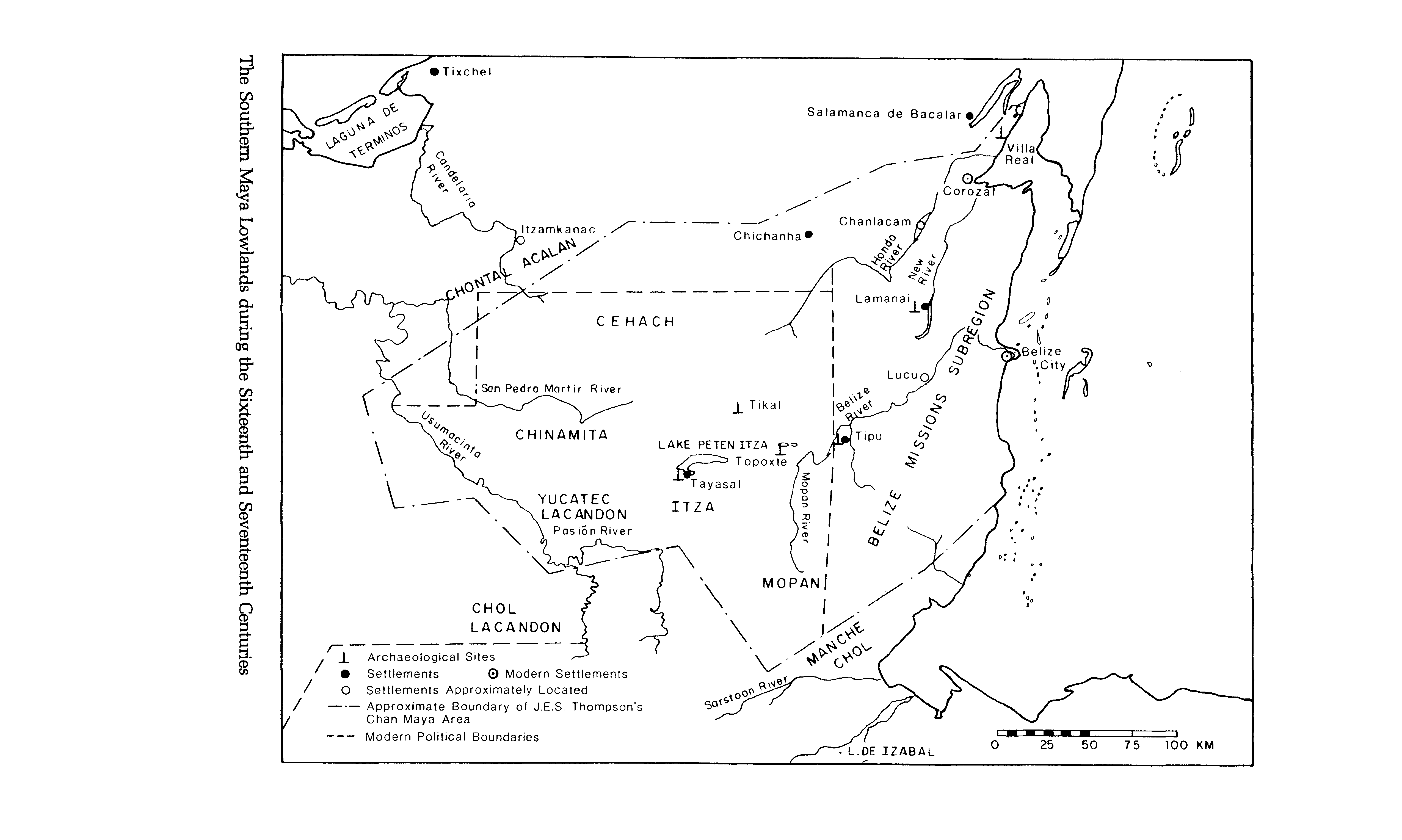
The Southern Maya Lowlands during the Sixteenth and Seventeenth Centuries
Mapa 1500 - 1700
Popoloca Region at Spanish Conquest
Mapa 1969
Mapa de las culturas indígenas en vísperas de la conquista española.
Mapa 1650 - 1750
Carte de la coste depuis la Rivière des Amazones jusques à l'Isle de Cayenne / Levée et présentée à Monseigneur le Comte de Pontchartrain Ministre et secrétaire d'Etat ;Par son très-humble et très-obeissant serviteur de Créanton Officier de Marine.
Mapa 1701