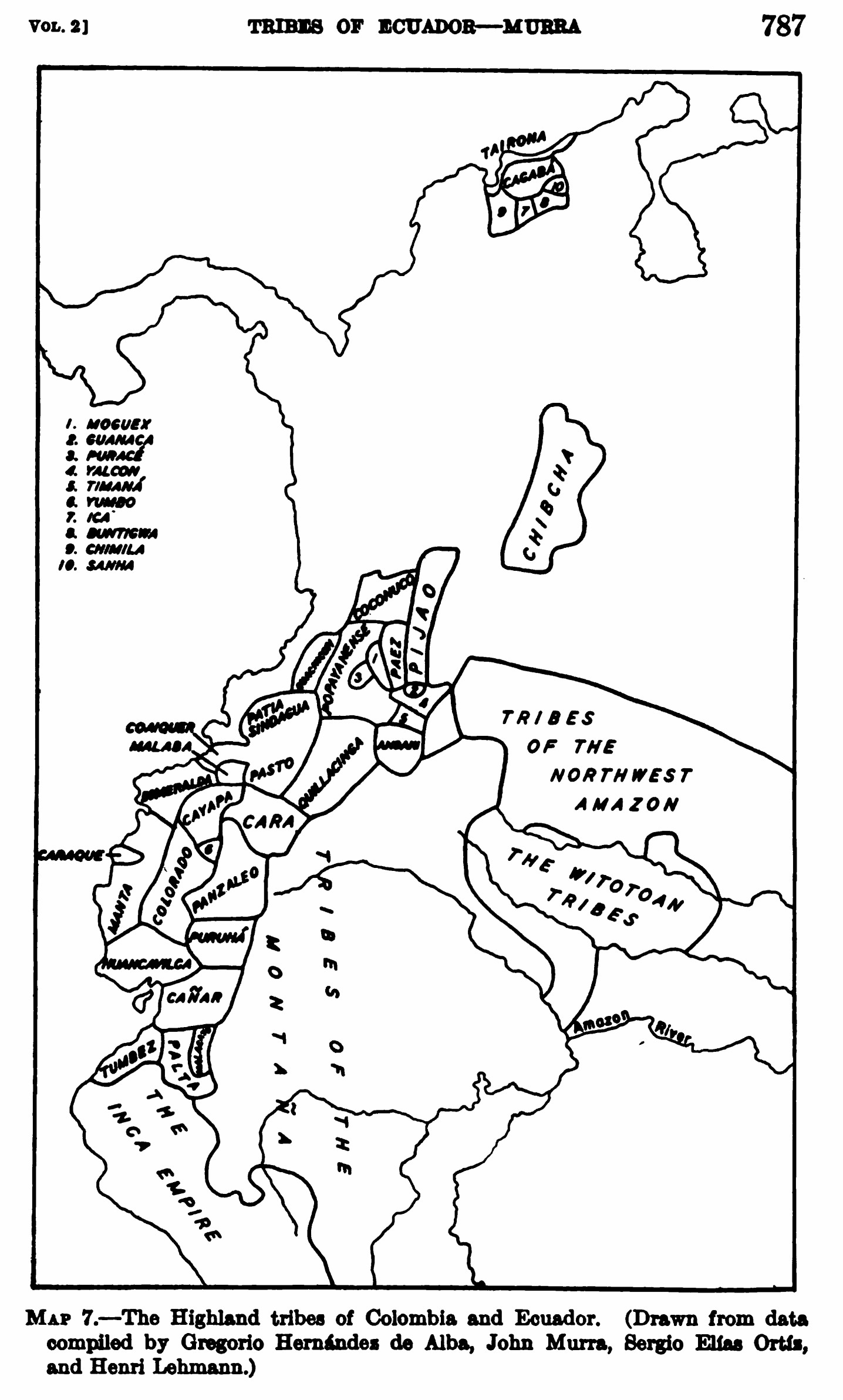
Pueblos
- KANARI
- TSACHILAS
- PURUHA
- PALTAS
Cita
Steward;Julian Haynes;Handbook of South American Indians: Volume 2. New York: Cooper Square Publishers;1963. pages 786-791 https://babel.hathitrust.org/cgi/pt?id=uva.x001436992&view=1up&seq=18&skin=2021
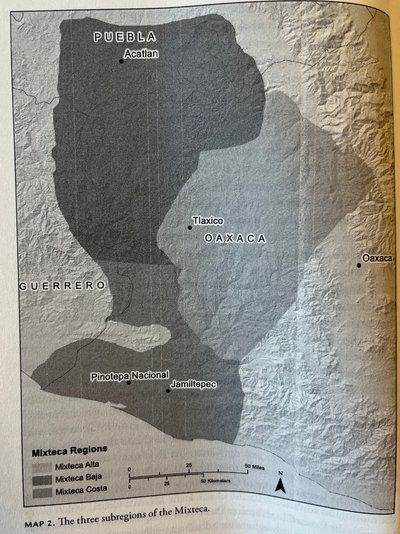
THE THREE SUBREGIONS OF THE MIXTECA
Mapa 1960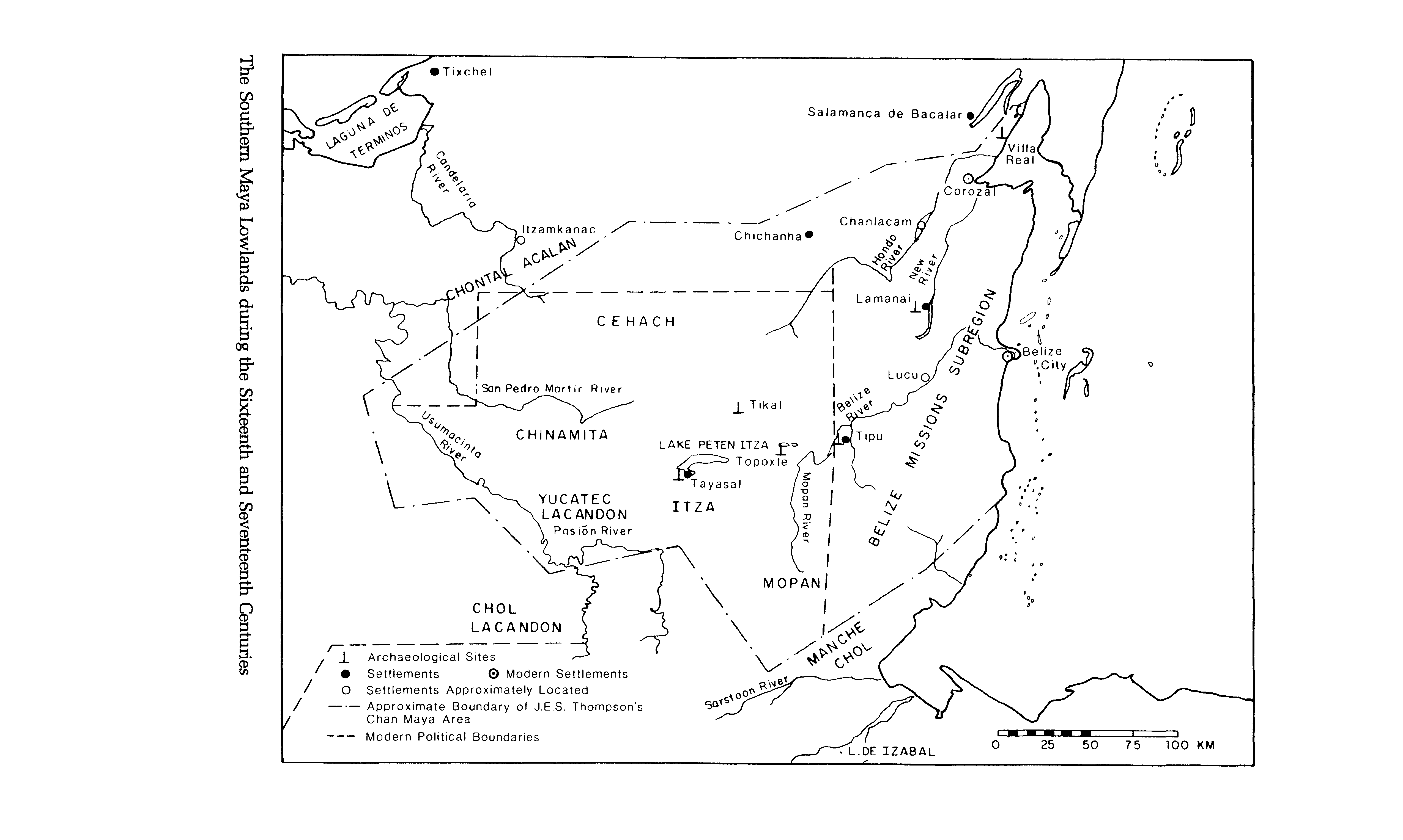
The Southern Maya Lowlands during the Sixteenth and Seventeenth Centuries
Mapa 1500 - 1700
SIDA / AIDS
Obra de Arte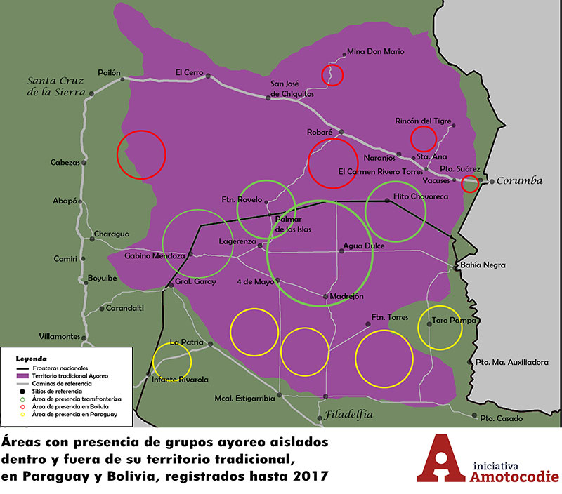
Áreas con presencia de grupos ayoreo aislados dentro y fuera de su territorio traditional, en Paraguay y Bolivia, registrados hasta 2017
Mapa 2017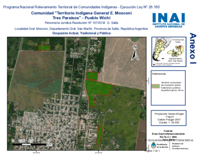
Comunidad "Territorio Indígena General E. Mosconi Tres Paraísos" - Pueblo Wichí
Mapa 2020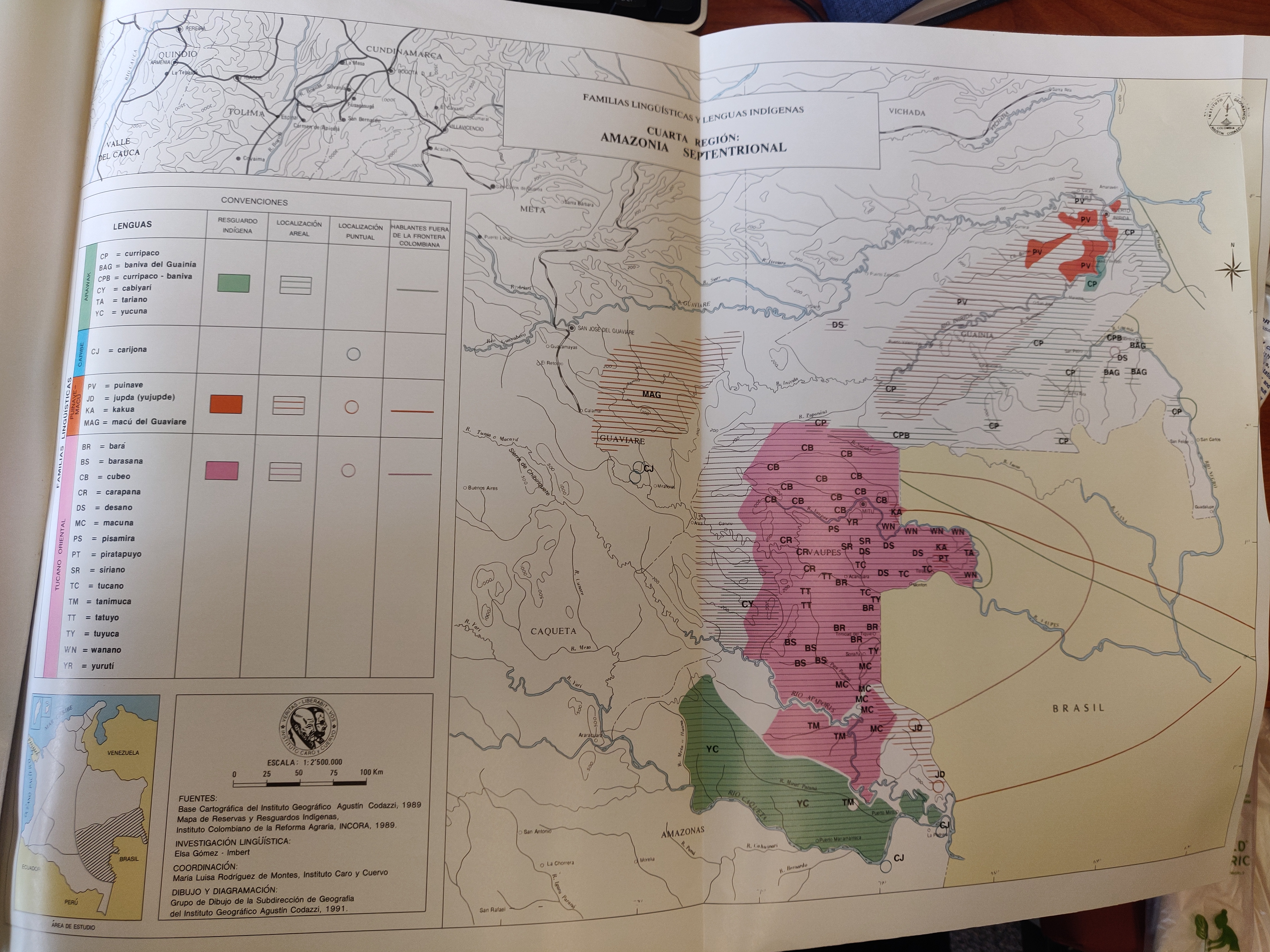
FAMILIAS LINGUÍSTICAS Y LENGUAS INDÍGENAS. CUARTA REGIÓN: AMAZONIA SEPTENTRIONAL
Mapa 1989![Tawahka homeland, 1916: Showing Río Wampú (Wanpo), Río Patuca (Butuk), Cerro Quigungun (Wangkibila Volc [anol]), and the first cartographical rendering of Krautara (Moravian Archives, Bethlehem, Pennsylvania, Heath 1916)](https://dnet8ble6lm7w.cloudfront.net/maps_sm/HON/HON0014.png)
Tawahka homeland, 1916: Showing Río Wampú (Wanpo), Río Patuca (Butuk), Cerro Quigungun (Wangkibila Volc [anol]), and the first cartographical rendering of Krautara (Moravian Archives, Bethlehem, Pennsylvania, Heath 1916)
Mapa 1916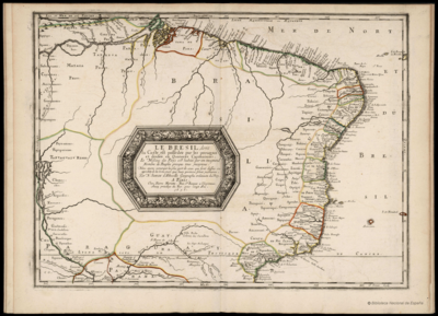
LE BRESIL, dont la Coste est posse dée par les portugais et divisée en Quatorze Capitanieries.
Mapa 1656