Pueblos
- ARAWAK
- LUCAYAN
Cita
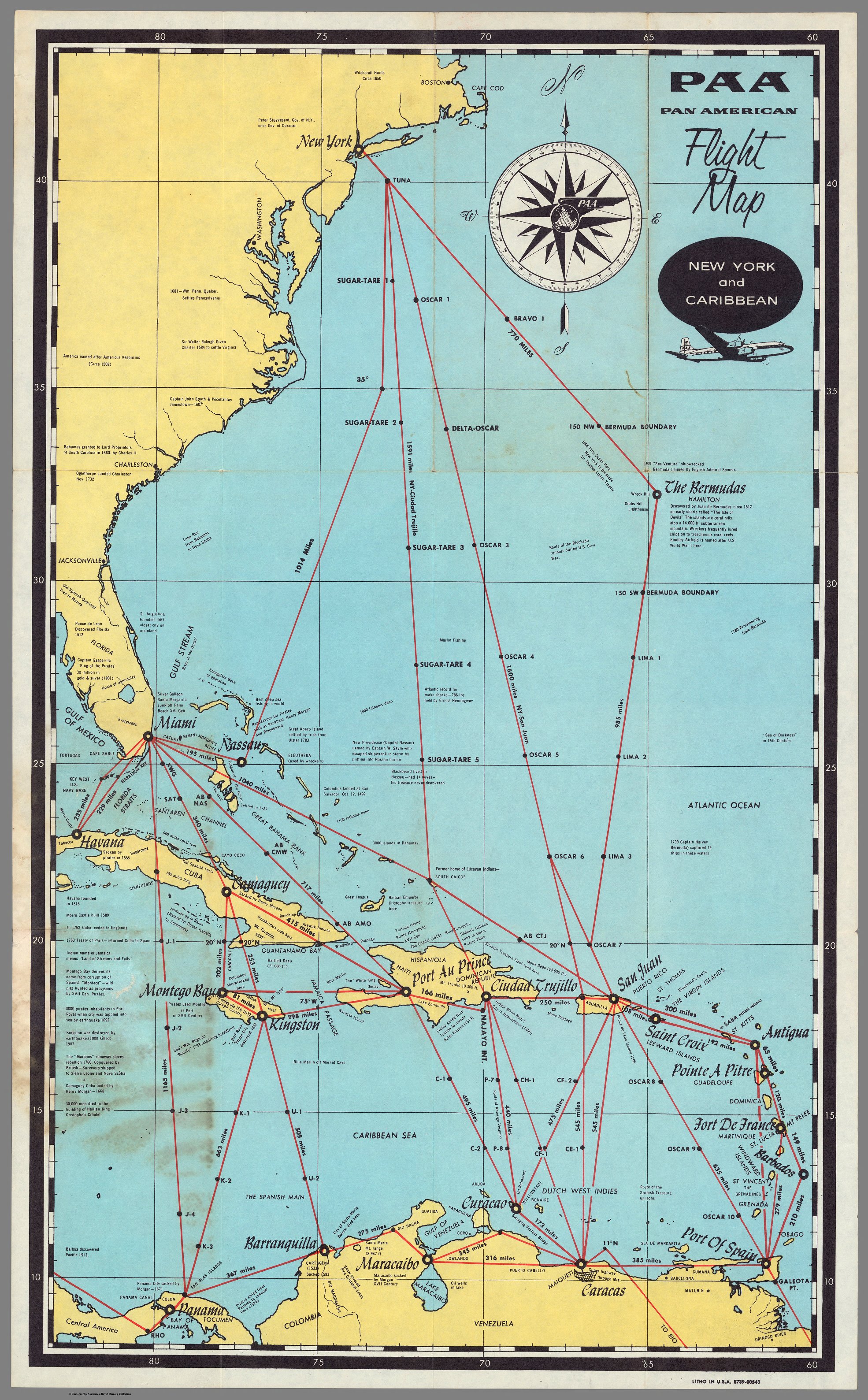
PAA. Pan American Flight Map. New York and Caribbean. David Rumsey Map Collection. Accessed, April 3, 2024. https://www.davidrumsey.com/luna/servlet/detail/RUMSEY~8~1~289778~90061599
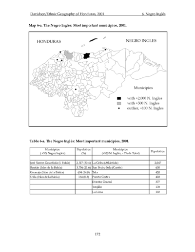
The Negro Inglés: Most important municipios, 2001
Mapa 2001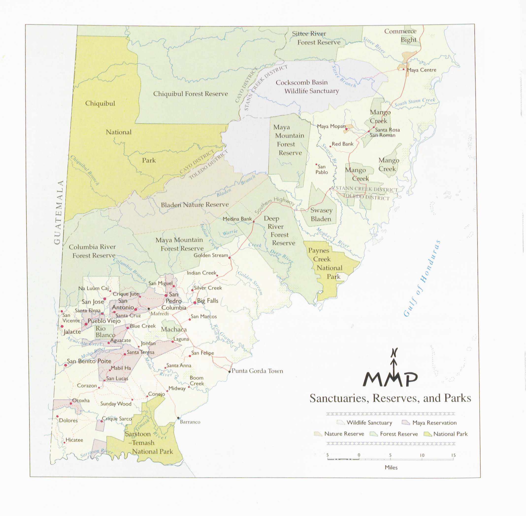
Sanctuaries Reserves and Parks
Mapa 1997
4. Ubicación de las comunidades indígenas y composición étnica de la región del Vaupés.
Mapa 2013
Signo de protesta II
Obra de Arte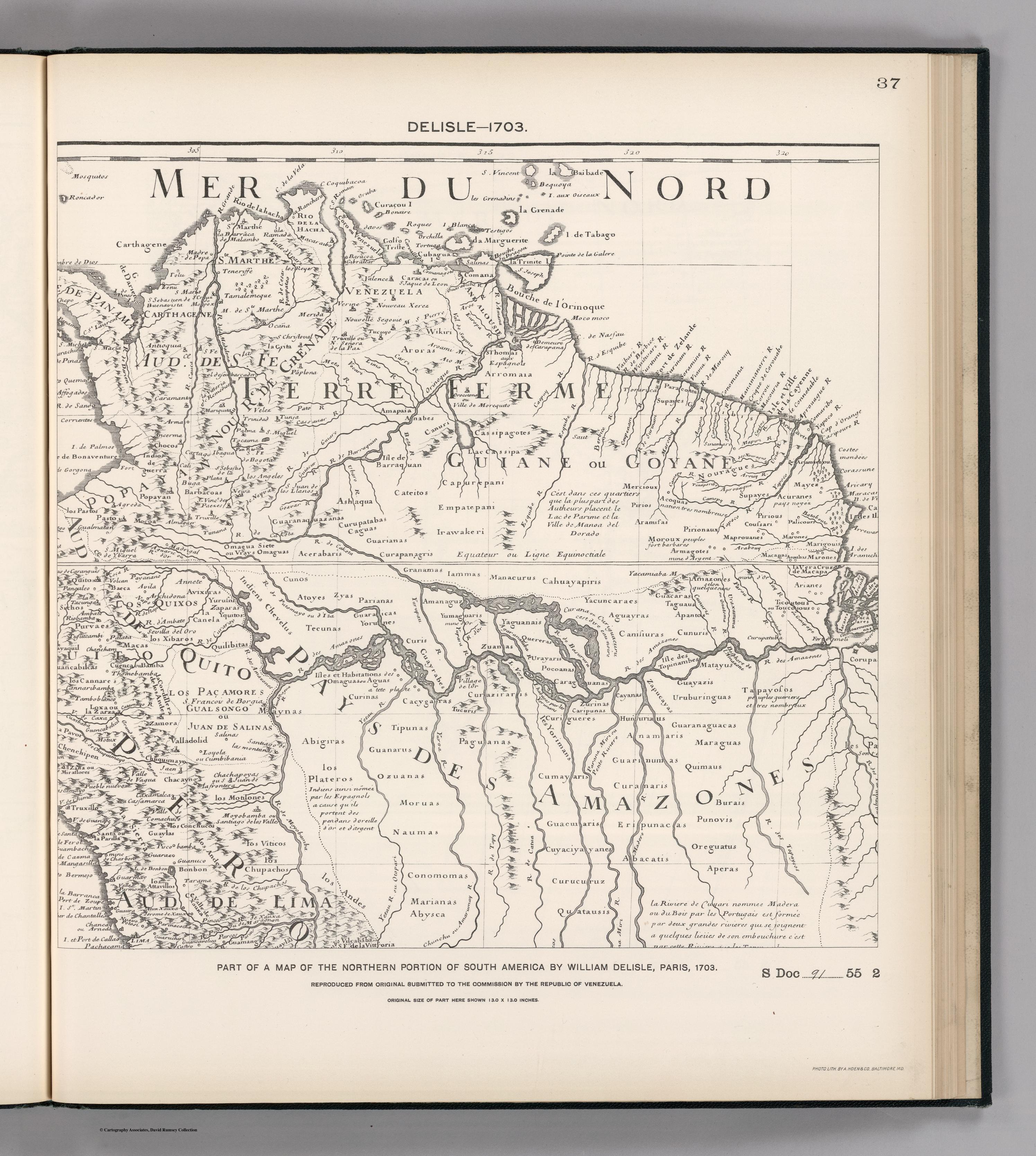
FACSIMILE: NORTHERN PORTION OF SOUTH AMERICA
Mapa 1703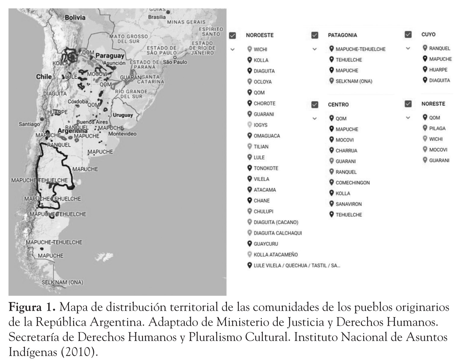
La problemática de los pueblos originarios en la Argentina y el impacto social de la gestión de los bosques nativos
Mapa 2018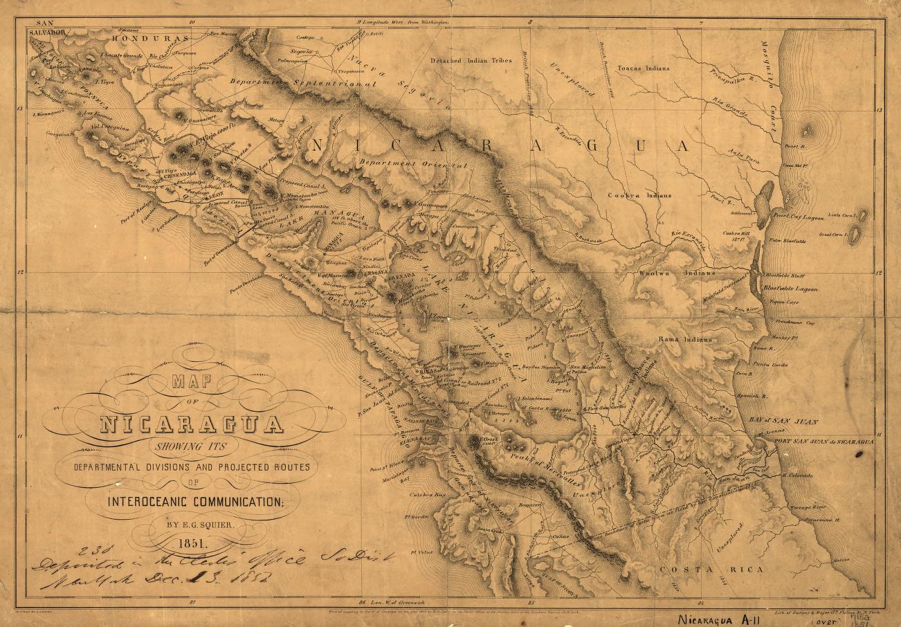
Map of Nicaragua showing departmental divisionsand projected routes of interoceanic communication.
Mapa 1851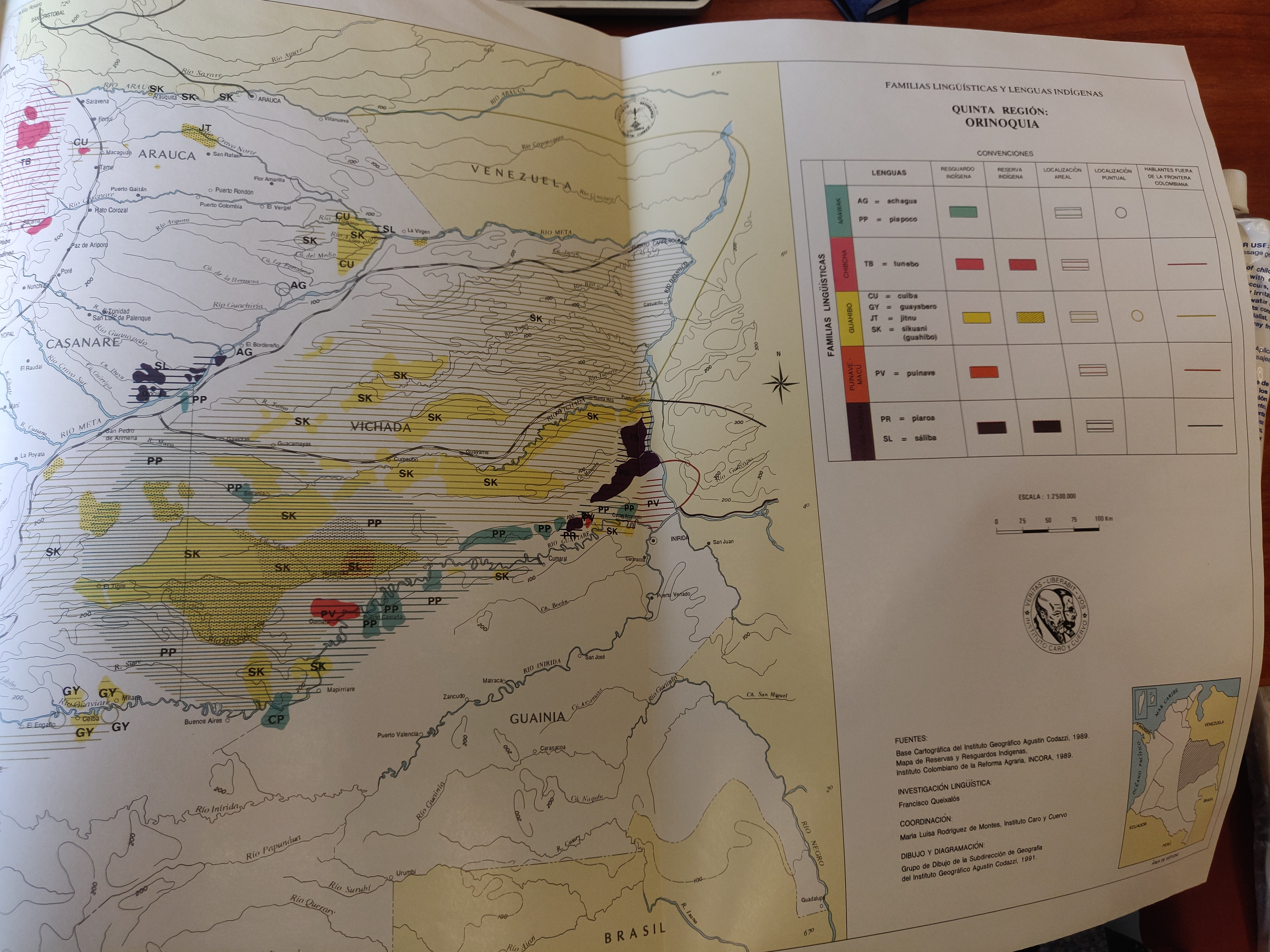
FAMILIAS LINGUISTICAS Y LENGUAS INDÍGENAS. QUINTA REGION: ORINOQUIA.
Mapa 1989