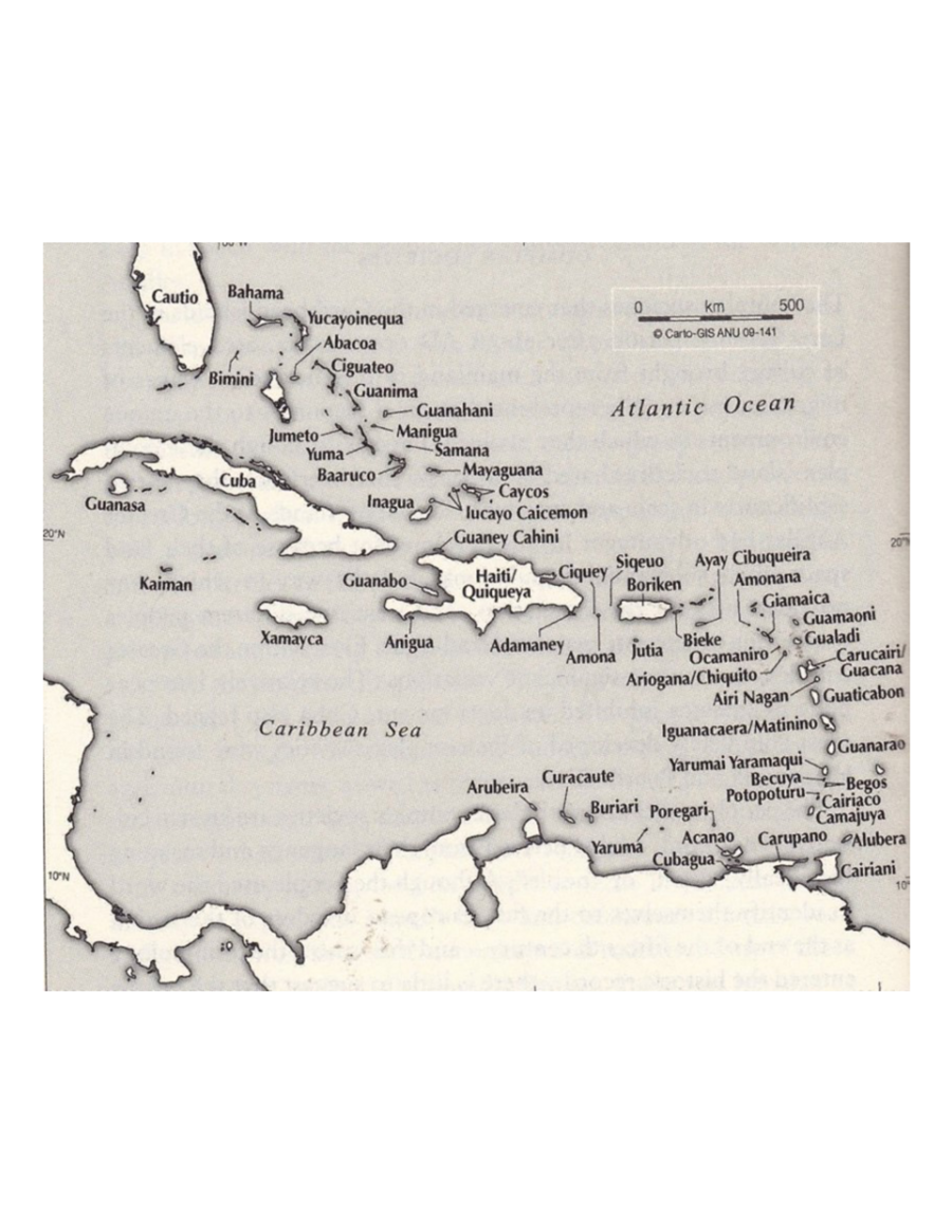
Pueblos
- TAINO
Cita
"Taino Names of the Caribbean Islands." Map. The Decolonial Atlas. February 2, 2015. Accessed March 31, 2021. https://decolonialatlas.wordpress.com/2015/02/02/taino-names-of-the-caribbean-islands/.
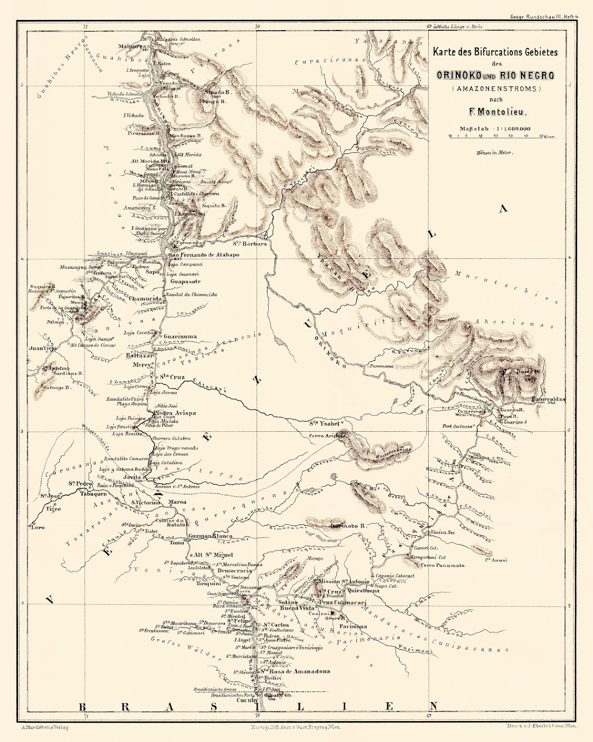
Karte des Bifurcations Gebietes des ORINOKO und RIO NEGRO (AMAZONENSTROMS)
Mapa 1881
CHARTE VON SÜD AMERICA;NACH ASTRONOMISCHEN BEOBACHTUNGEN;DEN BESTEN VORHANDENEN CHARTEN;UND DEN BERICHTEN DER MISSIONARIEN
Mapa 1803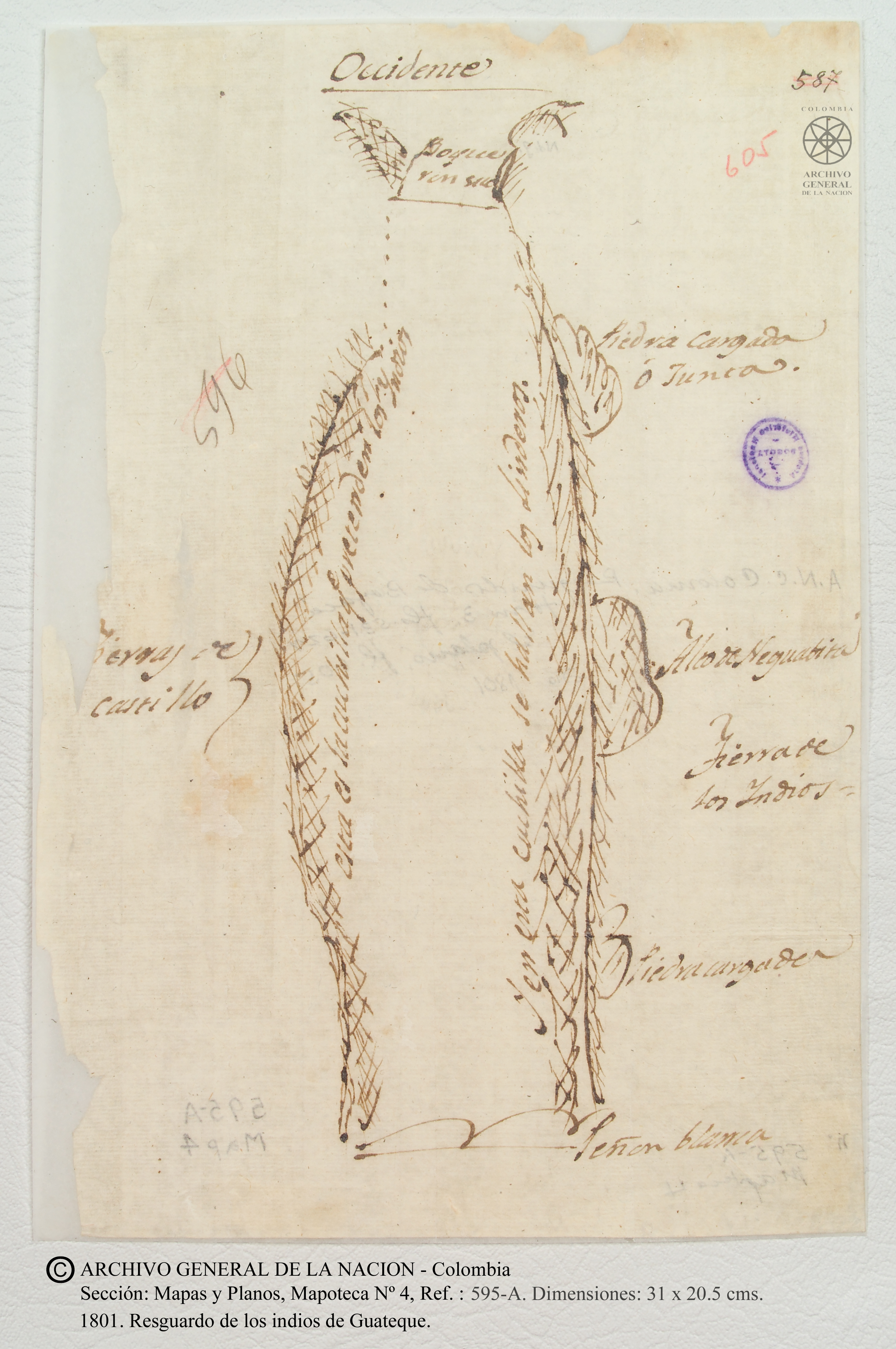
Resguardo de los indios de Guateque. Plano en trazo simple de la cuchilla que pretenden los indios. Corresponde al expediente seguido por los indios con Francisco Javier del Castillo, por deslinde de tierras
Mapa 1801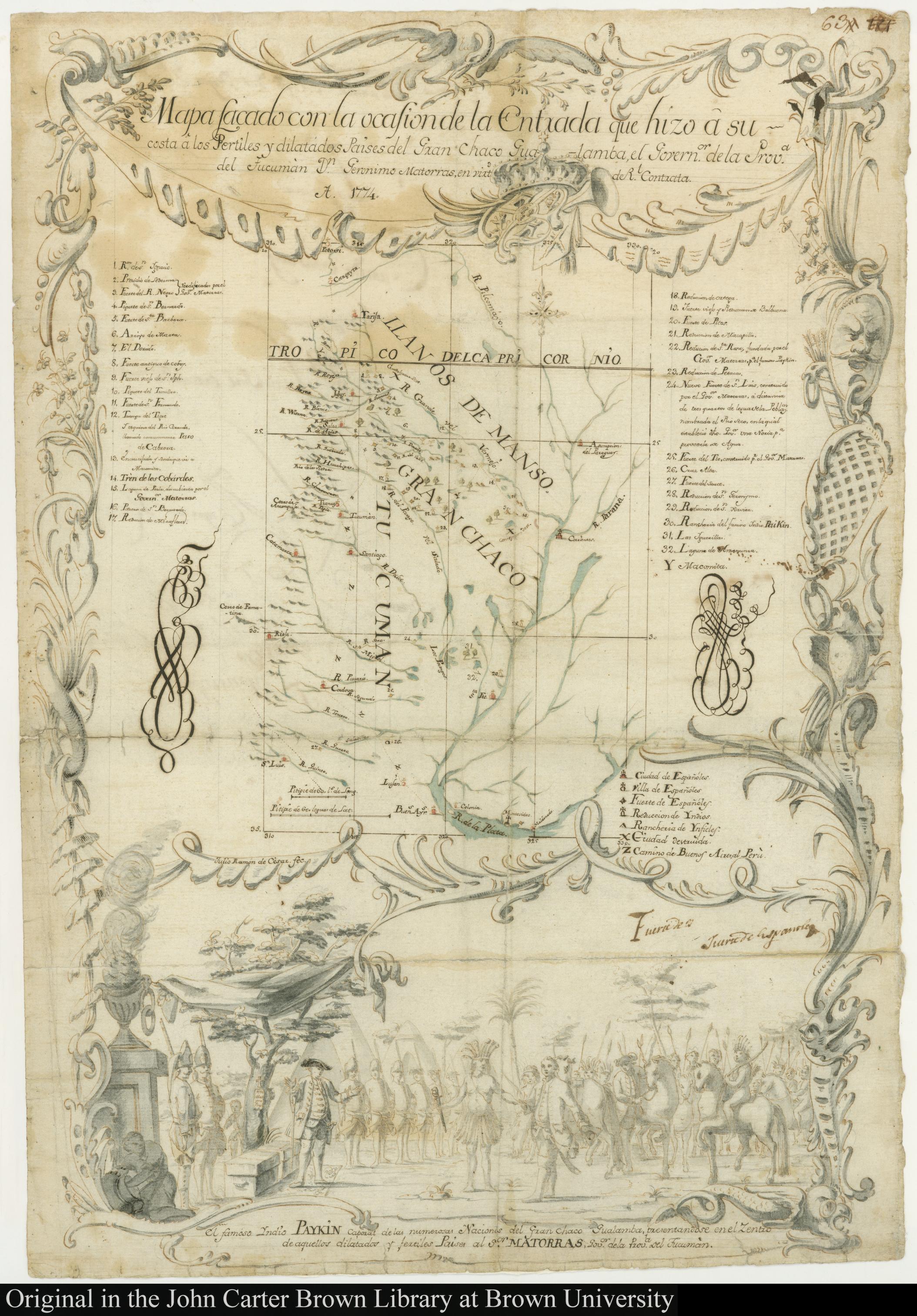
MAPA SACADO CON LA OCASION DE LA ENTRADA QUI HIZO Â SU COSTA Â LOS FERTILES Y DILATADOS PAISES DEL GRAN CHACO GUALAMBA
Mapa 1774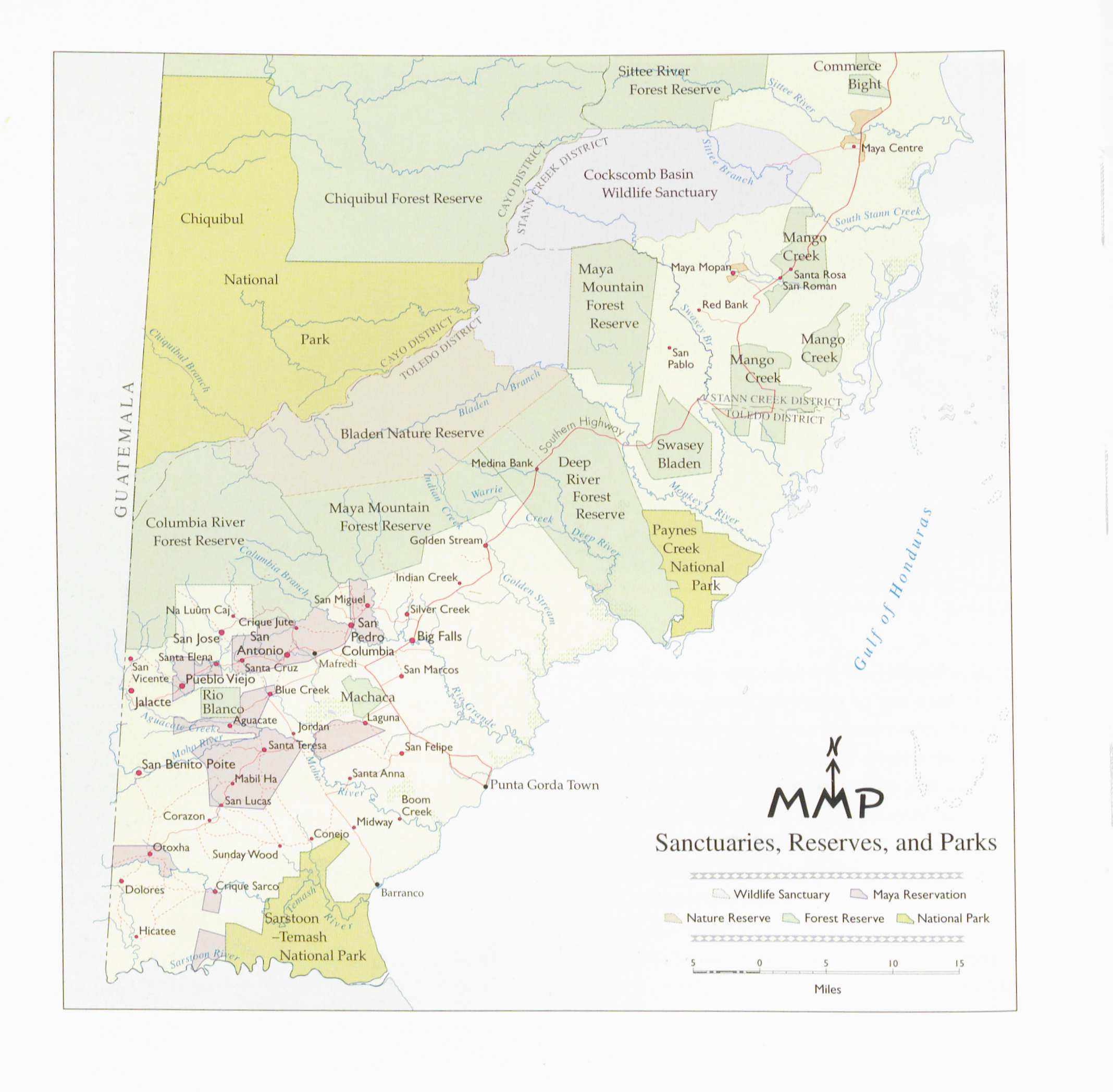
Sanctuaries Reserves and Parks
Mapa 1997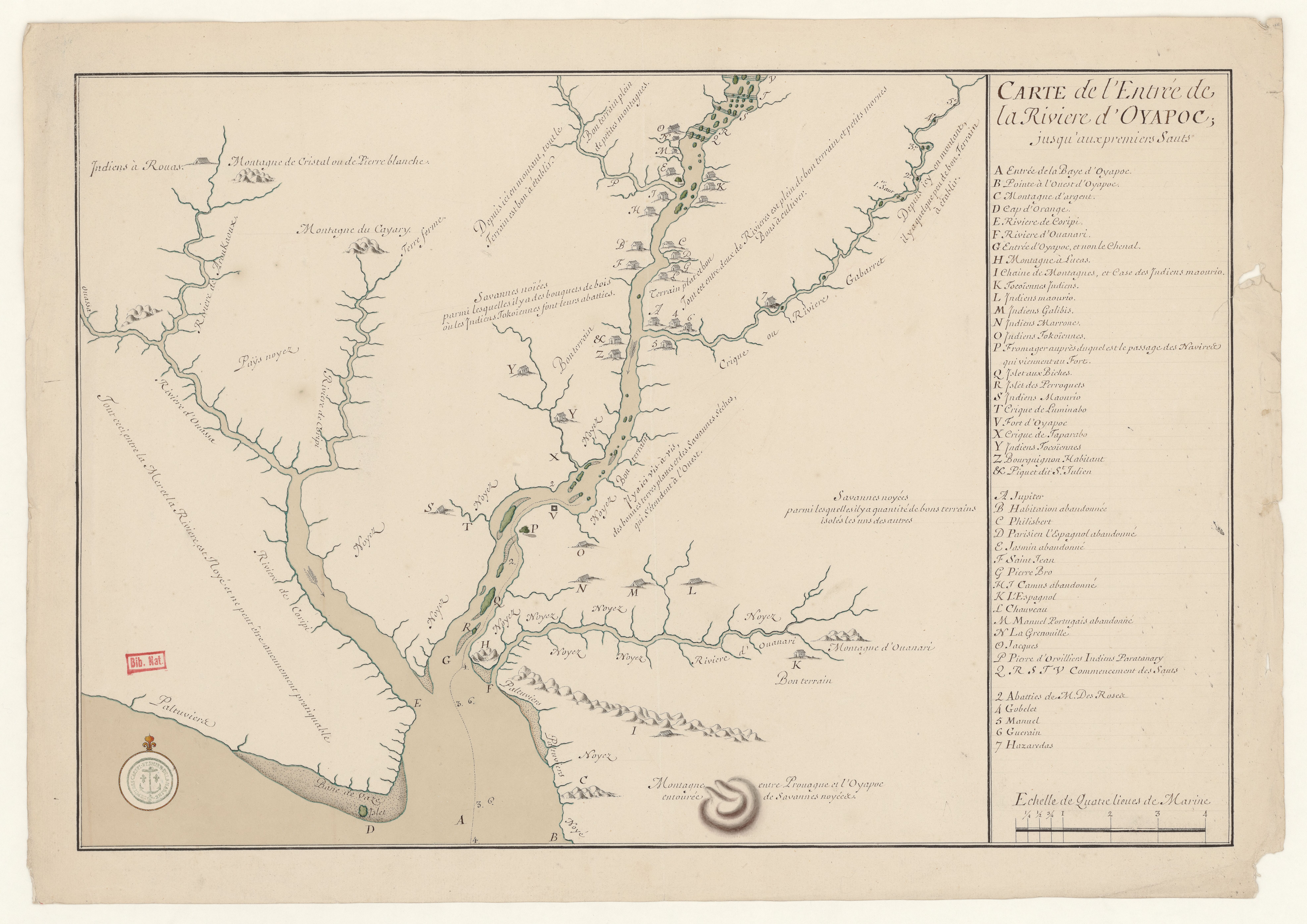
Carte de l'entrée de la Rivière d'Oyapoc jusqu'aux premiers sauts.
Mapa 1700 - 1799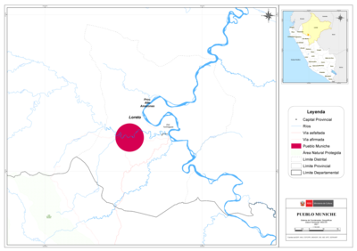
PUEBLO MUNICHE
Mapa 2021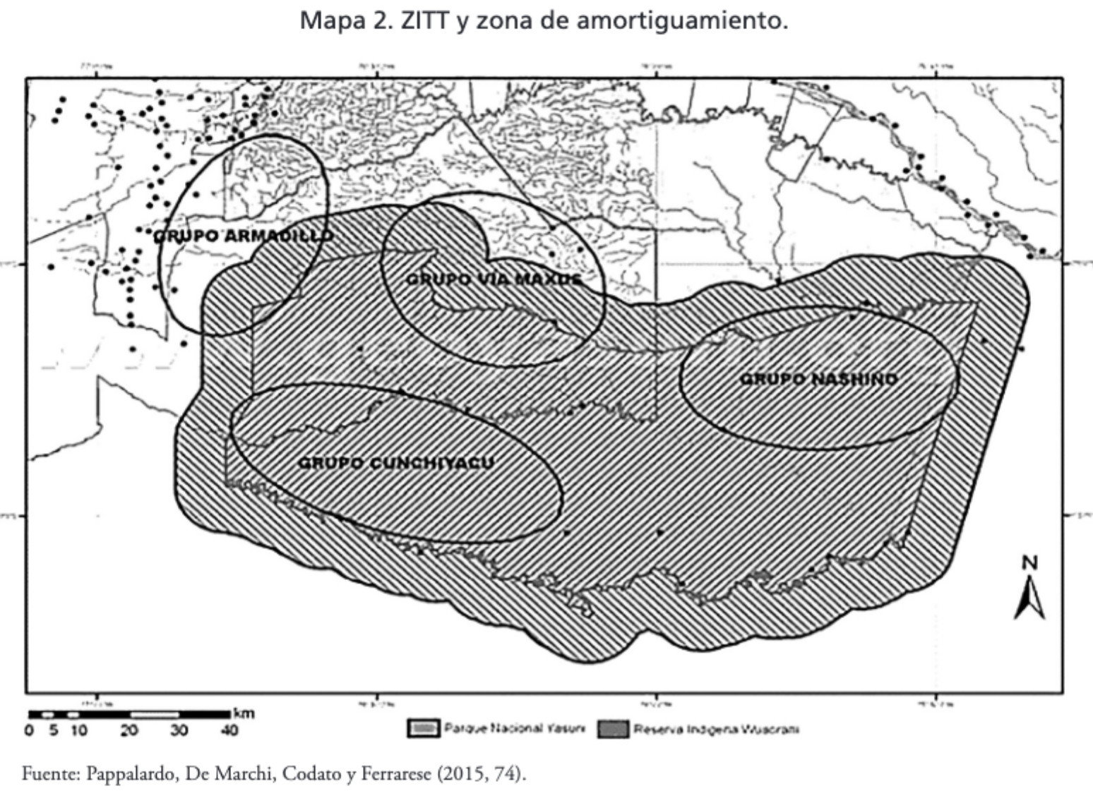
MAPA 2. ZITT Y ZONA DE AMORTIGUAMIENTO.
Mapa 2015