Dispossesions in the Americas

Dispossesions in the Americas

  • Inicio
  • Explorar
  • Autores
  • Sobre
  • Arte
  • Cuerpos
  • Planes de Estudio
  • Herencia Cultural
  • Mapas
  • Territorios
Volver a Explorar

Leyendo en Inglés

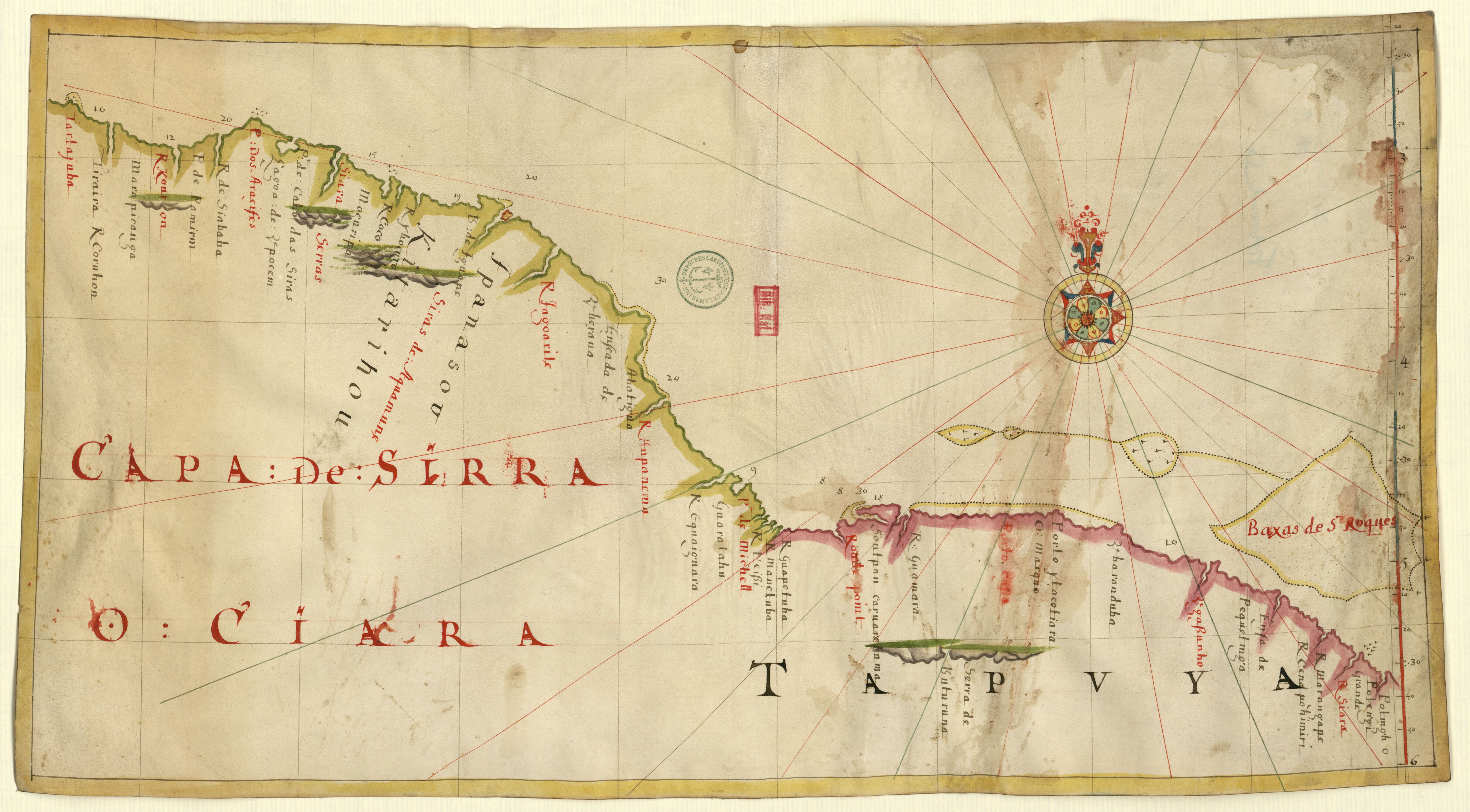
Mapa 2010

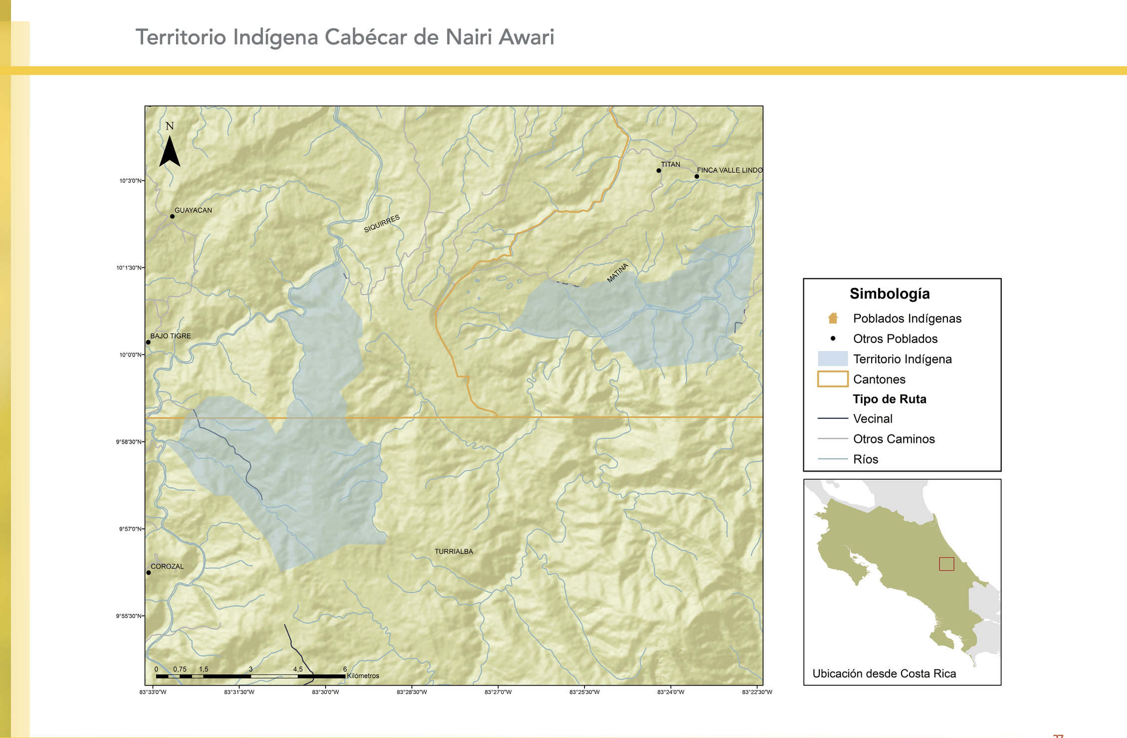
"Territorio Indígena Cabécar de Nairi Awari"

  • GÓMEZ ET AL.

Publicado: 2014

  • Descargar Imágen
  • Descargar Imágen
Mapa 2010

"Territorio Indígena Cabécar de Nairi Awari"

  • GÓMEZ ET AL.

Publicado: 2014

  • Descargar Imágen

Pueblos

  • CABECAR DE NAIRI AWARI

Citas

Gómez Meléndez, Agustín, Felipe González Evora, Heiddys García, Marco      Espinoza, and Fabián Solano Monge. Atlas de territorios      indígenas--Universidad de Costa Rica. Costa Rica: Universidad de Costa      Rica, 2014.         https://hdl.handle.net/10669/15100
  • Descargar Imágen

Artículos Relacionados

CARTE ITINÉRAIRE DU COURS DE L’ORÉNOQUE;DE L’ATABAPO;DU CASIQUIARE;ET DU RIO NEGRO OFFRANT la bifurcation de l’Orénoque et sa communication avec la Rivière des Amazones

CARTE ITINÉRAIRE DU COURS DE L’ORÉNOQUE;DE L’ATABAPO;DU CASIQUIARE;ET DU RIO NEGRO OFFRANT la bifurcation de l’Orénoque et sa communication avec la Rivière des Amazones

Mapa 1802
Plano del castillo de San Ildefonso, a orillas del río Paraguay

Plano del castillo de San Ildefonso, a orillas del río Paraguay

Mapa 1600 - 1650
GUARANÍ ÑANDÉVA

GUARANÍ ÑANDÉVA

Mapa 2015
Mapa de las tierras indígenas - Situación legal

Mapa de las tierras indígenas - Situación legal

Mapa 2017
Carte de la Guïane françoise ou du gouvernement de Caïenne depuis le Cap de Nord jusqu'àla rivière de Maroni inclusivement.

Carte de la Guïane françoise ou du gouvernement de Caïenne depuis le Cap de Nord jusqu'àla rivière de Maroni inclusivement.

Mapa 1729
CAMINOS DEL KUWAI

CAMINOS DEL KUWAI

Mapa 1399
Linguistic Map of Southern Mexican Highlands and Adjacent Regions at Contact Period

Linguistic Map of Southern Mexican Highlands and Adjacent Regions at Contact Period

Mapa 1969
A Sequel of the Seat of War in the West Indies containing… Sub-map title: A large & accurate MAP of part of the Isthmus of Panama, taken from a Spanish drought exhibiting the Country adjacent to that City and Puerto Bello, with the Roads and Course of the River CHAGRE, by which the Treasure of the South Sea is conveyed a cross the Isthmus

A Sequel of the Seat of War in the West Indies containing… Sub-map title: A large & accurate MAP of part of the Isthmus of Panama, taken from a Spanish drought exhibiting the Country adjacent to that City and Puerto Bello, with the Roads and Course of the River CHAGRE, by which the Treasure of the South Sea is conveyed a cross the Isthmus

Mapa 1740

Despojos en las Américas

Un Proyecto de

University of Pennsylvania

Copyright 2024

Con el apoyo de

Mellon Foundation

Diseño y Desarrollo del Sitio

Element 84

Créditos Artísticos

Gómez Meléndez, Agustín, Felipe González Evora, Heiddys García, Marco      Espinoza, and Fabián Solano Monge. Atlas de territorios      indígenas–Universidad de Costa Rica. Costa Rica: Universidad de Costa      Rica, 2014.         https://hdl.handle.net/10669/15100
Páginas del Sitio

  • Inicio
  • Explorar
  • Autores
  • Sobre
  • Arte
  • Cuerpos
  • Planes de Estudio
  • Herencia Cultural
  • Mapas
  • Territorios