Pueblos
- SOMBRERILLO
Cita
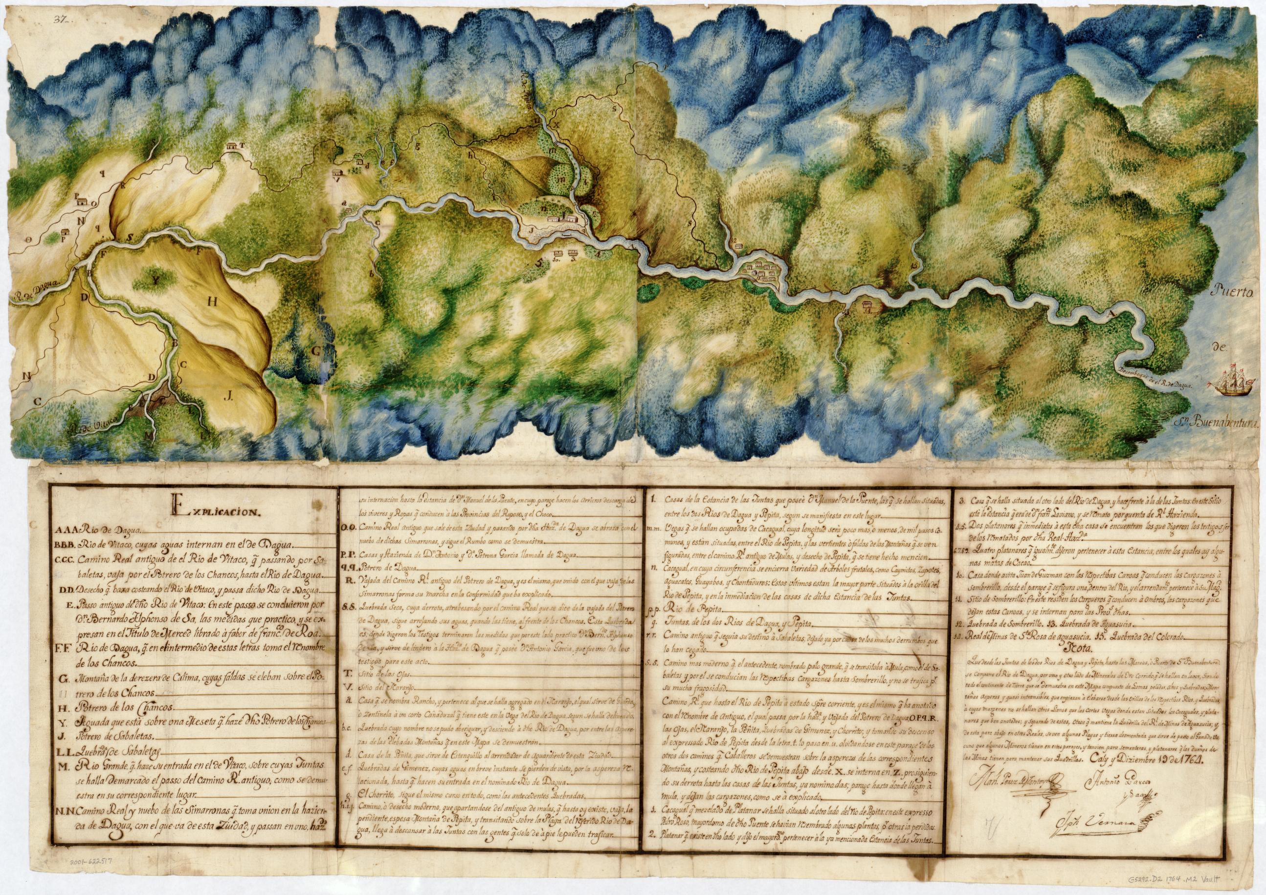
MANUEL PEREZ DE MONTOYA;ANTONIO GARCES Y SAAZ;JOSEPH VERNAZA. Manuscript Map of the Dagua River Region. Library of Congress Geography and Map Division Washington, D.C. 1764. - Call Number/Physical Location: G5292.D2 1764 .M2 https://www.loc.gov/resource/g5292d.ct001464/?st=image&r=0.23,0.154,0.492,0.193,0