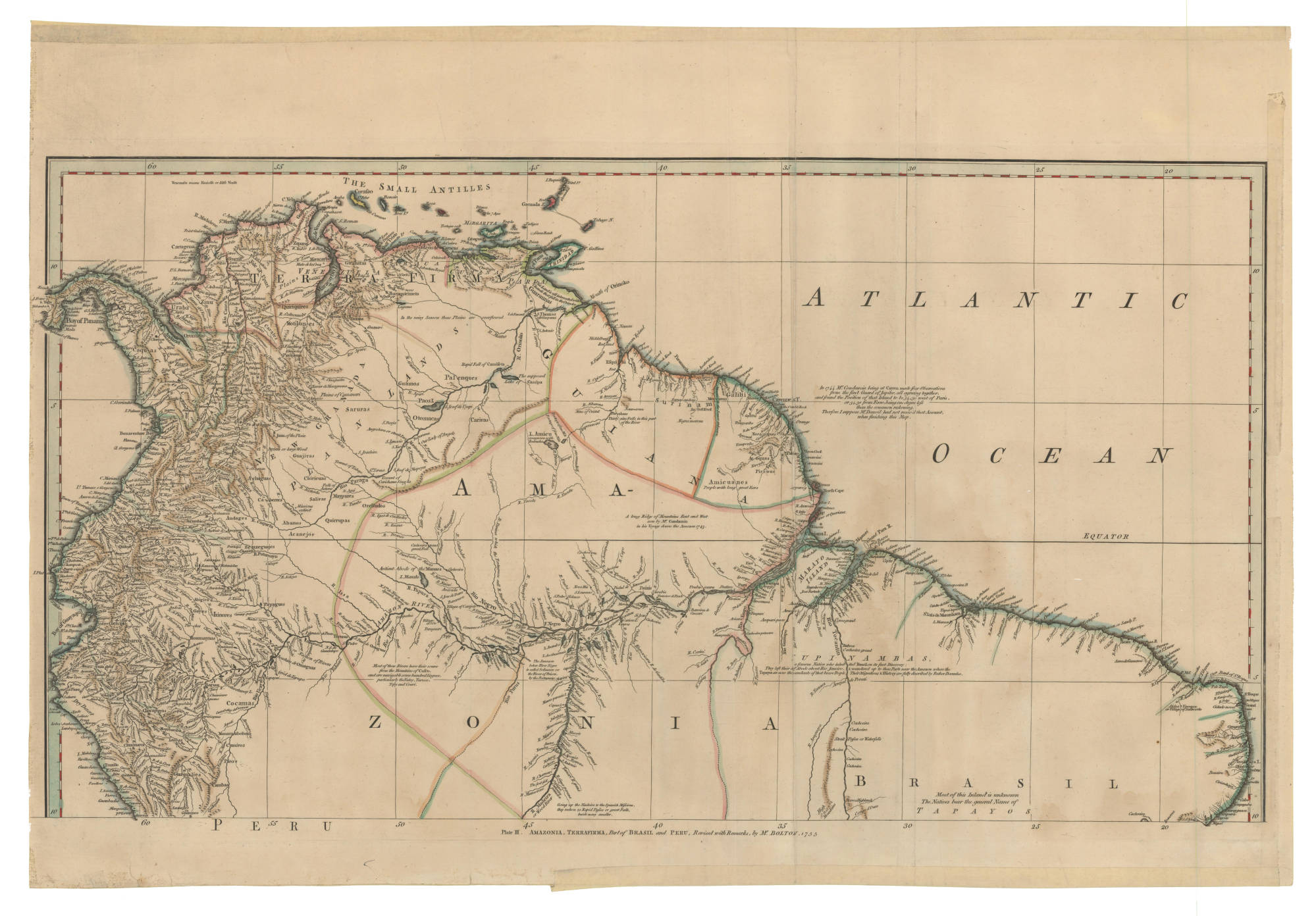
Dispossesions in the Americas

Dispossesions in the Americas

  • Inicio
  • Explorar
  • Autores
  • Sobre
  • Arte
  • Cuerpos
  • Planes de Estudio
  • Herencia Cultural
  • Mapas
  • Territorios
Volver a Explorar

Leyendo en Inglés

Mapa 1800 - 1899

Outlines of the physical and political division of South America: Delineated by A. Arrowsmith partly from scarce and original documents, published before the year 1806 but principally from manuscript maps & surveys made between the years 1771 and 1806, corrected from accurate astronomical observations to 1810.

  • Arrowsmith, Aaron

Publicado: 1810

  • Descargar Imágen
  • Descargar Imágen
Mapa 1800 - 1899

Outlines of the physical and political division of South America: Delineated by A. Arrowsmith partly from scarce and original documents, published before the year 1806 but principally from manuscript maps & surveys made between the years 1771 and 1806, corrected from accurate astronomical observations to 1810.

  • Arrowsmith, Aaron

Publicado: 1810

  • Descargar Imágen

Pueblos

  • ABACACHIS
  • ACOQUAS
  • AMICOUANES
  • ANDIRASES
  • APAMAS
  • ARAPIYUS
  • ARARAS
  • ARINACOTOS
  • ARINOS
  • ARITUS
  • ARMABOUTOUS
  • ARUACAS
  • ATURAYOS
  • CARPINAS
  • CNDURISES
  • COPARIPUCUS
  • COUSSARIS
  • ENGAYABAS
  • GALIBIS
  • GUACANAYAS
  • KIRIKIRISCOTAS
  • MACUSIS
  • MAGUES
  • MAMAYANASES
  • MARAYUS
  • MAYEZ
  • PACAJAS
  • PALICOURS
  • PARABAYAS
  • PARAGUANAS
  • PIRIOUS
  • QUIMAUS
  • SAMUNDASES
  • TACUANHAS
  • TARUMAS
  • TOPINAMBAS
  • TUCAHUNOS
  • URUBAQUIS
  • YURUNAS

Citas

Arrowsmith, Aaron, South America 1. David Rumsay Map Collection. Accessed, August 4, 2023. https://www.davidrumsey.com/luna/servlet/detail/RUMSEY~8~1~26064~1110385:South-America-1-

  • Descargar Imágen

Artículos Relacionados

Desde adentro. Las comunidades originarias de la Argentina

Desde adentro. Las comunidades originarias de la Argentina

Mapa 1600
MÉXICO

MÉXICO

Mapa 2015
Toba-Maskoy

Toba-Maskoy

Mapa 2001
Languages of Northwest Mexico

Languages of Northwest Mexico

Mapa 1700
ANGAITÉ

ANGAITÉ

Mapa 2015
Población tohono o'otham (pápago) en 2010

Población tohono o'otham (pápago) en 2010

Mapa 2010
Geographisch-statistische und historische Charte von Guyana.

Geographisch-statistische und historische Charte von Guyana.

Mapa 1800 - 1899
SOUTH AMERICA - NORTHERN SECTION

SOUTH AMERICA - NORTHERN SECTION

Mapa 1923

Despojos en las Américas

Un Proyecto de

University of Pennsylvania

Copyright 2024

Con el apoyo de

Mellon Foundation

Diseño y Desarrollo del Sitio

Element 84

Créditos Artísticos

Arrowsmith, Aaron, South America 1. David Rumsay Map Collection. Accessed, August 4, 2023. https://www.davidrumsey.com/luna/servlet/detail/RUMSEY~8~1~26064~1110385:South-America-1-

Páginas del Sitio

  • Inicio
  • Explorar
  • Autores
  • Sobre
  • Arte
  • Cuerpos
  • Planes de Estudio
  • Herencia Cultural
  • Mapas
  • Territorios