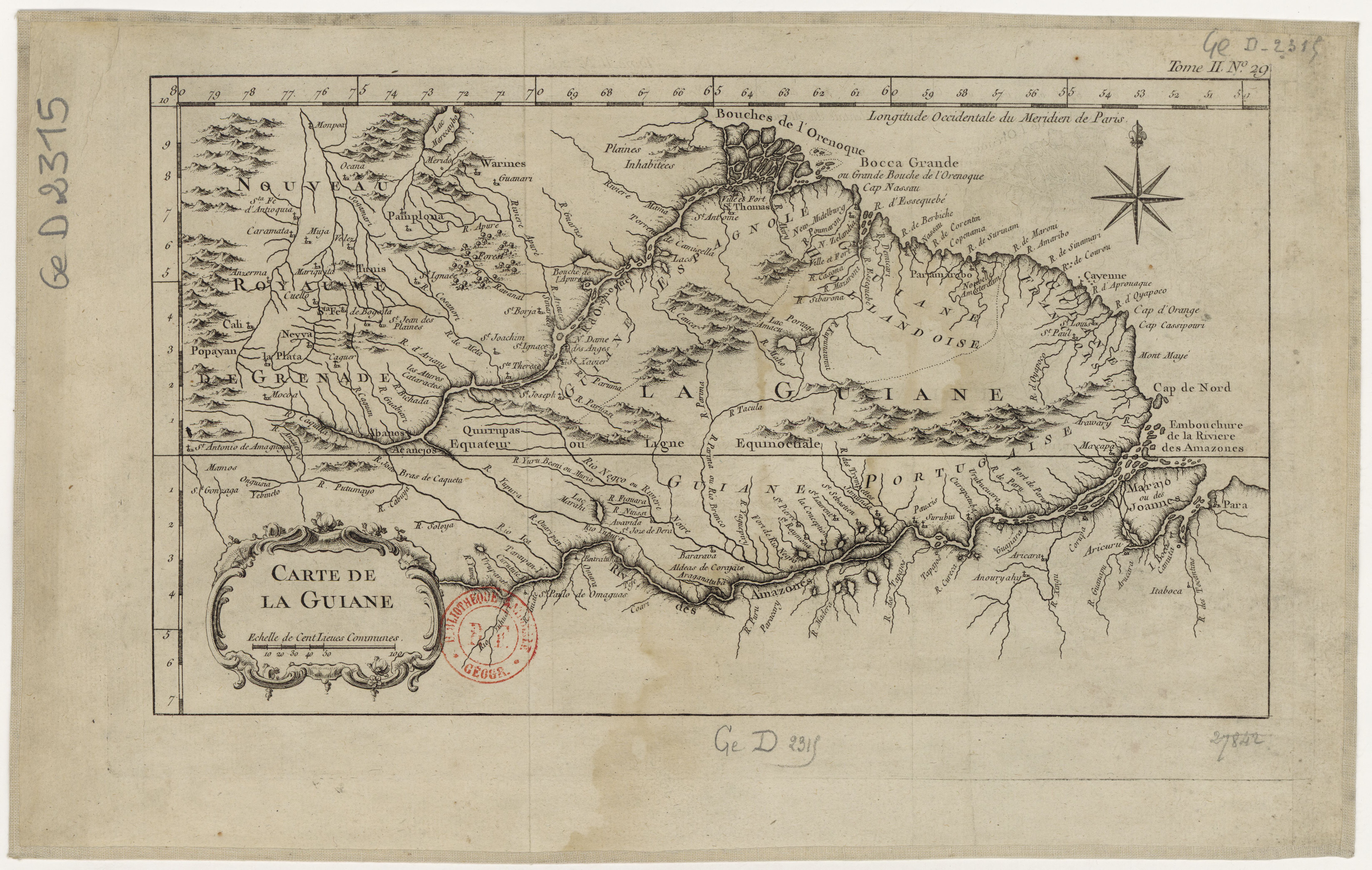
Pueblos
- ABANOS
- ACANEJOS
- QUIRRUPAS
- TUNIS
- WARINES
Cita
Bellin, Jacques Nicolas, Carte de la Guiane. Gallica. Last modified: August 5, 2013. Accessed, July 21, 2023. https://gallica.bnf.fr/ark:/12148/btv1b8596766t
![Haec pars Peruvianae, regiones Chicam & Chile[nsem]
complectitur, & Regionem](https://dnet8ble6lm7w.cloudfront.net/maps/ARG/ARG0063.jpg)
Haec pars Peruvianae, regiones Chicam & Chile[nsem] complectitur, & Regionem
Mapa 1551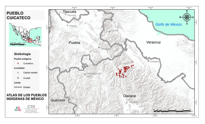
PUEBLO CUICATECO
Mapa 2020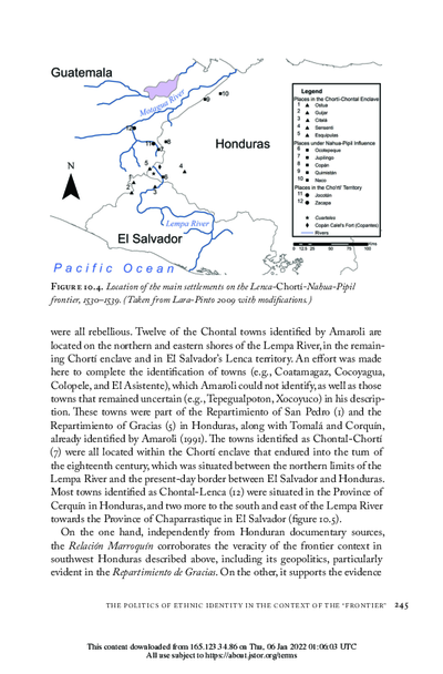
Location of the main settlements on the Lenca-Chortí-Nahua-Pipil frontier, 1530-1539. (Taken from Lara-Pinto 2009 with modifications.)
Mapa 1530 - 1539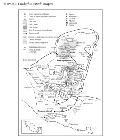
Ciudades-estado mayas
Mapa 709![[Embouchure de l'Oyapock].](https://dnet8ble6lm7w.cloudfront.net/maps/FGU/FGU0062.jpeg)
[Embouchure de l'Oyapock].
Mapa 1700 - 1799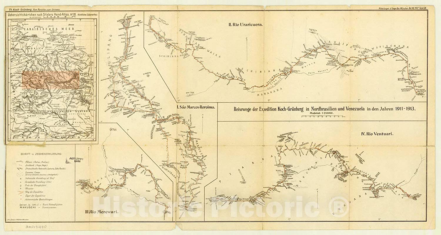
Expedition Koch-Grunberg in Nordbrasilien und Venezuela in den Jahren 1911-1913
Mapa 1911 - 1913
Xuchimilco. Distrito Federal, 1585
Mapa 1585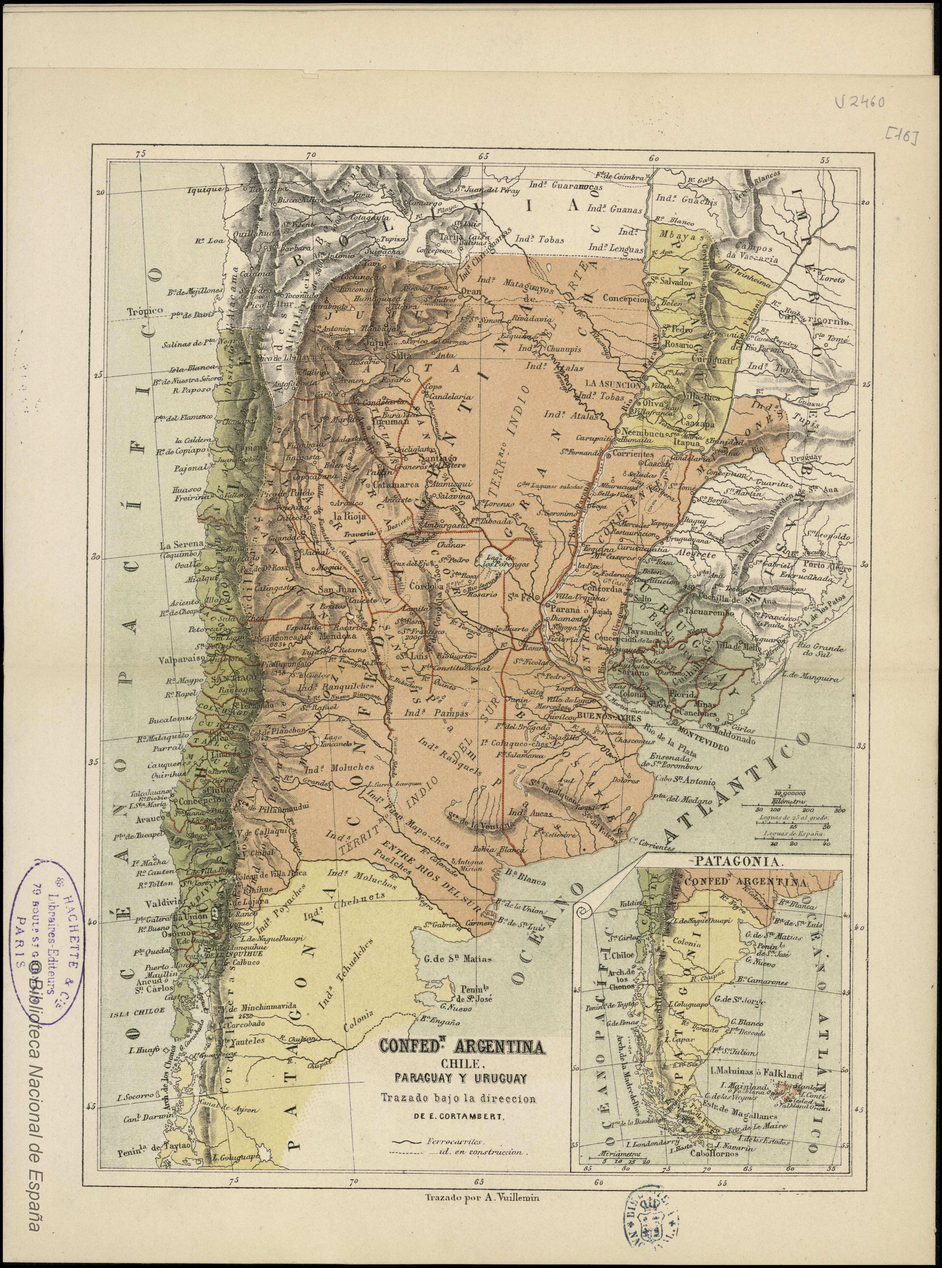
CONFED. ARGENTINA, CHILIE, PARAGUAY, Y URUGUAY.
Mapa 1850