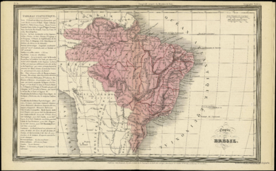
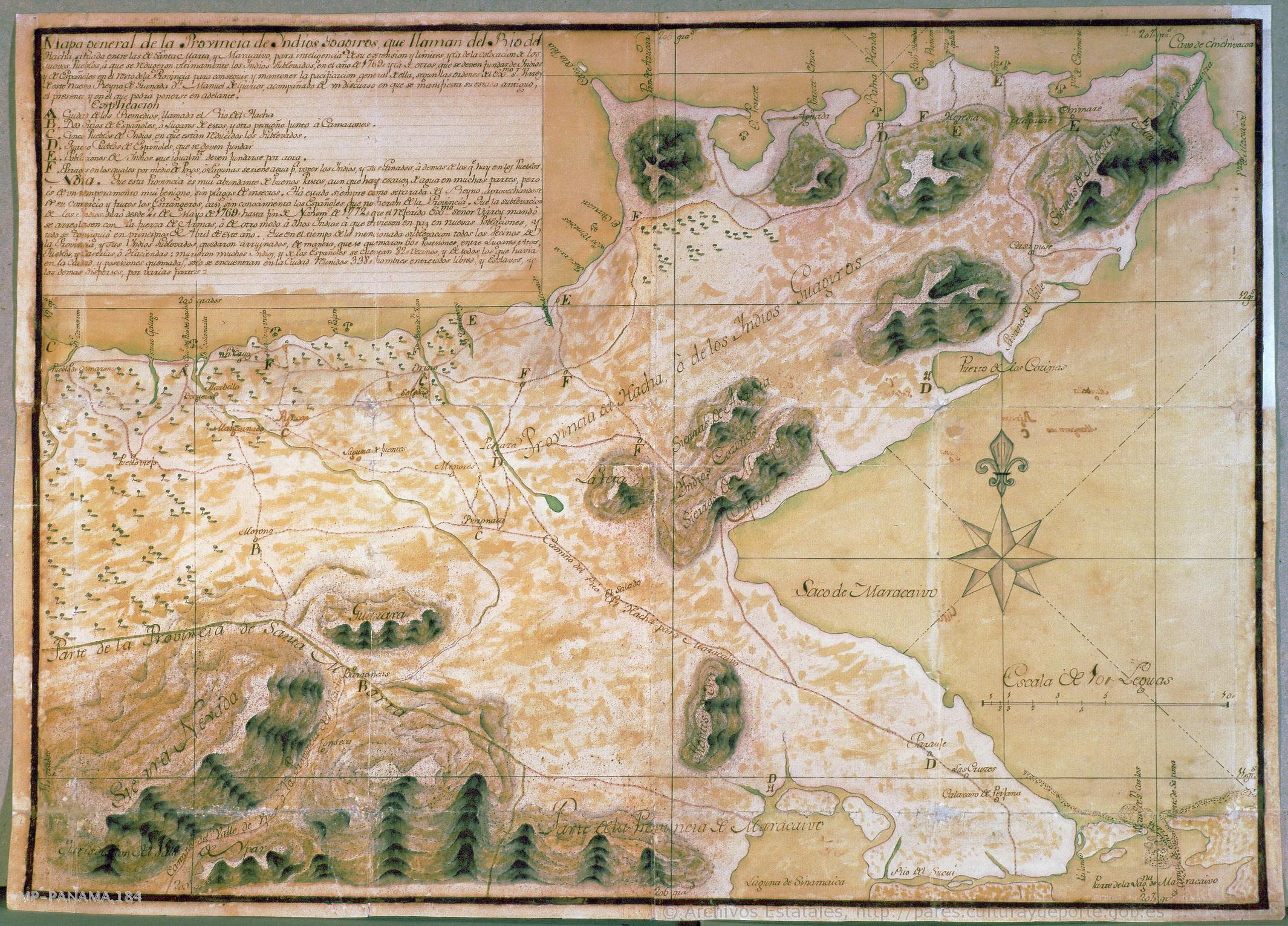
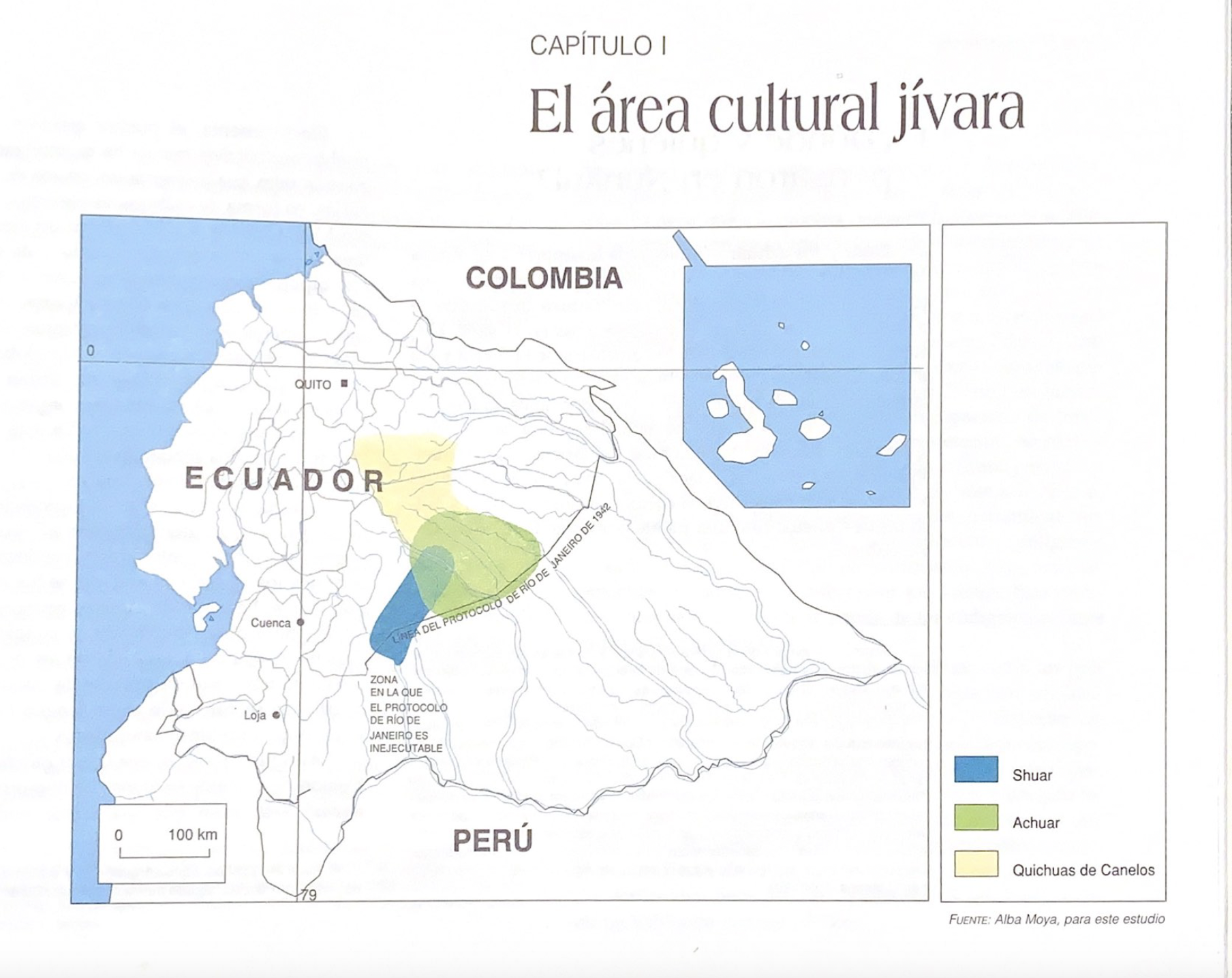
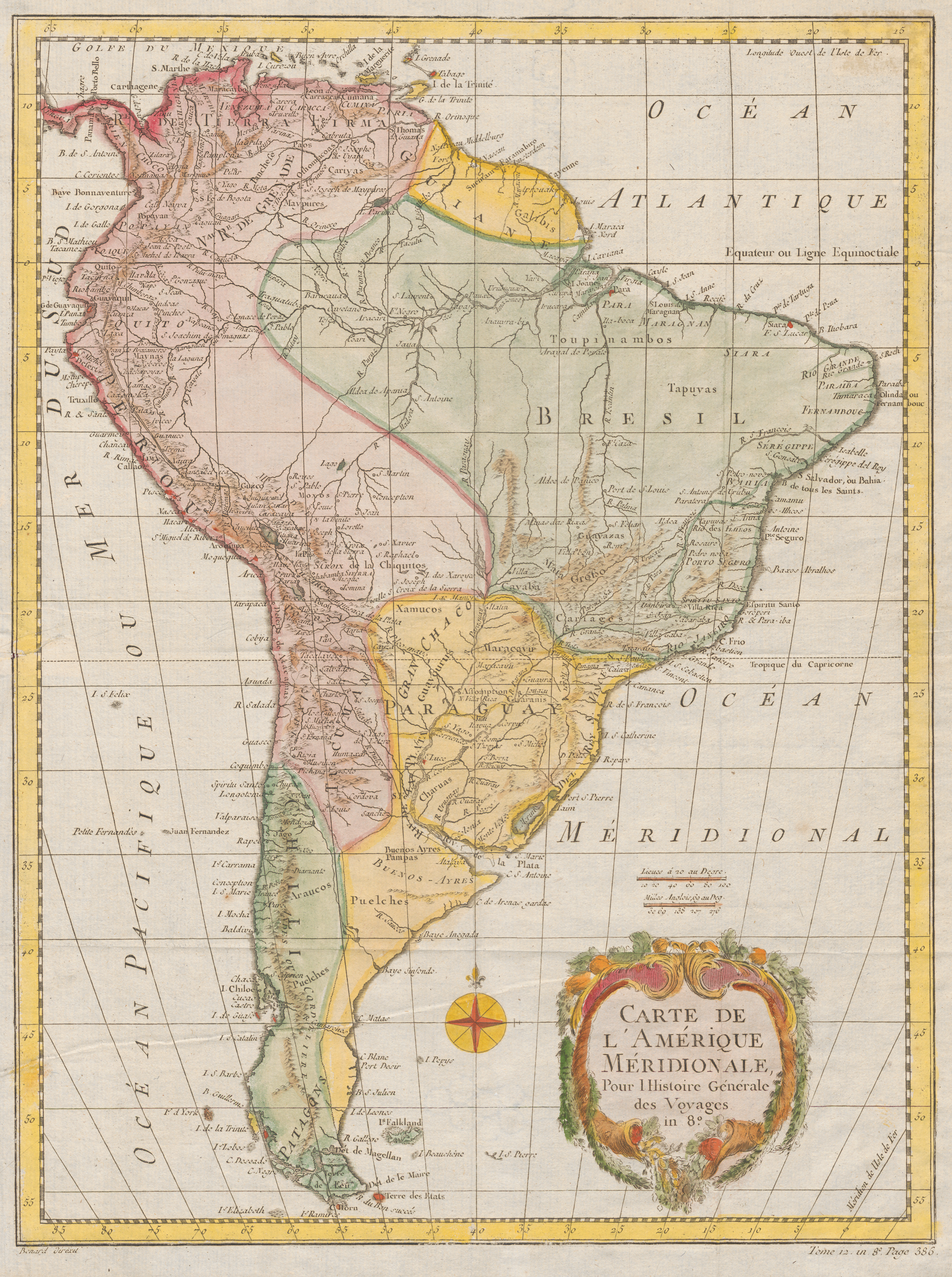
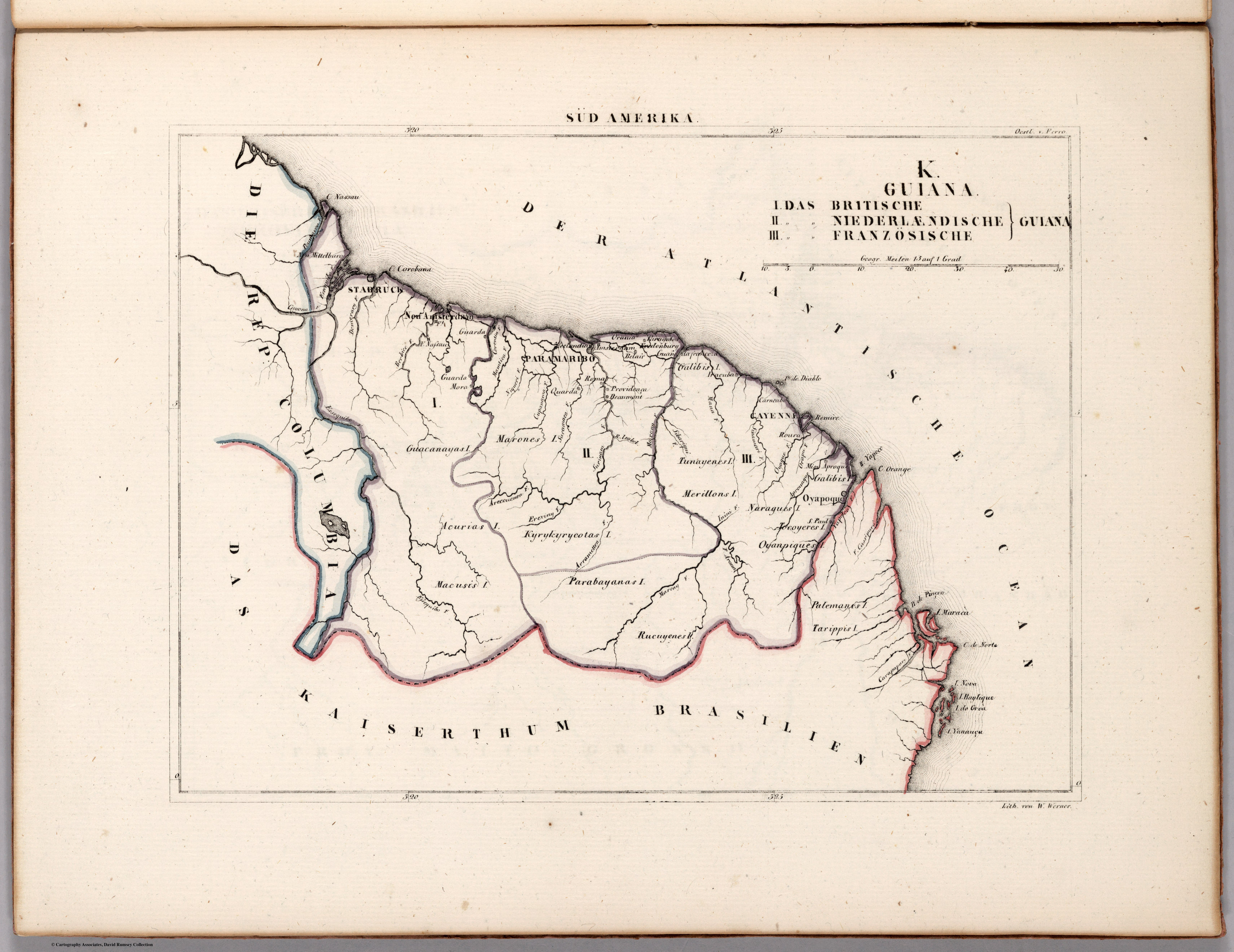
Dispossesions in the Americas

Dispossesions in the Americas

  • Inicio
  • Explorar
  • Autores
  • Sobre
  • Arte
  • Cuerpos
  • Planes de Estudio
  • Herencia Cultural
  • Mapas
  • Territorios
Volver a Explorar

Leyendo en Inglés

Mapa 1800 - 1899

K. GUIANA. I. DAS BRITISCHE, II. [DAS] NIEDERLAENDISCHE, III. [DAS FRANZÖSISCHE.]

  • Schlieben, Wilhelm Ernst August von

Publicado: 1830

  • Descargar Imágen
  • Descargar Imágen
Mapa 1800 - 1899

K. GUIANA. I. DAS BRITISCHE, II. [DAS] NIEDERLAENDISCHE, III. [DAS FRANZÖSISCHE.]

  • Schlieben, Wilhelm Ernst August von

Publicado: 1830

  • Descargar Imágen

Pueblos

  • ACURIAS
  • GALIBIS
  • GUACANAYAS
  • KYRYKYRYCOTAS
  • MACUSIS
  • MARONES
  • MERILLONS
  • NARAGUES
  • OYANPIQUES
  • PALEMANES
  • PARABAYANAS
  • RUCUYENES
  • TARIPPIS
  • TOCOYERES
  • TUNAYENES

Citas

Schlieben, Wilhelm Ernst August von, K. Guiana. David Rumsey Map Collection. Accessed: July 5, 2023. https://www.davidrumsey.com/luna/servlet/detail/RUMSEY~8~1~269902~90045191:K--Guiana

  • Descargar Imágen

Artículos Relacionados

"Pueblos Indígenas 1940 y Cacicazgos del Siglo XVI de Costa Rica"

"Pueblos Indígenas 1940 y Cacicazgos del Siglo XVI de Costa Rica"

Mapa 1500 - 1899
Carte de la Guyane française

Carte de la Guyane française

Mapa 1946
South America corrected from the observation communicated to the
     Royal Society"s of London & Paris by John Senex, at the Globe against St.
     Dunstans Church Fleetstreet.

South America corrected from the observation communicated to the Royal Society"s of London & Paris by John Senex, at the Globe against St. Dunstans Church Fleetstreet.

Mapa 1755
Carte 4: Le Pays Wayãpi : region Septentrionale

Carte 4: Le Pays Wayãpi : region Septentrionale

Mapa 1820 - 1860
Venezuela;cum parte Australi Novae Andalusiae

Venezuela;cum parte Australi Novae Andalusiae

Mapa 1630
Foodtopia: después de todo territorio

Foodtopia: después de todo territorio

Obra de Arte
A Map of the United and Independant Provinces of Venezuela and New Grenada.

A Map of the United and Independant Provinces of Venezuela and New Grenada.

Mapa 1800 - 1899
Carte de la partie de l'Yucatan concedée aux Anglais: [traités de 1783 et 1786].

Carte de la partie de l'Yucatan concedée aux Anglais: [traités de 1783 et 1786].

Mapa 1783 - 1786

Despojos en las Américas

Un Proyecto de

University of Pennsylvania

Copyright 2024

Con el apoyo de

Mellon Foundation

Diseño y Desarrollo del Sitio

Element 84

Créditos Artísticos

Schlieben, Wilhelm Ernst August von, K. Guiana. David Rumsey Map Collection. Accessed: July 5, 2023. https://www.davidrumsey.com/luna/servlet/detail/RUMSEY~8~1~269902~90045191:K--Guiana

Páginas del Sitio

  • Inicio
  • Explorar
  • Autores
  • Sobre
  • Arte
  • Cuerpos
  • Planes de Estudio
  • Herencia Cultural
  • Mapas
  • Territorios