Dispossesions in the Americas

Dispossesions in the Americas

  • Inicio
  • Explorar
  • Autores
  • Sobre
  • Arte
  • Cuerpos
  • Planes de Estudio
  • Herencia Cultural
  • Mapas
  • Territorios
Volver a Explorar

Leyendo en Inglés

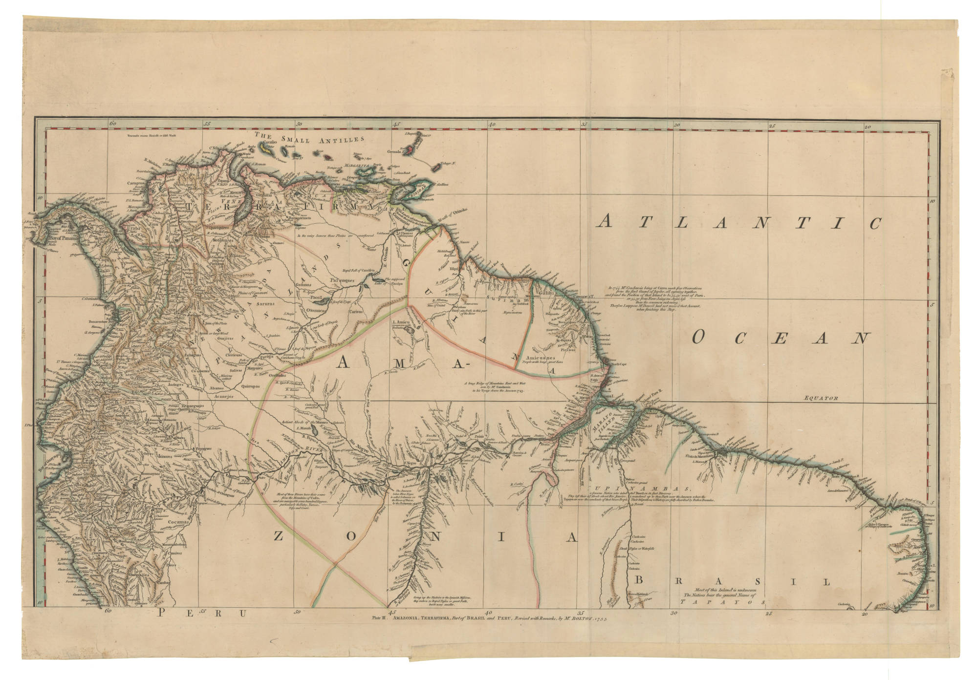
Mapa 1735

AMAZONIA;TERRAFIRMA;Part of BRASIL and PERÚ

  • BOLTON;HERBERT EUGENE

Publicado: 1755

  • Descargar Imágen
  • Descargar Imágen
Mapa 1735

AMAZONIA;TERRAFIRMA;Part of BRASIL and PERÚ

  • BOLTON;HERBERT EUGENE

Publicado: 1755

  • Descargar Imágen

Pueblos

  • WAYUU
  • ZAPARA
  • GUARUANA
  • PALENQUES
  • PAOS
  • GUAMOS
  • JIRAJARA
  • QUIRIQUIRES
  • BARI
  • CABERRE
  • ACHAGUA
  • JIVI
  • CIHRICOA
  • SALIVA
  • MAIPURE
  • OTOMACO
  • CARIVA
  • SARURAS
  • QUIRRUBAS
  • CARATES
  • ABANOS
  • ORELLUDOS
  • PIRIOUS
  • ACOQUAS
  • NORAGUES
  • URABA
  • ZINU
  • OROMIRAS
  • ZITARA
  • ANDARIEL
  • CAQUAS
  • GALIBIS
  • MERCIOUS
  • AMICUANES
  • EFQUIBI
  • ANDAGES
  • ANDAJIES
  • ACANEJOS
  • IXINORES
  • ZENZEGUAJES
  • PAYAGUAS
  • MAYORUNAS
  • GAYES
  • ABIGIRA
  • ROAMAYNAS
  • XIBAROS
  • QUIXOS
  • GUAMALIES
  • CAMBAS
  • PIROS
  • CUNIVOS
  • MANAMABOBOS
  • COCAMAS
  • TAPAYOS
  • UPINAMBAS

Citas

Bolton, Herbert Eugene. "Plate III. Amazonia, Terrafirma, Part of Brasli and Peru." Map. 1755. Accessed February 5, 2023. https://babel.banrepcultural.org/digital/collection/p17054coll13/id/7/rec/64.
  • Descargar Imágen

Artículos Relacionados

The Course of the River of Amazons.

The Course of the River of Amazons.

Mapa 1600 - 1699
Fig. 1 Map of the Guianas with schematic locations of the
indigenous groups relevant to our study, based on the linguistic
map of South America (http://www.muturzikin.com/cartesamerique/
7.htm). Carib-speaking groups are indicated in yellow, Arawak-speaking
groups in blue, Tupi-speaking Wayãpi in pink and the Warao-speaking
group in green

Fig. 1 Map of the Guianas with schematic locations of the indigenous groups relevant to our study, based on the linguistic map of South America (http://www.muturzikin.com/cartesamerique/ 7.htm). Carib-speaking groups are indicated in yellow, Arawak-speaking groups in blue, Tupi-speaking Wayãpi in pink and the Warao-speaking group in green

Mapa 2000 - 2024
PUEBLO PIMA

PUEBLO PIMA

Mapa 2020
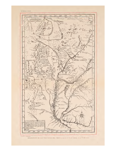
Descripción de las Provincias del Chaco, y/confindantes
     según las relaciones modernas

Descripción de las Provincias del Chaco, y/confindantes según las relaciones modernas

Mapa 1700
RESGUARDO INDÍGENA DE GUAMBÍA

RESGUARDO INDÍGENA DE GUAMBÍA

Mapa 1981
Community Services

Community Services

Mapa 1997
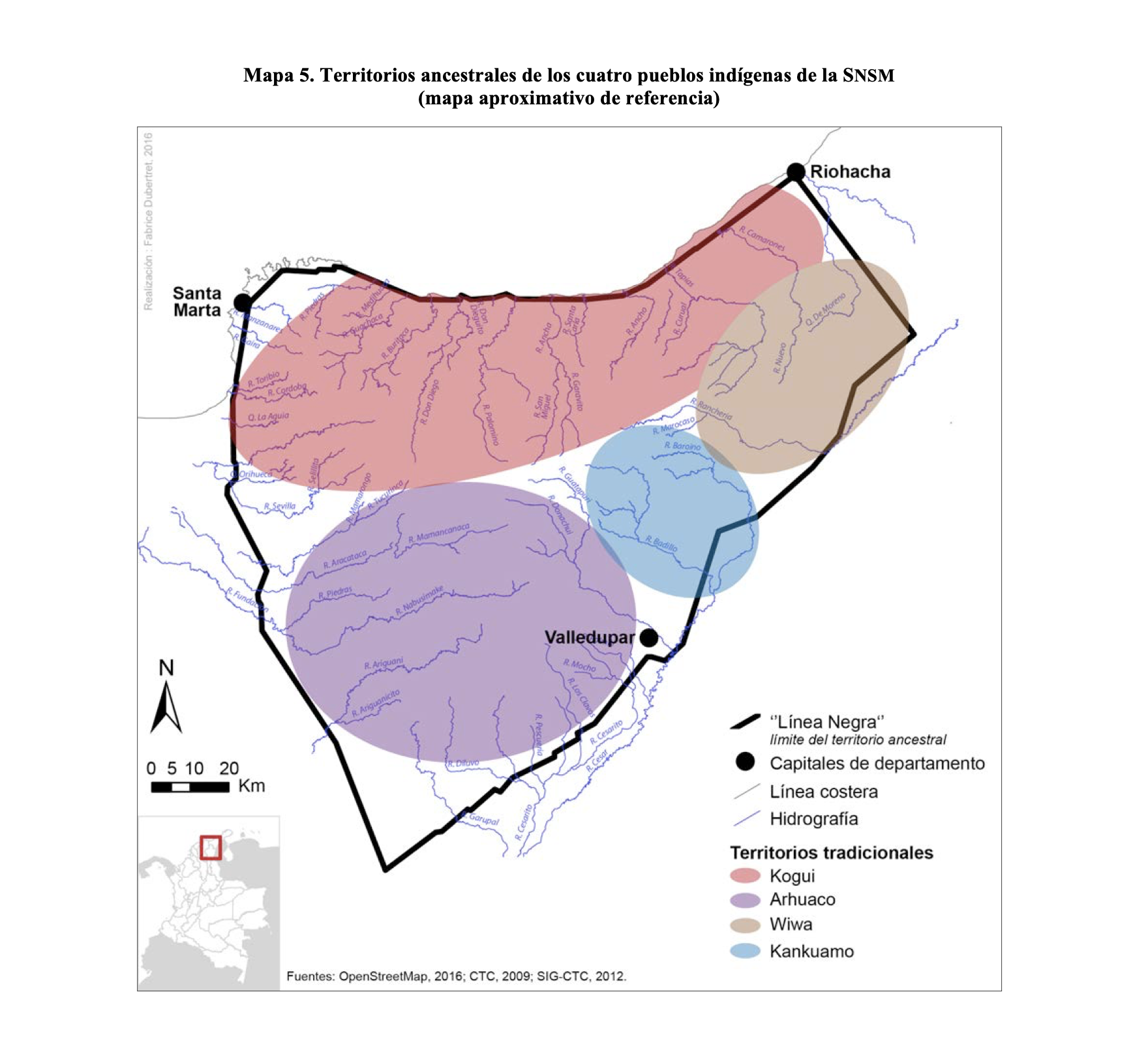
Mapa IX.1 Familias y lenguas indígenas del Caribe Continental

Mapa IX.1 Familias y lenguas indígenas del Caribe Continental

Mapa 2009
Carte de la Guyane française

Carte de la Guyane française

Mapa 1852

Despojos en las Américas

Un Proyecto de

University of Pennsylvania

Copyright 2024

Con el apoyo de

Mellon Foundation

Diseño y Desarrollo del Sitio

Element 84

Créditos Artísticos

Bolton, Herbert Eugene. “Plate III. Amazonia, Terrafirma, Part of Brasli and Peru.” Map. 1755. Accessed February 5, 2023. https://babel.banrepcultural.org/digital/collection/p17054coll13/id/7/rec/64.
Páginas del Sitio

  • Inicio
  • Explorar
  • Autores
  • Sobre
  • Arte
  • Cuerpos
  • Planes de Estudio
  • Herencia Cultural
  • Mapas
  • Territorios