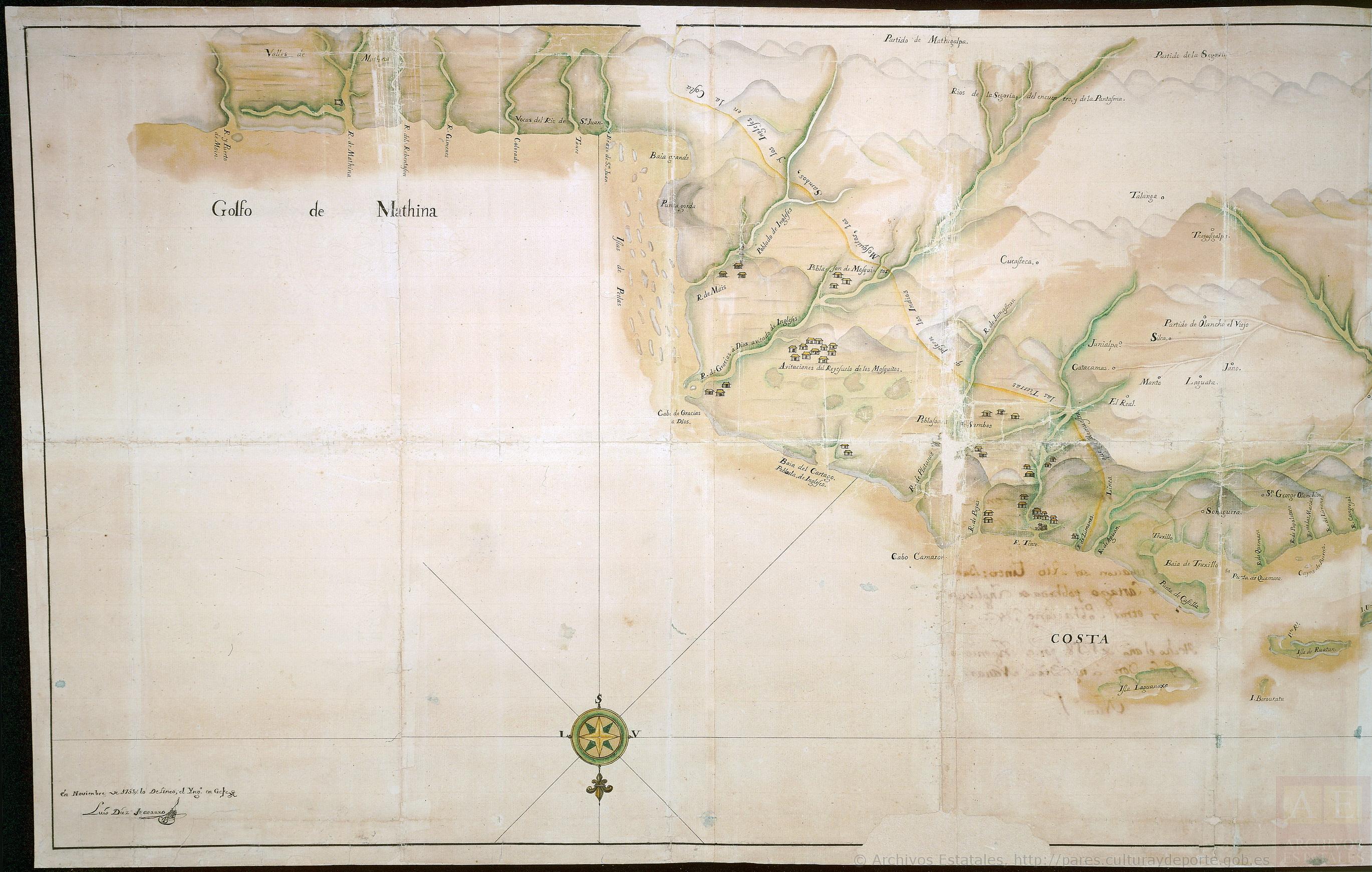
Pueblos
- POBLACION DE MOSQUITOS
- HABITACIONES DEL REYEZUELO DE LOS MOSQUITOS
Cita
Archivo General de Indias, ES.41091.AGI//MP-GUATEMALA, 49 http://pares.mcu.es:80/ParesBusquedas20/catalogo/description/19567
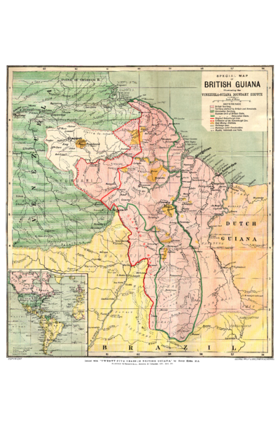
SPECIAL MAP OF BRITISH GUIANA Illustrating the VENEZUELA-GUIANA BOUNDARY DISPUTE
Mapa 1898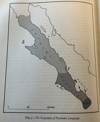
The Geography of Peninsular Languages
Mapa 1994![Índia [India]](https://dnet8ble6lm7w.cloudfront.net/art/ABRA005.jpg)
Índia [India]
Obra de Arte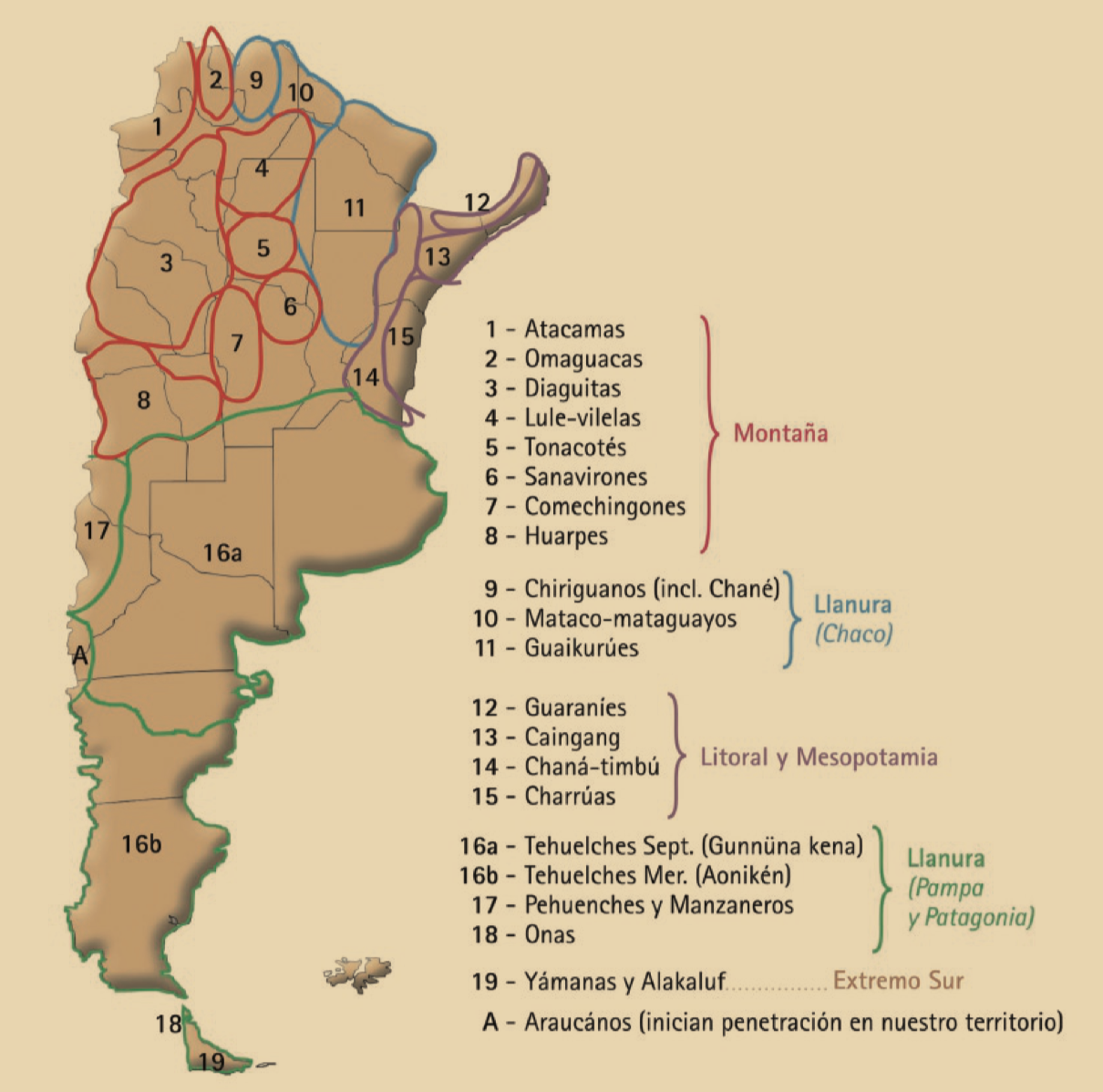
Desde adentro. Las comunidades originarias de la Argentina
Mapa 1600
VENEZUELA: INDIAN LANDS IN CRISIS
Mapa 1995
CARTE GÉOGRAPHIQUE, STATISTIQUE, HISTORIQUE ET POLITIQUE DU BRÉSIL
Mapa 1826
Map of deforestation within protected areas in Guatemala and adjoining areas
Mapa 2000 - 2100
CÓDICE XOLOTL
Mapa 1100 - 1499