Pueblos
- PAMPAS
- YUIQUIS
- NAMBACAS
- MANASICAS
- TANIPICAS
- MOROTOCOS
- CHIRIGUANOS
- OREJONES
- LENGUAS
- MBAYAS
- TOBAS
- GUARANIS
- YTATI
- MOCOBIS
- MATAGUAYES
- UGARONOS
- ZAMUCOS
- YACHIMES
- CHIRIVIONOS
- ORECHONES
- TEQUET
- CHURUMATAS
- NAPAROS
- VILELAS
- AQUILOTES
- SOCONDUES
- POREREGANOS
- GUATUTAS
- GUANAS
- YAYAS
- CARCARAS
- MOCOBS
- LULES
- CONOEOTES
- GUAYEURUS
- CAPITALAUAS
- YACOLAQUIS
- CURETAS
- SISICAS
- YDAICAS
- YVIRAYARAS
- RACHES
- YURACARES
- YUNCAS
- OROPESA
- MOXOS
- CHIQUITOS
- CHICHAS
- HUMAYONOS
- TAYNUIES
- FRENTONES
- YSISTINES
- TUANES
- ABIPONES
- CHIPITA
- PALOMOS
- CATAMARCA
- PALCIPAS
- MUSTAVAS
- TALUET
- TALUHET
- PUELCHE
- SANQUELCHE
- AUCASOAUCAES
- PICUNCHES
- PEHUENCHES
- CHECHEHETS
- CUARRUAS
- MINUANES
- BOANES
- GUANOA
Citas
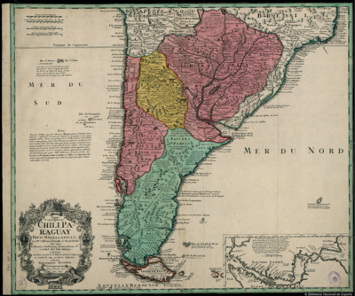
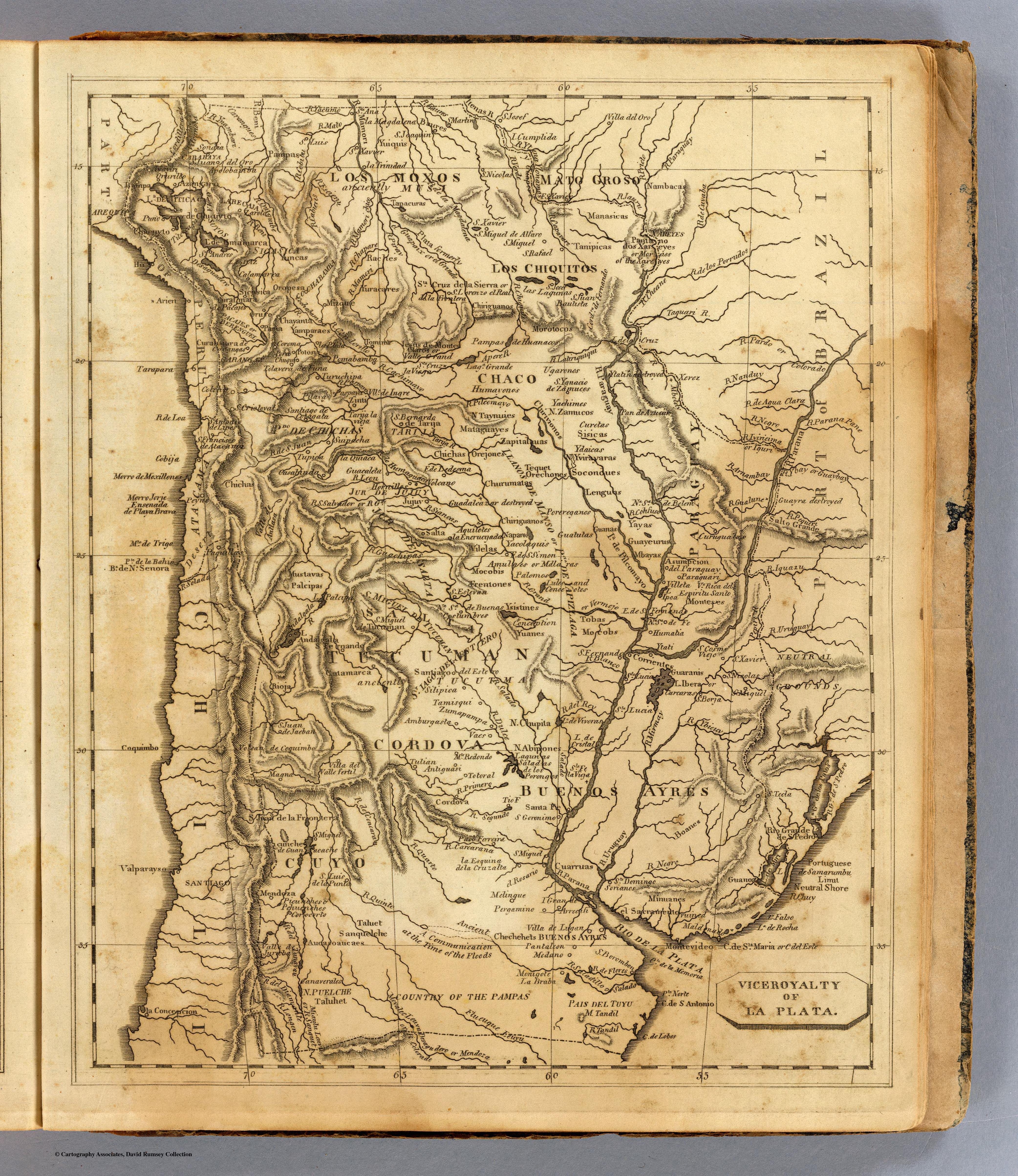
Arrowsmith, Aaron. Viceroyalty of La Plata. Map. Boston: Thomas & Andrews, 1812. Accessed April 24, 2022. https://www.davidrumsey.com/luna/servlet/detail/RUMSEY~8~1~31723~1150518:La-Plata-?qvq=w4s%3A%2Fwhere%2FURU%3Bsort%3Apub_list_no_initialsort%2Cpub_list_no_initialsort%2Cpub_date%2Cpub_date%3Blc%3ARUMSEY%7E8%7E1&mi=4&trs=88.