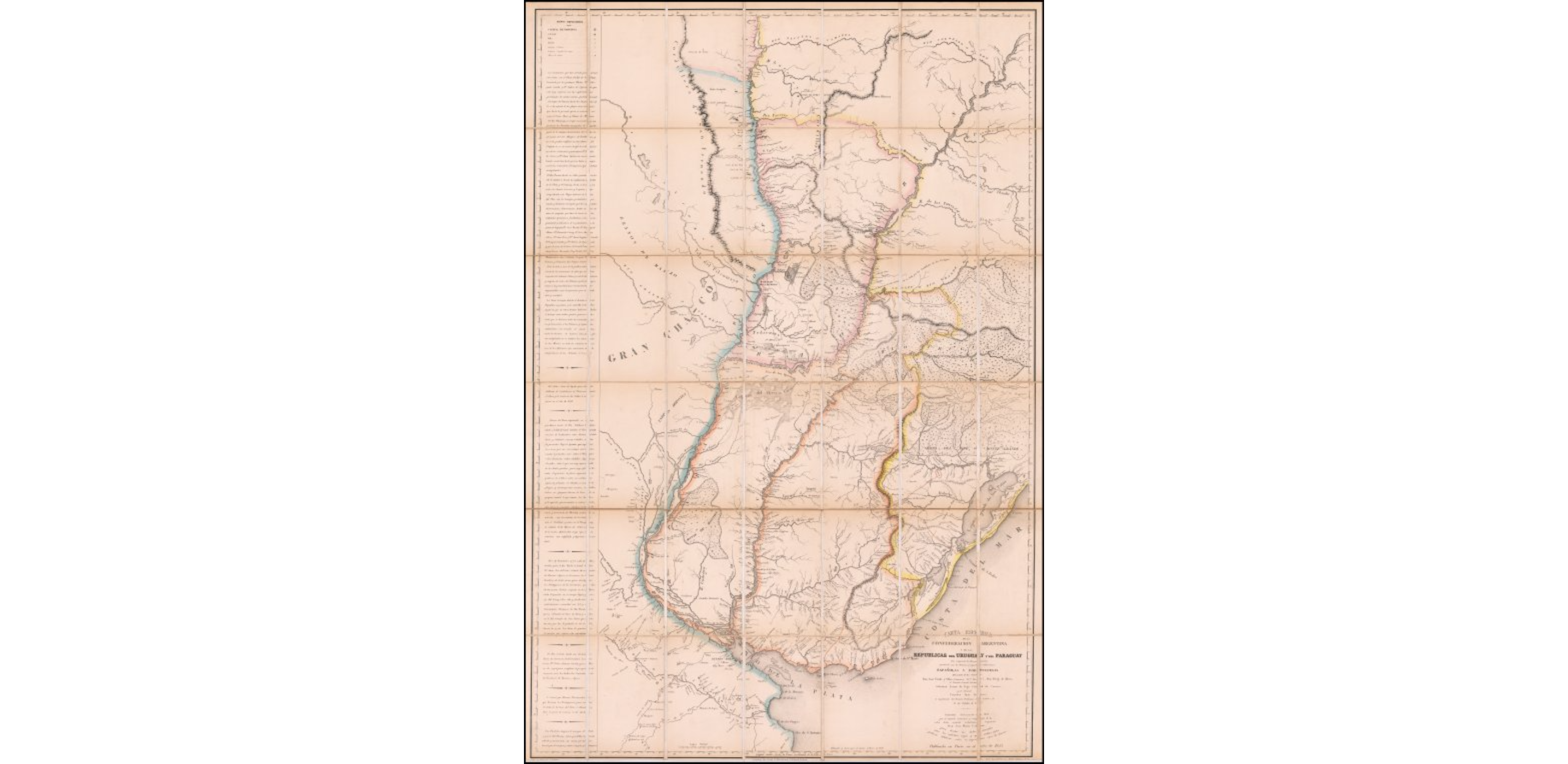
Dispossesions in the Americas

Dispossesions in the Americas

  • Inicio
  • Explorar
  • Autores
  • Sobre
  • Arte
  • Cuerpos
  • Planes de Estudio
  • Herencia Cultural
  • Mapas
  • Territorios
Volver a Explorar

Leyendo en Inglés

Mapa 1802

Carta Esférica de la Confederacion Argentina y de las Republicas del Uruguay y del Paraguay que comprende los Reconocimientos practicados por las Primeros y Segundas Subdivisions Españolas y Portuguesas del mando de los Señores Don Jose Varlea y Ulloa (Comisario Pral. Diror.) Don Diego de Albear;el Teniente General Lucitano Sebastian Xavier da Vega Cabrad da Camara;y el Coronel Francisco Juan Roscio;en Cumplimento del Tratado Preliminar de Limites de 11 de Ocubre de 1777

  • CABRER;JOSE MARIA

Publicado: 1853

  • Descargar Imágen
  • Descargar Imágen
Mapa 1802

Carta Esférica de la Confederacion Argentina y de las Republicas del Uruguay y del Paraguay que comprende los Reconocimientos practicados por las Primeros y Segundas Subdivisions Españolas y Portuguesas del mando de los Señores Don Jose Varlea y Ulloa (Comisario Pral. Diror.) Don Diego de Albear;el Teniente General Lucitano Sebastian Xavier da Vega Cabrad da Camara;y el Coronel Francisco Juan Roscio;en Cumplimento del Tratado Preliminar de Limites de 11 de Ocubre de 1777

  • CABRER;JOSE MARIA

Publicado: 1853

  • Descargar Imágen

Pueblos

  • ABIPONES
  • YARAO
  • PORONGOS
  • MONIGOTES
  • JUNCALES
  • YACEGUA

Citas

Cabrer, Jose Maria. Carta Esferica de la Confederacion Argentina y de las Republicas del Uruguay y del Paraguay. Map. Paris, 1853. Accessed April 24, 2022. https://www.raremaps.com/gallery/detail/60309/carta-esferica-de-la-confederacion-ARG-y-de-las-republ-cabrer.

  • Descargar Imágen

Artículos Relacionados

A Sequel of the Seat of War in the West Indies containing… Sub-map title: A large & accurate MAP of part of the Isthmus of Panama, taken from a Spanish drought exhibiting the Country adjacent to that City and Puerto Bello, with the Roads and Course of the River CHAGRE, by which the Treasure of the South Sea is conveyed a cross the Isthmus

A Sequel of the Seat of War in the West Indies containing… Sub-map title: A large & accurate MAP of part of the Isthmus of Panama, taken from a Spanish drought exhibiting the Country adjacent to that City and Puerto Bello, with the Roads and Course of the River CHAGRE, by which the Treasure of the South Sea is conveyed a cross the Isthmus

Mapa 1740
THE ARGENTINE REPUBLIC;CHILE;PARAGUAY AND URUGUAY

THE ARGENTINE REPUBLIC;CHILE;PARAGUAY AND URUGUAY

Mapa 1887
Maká

Maká

Mapa 2001
PUEBLO TICUNA

PUEBLO TICUNA

Mapa 2021
Paraguay, ó prov. de Rio de la Plata cum regionibus adiacentibus Tucuman et Sta. Cruz de la Sierra

Paraguay, ó prov. de Rio de la Plata cum regionibus adiacentibus Tucuman et Sta. Cruz de la Sierra

Mapa 1633
CARTE DE LA DEPENDANCE DU YAPOK JUSQU'A la Riviere des Amazones

CARTE DE LA DEPENDANCE DU YAPOK JUSQU'A la Riviere des Amazones

Mapa 1737
CHARTE eines Theils von PARAGUAY und der Provinz BUENOS-AYRES

CHARTE eines Theils von PARAGUAY und der Provinz BUENOS-AYRES

Mapa 1809
PUEBLO KUMIAI

PUEBLO KUMIAI

Mapa 2020

Despojos en las Américas

Un Proyecto de

University of Pennsylvania

Copyright 2024

Con el apoyo de

Mellon Foundation

Diseño y Desarrollo del Sitio

Element 84

Créditos Artísticos

Cabrer, Jose Maria. Carta Esferica de la Confederacion Argentina y de las Republicas del Uruguay y del Paraguay. Map. Paris, 1853. Accessed April 24, 2022. https://www.raremaps.com/gallery/detail/60309/carta-esferica-de-la-confederacion-ARG-y-de-las-republ-cabrer.

Páginas del Sitio

  • Inicio
  • Explorar
  • Autores
  • Sobre
  • Arte
  • Cuerpos
  • Planes de Estudio
  • Herencia Cultural
  • Mapas
  • Territorios