Pueblos
- EMERILLON
- KIRIKIRIS
- RUCUYENNE
- OYAMPIS
- ACURAI
- PIANOGHOTTO
- GAMELLA
- GEZ
- BO
- JACUNDA
- PACAJA
- TUCUNA-PEUAS
- ARARA
- JACIPUYAS
- MAUES
- MUNDRUCU
- YURUNA
- GRADAHO
- AKROA
- CHAVANTE
- MANITSAUA
- BACAURI
- CAPOYO
Cita
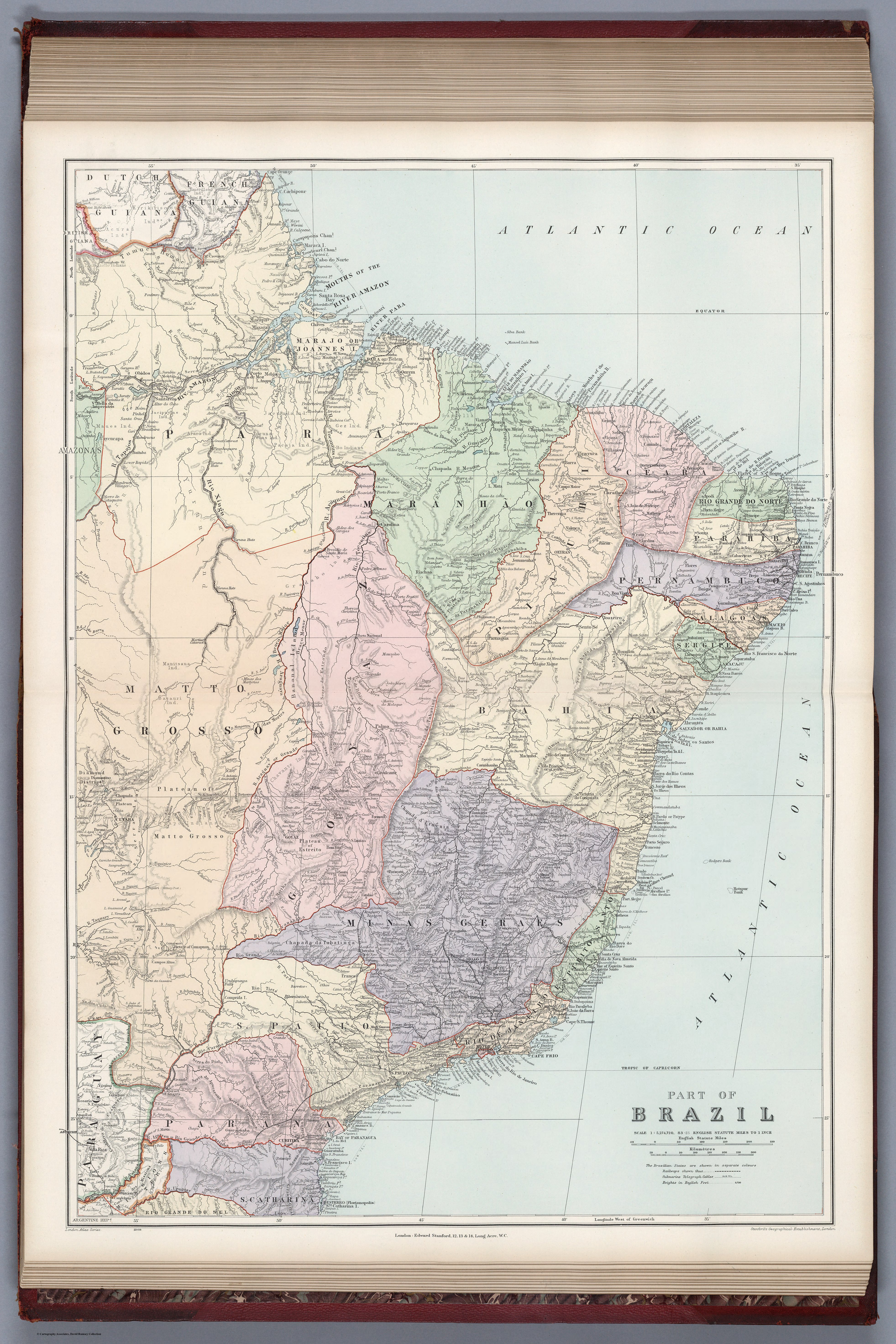
Stanford, Edward. Part of Brazil. Map. London: Stanford's Geographical Establishment, 1904. Accessed August 4, 2023. https://www.davidrumsey.com/luna/servlet/detail/RUMSEY~8~1~314747~90083533.