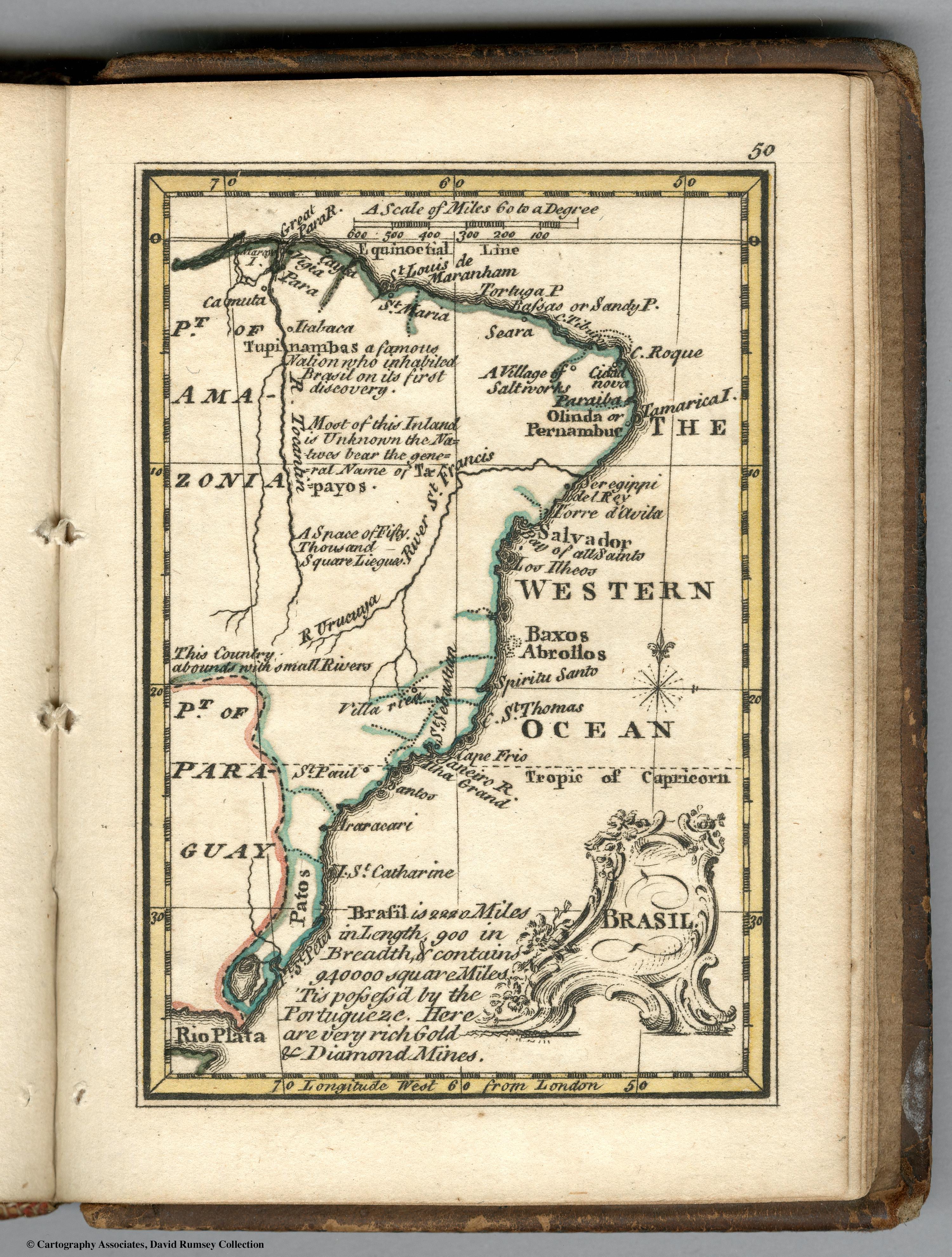
Pueblos
- TUPINAMBAS
- TAPAYOS
Cita
Bowen, Emanuel, and John Gibson. Brasil. Map. London: J. Newberry, 1758. Accessed July 27, 2023. https://www.davidrumsey.com/luna/servlet/detail/RUMSEY~8~1~239216~5511691.
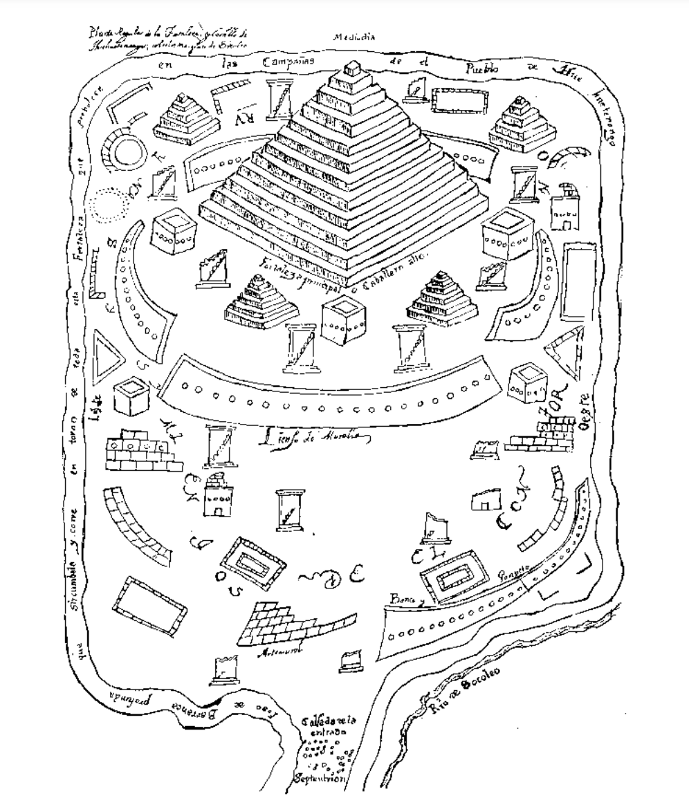
Planta regular de la fortaleza y castillo de Huehuetenango, sobre las márgenas de Socoleo.
Mapa 1672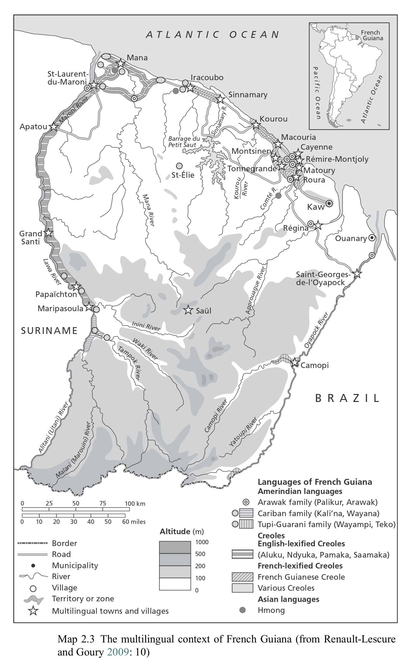
Map 2.3 The multilingual context of French Guiana (from Renault-Lescure and Goury 2009: 10)
Mapa 2012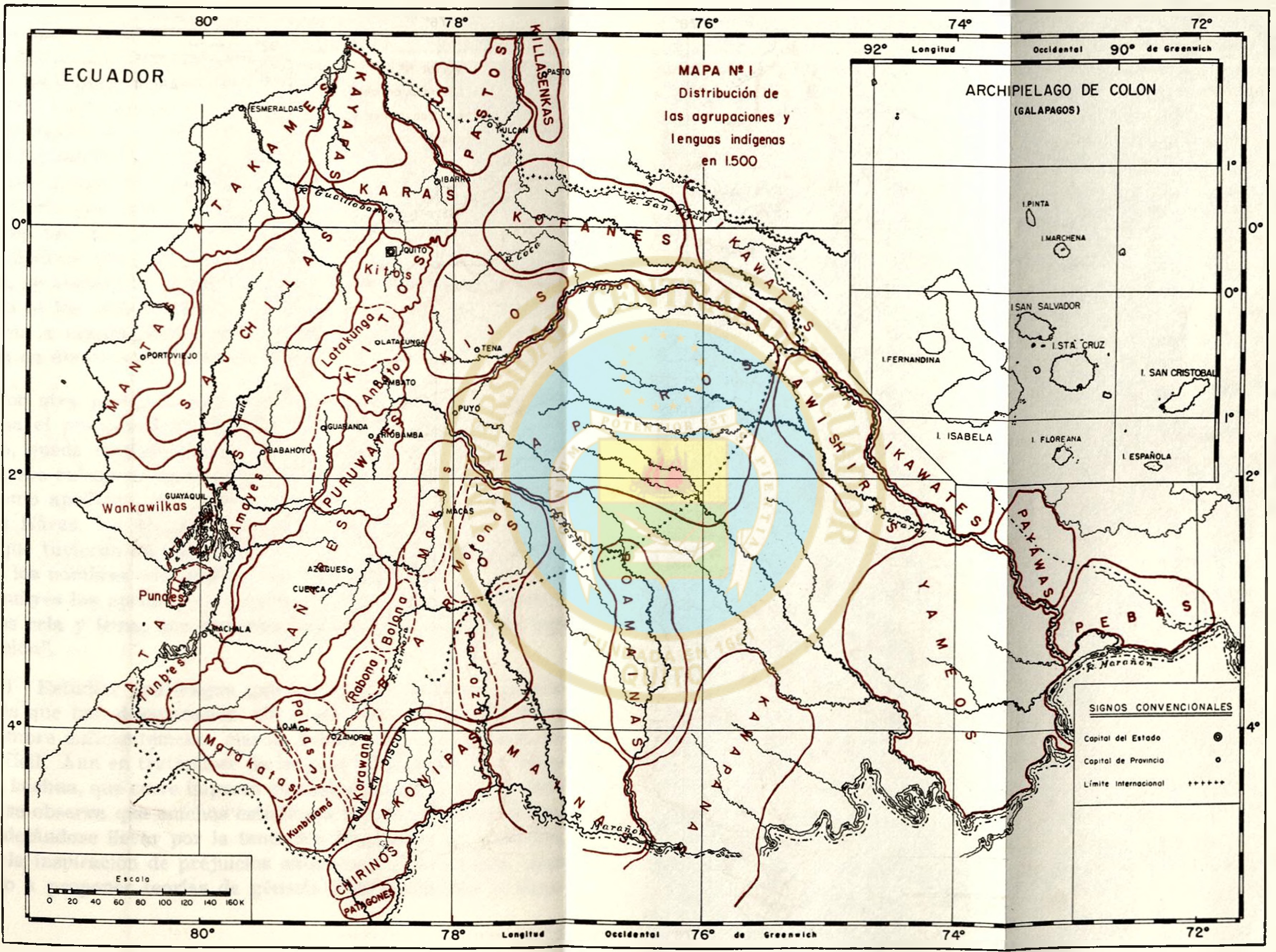
MAPA N. 1 DISTRIBUCIÓN DE LAS AGRUPACIONES Y LENGUAS INDÍGENAS EN 1500
Mapa 1500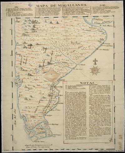
Mapa de Magallanes
Mapa 1746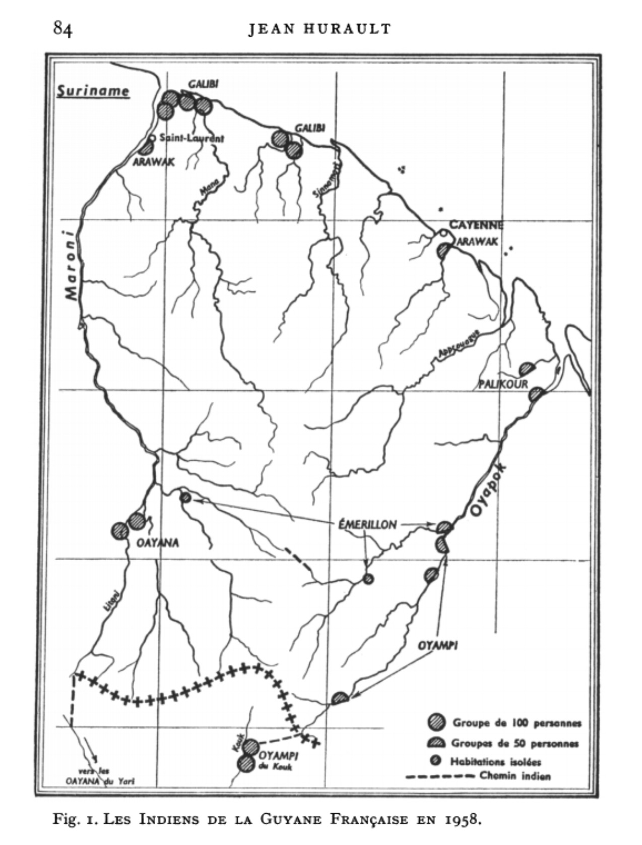
Fig. 1. Les Indiens de la Guyane Française en 1958
Mapa 1958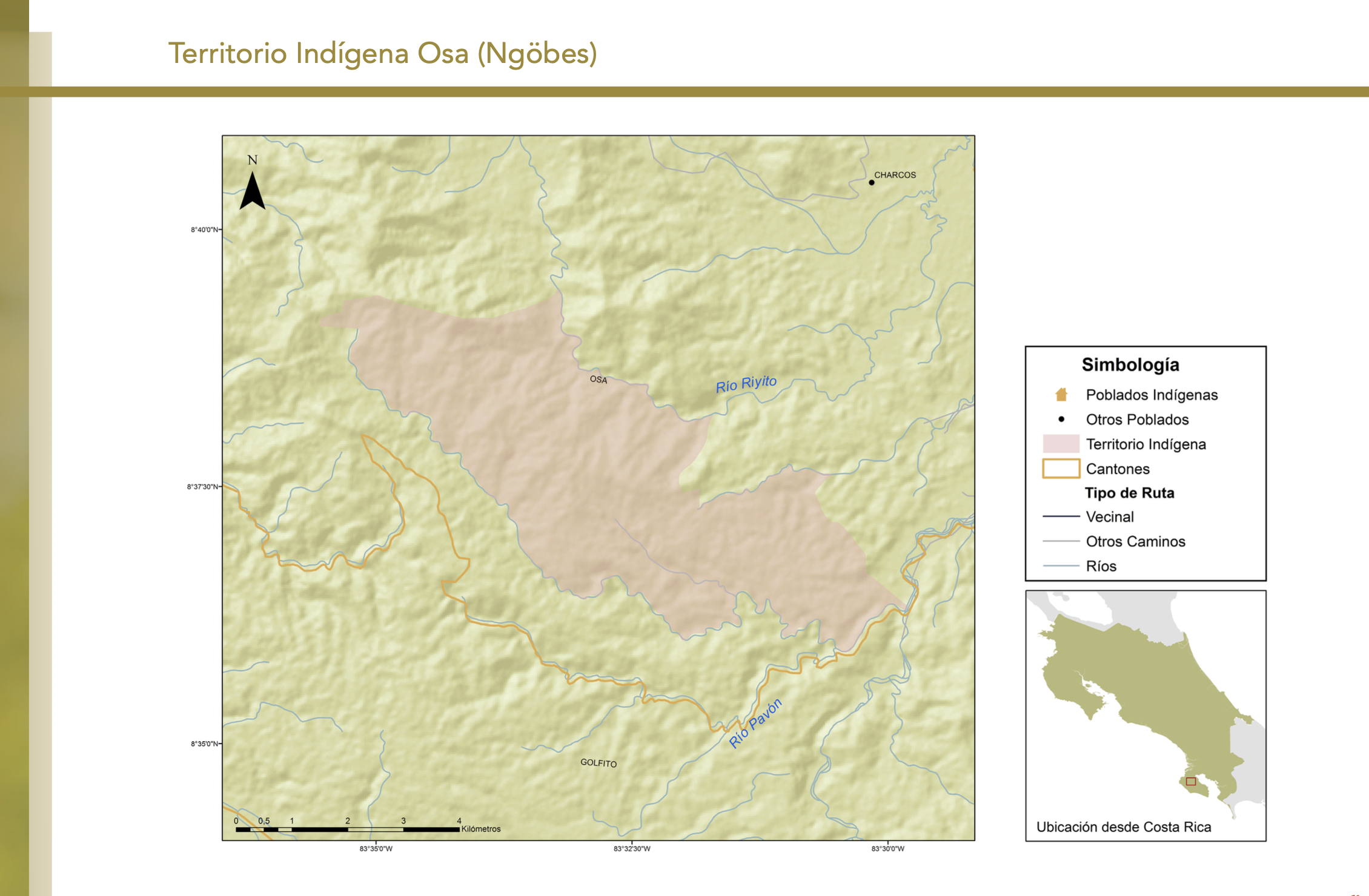
"Territorio Indígena Osa (Ngöbes)"
Mapa 2010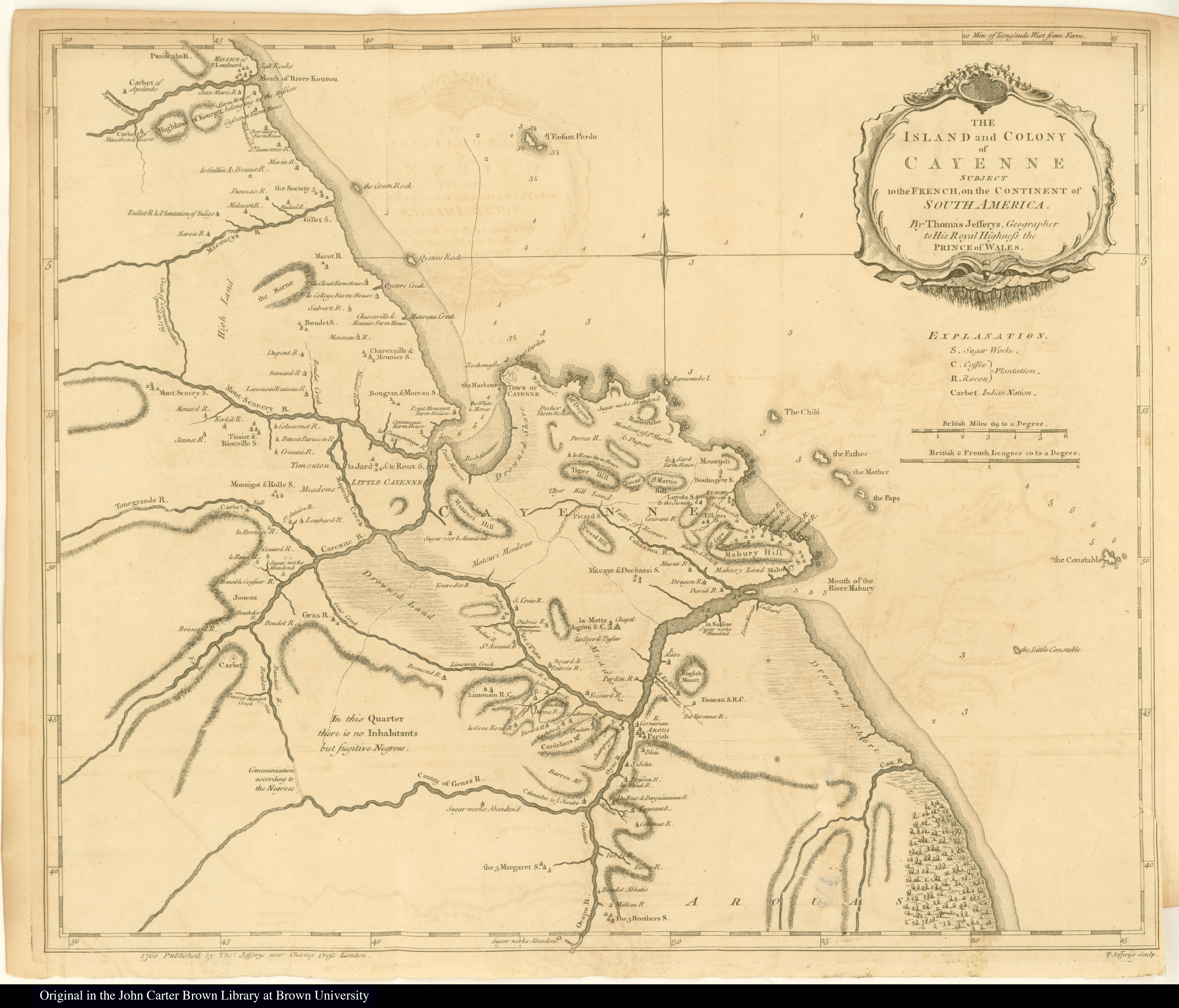
The Island and Colony of Cayenne subject to the French, on the Continent of South America.
Mapa 1760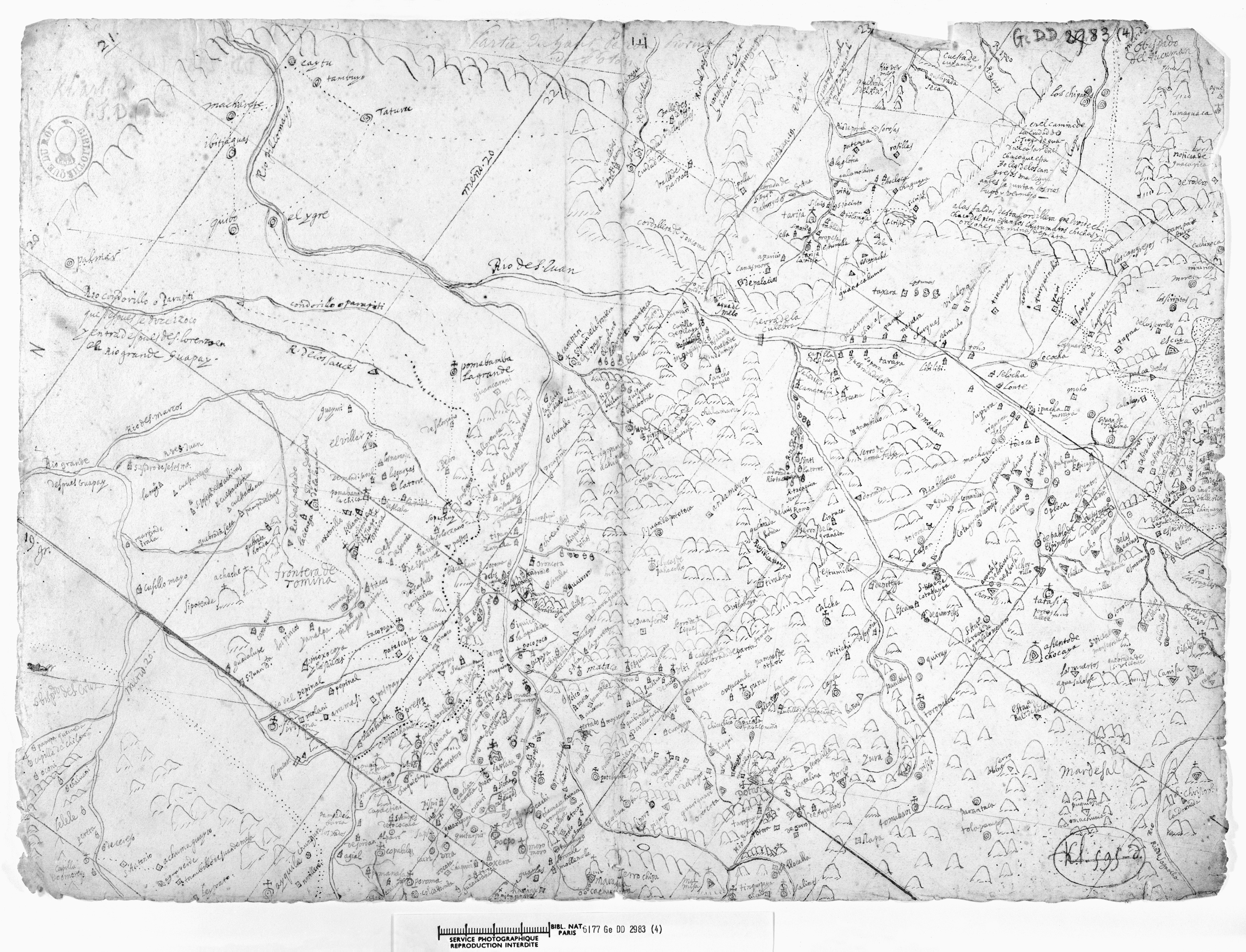
LA PROVINCIA DE POTOSÍ EN EL ALTO PERÚ EN EL SIGLO XVII
Mapa 1600 - 1699