Pueblos
- ALDEAS D'INDIOS
Cita
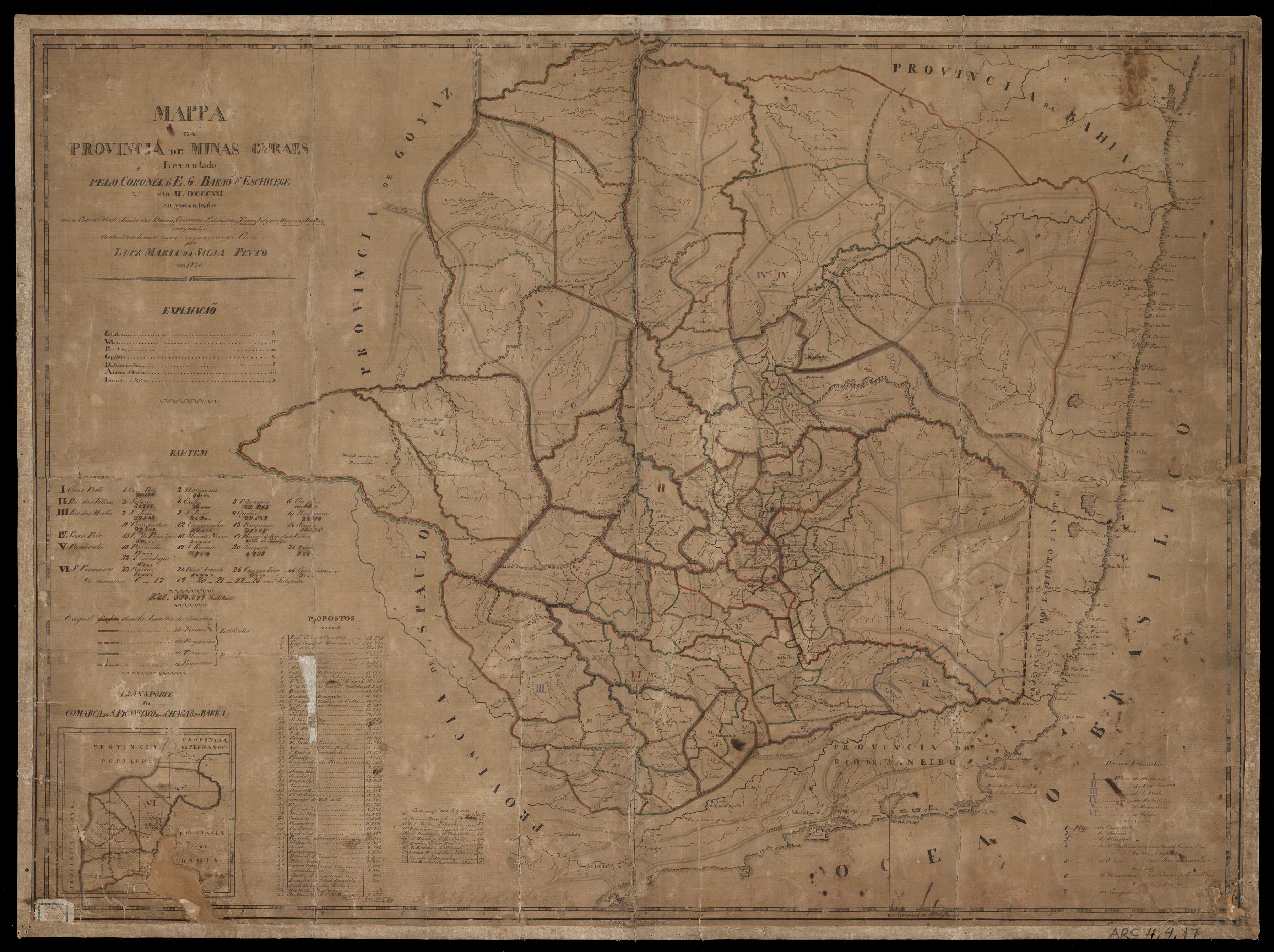
Barão d'Eschwege, E. G., and Luiz Maria da Silva Pinto. "Mappa da provincia de Minas Geraes." Map. 1826. Accessed July 18, 2023. https://bdlb.bn.gov.br/acervo/handle/20.500.12156.3/31606.
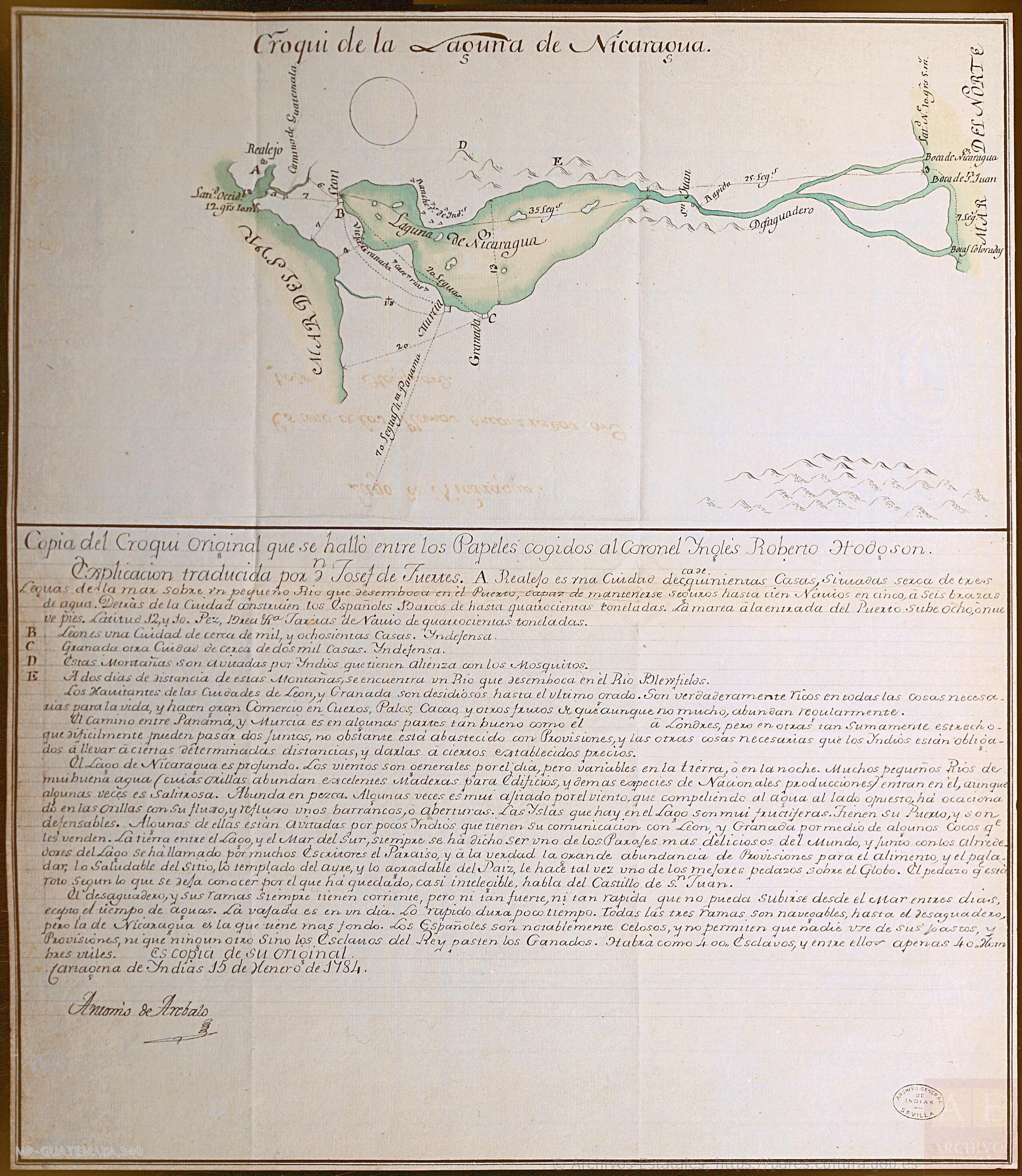
Croquis de la Laguna de Nicaragua
Mapa 1784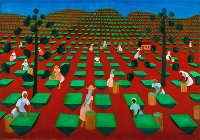
Hacienda de té en Itacolomi
Obra de Arte
Government map of Nicaragua : from the latest surveys ordered by President Patricio Rivas and Genl. William Walker ;executed under the supervision of the Señor Fermín Ferrer;Governor of the Western Department;1856
Mapa 1800 - 1856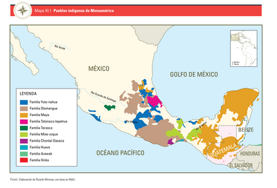
PUEBLOS INDÍGENAS DE MESOAMÉRICA
Mapa 2009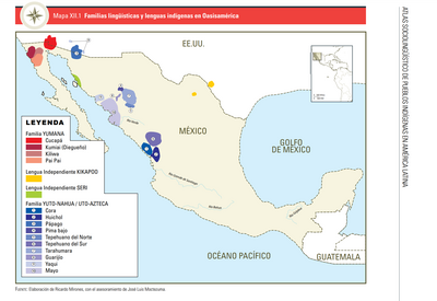
FAMILIAS LINGUÍSTICAS Y LENGUAS INDÍGENAS EN OASISAMÉRICA
Mapa 2009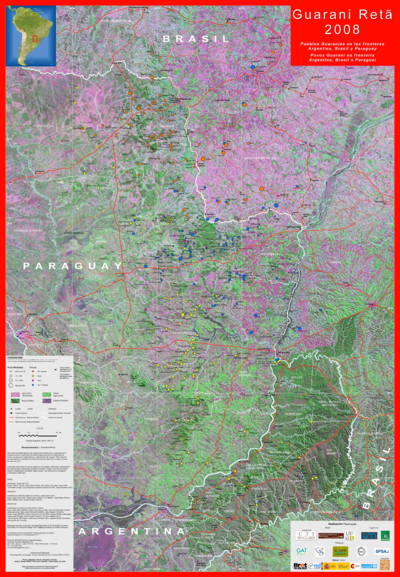
Guarani Retã 2008: Pueblos Guaraníes en las fronteras Argentina, Brasil y Paraguay
Mapa 2008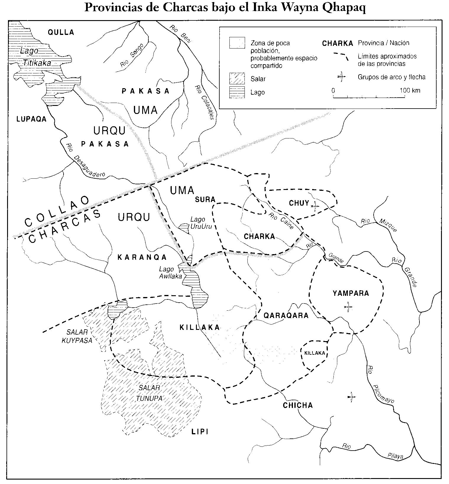
PROVINCIAS DEL QULLASUYU BAJO DOMINIO INCA PRINCIPIOS DEL SIGLO XVI
Mapa 1530 - 1540![Bedxe´Guie´ [Tierra Sagrada]](https://dnet8ble6lm7w.cloudfront.net/art_sm/AMEX002.png)
Bedxe´Guie´ [Tierra Sagrada]
Obra de Arte