Pueblos
- CHUMANA
- PASSES
- CARA-CARAHY
Cita
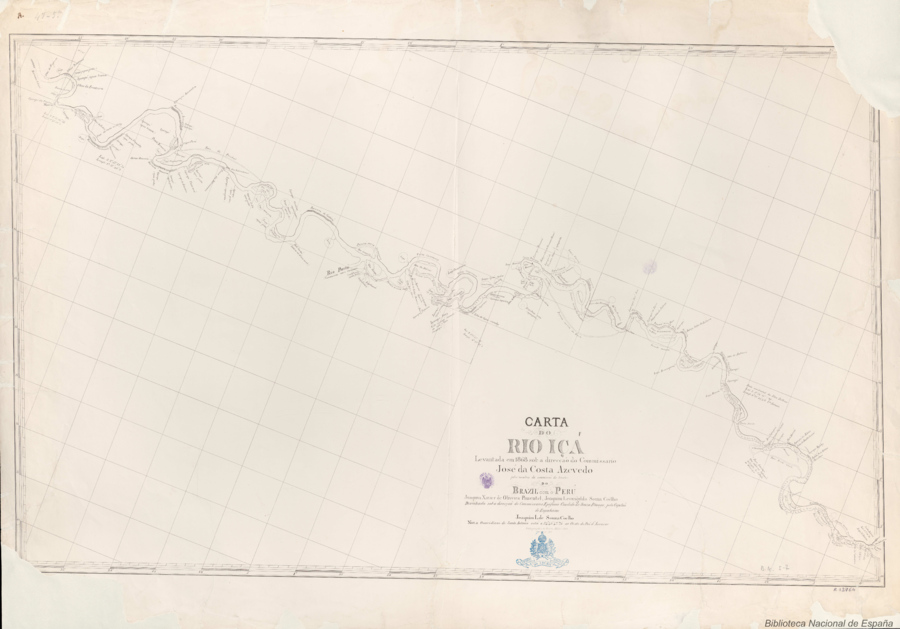
da Costa Azevedo, José, and Leovigildo Souza Coêlho. Carta do Rio Içá. Map. Rio de Janeiro: Lithographia do Archivo Militar, 1868. Accessed July 15, 2023. http://bdh.bne.es/bnesearch/detalle/bdh0000248624.

Veta Negra
Obra de Arte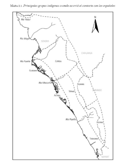
Principales grupos indígenas cuando ocurrió el contacto con los españoles
Mapa 1530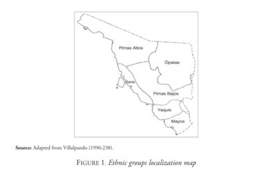
Ethnic Groups Localization Map
Mapa 2014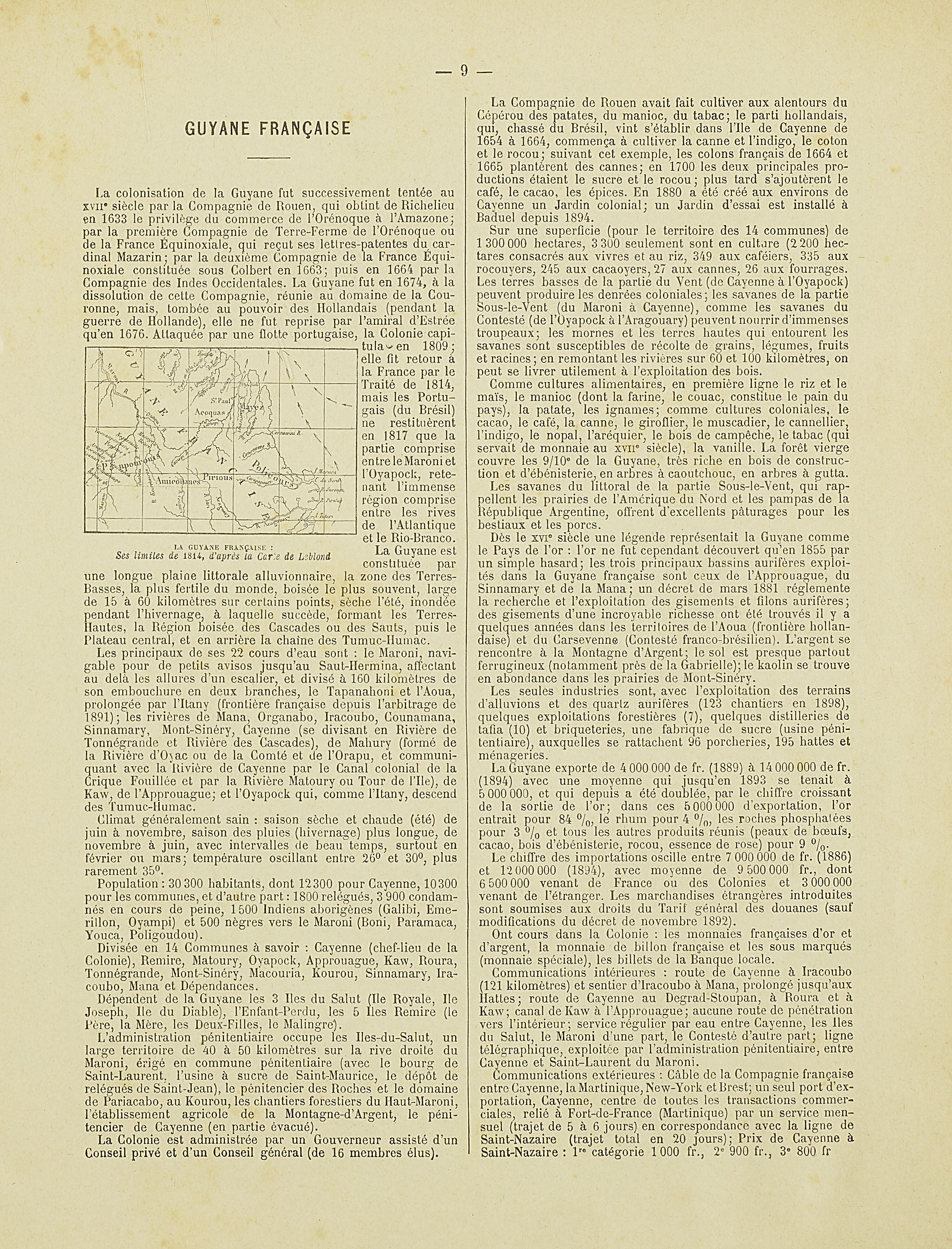
La Guyane française : Ses limited de 1814, d'après la carte de Leblond.
Mapa 1814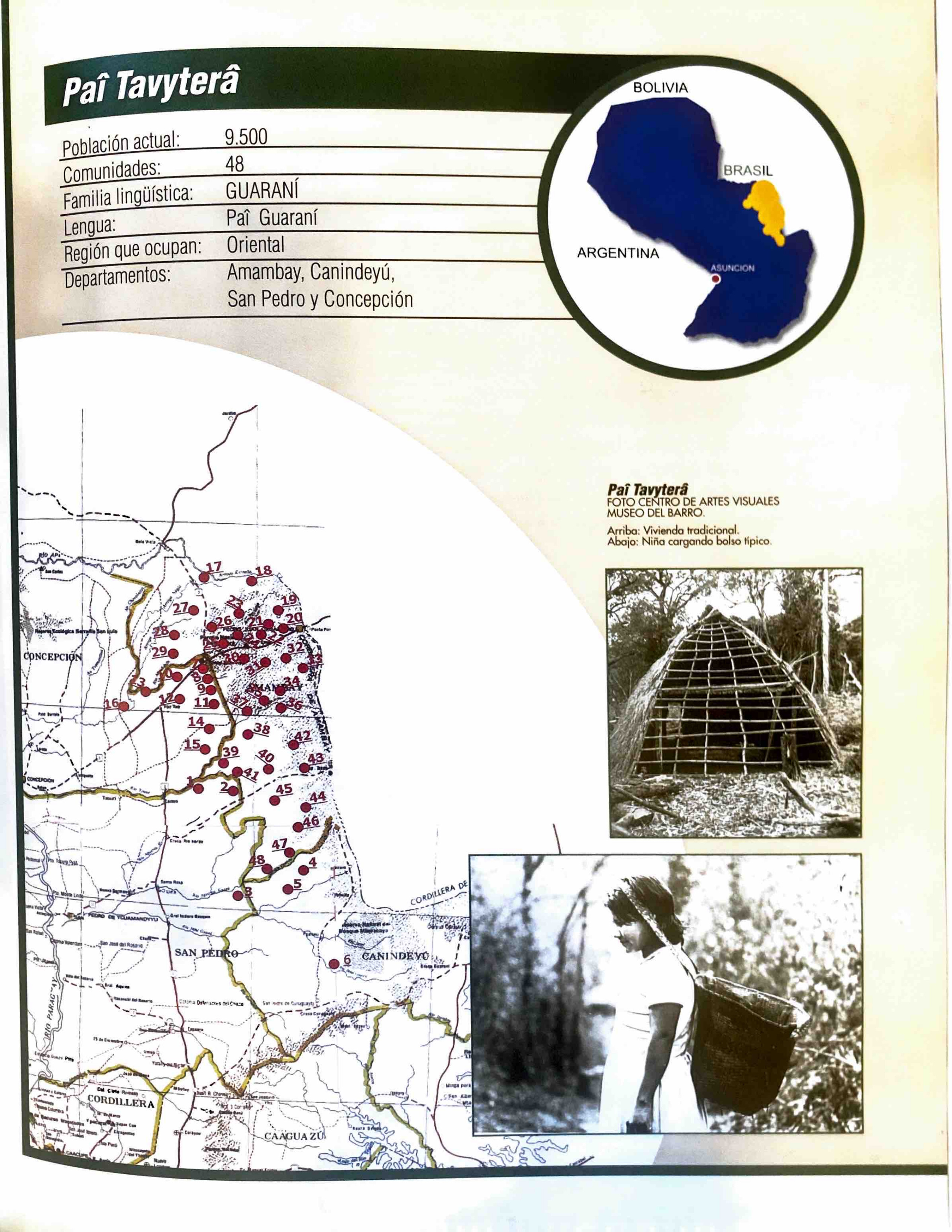
Paî Tavyterâ
Mapa 2001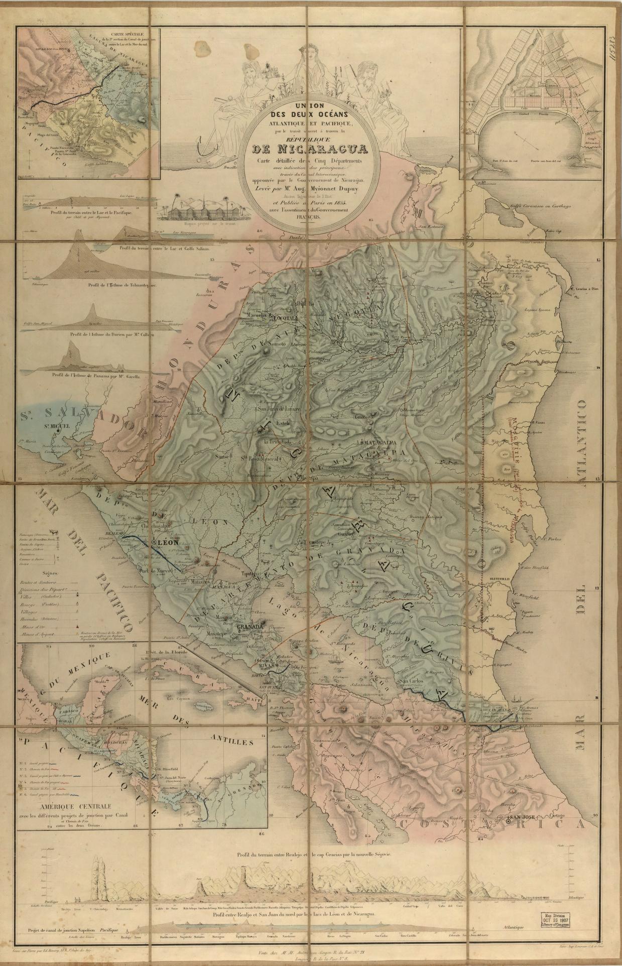
Union des deux ocʹeans Atlantique et Pacifique;par le transit ouvert à travers la rʹepublique De Nicaragua : carte dʹetaillʹee des cinq dʹepartements avec indication des principaux tracʹes du Canal Interocʹeanique ...
Mapa 1855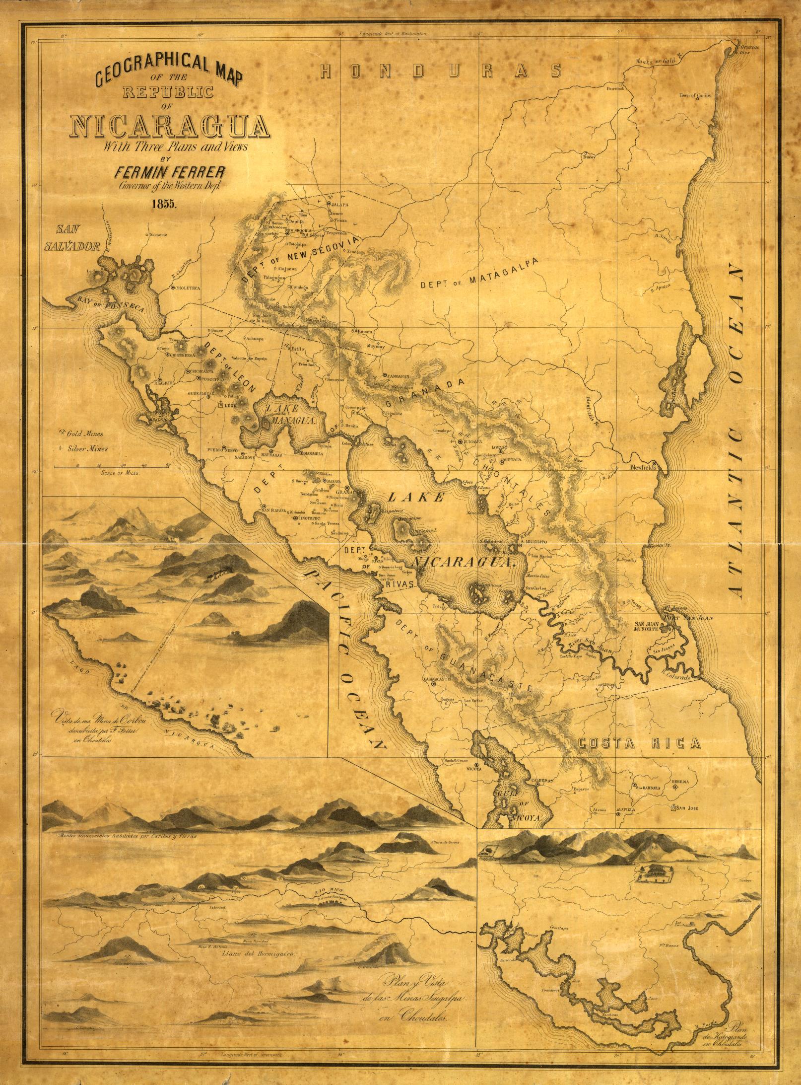
Geographical Map of the Republic of Nicaragua.
Mapa 1855
Sketch of the country from reduction to Buenos Ayres, shewing the movements of B. Genl. Beresford, when he captured that place June 1806. Drawn from memorandums furnished by Capt: Donnelly
Mapa 1806